Iceland is famous for volcanoes, glaciers, geysers, waterfalls, geothermal lagoons, the Northern Lights, and a national image built on extreme nature and striking self-reliance. Official Icelandic and UNESCO sources present the country through “fire and ice”, Viking history, hot springs, and dramatic protected landscapes, and UNESCO currently lists three World Heritage Sites in Iceland.
1. Reykjavík
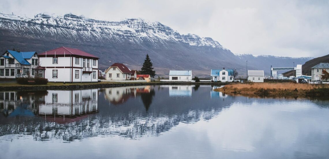
Iceland is famous for Reykjavík because the capital shapes the country’s image more than any other place. It is the world’s northernmost capital of a sovereign state, but what makes it memorable is not size. Reykjavík stays small enough to feel personal, with a compact center, low-rise streets, colorful houses, a working harbor, and Hallgrímskirkja rising above the city as one of Iceland’s clearest landmarks. The city itself has about 135,000 residents, while the wider capital area has nearly 244,000, which means a large share of Icelandic life is concentrated there.
Reykjavík also became famous because it combines city life with things that usually belong to a much larger landscape. Geothermal bathing is built into everyday routine, with 18 public swimming pools spread across the city, and nature never feels far away: the sea, mountain views, lava fields, whale-watching trips, and northern-lights excursions all sit close to the capital. That mix gives Reykjavík its strongest advantage as a symbol of Iceland.
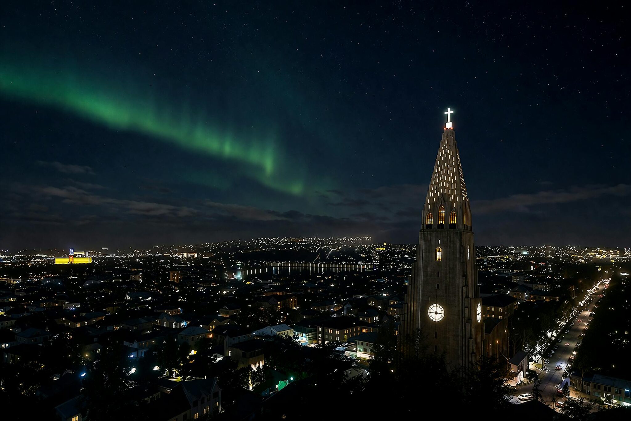
2. The Northern Lights
The season usually runs from late August to late April, and clear nights can bring the lights into view not only in the countryside but sometimes even near Reykjavík. That is why the aurora became one of Iceland’s strongest modern travel images. The association stayed strong because the Northern Lights fit Iceland’s wider image so well. They appear over lava fields, black coastlines, snowy ground, and open winter skies, so the aurora does not feel separate from the landscape but like an extension of it. In practical terms, viewing conditions in Iceland are monitored closely enough that people can track both cloud cover and auroral activity, and the lights are on average most frequent around 11 pm.
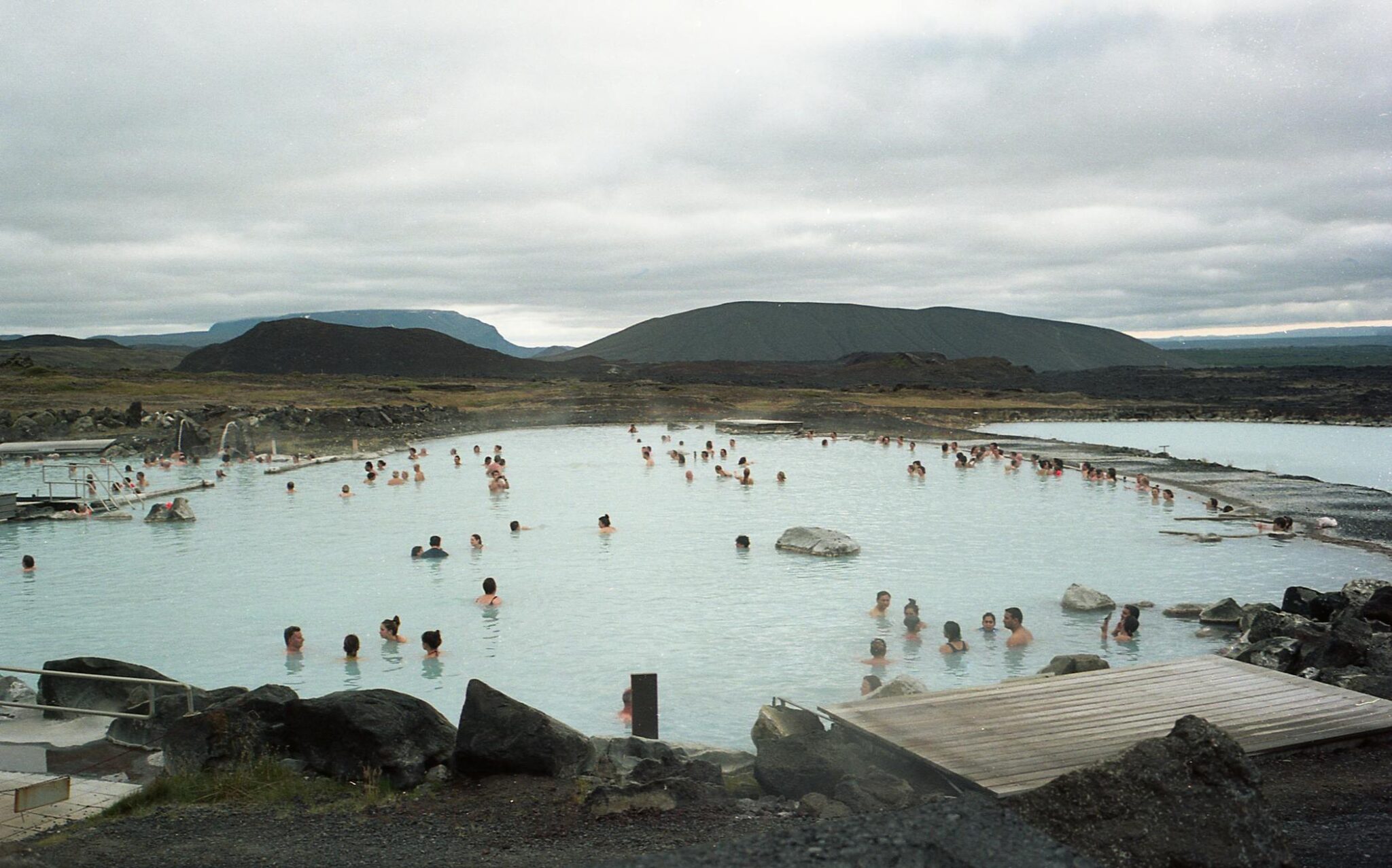
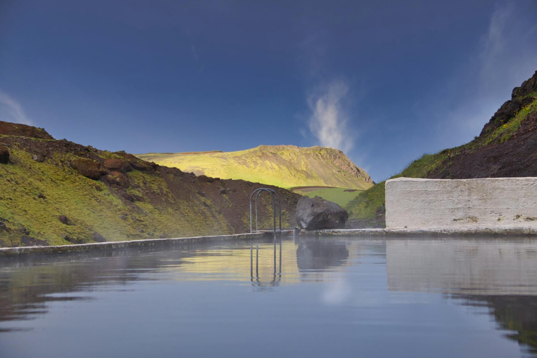
3. The Blue Lagoon and geothermal bathing
Iceland is famous for geothermal bathing, and no place represents that more clearly than the Blue Lagoon. Set in a lava field on the Reykjanes Peninsula, the lagoon grew out of geothermal activity linked to the nearby Svartsengi power plant in the 1970s and later developed into one of the country’s best-known attractions. Its water stays around 38°C, and its unusual blue color comes from silica in the geothermal seawater.
The wider bathing culture matters just as much. In Iceland, heated outdoor pools are not treated as luxury spaces only, but as part of ordinary life, where people swim, relax, talk, and spend time year-round despite the climate. That everyday importance was formally recognized in December 2025, when Iceland’s swimming pool culture was added to UNESCO’s Representative List of the Intangible Cultural Heritage of Humanity. The Blue Lagoon is the most famous expression of that habit, but its real importance is larger: it stands for a national tradition in which warm water is tied to community, routine, and the use of natural geothermal heat on a countrywide scale.
4. Volcanoes
Iceland has 33 active volcanic systems, and recent eruptions on the Reykjanes Peninsula made that reality visible again in real time. Between December 2023 and August 2025, nine eruptions took place there, which kept lava, gas pollution, evacuation risk, and hazard maps in the public eye. That is why volcanoes remain such a strong part of Iceland’s image: they are not only ancient geology, but something the country still lives with in the present.
The connection feels even stronger because Iceland’s volcanic landscapes are rarely separate from its other natural symbols. In Vatnajökull National Park alone, volcanic and glacial forces meet on an exceptional scale: the UNESCO site covers more than 1.4 million hectares, nearly 14% of Iceland, and includes ten central volcanoes, eight of them beneath ice. This interaction produces some of the country’s most dramatic natural processes, including jökulhlaups, the sudden floods caused when volcanic activity disrupts glaciers.
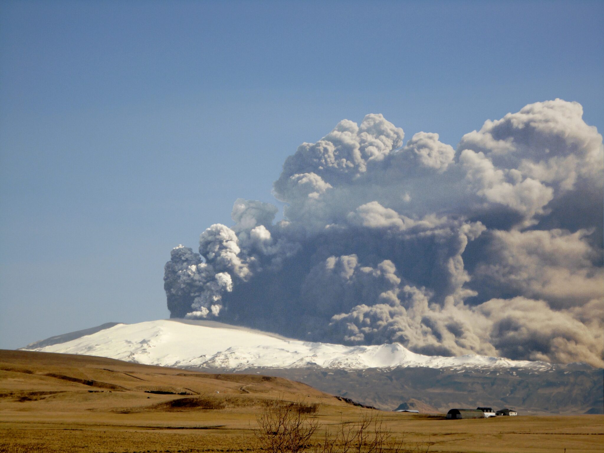
5. Eyjafjallajökull and the 2010 eruption
Iceland is also famous for Eyjafjallajökull because the 2010 eruption pushed the country into global headlines in a way few natural events ever do. The volcano first erupted on 20 March 2010, but the phase that fixed its name in public memory began on 14 April, when magma broke through ice and sent a large ash plume into the atmosphere. That combination of fire and glacier mattered far beyond Iceland itself.
What made Eyjafjallajökull so memorable was not only the eruption, but the scale of the disruption it caused. Airspace closures across Europe between 15 and 21 April created the biggest interruption to commercial air traffic since World War II. EUROCONTROL estimated that the crisis disrupted about 100,000 flights and around 10 million passenger journeys.
Árni Friðriksson, CC BY-SA 3.0 https://creativecommons.org/licenses/by-sa/3.0, via Wikimedia Commons
6. The Golden Circle and geysers
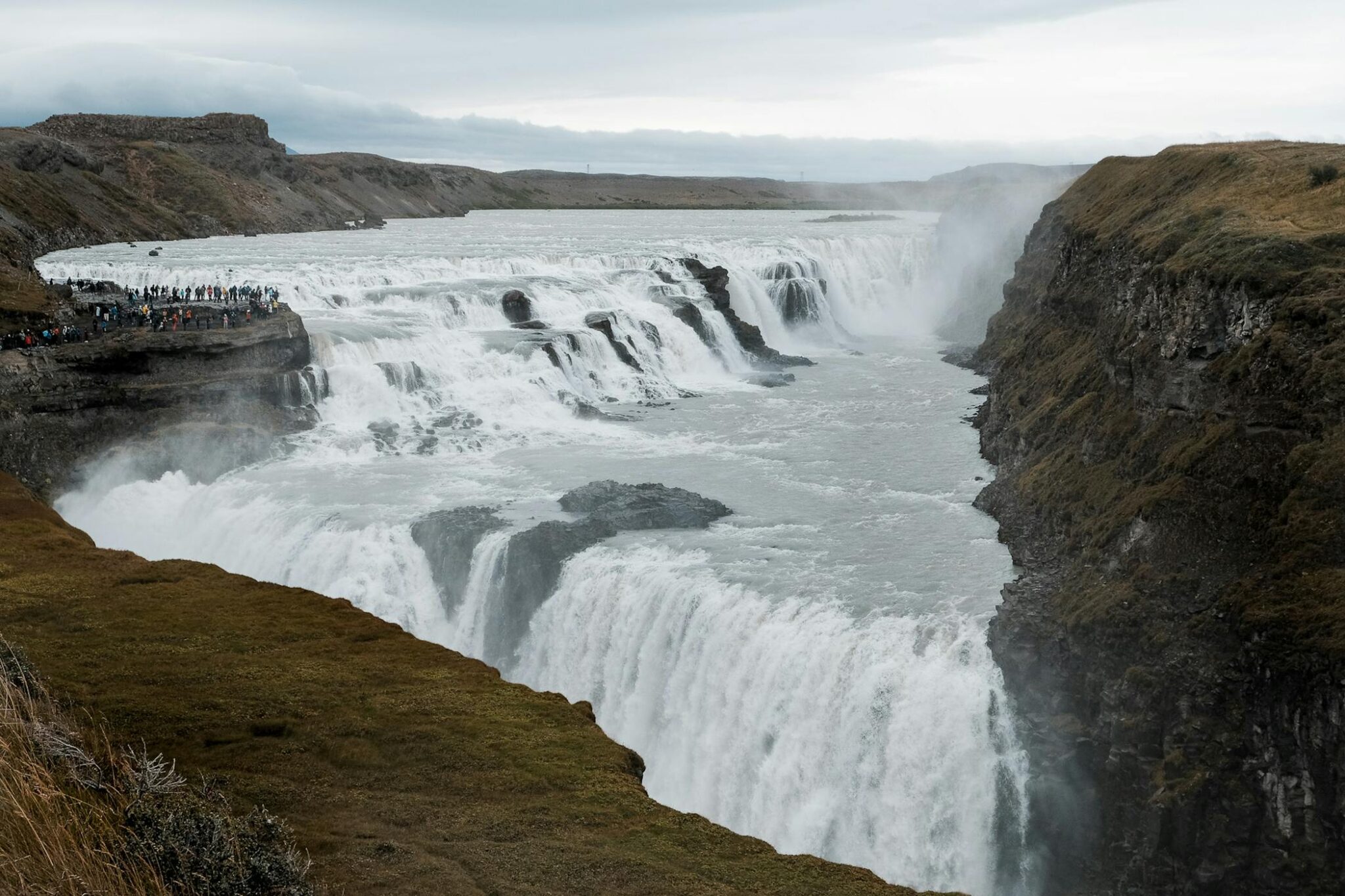
Iceland is famous for the Golden Circle because this route brings several of the country’s defining features into one compact loop from Reykjavík. It links Þingvellir, Geysir, and Gullfoss, which means history, tectonic geology, geothermal force, and glacial water all appear within the same day trip. Þingvellir matters not only for its landscape but because the Alþing, Iceland’s general assembly, was established there in 930. Gullfoss adds the scale people expect from Icelandic nature, dropping 32 metres in two stages into a steep canyon.
The geysers make the route even more distinctive because Iceland gave the English language one of its best-known natural terms. The word “geyser” comes from Geysir, the famous hot spring in southwest Iceland, whose name is tied to the idea of a gusher. The Great Geysir is now mostly inactive, but the area remains highly active, and nearby Strokkur erupts at regular intervals, often around every 10 minutes, sending boiling water up to about 30 metres into the air.
7. Waterfalls
They appear again and again across the standard image of Iceland, from the Golden Circle to the South Coast and long stretches of the Ring Road. That matters because waterfalls in Iceland do not feel like isolated sights. They are part of how the landscape works: glacial rivers, steep drops, open valleys, and exposed cliffs keep producing scenes that are easy to recognize and hard to separate from the country’s wider identity. Skógafoss is one of the country’s best-known falls, dropping 60 metres in a broad, almost wall-like curtain of water, while Seljalandsfoss is also 60 metres high but became famous for something rarer: a footpath that lets people walk behind the falling water.
8. Glaciers and Vatnajökull
In 2023, the ice cap covered about 7,500 square kilometres, roughly 7% of Iceland, and it remains Europe’s largest ice cap by volume. Its scale matters because Vatnajökull is not just one white mass on a map: it feeds outlet glaciers, river systems, lagoons, and wide areas of the southeast, so glaciers in Iceland are experienced as part of the land itself rather than as distant mountain features.
Vatnajökull also became one of the clearest symbols of Iceland because it shows the country’s defining interaction of fire and ice in one place. Vatnajökull National Park is the largest national park in Iceland and a UNESCO World Heritage Site, covering more than 1.4 million hectares, nearly 14% of the country. UNESCO notes that the area contains ten central volcanoes, eight of them beneath ice, which means glaciers here are tied directly to eruptions, geothermal heat, and sudden glacial floods.
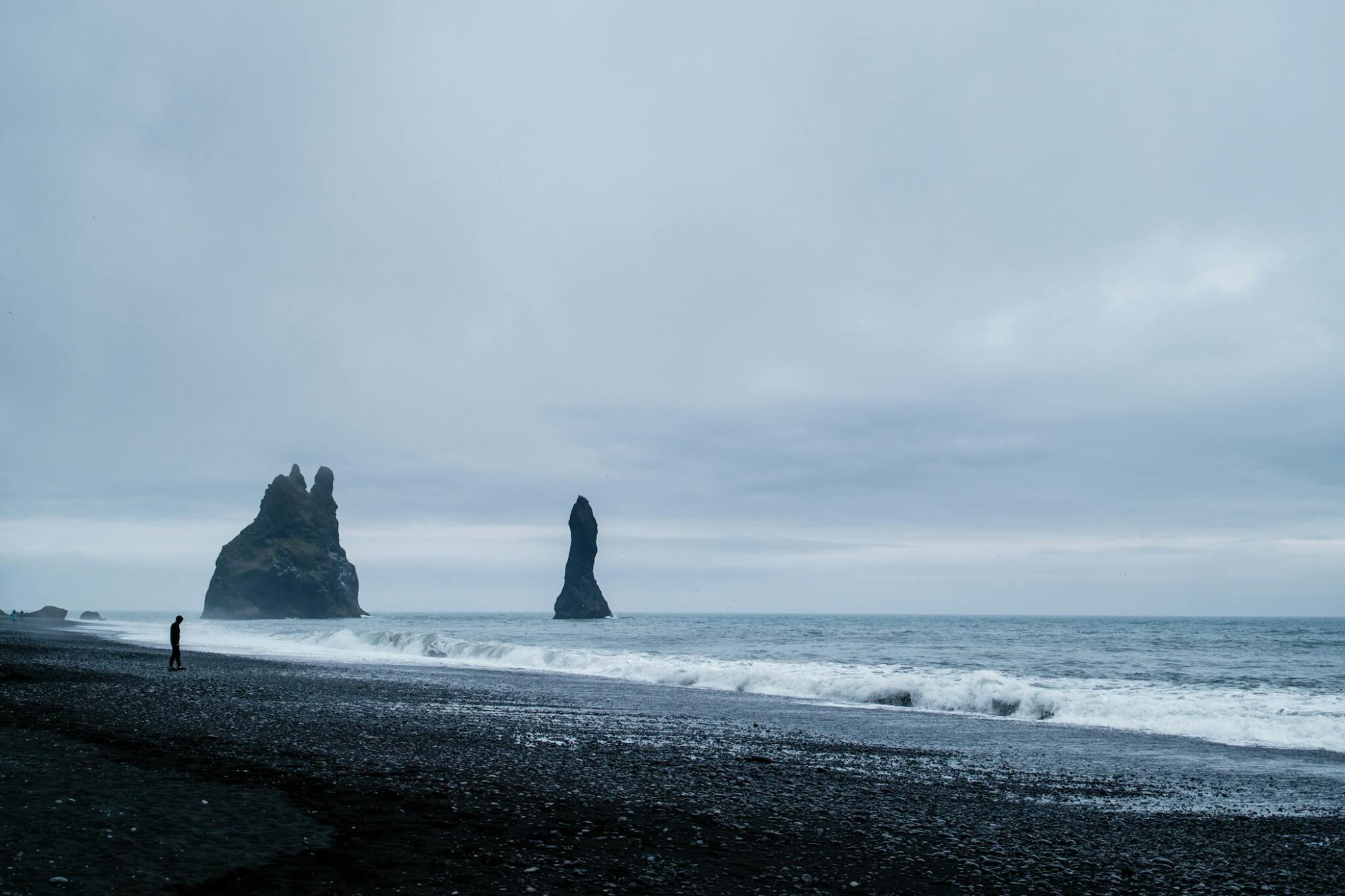
9. Black sand beaches
Iceland is famous for black sand beaches because volcanic geology shapes even the country’s coastline into something people recognize at once. The clearest example is Reynisfjara near Vík, where black volcanic sand, basalt columns, the Reynisdrangar sea stacks, and heavy Atlantic surf meet in one narrow stretch of coast. The beach became so well known not only because it photographs well, but because it shows Iceland’s landscape in a direct way: lava turned into shoreline, rock turned into columns, and the ocean still strong enough to make the place dangerous. That is also why Reynisfjara stays in people’s memory.
That sense of exposure became even more real in the winter of 2025-2026, when severe coastal erosion and a collapse beneath Reynisfjall heavily altered parts of Reynisfjara. Large sections of sand were stripped away, the shoreline shifted, and the sea reached much closer to the basalt formations than before. The erosion also weakened warning signs and a viewing platform, and local reports described the changes as greater than previously seen there.
10. Þingvellir and the Althing
The Alþing, the general assembly representing the whole of Iceland, was established there around 930 and continued to meet at Þingvellir until 1798. Laws were declared, disputes were settled, and major decisions affecting the island were made in the open air, which is why the site carries such strong political and symbolic weight in Icelandic identity. Þingvellir is not just where early Iceland met.
The place stayed central because its history is inseparable from the landscape itself. Þingvellir lies in a rift valley shaped by the separation of the North American and Eurasian tectonic plates, so the site feels physically divided even as it represents national assembly and shared rule. The Law Rock, the assembly plains, and the remains of temporary booths still give the area a strong sense of its original function. UNESCO inscribed Þingvellir on the World Heritage List in 2004, recognizing both its political history and its enduring cultural meaning.
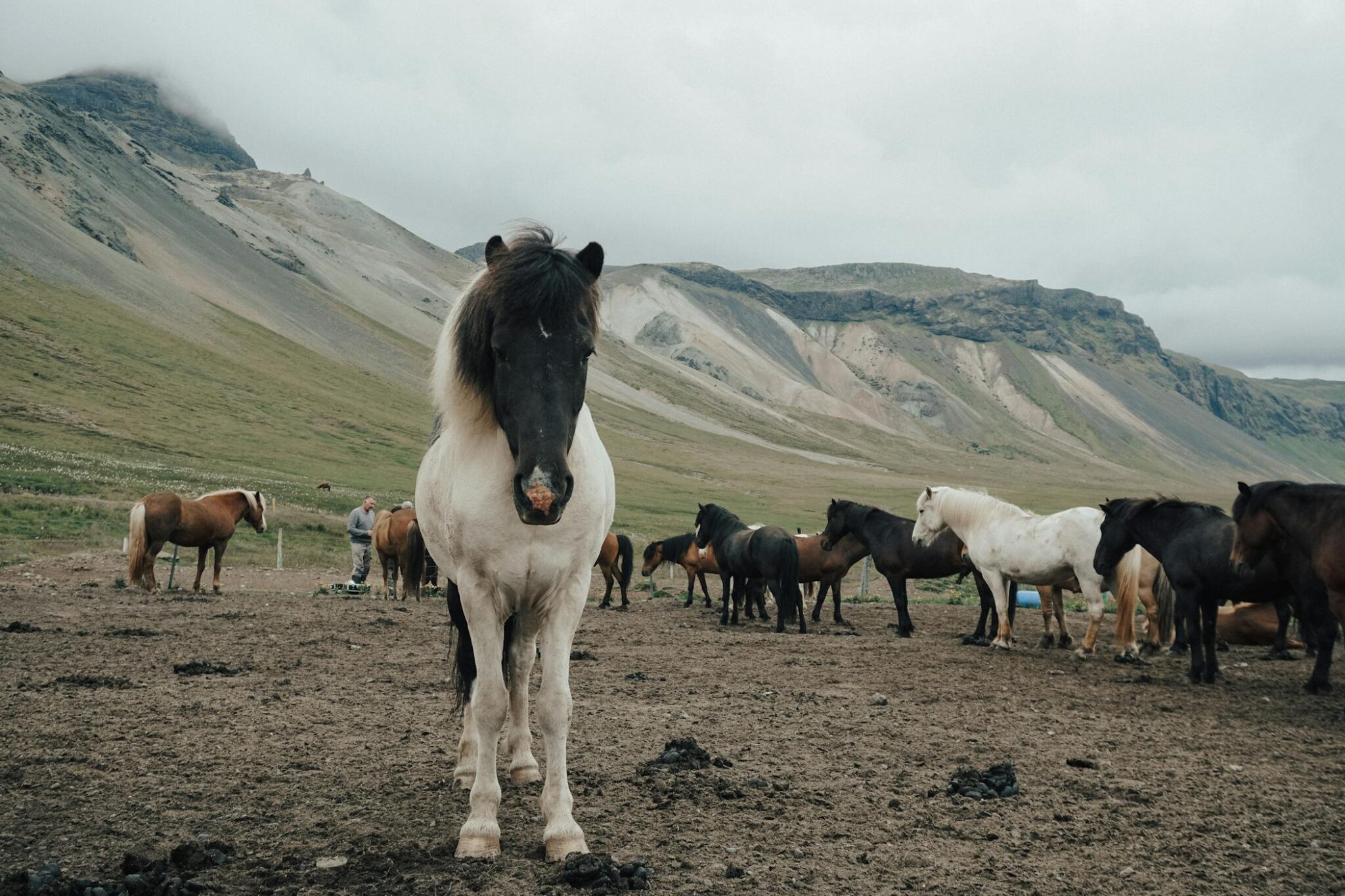
11. Icelandic horses
The breed came with the first settlers more than 1,000 years ago and has remained isolated on the island ever since, with almost no genetic input from other breeds. That long separation gave Iceland a horse that feels closely tied to the country itself: small, sturdy, sure-footed, and built for rough ground, bad weather, and long distances. The protection around the breed is also unusually strict. No horse or other equine can enter Iceland, and once an Icelandic horse leaves the country, it is not allowed to return.
Icelandic horses are five-gaited, which means that besides walk, trot, and canter, many of them also have two extra gaits: the tölt and the flying pace. The tölt in particular became one of the breed’s best-known features because it is smooth and practical over long distances. Their importance is not only symbolic, either. As of 2024, more than 300,000 Icelandic horses were registered around the world, with about 40% of them still in Iceland.
12. Renewable energy and geothermal heating
Renewable sources provide almost all of Iceland’s electricity, with the mix still dominated by hydropower and geothermal power. That matters because energy in Iceland is not a marginal success story or a pilot project. It works at national scale and shapes how the country is understood abroad: a cold North Atlantic island that learned to turn water, underground heat, and volcanic geology into a functioning modern energy system. Geothermal heating makes that achievement even easier to picture in daily life. More than 90% of Icelandic households are heated with geothermal water, so renewable energy is felt not only in infrastructure or policy, but in ordinary homes across the country.
13. Swimming pool culture
Heated outdoor pools are used by people of all ages and are woven into ordinary social life, with locals going there to swim, soak, relax, and talk year-round. Hot tubs in particular became informal meeting places, which is one reason pool culture feels so central to Icelandic identity rather than just to leisure. That role was formally recognized in December 2025, when UNESCO added Swimming pool culture in Iceland to the Representative List of the Intangible Cultural Heritage of Humanity. The connection is especially visible in Reykjavík, where geothermal energy keeps outdoor pools warm even in winter. The city highlights 18 public swimming pools, spread across the capital and heated with naturally hot water from beneath the earth.
14. Vikings and the sagas
The first settlers arrived more than 1,100 years ago, and that early period is still tied to real places people can point to. In central Reykjavík, the Settlement Exhibition preserves a 10th-century Viking longhouse in its original location, along with a wall fragment from before 871, one of the oldest archaeological remains found in Iceland. Medieval Iceland produced one of the richest manuscript cultures in northern Europe, and the Arnamagnæan Manuscript Collection, added to UNESCO’s Memory of the World Register in 2009, contains nearly 3,000 manuscripts, with the oldest dating from the 12th century. Those texts turned Iceland into the main literary home of the Viking world, preserving stories of settlement, law, feud, travel, and family memory in a form that still shapes how the country is seen today.
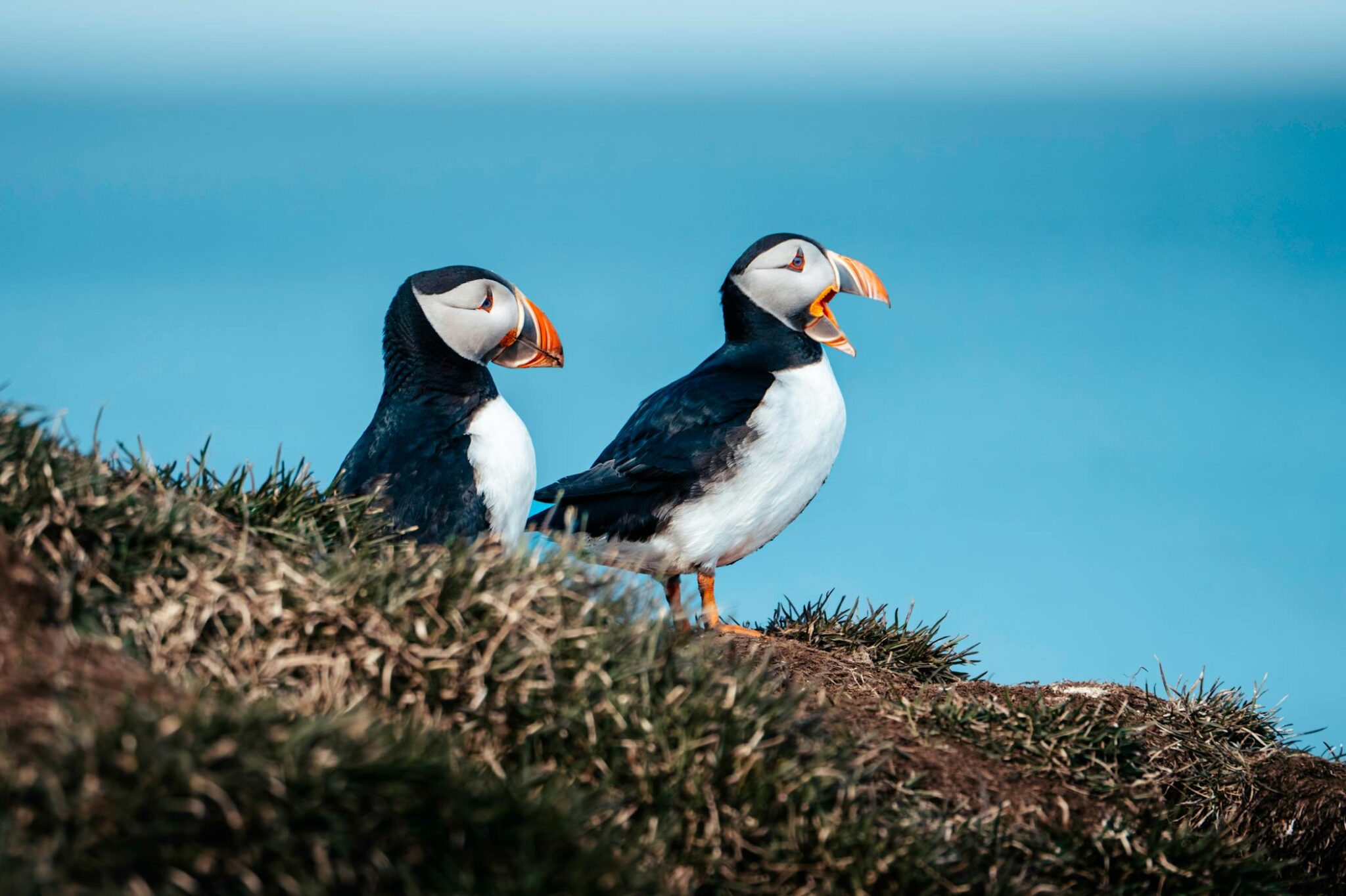
15. Puffins
The Atlantic puffin is described as Iceland’s signature bird, and it matters there on real scale, not as a mascot only. The Natural Science Institute of Iceland says the puffin population is the largest bird population in the country, which helps explain why puffins became such a strong part of Iceland’s identity. The association is also strong because puffins are part of the Icelandic summer season in a very visible way. They come ashore for nesting from around 1 May to 20 August, and breeding grounds can even be seen on islands just off the coast of Reykjavík. That makes puffins feel closely linked to Iceland itself rather than to distant Arctic wildlife in general.
16. Whale watching
Iceland is famous for whale watching because the country turned marine wildlife into one of its most visible travel experiences, not only on the remote northern coast but also right from the capital. Reykjavík plays a big role in that image. Boats leave from the Old Harbour and reach the feeding grounds of Faxaflói Bay in a short time, where humpback whales, minke whales, white-beaked dolphins, and harbour porpoises are among the most commonly seen animals. That easy access matters. In many countries whale watching belongs to long excursions or distant islands, but in Iceland it became part of the standard picture of the country itself: cold water, open sea, and large wildlife close enough to turn a city trip into a marine one.
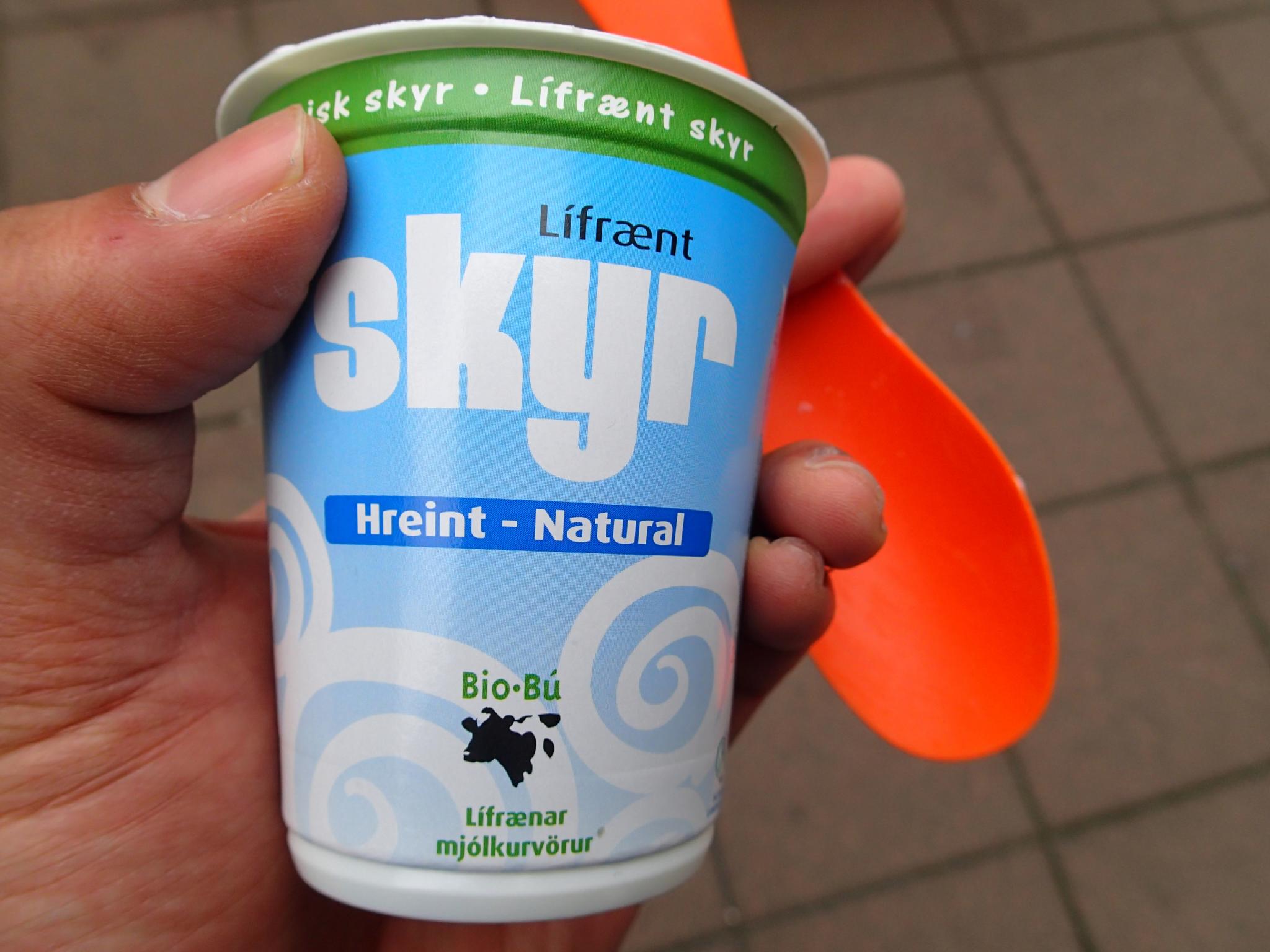
17. Skyr
Iceland is famous for skyr because this thick cultured dairy product stayed part of the national diet for more than a thousand years and still feels closely tied to the country’s settlement-era identity. It is often compared to yogurt, but in Iceland it is treated as its own traditional food, with a denser texture and a long history in everyday eating. Reykjavík’s food guides still describe skyr as a staple of the Icelandic diet for over 1,000 years, which helps explain why it remains one of the country’s clearest food symbols rather than just another dairy product.
Neerav Bhatt, CC BY-NC-SA 2.0
18. Lopapeysa wool sweaters
The style took shape in the early to mid-20th century, when Icelanders looked for new ways to use their native wool, and it later grew into a national icon. What makes it stand out is not only the familiar circular yoke pattern, but the wool itself. Icelandic sheep developed in isolation for more than 1,100 years, and their fleece combines a water-resistant outer layer with a softer insulating inner layer, which is why the sweater works so well in cold, wet, and windy weather.
19. The Ring Road
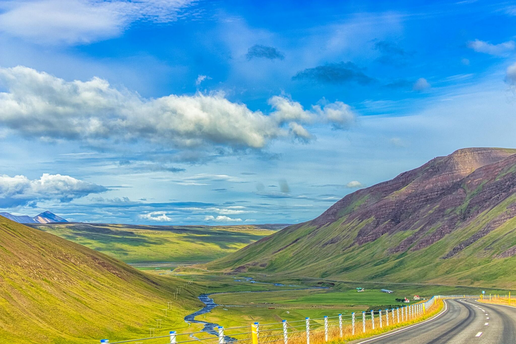
Route 1 runs about 1,322 kilometres around the island and links many of the landscapes most closely associated with Iceland: black sand beaches, glacier tongues, lava fields, waterfalls, fjords, and small coastal towns. It was completed in 1974, which gave Iceland a single road connection around the country and helped make the island feel legible to visitors in a very direct way. Unlike a scenic road that leads to one major viewpoint, the Ring Road keeps changing character as it moves through different parts of the country, so the drive itself becomes part of the destination. Glaciers, waterfalls, volcanic plains, ocean stretches, and settlement landscapes appear in sequence, which is one reason the road is so strongly tied to Iceland’s image abroad. It gives the country one of Europe’s most recognizable road-trip formats: a full loop where the standard attractions are not side notes, but part of the road’s natural rhythm
20. The 2008 financial crisis
Iceland is also known for the 2008 financial crisis because the collapse was so sudden and so large relative to the size of the country that it became one of the most internationally visible financial failures of the period. In the first week of October 2008, the three main cross-border banks – Kaupthing, Landsbanki, and Glitnir – failed, and around 90% of Iceland’s financial sector collapsed. The króna had already come under heavy pressure earlier that year and then fell sharply again during the crash, turning a banking crisis into a national economic shock.
If you’ve been captivated by Iceland like us and are ready to take a trip to Iceland – check out our article on interesting facts about Iceland. Check if you need an International Driving Permit in Iceland before your trip.
Published April 11, 2026 • 14m to read