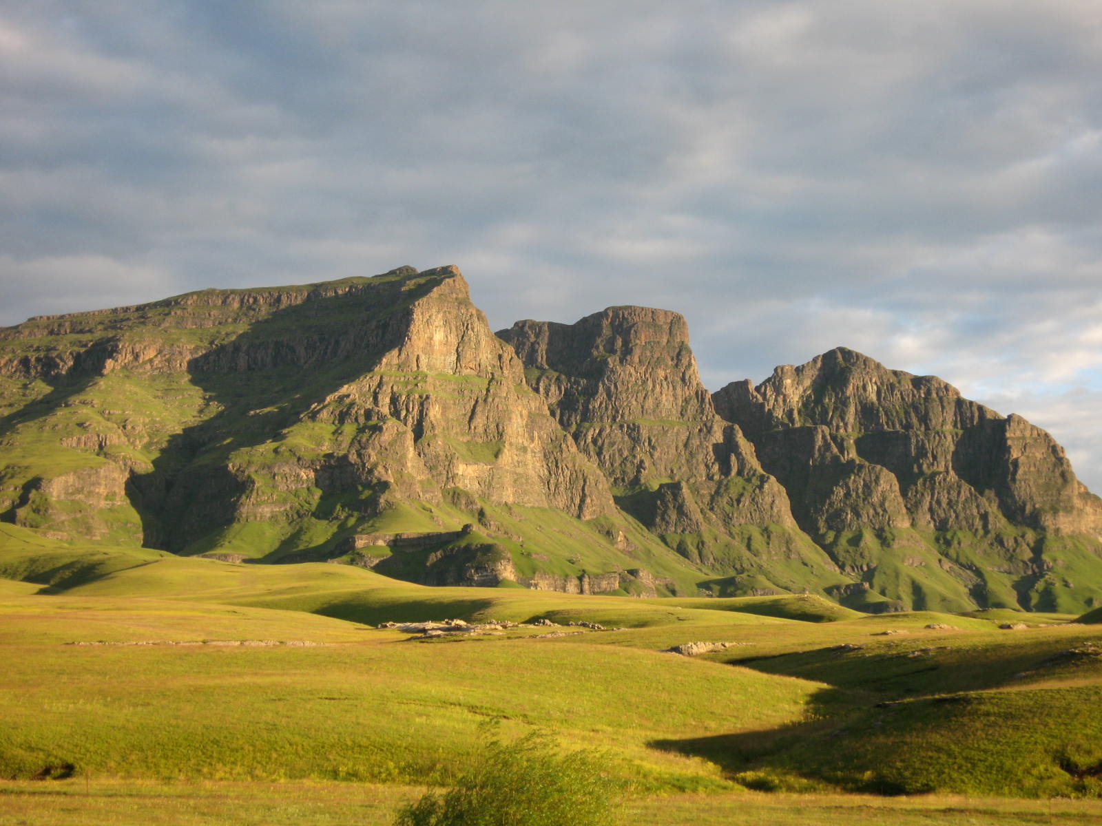
Lesotho is a high-altitude kingdom entirely surrounded by South Africa, defined by steep mountain ranges, deep valleys, and a rural lifestyle closely connected to the land. Often referred to as the Kingdom in the Sky, it sits almost entirely above 1,400 meters, giving it a climate and landscape unlike anywhere else in the region. Travel here centers on mountain scenery, hiking, pony trekking, and quiet roads that climb through remote passes.
Lesotho is best approached slowly and with realistic expectations. Distances can be deceptive, roads are winding, and weather conditions can change quickly, especially at higher elevations. In return, travelers gain access to a country that feels open, uncrowded, and culturally grounded. Village stays, long drives through mountain terrain, and everyday encounters with Basotho life form the core of the experience, making Lesotho well suited to travelers who value authenticity, patience, and landscape over convenience.
Best Cities in Lesotho
Maseru
Maseru is the practical gateway to Lesotho, set on the Caledon River opposite South Africa, and most travelers use it to transition from border formalities to highland travel rather than to “sightsee”. A useful first stop is the central market area and nearby craft stalls, where you can browse Basotho hats, wool blankets, knitwear, and everyday goods in one short loop, then move on. If you want one straightforward cultural visit, the Basotho Hat at the main roundabout is a quick photo point that signals you have arrived, and short walks along busier central streets give you a feel for the city’s daily pace without needing a long itinerary. Maseru also functions well for essentials: SIM cards, cash, basic gear, and any last-minute vehicle items if you are driving deeper into the country.
Logistics are the reason to be efficient. The main border post area is a short drive from the city center, and Maseru is commonly about 140 km from Clarens in South Africa (often around 2 to 3 hours by road with border time) and roughly 450 km from Johannesburg (often around 5.5 to 7.5 hours plus border time), so travel days can stretch. If you are heading into the mountains, treat Maseru as a staging stop: buy water and snacks, fuel up, and confirm your route plan because travel speeds drop once you leave the lowlands.
Teyateyaneng (TY)
Teyateyaneng (often shortened to TY) is a market town north of Maseru that works well as a short cultural stop focused on crafts rather than formal museums. The most useful visit is the town market area and craft stalls, where you can look for Basotho hats, woven items, and blankets, and see how everyday trade runs outside the capital. If you are interested in materials and technique, this is one of the better places to ask practical questions about weaving methods, straw quality, and how hats are finished, then compare a few pieces before you buy. The impression is less “attraction-based” and more routine-based: people coming in to sell produce and crafts, minibuses and shared taxis moving through, and a town pace that feels functional and local.
For logistics, TY is an easy detour on the way toward the northern and central highlands. It is roughly 40 to 50 km from Maseru and often about 45 to 75 minutes by road, depending on traffic and exact start point, so it fits as a morning stop before you commit to longer mountain driving. If you are coming from the Maseru border area, plan a similar order of travel time, then continue north or east toward your first overnight in the highlands once you have supplies and any crafts sorted.
Best Natural Wonders Sites
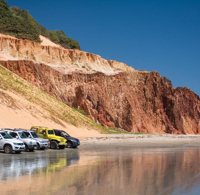
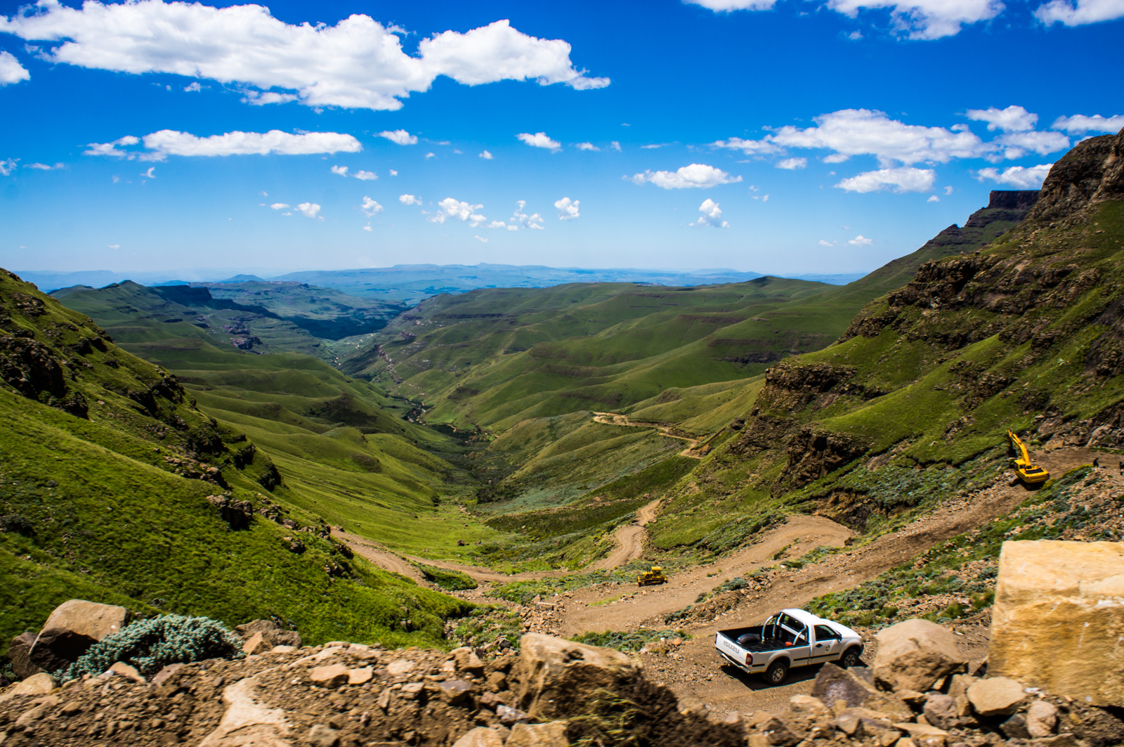
Sani Pass (Lesotho side)
Sani Pass on the Lesotho side is a high-altitude entry into the Maloti-Drakensberg landscape, where the road tops out at around 2,870 m and the scenery shifts fast from green slopes to open, treeless highlands. The experience is built around the climb itself: tight switchbacks, steep sections, and repeated pull-offs where you can stop for valley views and look back at the line of the pass. Once you are up on the plateau, the pace changes, with long horizons, grazing animals, and small settlements that make the route feel like a transition into a different climate zone. Many travelers combine the pass with a short walk on the Lesotho side to stretch legs and take in the altitude and silence, then continue only as far as their daylight and confidence allow.
This is not a casual drive, and planning determines whether it feels controlled or stressful. The Lesotho side is typically approached via the border at the top of the pass after entering from South Africa, and conditions can change within hours due to cloud, wind, rain, or winter snow and ice. A proper high-clearance 4×4 is the standard choice, and average speeds are low, so allow several hours for the up-and-down movement even though the straight-line distance is short. Start early, set a firm turnaround time, and avoid committing late in the day when visibility drops and recovery options shrink.
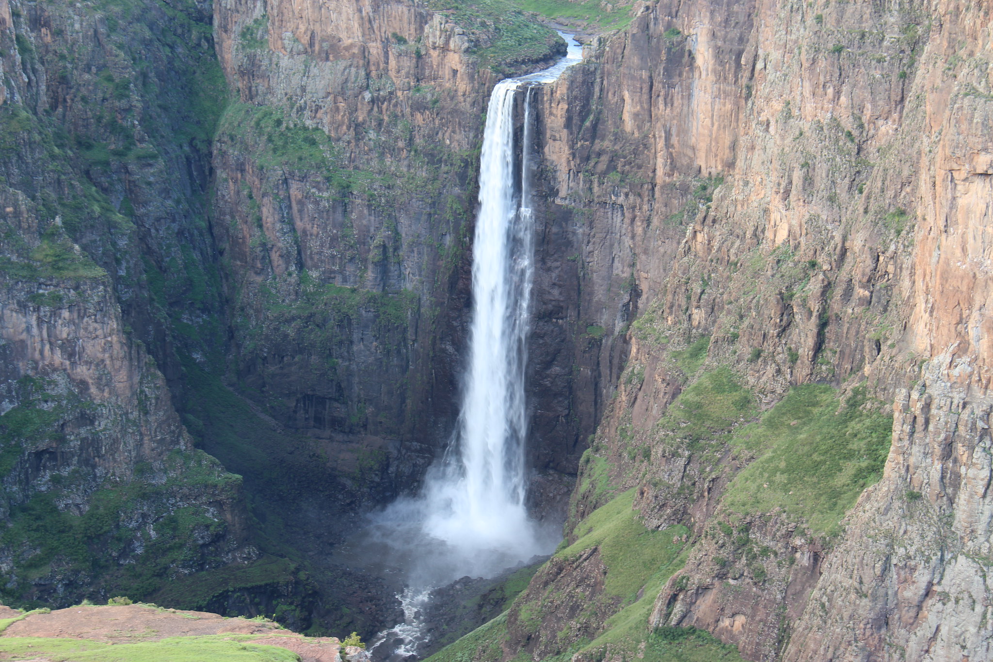
Maletsunyane Falls
Maletsunyane Falls, near Semonkong in Lesotho, is a major highland waterfall with a single plunge of about 192 m, dropping into a deep gorge that you view from open cliff-edge perspectives. The impact comes from scale and sound rather than a “close-up” river walk: you stand above a narrow river that suddenly disappears, then look down into a steep-walled canyon with spray rising in windy conditions. The stop works best if you add one hike, because the surrounding plateau and gorge edges give you changing angles and a sense of distance, and the landscape feels like a route system rather than one viewpoint. Depending on season and rainfall, flow can range from a thin ribbon to a heavy drop, so timing affects the look and the amount of mist at the main viewpoints.
Semonkong is the usual base, and it is also where you arrange guides for longer routes and safer access lines if you want more than the standard viewpoints. From Maseru, Semonkong is roughly 120 to 140 km by road, but driving time is usually about 2.5 to 4 hours because mountain roads are slow and conditions vary. From Roma, plan roughly 80 to 100 km and about 2 to 3 hours. If you are coming from the Sani Pass side, it is a longer cross-country transfer that is best treated as a full travel day.
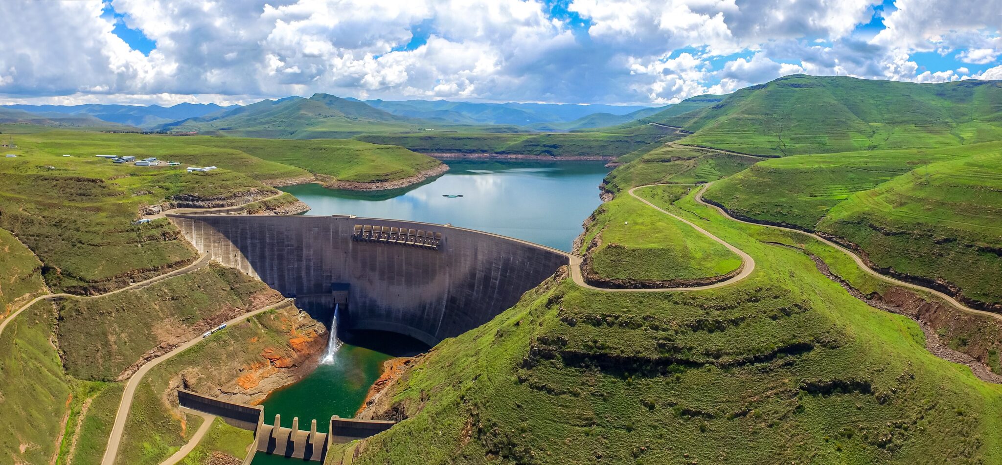
Katse Dam
Katse Dam is the most recognizable landmark of the Lesotho Highlands Water Project and a highland stop where engineering and landscape are inseparable. The dam wall rises about 185 m, and the reservoir pushes into steep valleys, creating long, narrow lake arms that read like fjords when you see them from the road above. The usual experience is a combination of viewpoints on the approach roads and time near the dam itself, where the scale becomes clearer and the wind coming off the water can be noticeable even on mild days. If you are interested in how the system works, look for a formal dam tour option when available, because it turns the site from a viewpoint stop into a structured visit; if not, the drive and the surrounding terrain still deliver the main “wow” factor.
Katse is best treated as a full-day move rather than a quick detour because mountain road speeds stay low. From Maseru, it is roughly 190 to 210 km by road, but driving time is commonly about 4.5 to 6.5 hours depending on route and conditions. From Roma, plan a similar time window with slightly shorter distance, and from Thaba-Tseka it is often around 70 to 90 km but still about 1.5 to 2.5 hours because of winding sections. Build in multiple stops because the viewpoints improve the trip, keep fuel margins comfortable before you leave larger towns, and carry water and warm layers, since weather and visibility can shift quickly at altitude. If you can overnight in the Katse area, the roads feel less pressured and you can time the reservoir views for early morning or late afternoon light.
Sehlabathebe National Park
Sehlabathebe National Park is a high-altitude landscape in eastern Lesotho where the main draw is open grassland, basalt ridges, and sandstone formations rather than wildlife density. It sits around 2,400 to 2,600 m above sea level in much of the park, so days can feel cool even in summer and nights drop fast. The best experiences are on foot: short hikes to rock arches and natural bridges, longer walks across wide plateaus with views into valleys, and quiet time around streams and pools after rain. The park’s atmosphere is defined by distance and emptiness, so it suits travelers who want long horizons, repeated viewpoints, and walking routes where you may see few other people.
Thabana Ntlenyana
Thabana Ntlenyana is the highest peak in Southern Africa at about 3,482 m, and it is best approached as a serious mountain outing rather than a “big day walk” you improvise. The experience is defined by altitude, distance, and exposure: long stretches of open highland terrain, steep final slopes, and weather that can switch from sun to wind, cloud, or sleet within a short window. The summit itself is not a developed viewpoint platform, so the payoff is the scale of the Maloti range around you, the sense of isolation, and the fact that you are standing above the regional skyline. Most visitors treat it as a 2-day trek with an overnight in the highlands, which also allows safer pacing and reduces the pressure to push late into the afternoon.
Logistics usually run through the Sani Pass and Mokhotlong side, or via other highland access routes depending on where you are starting in Lesotho. From the Sani Pass border area to Mokhotlong is often around 110 to 130 km, but it can take 2.5 to 4 hours because speeds are low on mountain roads; from Mokhotlong you still need additional time to reach the usual trail approach areas. Because this is remote hiking, the most reliable plan is to use a local guide, confirm water sources and weather before departure, and carry warm emergency layers even in summer.
Semonkong
Semonkong is a small highland town set on a plateau above deep valleys, used mainly as a base for Maletsunyane Falls and for day routes that rely on trails rather than roads. The most common plan is a falls day plus one additional activity: a longer walk along the gorge edge for changing viewpoints, or pony trekking that follows ridgelines and river crossings to villages and lookouts. The town is also a good place to see how horses function as daily transport in the mountains, with pack horses, riders, and trail movement built into the routine, which is part of what makes the stay feel distinct from road-based travel elsewhere in Lesotho.
From Maseru, Semonkong is roughly 120 to 140 km by road, but driving time is usually about 2.5 to 4 hours because mountain roads are narrow and winding. From Roma, plan roughly 80 to 100 km and about 2 to 3 hours, while transfers from the Sani Pass or Mokhotlong side are longer and are best treated as full travel days. If you want pony trekking, arrange it through a reputable lodge or local operator and confirm the route length, expected hours in the saddle, terrain type, and what is included, since comfort depends on pace and horse handling.
Bokong Nature Reserve
Bokong Nature Reserve is a compact highland stop on Lesotho’s central mountain routes, built around altitude scenery rather than wildlife viewing. The reserve sits high enough for winter snow and ice, and the main experiences are short walks through alpine-style vegetation, viewpoints over steep valleys, and time near the well-known waterfall lookout, where the drop can freeze in colder spells and the gorge views give a clear sense of scale. It works best as a 1 to 3 hour stop: one viewpoint, one short hike, and then a slow drive onward, because the landscape changes quickly with light and cloud at this elevation.
Bokong fits naturally into a driving day between major highland points, especially if you are using the main mountain roads and want a nature break without a long detour. Road times in Lesotho’s highlands are slow, so even short distances can take longer than expected; plan your day with buffer for photo stops and reduced speeds on bends. In winter, treat it like mountain driving: carry warm layers, keep water and snacks in the car, and avoid late-afternoon arrivals when fog and ice become more likely.
Best Cultural and Historical Sites
Thaba-Bosiu
Thaba-Bosiu is the key heritage site for understanding how the Basotho nation formed under King Moshoeshoe I. It is a flat-topped sandstone plateau that functioned as a stronghold in the 19th century, and a visit is built around guided storytelling: defensive geography, early settlement patterns, conflict periods, and how Moshoeshoe’s diplomacy shaped the kingdom’s survival. On the ground, you move between marked points on the plateau and lookouts over the surrounding lowlands, so the experience combines short walks with pauses where the guide explains what happened at each location. Plan about 1.5 to 3 hours depending on the depth of the tour and how much time you spend at the viewpoints.
Thaba-Bosiu is easy to include as a half-day trip from Maseru, which is why it works well at the start or end of a Lesotho itinerary. It is roughly 25 to 35 km from central Maseru and typically 30 to 60 minutes by road depending on traffic and the exact approach route. From the Maseru border area, timing is similar once you are through formalities. Go earlier in the day for clearer light and a calmer pace, bring water and sun protection for plateau walking, and avoid treating it as a quick photo stop.
Morija Museum and Archives
Morija Museum and Archives is one of the most useful cultural stops in Lesotho for understanding Basotho heritage beyond landscapes. The visit is centered on collections that cover traditional life, social change, and the country’s historical timeline, often through everyday objects, photographs, and curated local narratives rather than large-scale “national museum” displays. Plan about 1 to 2 hours for the museum and archives, then add time for a short village walk to see stone buildings, churches, and daily routines that connect naturally to what you have just seen inside. The experience tends to work best when you move slowly, because the value is in context and detail rather than a single headline exhibit.
Morija is an easy addition to a lowlands route, especially if you are based in Maseru or traveling between the capital and interior roads. It is roughly 40 to 50 km from central Maseru and typically about 45 to 75 minutes by road, depending on traffic and exact start point. From Roma, it is often around 25 to 35 km and roughly 30 to 50 minutes. A practical plan is to go in the morning, do the museum at a steady pace, then take a calm lunch break nearby before continuing, because the day feels better when you keep driving segments short and avoid stacking multiple cultural sites back-to-back.
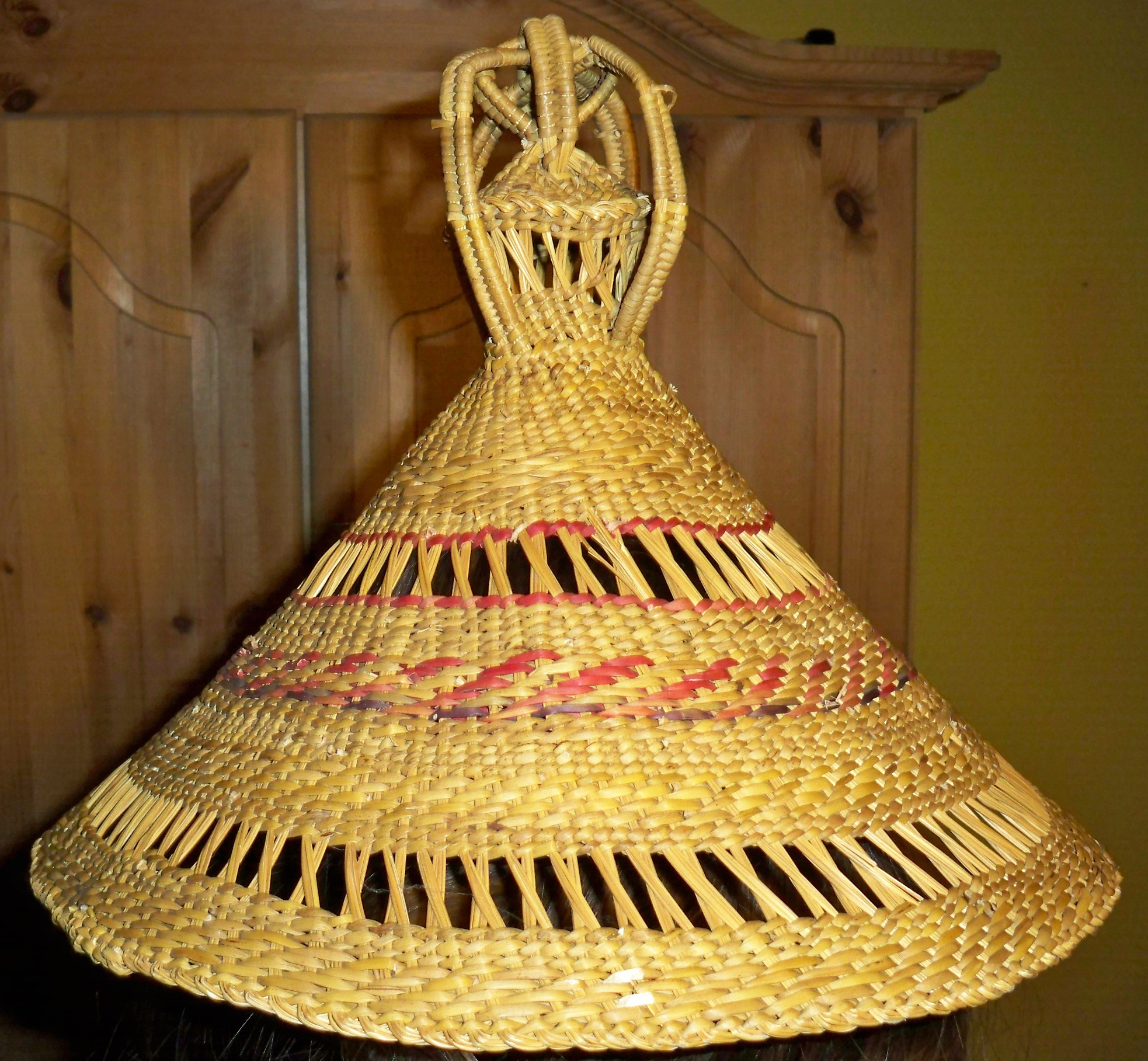
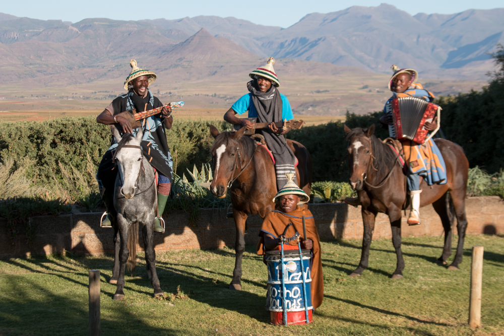
Basotho Hat (Mokorotlo) Craft Markets
Basotho hat (mokorotlo) and blanket markets are among the most practical cultural stops in Lesotho because they combine daily use with symbolism. The mokorotlo is both a recognizable national marker and a functional item in mountain weather, while blankets are worn as outer layers and used for warmth, ceremonies, and gifting. The best market experience is not “buy and leave”, but a short conversation that helps you understand differences in weave tightness, weight, and finish, and how items are chosen for season and purpose. If you have time, visit two stalls before deciding, because you will notice clear variation in stitching, edge binding, and material feel.
Hidden Gems of Lesotho
Mafika Lisiu Pass
Mafika Lisiu Pass is one of Lesotho’s strongest mountain-road segments on the approach toward the Katse area, built for scenery rather than speed. The route climbs into high open country, with long ridge views, deep valley drops, and repeated moments where the road crests and the horizon opens up. The experience is mainly visual and rhythmic: tight bends, steady gradients, and frequent opportunities to stop for photographs, then continue a few minutes to the next angle as the terrain shifts from rounded slopes to sharper escarpment lines. In colder months, the pass can deliver snow-dusted ridges and clear, dry air, while in summer it can bring fast cloud build-up that changes visibility from one corner to the next.
As a drive, it works best when you plan for low average speeds and treat it as a highlight in its own right rather than a simple transfer. Even relatively short distances in the Lesotho highlands can take longer than expected due to narrow sections, road surface changes, and heavy vehicles on climbs, so build buffer time for viewpoint stops and cautious driving. Keep fuel margins comfortable before you leave the larger towns, carry water and warm layers, and avoid late-day descents when light drops and fog can form in valleys.
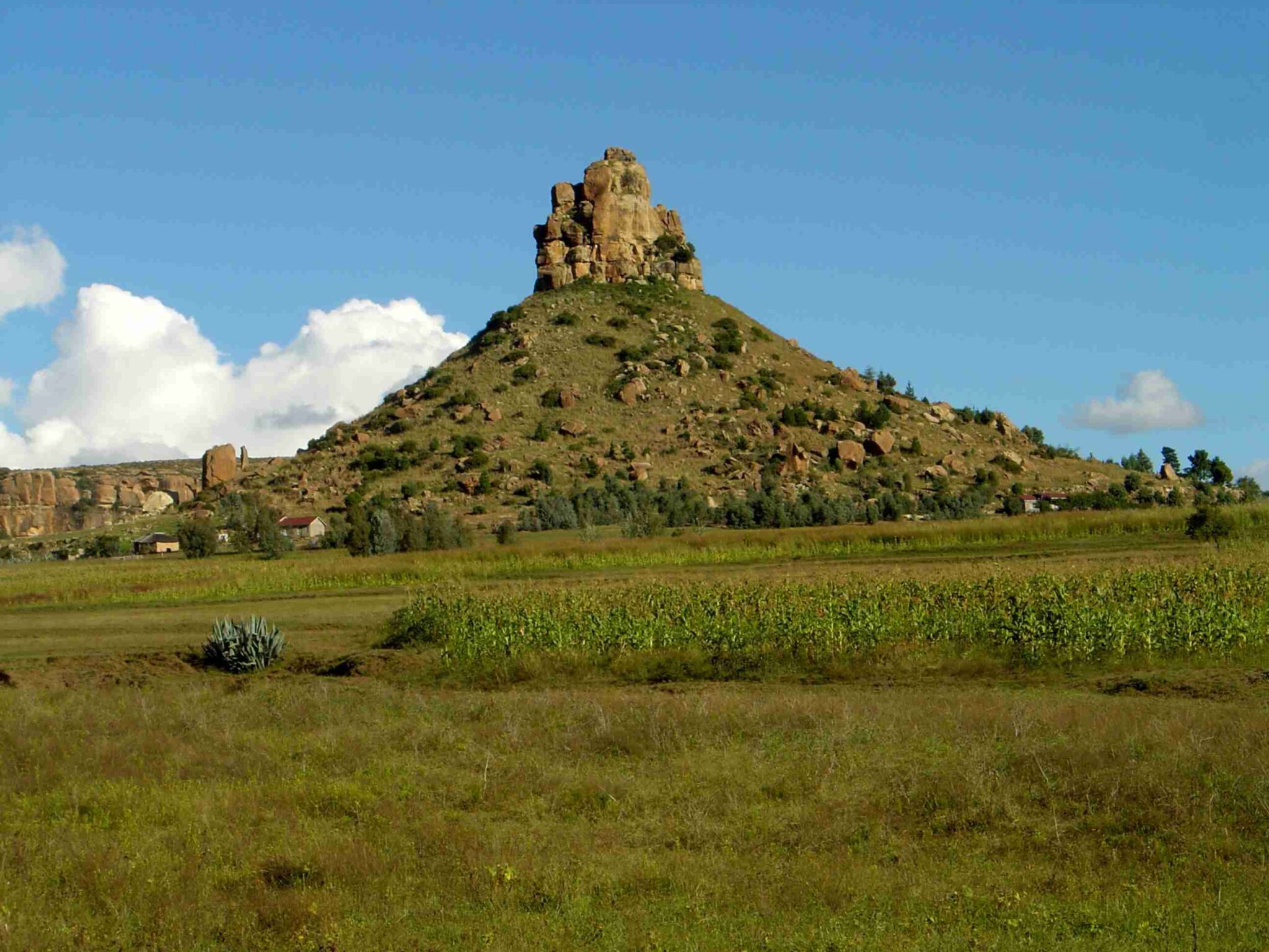
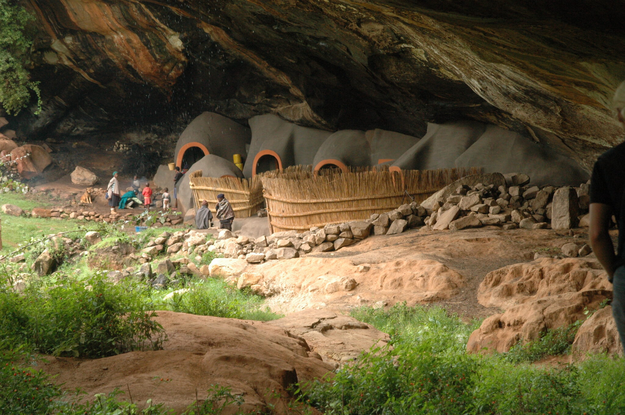
Ha Kome Caves
Ha Kome Caves are a living-heritage stop where you see how Basotho families used shallow caves as protected homes, shaping rooms and walls directly into the rock overhangs. The value is practical detail: how entrances were controlled, how interior spaces were arranged for cooking and sleeping, and how the rock itself provided insulation from cold nights and heavy rain. It feels different from formal museums because the scale is domestic and the setting explains the logic, you can read the landscape and understand why shelter, security, and concealment mattered. Plan around 1 to 2 hours for the visit, longer if you spend time listening to the local story and asking about construction methods and daily routines.
Ha Kome is usually visited as an easy cultural detour from Maseru-side routes into the interior. It is commonly around 40 to 70 km from Maseru depending on your approach, with driving times often 1 to 2 hours on mixed road conditions, and it can also be reached from Roma in roughly 45 to 90 minutes in many itineraries. The visit works best in daylight with local guidance, both for context and for etiquette, because this is tied to community identity rather than a closed-off “ruins” site.
Malealea
Malealea is a rural highland base best known for lodge stays that connect directly into village paths, pony trekking routes, and day hikes rather than car-based sightseeing. The strongest experiences are simple and route-driven: a full-day pony trek to remote viewpoints and small settlements, a shorter half-day hike to a waterfall or ridge, and time in the village atmosphere where daily movement happens on foot and by horse. Even without a long trek, the setting delivers a clear sense of how the landscape shapes routines, with fields on slopes, rivers in narrow valleys, and trails that link homes, schools, and grazing areas. If you want a cultural add-on, many stays can arrange a craft or community visit that focuses on practical skills rather than performances.
Malealea works best with at least two nights because activity timing is weather- and pace-dependent. From Maseru, it is typically around 80 to 100 km by road and often about 2 to 3.5 hours, depending on the final access road condition; from Roma, plan roughly 60 to 80 km and around 1.5 to 3 hours. Arrive in daylight, because the last sections can be slow and visibility matters on narrower roads. For trekking, book through a reputable lodge or operator and confirm route length, expected hours in the saddle, terrain difficulty, and what is included, then pack warm layers and rain protection even in summer.
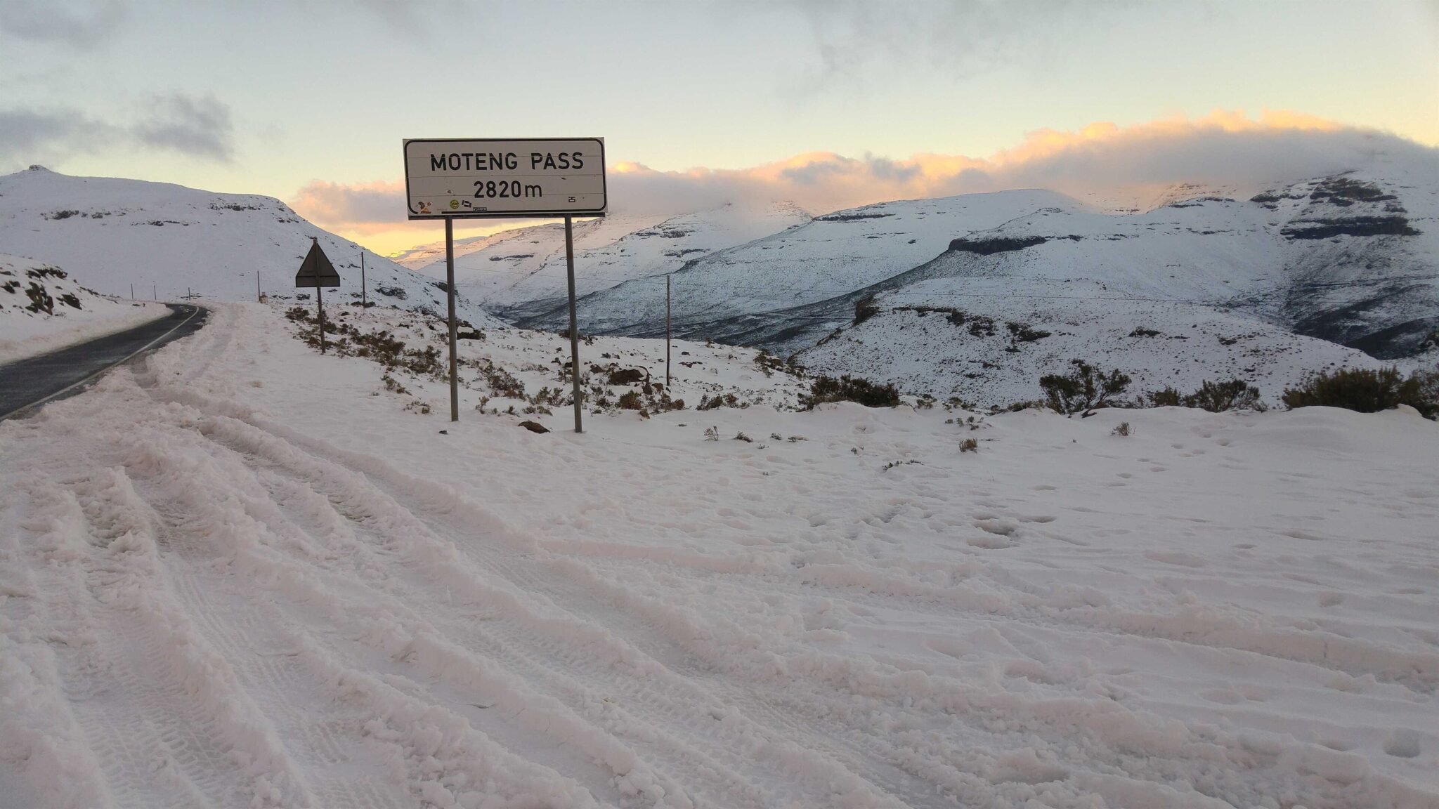
Moteng Pass
Moteng Pass on Lesotho’s A1 is one of the strongest “drive-for-the-views” sections in the northern highlands, with repeated ridge lines, steep valley drops, and long horizon changes as you gain altitude. The experience is less about a single landmark and more about a sequence of viewpoints where the road crests, the terrain opens, then folds into another set of bends. In clear weather, you get layered mountain scenery that makes even short stops feel worthwhile, and the drive becomes a rhythm of slow climbs, careful descents, and frequent pull-offs for photographs and short walks away from the road edge.
Moteng Pass is usually encountered on the main north-south movement between Butha-Buthe, Hlotse (Leribe), and Mokhotlong-side routes, so it fits naturally into a transfer day. Distances in the highlands do not translate cleanly into time, because average speeds drop on bends and visibility can collapse in fog, so build buffer and avoid trying to “make up time” late in the day. Start earlier for steadier light and fewer weather surprises, keep warm layers in the car even in summer, and carry water and snacks in case slow conditions stretch the drive.
Travel Tips for Lesotho
Safety and General Advice
Lesotho is a friendly and welcoming mountain kingdom, but its rugged terrain means that travel often involves remote routes and changing weather conditions. In the highlands, temperatures can drop sharply, especially in winter, and snow is possible at higher altitudes. Careful planning for routes, fuel stops, and accommodation is essential before setting out, as services are limited in rural areas. Visitors should check weather forecasts regularly and allow extra time for travel in mountainous regions.
Lesotho’s high altitude can affect travelers who are not acclimatized, particularly during hiking or other strenuous activities. It’s best to ascend gradually and stay hydrated to reduce the effects of altitude sickness. Medical facilities are limited outside Maseru, so comprehensive travel insurance with evacuation coverage is recommended. Tap water safety varies by region – use bottled or filtered water in rural areas, and carry basic first-aid supplies if traveling off the beaten path.
Car Rental and Driving
An International Driving Permit is recommended alongside your national driver’s license, and both should be carried at all times, especially at border crossings or police checkpoints. Driving in Lesotho is on the left-hand side of the road. Mountain routes are steep, winding, and occasionally unpaved, requiring careful driving and sometimes a 4×4 vehicle, particularly for challenging roads such as Sani Pass or routes through the central highlands. Night driving is not recommended due to livestock on the roads and limited visibility. Drivers should check fuel levels before long journeys, as petrol stations are scarce in remote areas.
Published January 25, 2026 • 17m to read