Benin is a compact West African country with a strong historical and cultural identity. It is widely known as the birthplace of Vodun, a living spiritual tradition that continues to shape daily life through temples, ceremonies, and sacred sites. The country also preserves the legacy of the former Kingdom of Dahomey, whose royal palaces, artifacts, and symbols reflect a powerful pre-colonial past. Alongside this heritage, Benin offers varied landscapes that include savannahs, wetlands, forests, and a short but scenic Atlantic coastline.
Travelers can explore historic cities such as Abomey, walk through Ouidah’s landmarks connected to global history, or visit Ganvié, a stilt village built over a lagoon. National parks in the north protect wildlife, while coastal towns offer a quieter rhythm of life. Easy to travel and rich in tradition, Benin provides a clear view into West African history, spirituality, and everyday culture.
Best Cities in Benin
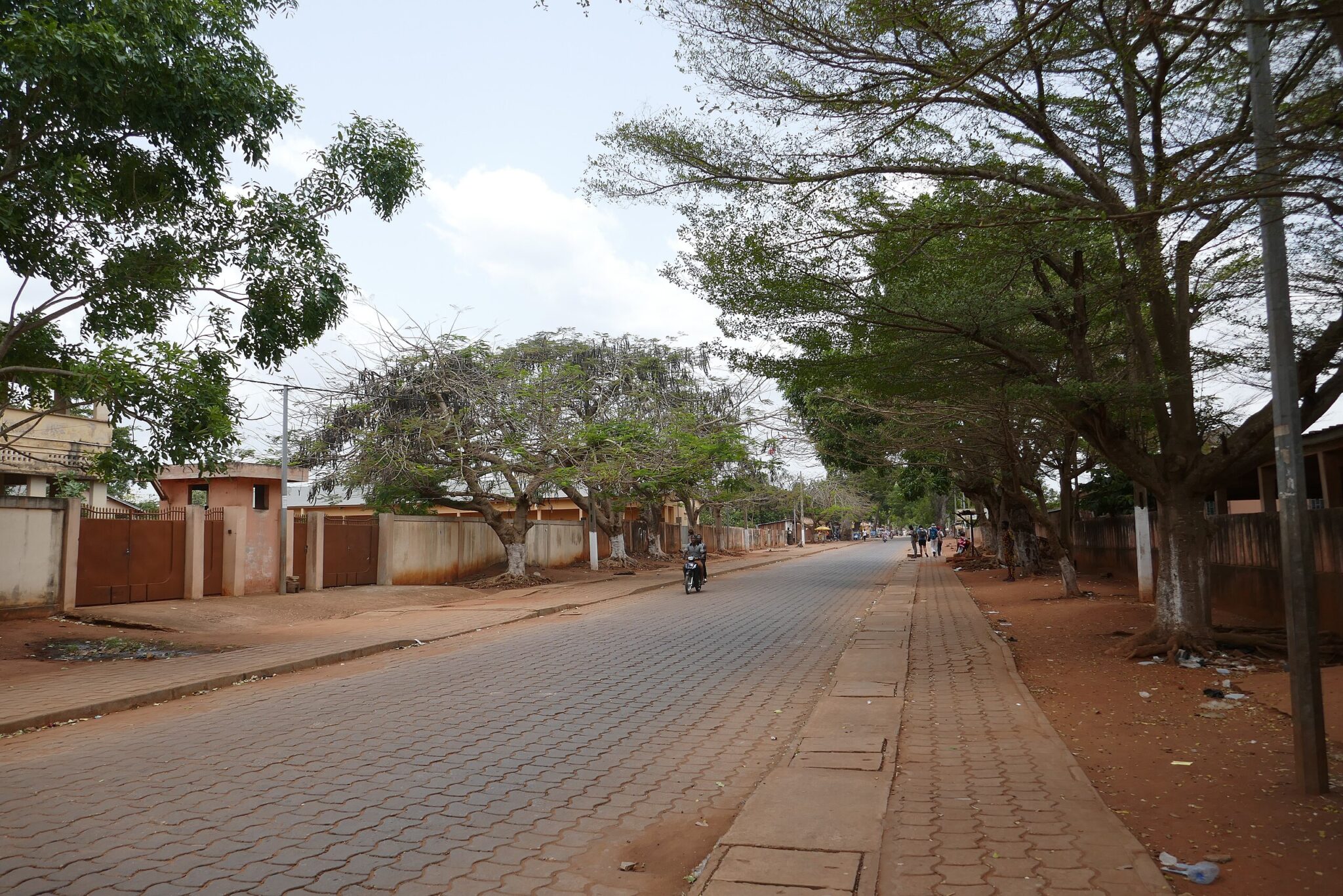
Cotonou
Sherbro Island lies off Sierra Leone’s southern coast and is reached by boat from mainland towns such as Shenge or Bonthe. The island is sparsely populated and characterized by mangrove forests, tidal river channels, and small fishing settlements that rely on canoe travel and seasonal inshore fisheries. Walking through villages provides insight into how households manage fishing, rice cultivation, and trade across the coastal lagoon system. The island’s waterways support birdlife, fish nurseries, and shellfish harvesting, offering opportunities for guided boat excursions with local operators.
Because Sherbro receives relatively few visitors, services are limited, and itineraries typically involve coordination with community lodges or local guides. Trips often include visits to mangrove creeks, short walks to inland farms, and discussions with residents about conservation challenges along the coast.
Porto-Novo
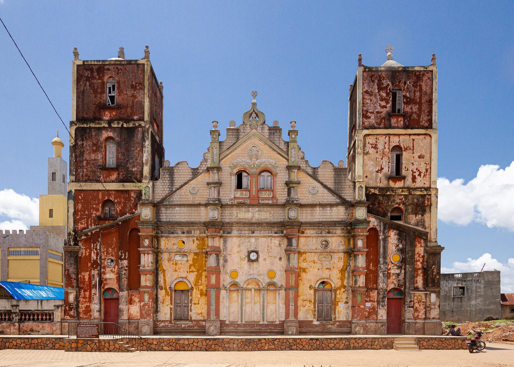
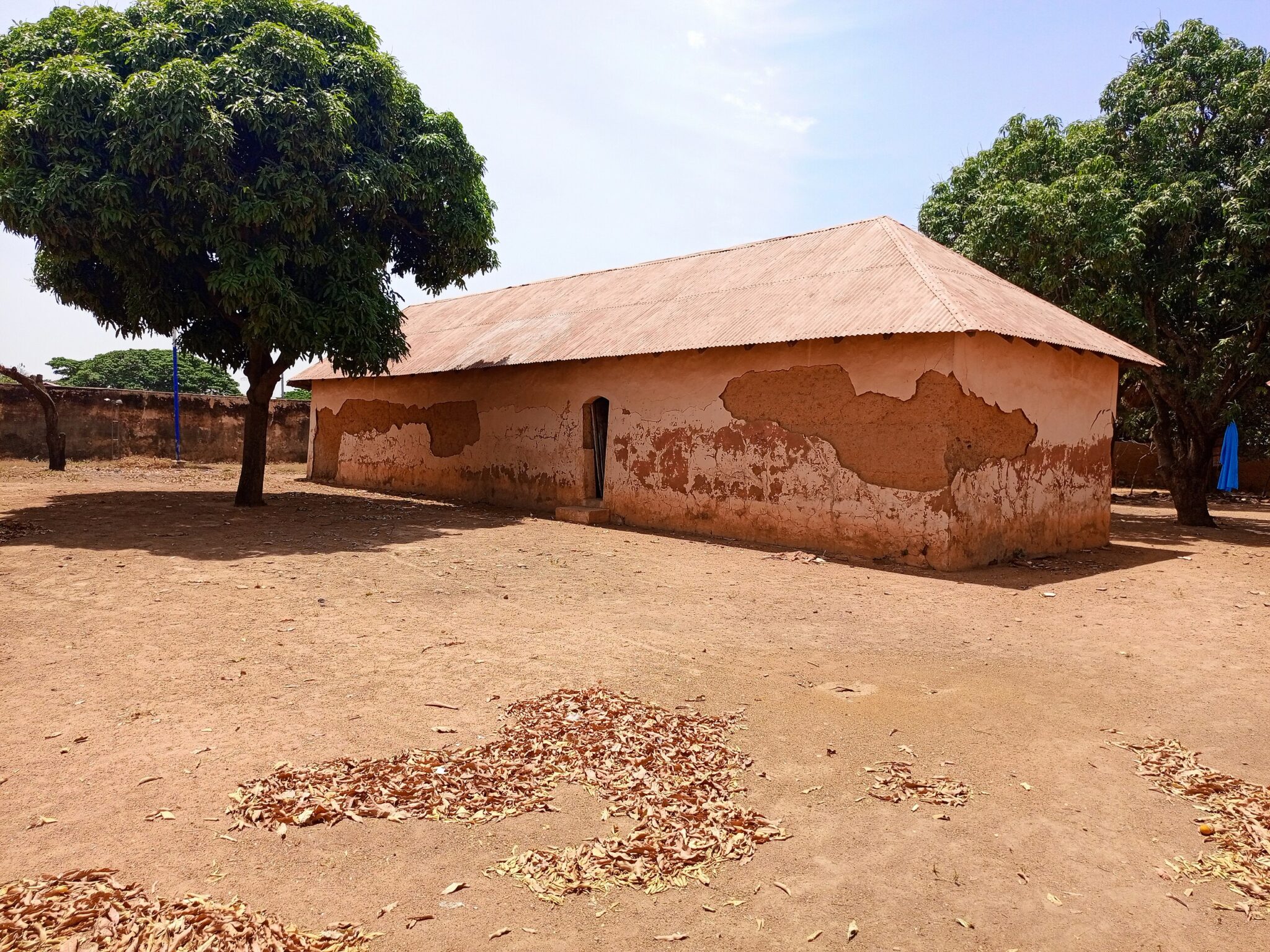
Porto-Novo is the official capital of Benin and a center of Yoruba and Afro-Brazilian cultural heritage. Its urban layout reflects a mix of traditional compounds, colonial-era buildings, and community spaces used for ceremonies and local governance. The Ethnographic Museum of Porto-Novo presents masks, musical instruments, textiles, and ritual objects that help explain the cultural practices of the region’s diverse ethnic groups. Exhibits also explore how returning Afro-Brazilian families influenced architecture, crafts, and social life in the city.
The Royal Palace of King Toffa provides context on pre-colonial political structures and the continuing role of local monarchy in community identity. Guided visits explain how the palace once operated as a seat of authority, the significance of its courtyards, and the relationship between royal institutions and religious practices. Porto-Novo’s quieter urban rhythm contrasts with the commercial activity of nearby Cotonou, making it a practical destination for travelers who want to focus on museums, heritage sites, and community traditions.
Abomey
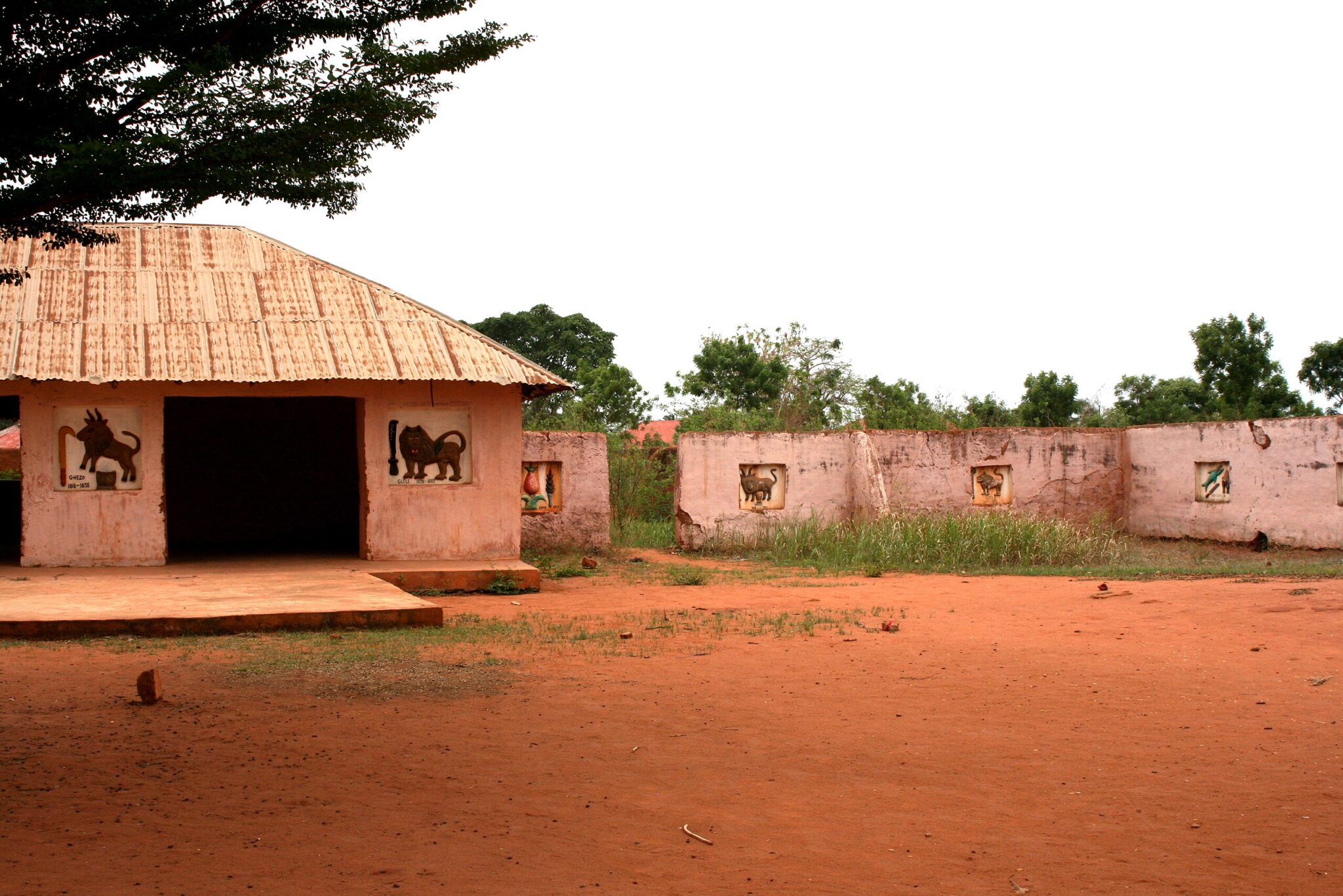
Abomey served as the capital of the Dahomey Kingdom from the 17th to the 19th century and remains one of Benin’s most significant historical centers. The Royal Palaces of Abomey, designated as a UNESCO World Heritage Site, consist of multiple earthen compounds that once housed Dahomean kings, their courts, and ceremonial spaces. Each palace features bas-reliefs, architectural layouts, and objects that document political authority, military organization, trade connections, and religious systems that shaped the kingdom’s development. Visitors can explore throne rooms, courtyards, and storage areas that reveal how royal households functioned and how rituals reinforced power.
The on-site museum displays royal thrones, weapons, textiles, and ceremonial items linked to specific rulers, offering insight into succession, governance, and the symbolic systems associated with kingship. Guided tours explain the meaning behind the bas-reliefs and how the palaces were arranged to host administrative duties, diplomatic receptions, and spiritual practices. Abomey is reached by road from Cotonou or Bohicon and is often included in itineraries covering Benin’s cultural heartland.
Ouidah
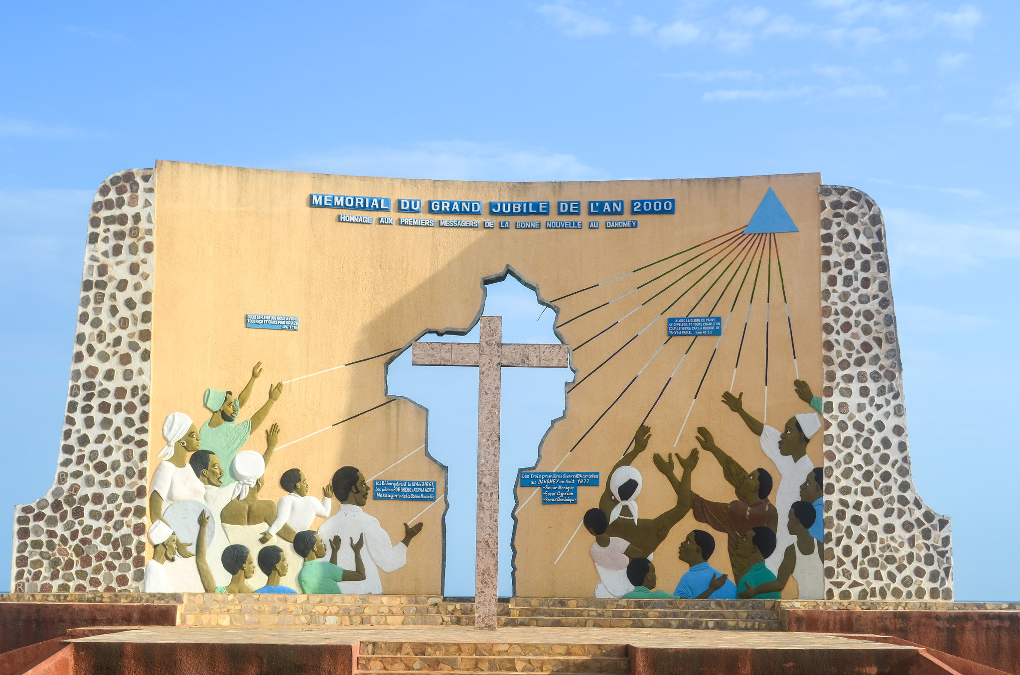
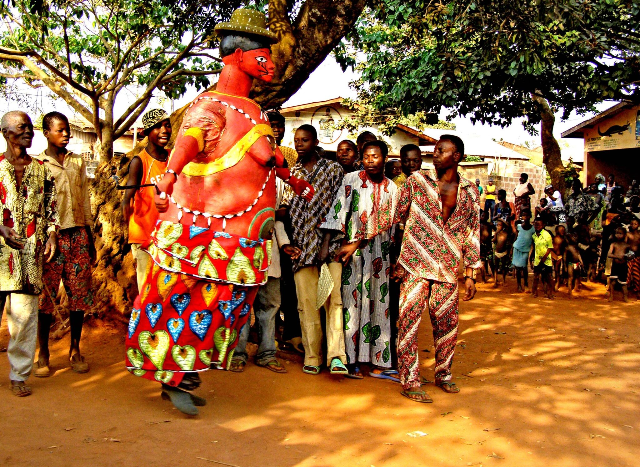
Ouidah is a major center of Vodun practice and an important historical site linked to the Atlantic slave trade. The town’s coastal corridor, known as the Route of Slaves, follows the path that enslaved Africans were forced to walk from the auction square to the shoreline. The route ends at the Door of No Return, a memorial marking the final departure point for captives shipped across the Atlantic. Walking this path with a guide provides context on trade systems, European involvement, and local communities affected by these events.
The Ouidah Museum of History, located in a former Portuguese fort, presents artifacts and archival material that explain the town’s political, economic, and cultural role over several centuries. Nearby, the Python Temple serves as an active Vodun shrine where priests conduct rituals central to local belief systems. Throughout the year, and especially during the Vodun Festival on January 10, Ouidah hosts ceremonies, music, and dance events that illustrate the enduring influence of Vodun in regional identity.
Best Historical Sites
Royal Palaces of Abomey
The Royal Palaces of Abomey form a large complex of earthen structures built by successive kings of the Dahomey Kingdom between the 17th and 19th centuries. Each ruler added his own palace within the compound, creating a network of courtyards, throne rooms, storage areas, and ceremonial spaces. The bas-reliefs that line many palace walls record key events in Dahomean history, including military campaigns, royal emblems, trade activities, and symbols associated with political and spiritual authority. These visual narratives provide one of the clearest historical records of the kingdom’s leadership and worldview.
As a UNESCO World Heritage Site, the palaces are preserved both for their architectural significance and for their role in documenting pre-colonial governance. The on-site museum displays thrones, weapons, regalia, and ritual objects associated with former kings. Guided tours help visitors understand how power was structured, how succession was managed, and how the palaces functioned as administrative centers. Abomey is reached easily from Bohicon or Cotonou, and many itineraries pair a visit with nearby crafts workshops and regional historical sites.
Route of Slaves
The Route of Slaves links central Ouidah with the Atlantic coast and follows the path taken by enslaved Africans before they were forced onto ships bound for the Americas. The marked route includes several symbolic stations, such as the Tree of Forgetfulness, public squares once used for auctions, and artistic installations that help explain the structure of the slave trade and the involvement of European and local intermediaries. These points illustrate how individuals were processed, held, and moved through the system before departure.
The path ends at the Door of No Return, a seaside memorial that marks the final point of embarkation. Guided visits provide historical context through oral accounts, archival information, and local perspectives on how the trade shaped communities in and around Ouidah. The route is easily explored on foot and is often paired with visits to the Ouidah Museum of History or nearby religious sites.
Afro-Brazilian Architecture
Afro-Brazilian architecture in southern Benin reflects the influence of formerly enslaved families who returned from Brazil and the Caribbean during the 19th century. These communities introduced building techniques, decorative elements, and urban layouts shaped by their experiences in the Atlantic world. Houses typically feature stuccoed façades, arched windows, wooden balconies, and painted ornamentation, blending Portuguese-influenced design with local construction methods and materials. Many structures also include courtyards that served as family or ceremonial spaces.
Porto-Novo and Ouidah contain the most concentrated examples of this architectural heritage. In Porto-Novo, residential streets and civic buildings display the characteristic Afro-Brazilian style, often tied to prominent family histories or religious associations. In Ouidah, restored homes and former trading compounds illustrate how returning Afro-Brazilian families contributed to commerce, urban planning, and cultural life.
Best Natural Wonders Destinations
Pendjari National Park
Pendjari National Park forms the northern section of the W–Arly–Pendjari (WAP) Complex, a transboundary UNESCO World Heritage Site shared by Benin, Burkina Faso, and Niger. It is one of the last protected areas in West Africa where large mammal populations remain relatively stable. The park contains savanna, woodland, and riverine ecosystems that support elephants, buffalo, several antelope species, hippos, and predators such as lions and leopards. Birdlife is also extensive due to seasonal wetlands and river corridors.
Safari activities in Pendjari are organized through designated entry points and managed eco-lodges that provide guiding services, vehicle access, and wildlife-viewing logistics. Game drives typically focus on water sources and open plains where wildlife congregates during the dry season. The park is reached by road from Natitingou or Parakou, with most itineraries combining wildlife viewing with cultural visits to nearby Atakora mountain communities.
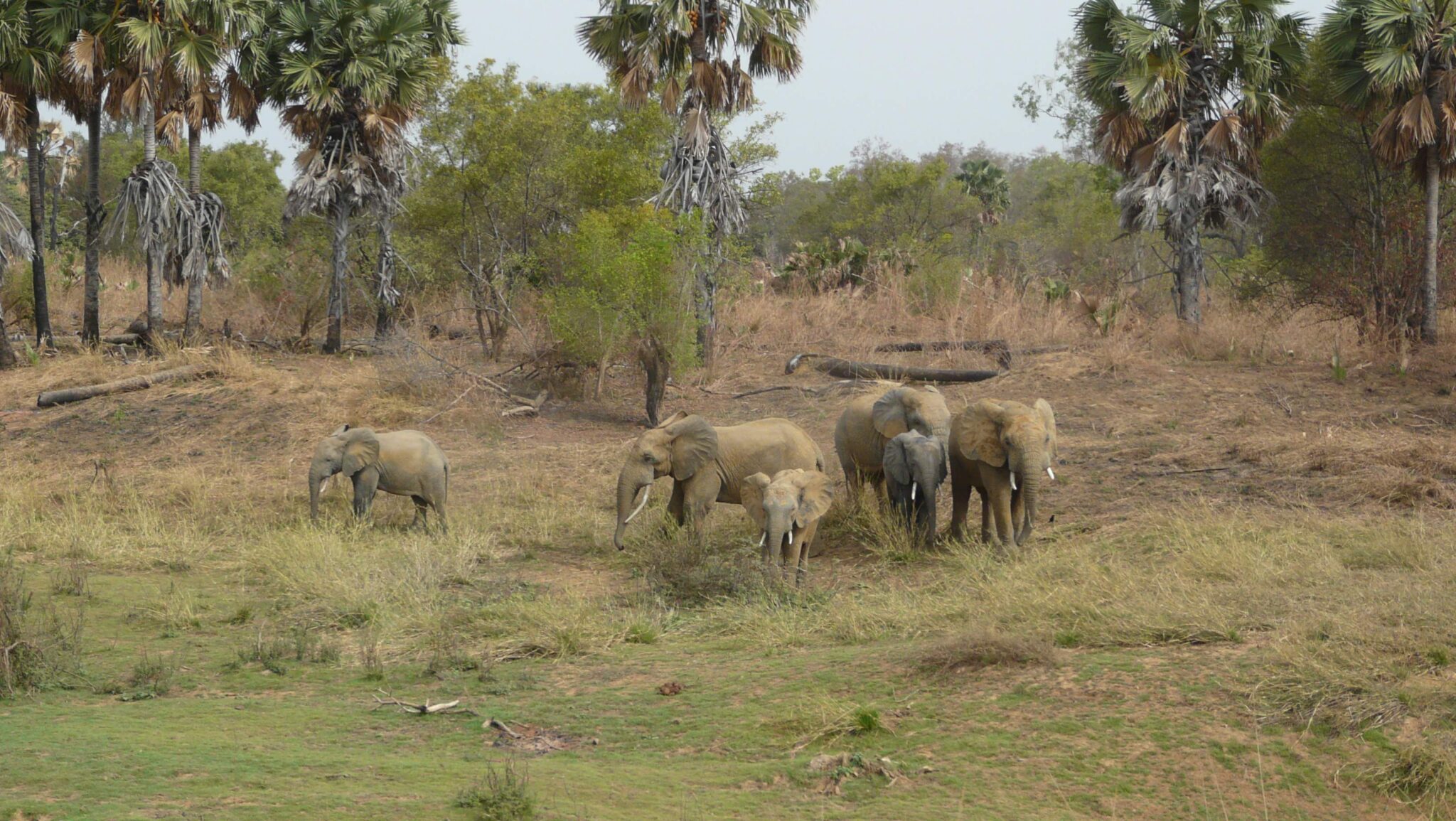
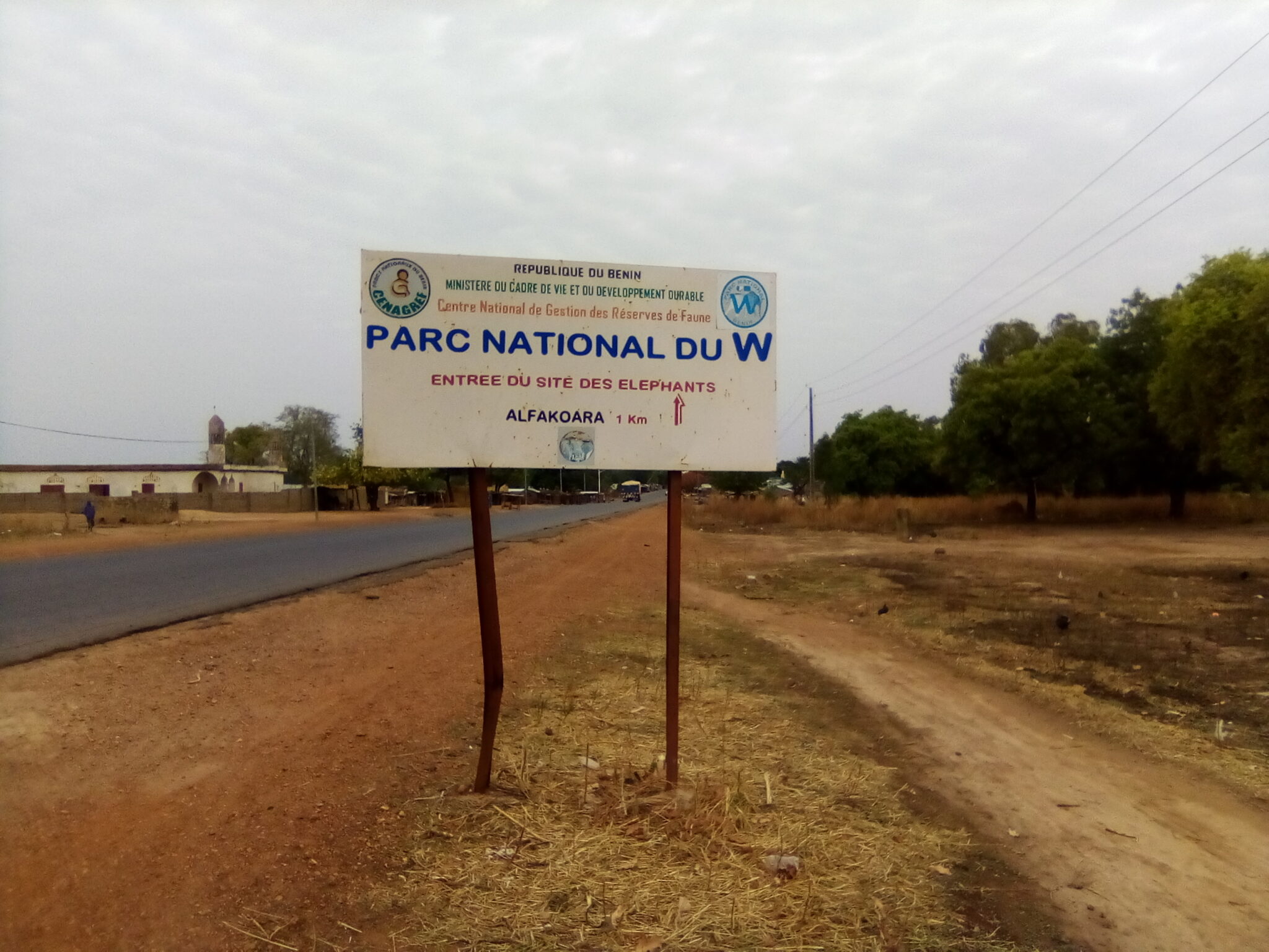
W National Park
W National Park is part of the larger W-Arly-Pendjari ecosystem that spans Benin, Niger, and Burkina Faso. The park takes its name from the W-shaped bend of the Niger River and protects a mosaic of savanna, woodland, and wetland habitats. These environments support elephant movements across borders, as well as populations of hippos, buffalo, antelope species, primates, and numerous birds that rely on seasonal floodplains and gallery forests. Wildlife distribution varies by season, with dry periods concentrating animals around remaining water sources.
The Niger and Burkina Faso sections of the park are more remote and require advance planning, permits, and coordination with guides familiar with current access conditions. Communities living near the park depend on pastoralism, small-scale farming, and traditional resource management practices that influence conservation strategies across the region.
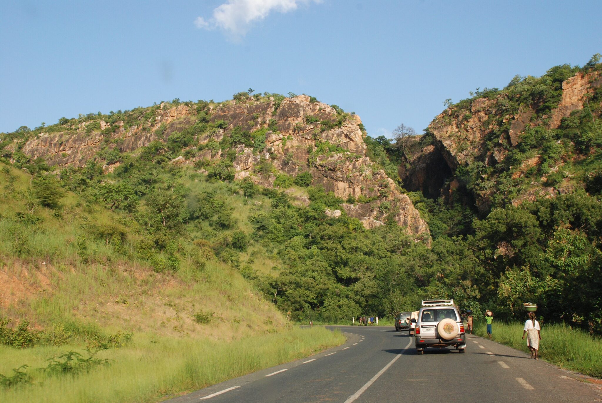
Atakora Mountains
The Atakora Mountains run through northwestern Benin and form one of the country’s most distinctive highland regions. The range includes hills, rocky plateaus, and pockets of woodland that create varied conditions for agriculture, grazing, and small-scale settlement. Villages are often positioned along slopes or valley floors, where water sources and arable land are more accessible. Walking routes connect communities, farms, and viewpoints, making the area suitable for day hikes or longer circuits that explore both natural and cultural landscapes.
The region is closely associated with the Somba and related northern ethnic groups. Their traditional compounds, sometimes built as multi-level fortified structures, illustrate how households organize space for storage, livestock, and daily activities. Guided village visits offer explanations of building methods, land-use practices, and rituals tied to farming and community life. The Atakora Mountains are typically accessed from Natitingou, which serves as the main base for excursions into nearby cultural sites, waterfalls, and nature reserves.
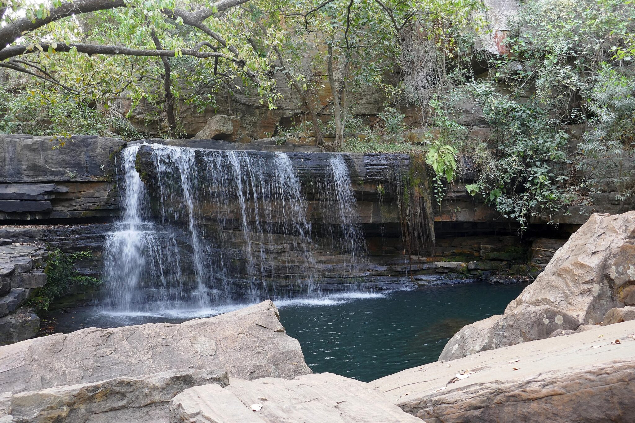
Tanougou Waterfalls
Tanougou Waterfalls are located northeast of Pendjari National Park and serve as a convenient stop for visitors traveling between the Atakora Mountains and the park’s safari routes. The falls create a series of natural pools fed by seasonal streams, offering a place to rest and swim after hikes or wildlife excursions. During the rainy season, water flow increases, while in the dry season smaller cascades and calmer pools remain accessible.
Local community groups manage the site, maintain footpaths, and provide information on safe swimming areas. Short walks around the falls lead to viewpoints over the surrounding farmland and forest patches. Tanougou is typically reached by road from Natitingou or from lodges near Pendjari, making it easy to include in itineraries focused on nature, culture, and outdoor activities in northern Benin.
Best Beaches in Benin
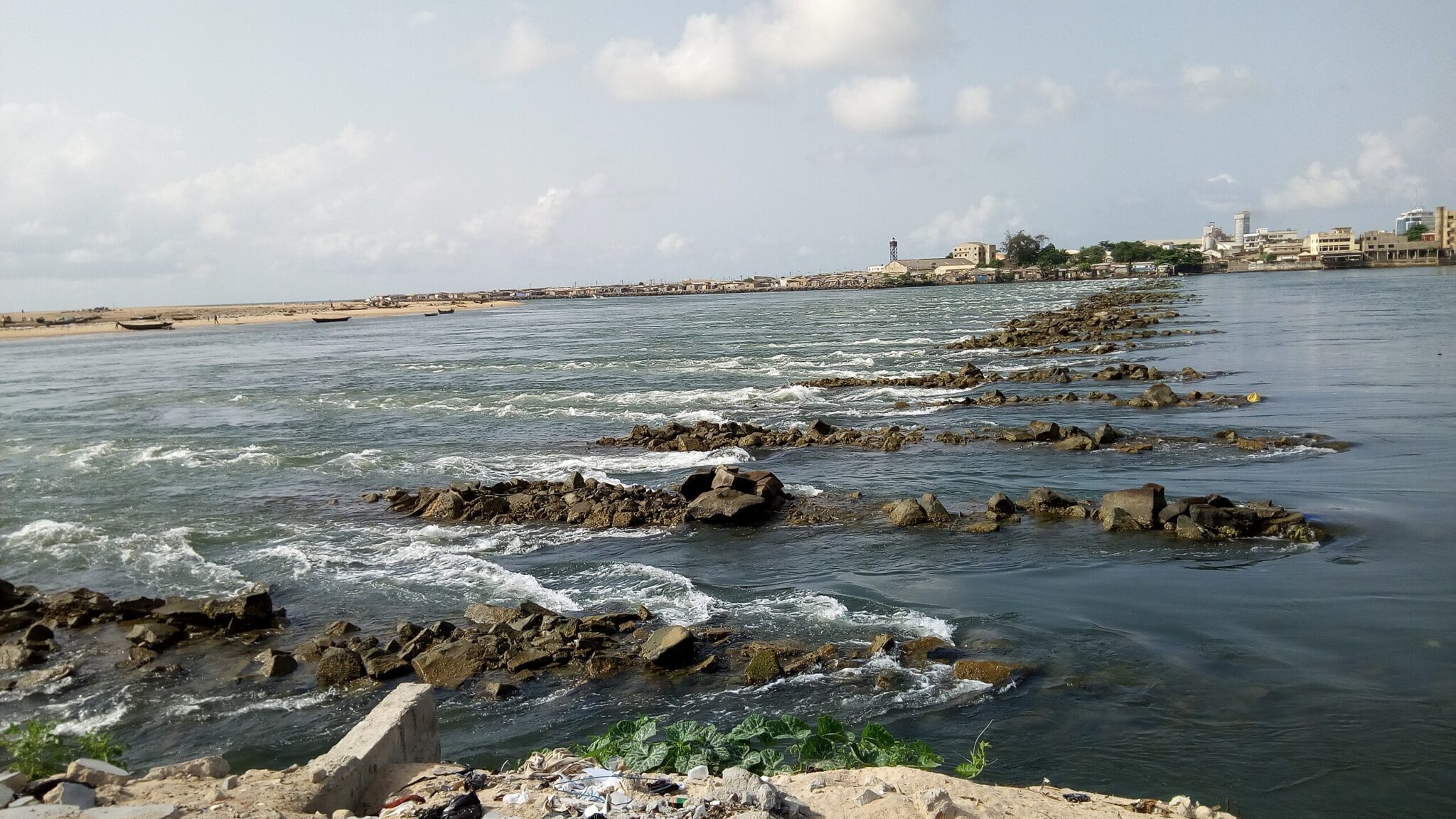
Grand-Popo
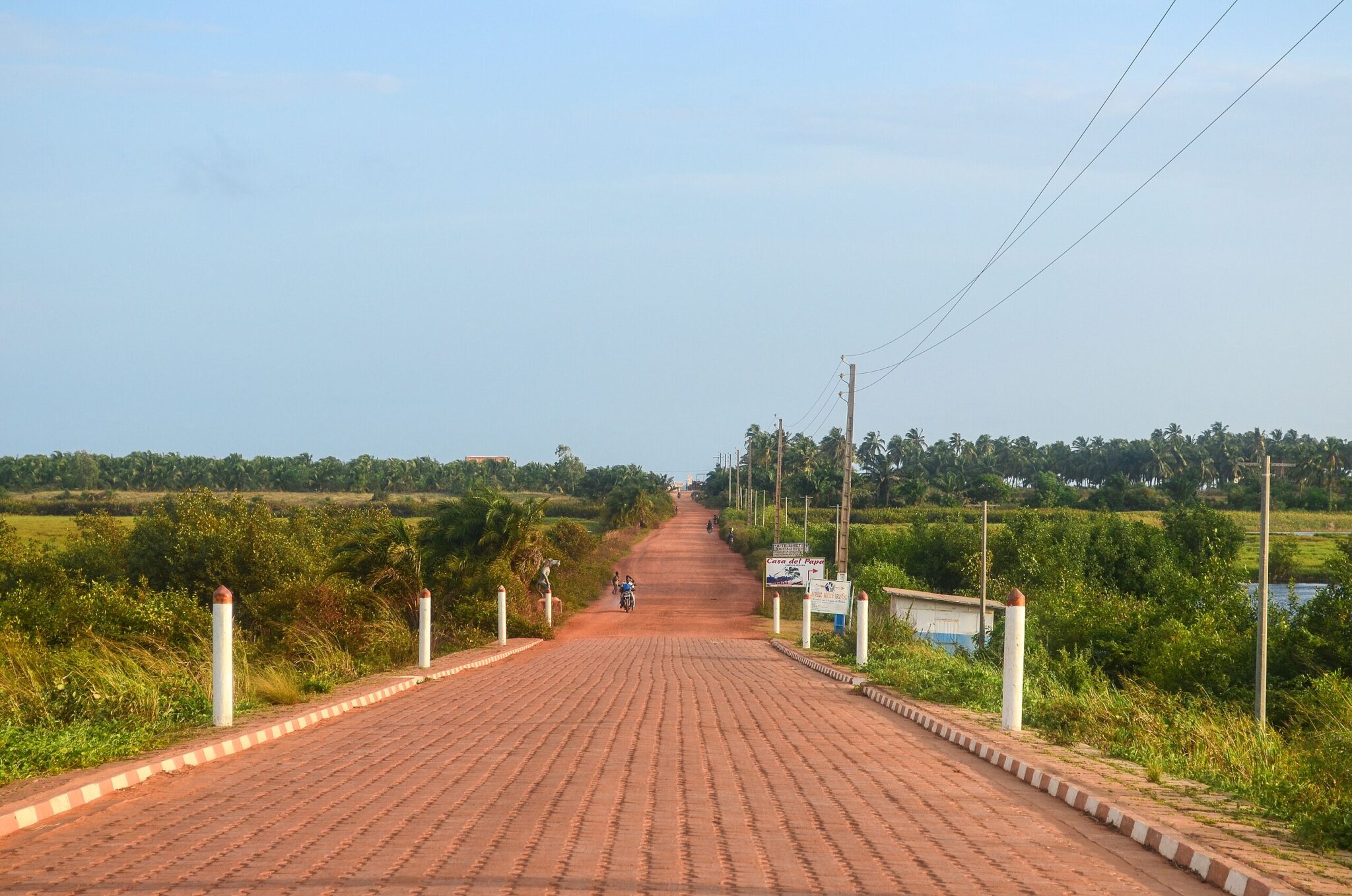
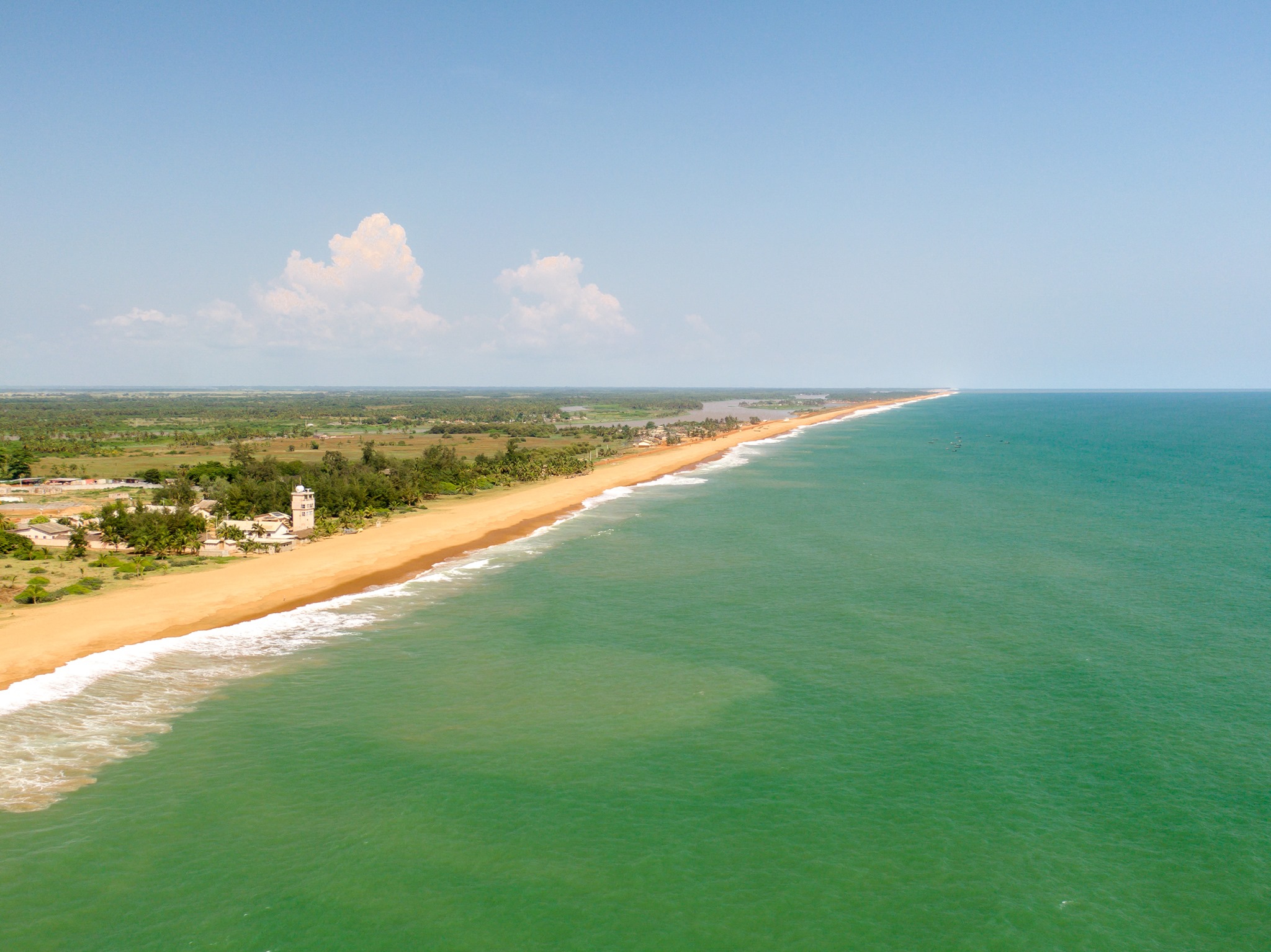
Grand-Popo is a coastal town in southwestern Benin, positioned between the Atlantic Ocean and inland lagoons. Fishing remains central to the local economy, with boats operating from the beach and fish-smoking activities taking place in nearby villages. The coastal environment includes long stretches of sand and areas where the lagoon and ocean run close together, creating opportunities for boat trips through mangrove channels and calm waterways. Several eco-lodges along the shore provide accommodation and organize guided excursions.
The town has a notable Vodun presence, with shrines, community spaces, and annual ceremonies that draw participants from surrounding regions. Visitors can learn about local practices through cultural tours that explain the role of Vodun in community governance, healing traditions, and seasonal events. Grand-Popo is easily reached by road from Cotonou or from the Togo border, making it a practical base for combining beach time with cultural visits.
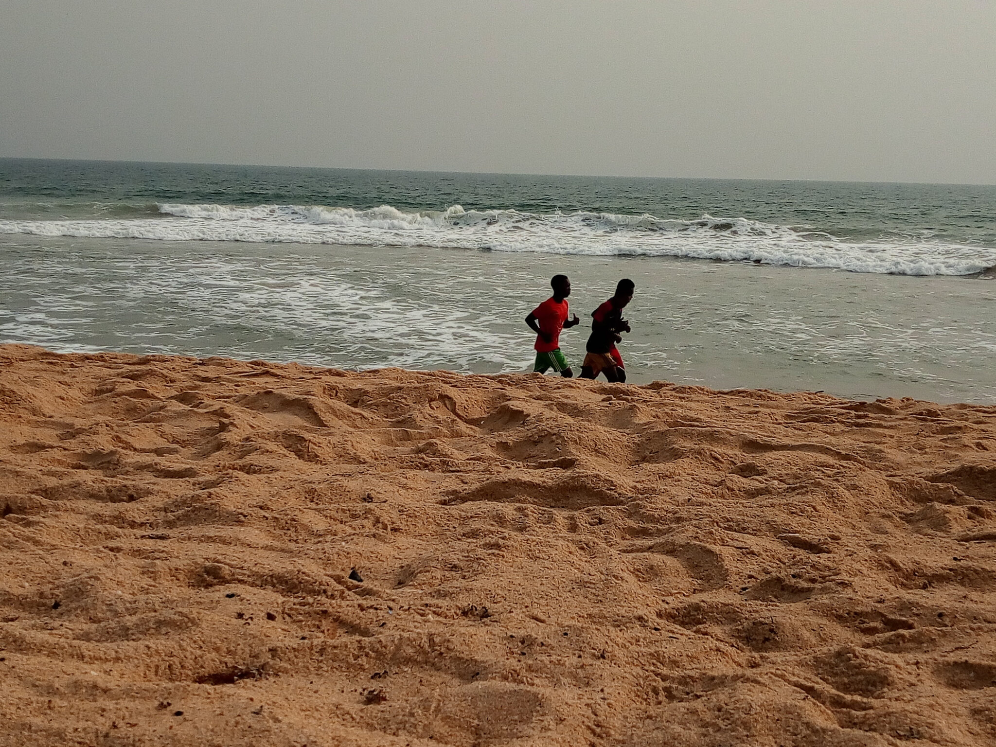
Fidjrossè Beach (Cotonou)
Fidjrossè Beach stretches along the western side of Cotonou and serves as one of the city’s most accessible coastal areas. Residents and visitors use the beach for walking, informal sports, and gatherings in the late afternoon when temperatures drop. A line of small restaurants, cafés, and open-air bars operates along the beachfront road, offering simple meals and a place to watch the ocean. The area becomes especially active on weekends and evenings, reflecting its role as a social space within the city.
Because of its proximity to central Cotonou and the airport, Fidjrossè is easy to include in short itineraries or to visit as a break from urban activity. Some travelers pair the beach with nearby craft markets or cultural sites in the city.
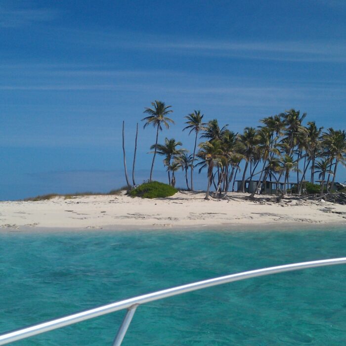
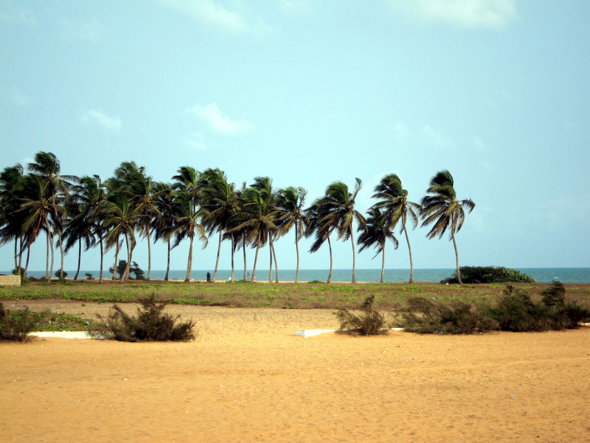
Ouidah Beach
Ouidah Beach lies at the end of the town’s historic Route of Slaves and serves as a coastal point of reflection on the Atlantic slave trade. The coastline is marked by the Door of No Return, a memorial that identifies the spot where captives were taken aboard ships bound for the Americas. Visitors often combine time on the beach with guided walks along the memorial route to understand how the shoreline functioned as the final stage of a larger trading system.
Outside its historical context, the beach provides a quieter alternative to the more developed sections of Benin’s coast. Fishing activity continues along parts of the shore, and small food stalls operate during busier times. The beach is easily reached from central Ouidah and is commonly included in itineraries focused on cultural heritage, religious sites, and coastal exploration.
Hidden Gems of Benin
Natitingou
Natitingou is the main urban center of northwestern Benin and functions as a gateway to the Atakora Mountains and Pendjari National Park. The town’s markets supply agricultural products, textiles, and tools used in surrounding rural communities, offering visitors a clear look at everyday commerce in the region. Natitingou’s Cultural Museum provides background on the traditions of northern ethnic groups, including Somba architecture, ritual practices, and local craftmaking. Exhibits help contextualize visits to nearby villages where multi-level earthen compounds and long-standing farming methods remain active.
Because of its location, Natitingou is a practical base for excursions into the Atakora highlands and for organizing wildlife viewing trips to Pendjari. Road connections link the town with cultural sites, waterfalls, and nature reserves across the region.
Nikki
Nikki is the principal ceremonial center of the Bariba (Baatonu) kingdom in northeastern Benin. The town maintains an active traditional monarchy whose authority structures, councils, and annual rituals continue to influence regional identity. Nikki is best known for major royal events, particularly horse festivals linked to the Gaani celebrations, during which riders, musicians, and representatives of different communities gather to affirm allegiance to the king and to display long-established equestrian traditions. These ceremonies illustrate the political and cultural systems that shaped the Bariba kingdom before colonial rule and that remain relevant today.
Visitors can explore the royal compounds, meet with local guides who explain the structure of the Bariba chieftaincy, and learn how ceremonies reinforce social ties across the region. Nikki’s markets and surrounding villages provide further context on agriculture, livestock keeping, and craft production in the Borgou area. The town is reachable by road from Parakou or Kandi.
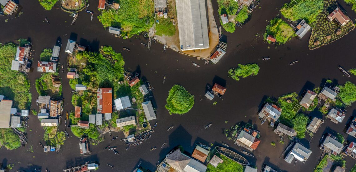
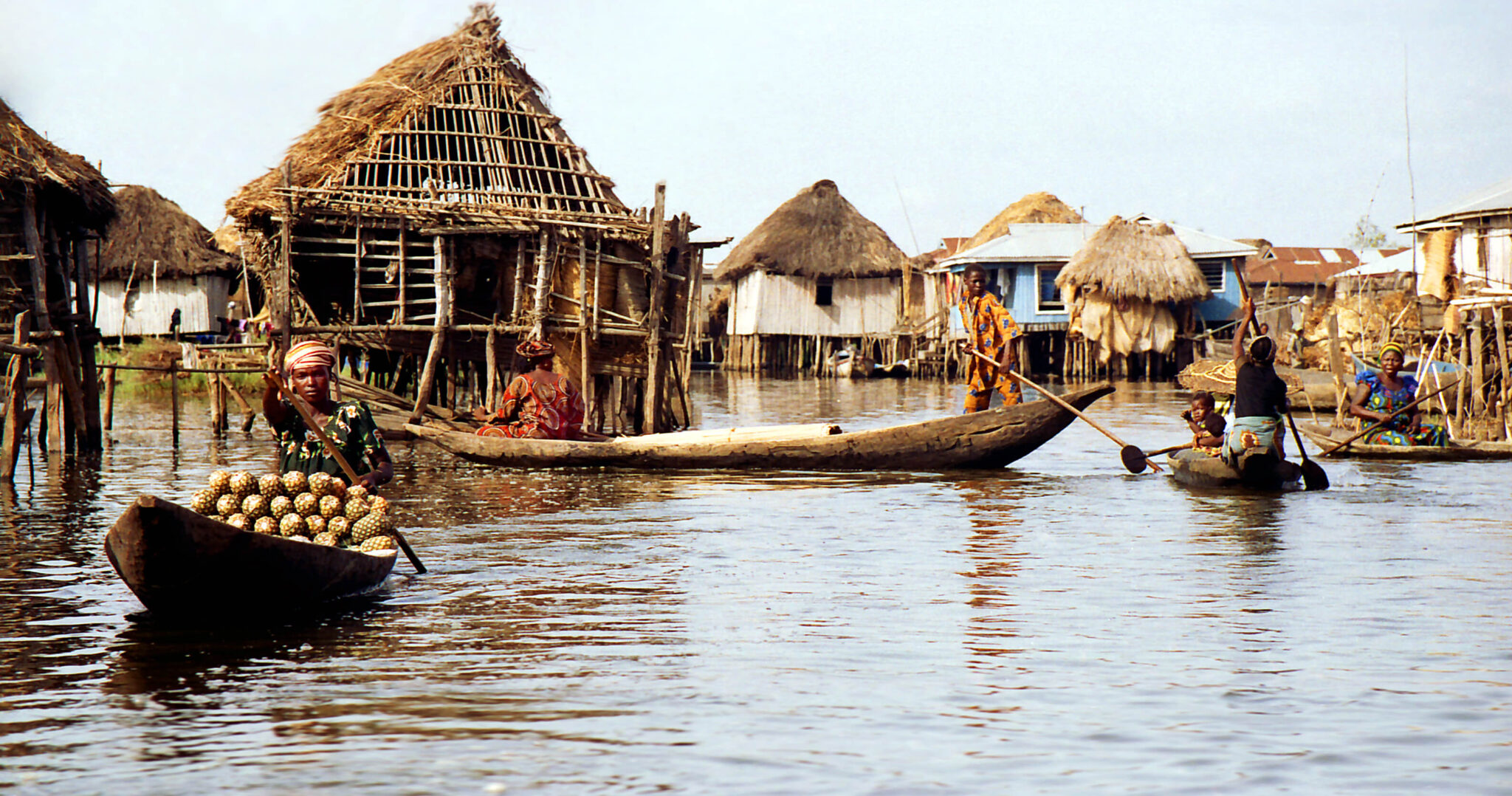
Lake Nokoué & Ganvié
Lake Nokoué, located just north of Cotonou, supports one of Benin’s most distinctive settlements: Ganvié, a large stilt village built directly above the water. The community was established several centuries ago as a place of refuge, and its layout reflects the need for security, fishing access, and mobility. Houses, schools, places of worship, and small shops stand on wooden stilts, and movement through the settlement is done almost entirely by canoe. Fishing remains the main economic activity, with fish traps, nets, and floating enclosures visible throughout the lake.
Boat tours depart from the lakeshore and follow channels that pass residential areas, fish-farming zones, and floating markets. Guides explain how water levels, seasonal flooding, and lake ecology shape daily routines and how traditional governance structures operate within a dispersed, water-based community. Many itineraries include visits to nearby lakeshore villages to understand the broader economic and cultural network around Lake Nokoué.
Covè
Covè is a small town in central Benin that provides access to surrounding lakes, farming areas, and villages where traditional livelihoods remain central to daily life. Local households rely on rice cultivation, fishing, and small-scale vegetable farming, while nearby waterways support canoe transport and seasonal floodplain agriculture. Walking or cycling through the outskirts of Covè offers a clear view of how rural communities organize work, manage water resources, and maintain communal fields.
The town is also a useful base for community-based tourism initiatives. Guided visits to nearby villages introduce travelers to local craft practices, food production, and cultural traditions linked to agriculture and river life. These activities are usually arranged through community groups that emphasize low-impact travel and direct interaction with residents.
Travel Tips for Benin
Travel Insurance & Safety
Comprehensive travel insurance is essential when visiting Benin, particularly for travelers planning safaris, long-distance overland journeys, or rural exploration. Your policy should include medical and evacuation coverage, as facilities outside Cotonou and Porto-Novo are limited. Having insurance that covers trip delays or unexpected emergencies will ensure a smoother experience.
Benin is regarded as one of the safest and most stable countries in West Africa, known for its welcoming people and rich cultural traditions. Nevertheless, travelers should take standard precautions in busy markets and at night. A yellow fever vaccination is required for entry, and malaria prophylaxis is strongly recommended. Always drink bottled or filtered water, as tap water is not safe for consumption. Pack insect repellent and sunscreen, especially if you plan to spend time in the countryside or national parks.
Transportation & Driving
Shared taxis and minibuses connect most towns and cities efficiently, making domestic travel straightforward given the country’s compact size. In urban areas, motorcycle taxis known as zemidjans are a common and affordable means of transportation, though helmets are recommended for safety. For greater flexibility, particularly when visiting remote or natural sites, renting a car with a driver is a convenient option.
Driving in Benin is on the right-hand side of the road. Roads in the southern regions are generally well-paved, while northern routes can be rough and may require a 4×4 vehicle, especially when traveling to Pendjari National Park or rural areas. An International Driving Permit is required alongside your national driver’s license, and you should always carry your documents at police checkpoints, which are frequent along main highways.
Published January 04, 2026 • 17m to read