Democratic Republic of the Congo is one of Africa’s largest and most environmentally significant nations, dominated by the vast Congo Basin rainforest, major river systems, and volcanic landscapes along its eastern frontier. This immense geography supports extraordinary biodiversity, including some of the continent’s most important wildlife habitats, while also shaping daily life across remote and densely populated regions alike.
Travel in the Democratic Republic of the Congo is complex and requires experience, preparation, and constant awareness of local conditions. Infrastructure is limited in many areas, and distances can be demanding. For travelers who plan carefully and move responsibly, the country offers rare rewards: encounters with unique wildlife, powerful natural scenery, and a cultural life that feels raw, creative, and deeply rooted. The DRC is not a destination for casual travel, but for those who approach it thoughtfully, it offers some of the most intense and memorable experiences in Africa.
Best Cities in the DRC
Kinshasa
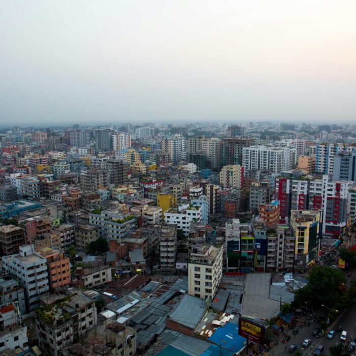
Kinshasa is the capital of the Democratic Republic of the Congo and one of Africa’s largest urban areas, set on the south bank of the Congo River directly opposite Brazzaville. Rather than monuments, Kinshasa is best “visited” through culture and street life: live music scenes tied to Congolese rumba and modern dance styles, busy market districts, and late-day riverfront socializing when the heat drops. The Congo River crossing is also part of the city’s identity. At its narrowest here the two capitals are only a few kilometers apart across the water, yet they sit in different countries, so the river feels like both a boundary and a daily transport corridor.
For structured cultural context, the National Museum of the DRC is a strong anchor and a practical first stop, especially because it is a modern institution that opened in 2019 and presents curated history and arts in a way that makes the rest of the country easier to interpret. The Académie des Beaux-Arts, founded in 1943, is a reliable window into contemporary Congolese creativity through exhibitions, student work, and workshops, and it is one of the best places to understand how Kinshasa generates new visual culture. For logistics, Kinshasa is the country’s main hub for arranging domestic flights, trusted drivers, and permissions. N’djili International Airport sits roughly 20–25 km from central districts, and travel time can swing from under an hour to much longer depending on congestion, so building a buffer day and avoiding tight connections right after arrival is a practical, time-saving strategy.
Lubumbashi
Lubumbashi is the Democratic Republic of the Congo’s second-largest city and the economic engine of the southeast, built around the Copperbelt mining economy. Founded in 1910 as Élisabethville, it still shows a planned, colonial-era street grid with notably wide boulevards that make it a strong stop for urban photography and architecture. At roughly 1,200 m elevation, the city often feels cooler and less humid than lowland river cities, and recent urban-area estimates commonly place its population around 3.19 million (2026). For a short, purposeful visit, focus on a few high-signal places: the Sts. Peter and Paul Cathedral (dating to 1920) for heritage architecture, and the National Museum of Lubumbashi (founded 1946) for ethnography and archaeology that connect the region’s cultures with the mining-era story. Add time in the central market districts to see how copper and cobalt wealth translates into everyday trade, transport, and city life.
Getting in and moving onward is straightforward if you plan conservatively. Lubumbashi’s main airport is Lubumbashi International (FBM) with an asphalt runway a little over 3.2 km, and direct flights to Kinshasa are typically around 2.5 hours in the air. By road, the Kasumbalesa border with Zambia is about 91 km (often roughly 1 to 1.5 hours depending on checks), making day trips to the border corridor realistic with an early start. For southeastern routes, Kolwezi is a common onward city in the mining belt, about 307 km by road (often 4 to 5 hours in good conditions). If you are continuing by car, daytime departures and conservative distances are the right approach, because road conditions and checkpoints can quickly turn a “short” leg into a much longer day.
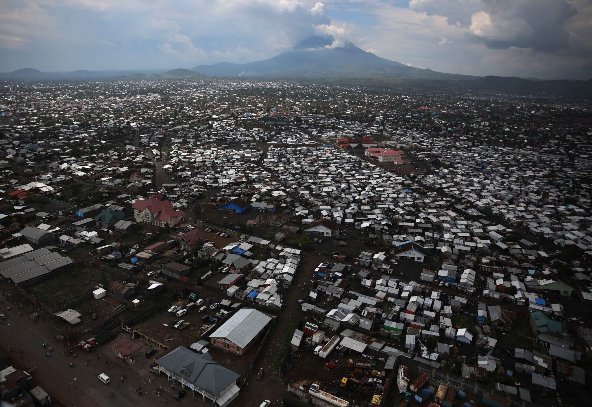
Goma
Goma is a lakeside city on the northern shore of Lake Kivu in eastern Democratic Republic of the Congo, sitting at roughly 1,450–1,500 m elevation with volcanoes and fresh lava terrain visible close to town. It is a practical base because it concentrates transport, hotels, and tour operators for nearby nature experiences, especially Virunga National Park, which is one of Africa’s oldest national parks (established 1925). The volcanic landscape is not abstract here: dark lava fields from recent eruptions lie within and around the urban area, and viewpoints toward the Nyiragongo and Nyamulagira volcano complex make the region feel geologically “alive”. For a lower-effort day, Lake Kivu excursions are a strong option: short boat rides along the shoreline, swimming in calmer bays where it is locally considered safe, and sunset trips that show the steep green hills rising directly from the water.
Kisangani
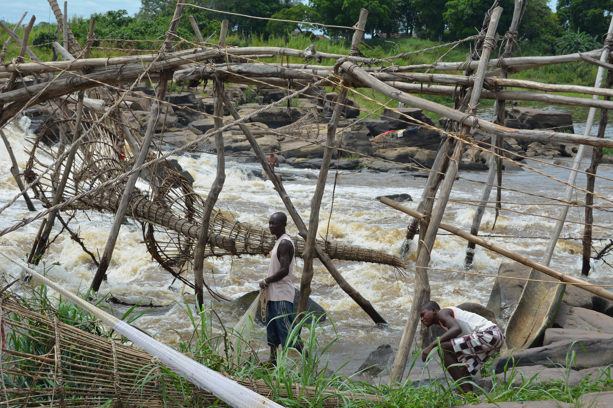
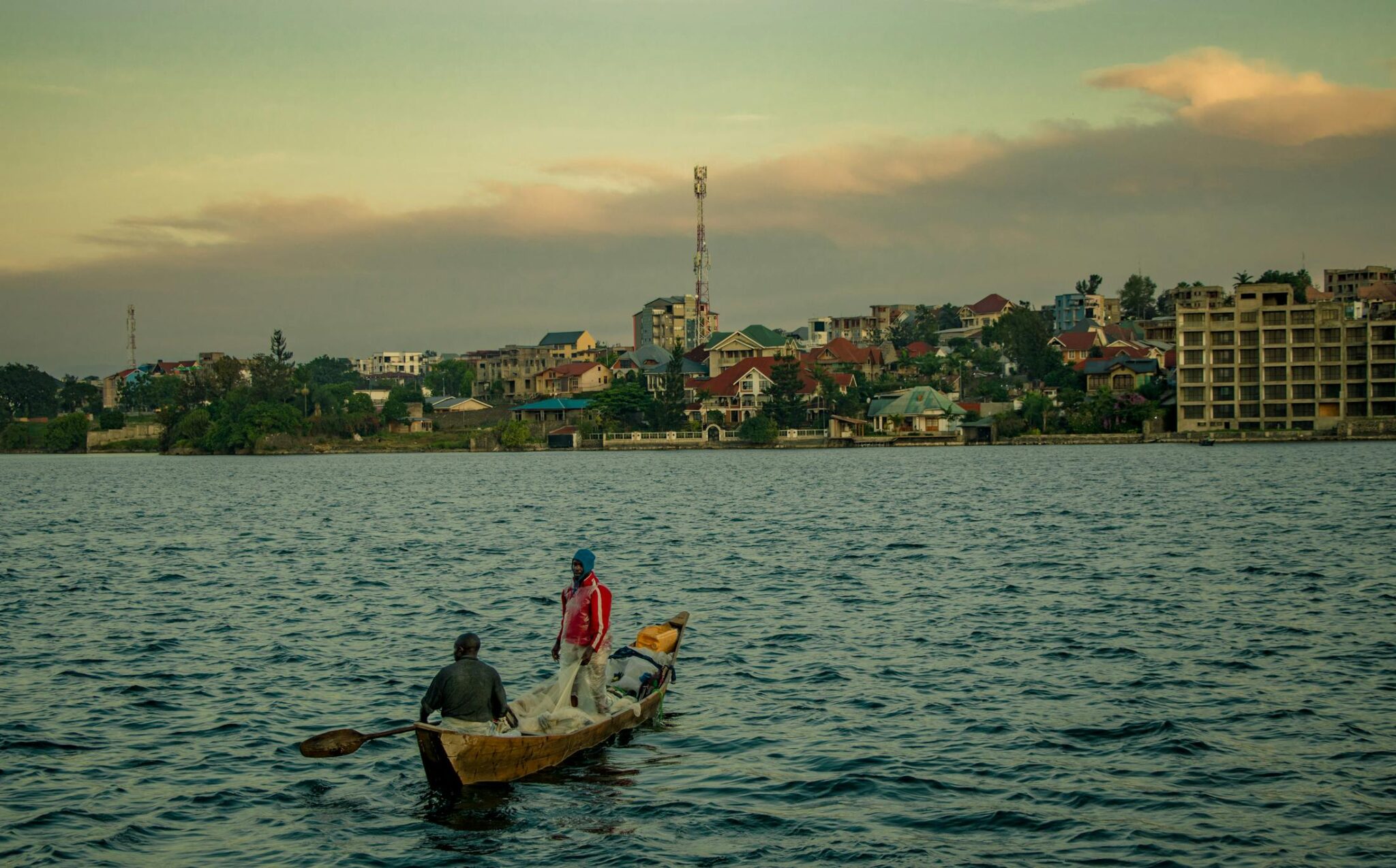
Kisangani is a historic Congo River city in central-northeastern DRC and the capital of Tshopo Province, long known as a river-transport hub for the surrounding rainforest. It is large by national standards, with recent urban-area estimates commonly around 1.61 million (2026). What to do here is context-driven rather than monument-driven: spend time along the Congo River waterfront to watch barges, pirogues, and market supply chains at work, then add a purposeful cultural stop such as the National Museum of Kisangani and a walk through the busiest market streets for everyday city energy. The headline nature excursion is the Boyoma Falls (formerly Stanley Falls) system just outside the city: a chain of seven cataracts stretching for over 100 km, with a total drop of roughly 60–61 m, including the famous Wagenia fishing zone where traditional basket-and-wooden-weir methods are still practiced on the rapids.
Best Natural Wonders Sites
Virunga National Park
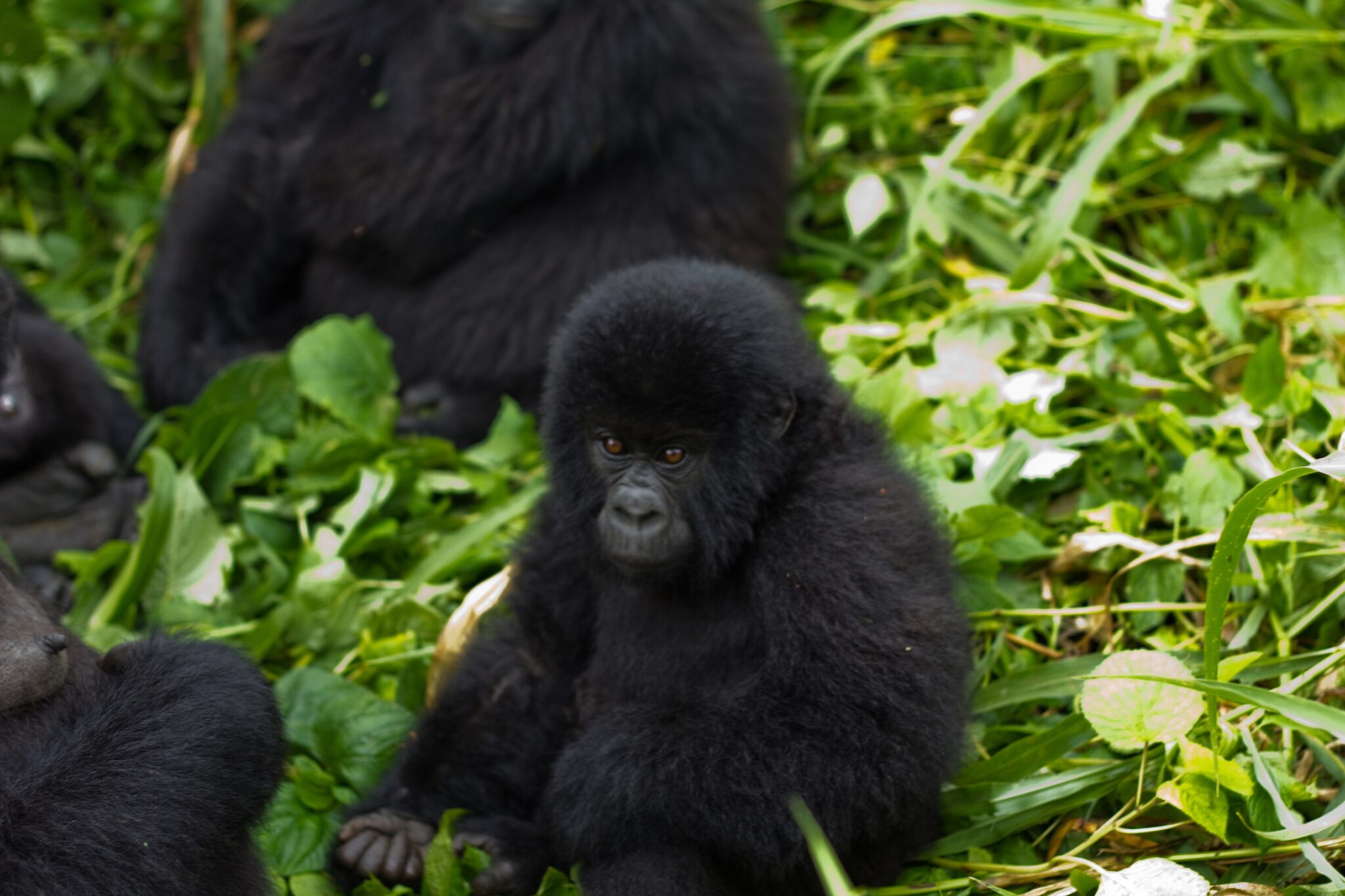
Virunga National Park in eastern Democratic Republic of the Congo is one of Africa’s most biologically rich protected areas, established in 1925 and covering roughly 7,800 km². It is unusual because it compresses multiple ecosystems into one park: lowland rainforest, savannah and wetlands around Lake Edward, lava fields and volcanic slopes in the Virunga massif, and high-altitude zones near the Rwenzori range. Virunga is best known for mountain gorilla trekking, which is strictly permit-based and guided. Treks typically take 2 to 6 hours round trip depending on gorilla location and terrain, and time with gorillas is usually limited to about 1 hour to reduce stress and health risks. Group sizes are kept small (commonly up to 8 visitors per gorilla group), so permits can sell out in peak periods.
Goma is the main practical base. Most trips start with a briefing and transfer to park hubs such as Rumangabo (often about 1 to 2 hours by road from central Goma, depending on checks and road condition), then continue to the relevant sector. For the Nyiragongo volcano (about 3,470 m elevation), the trek commonly begins at the Kibati trailhead, roughly 15 to 25 km from Goma, and the hike is often 4 to 6 hours up, typically done with an overnight at the crater rim to see the volcano landscape at its most dramatic. If you are arriving via Rwanda, the most common route is Kigali to Rubavu (Gisenyi) by road and then a short border crossing into Goma, after which reputable local operators handle permits, transport, and timing.
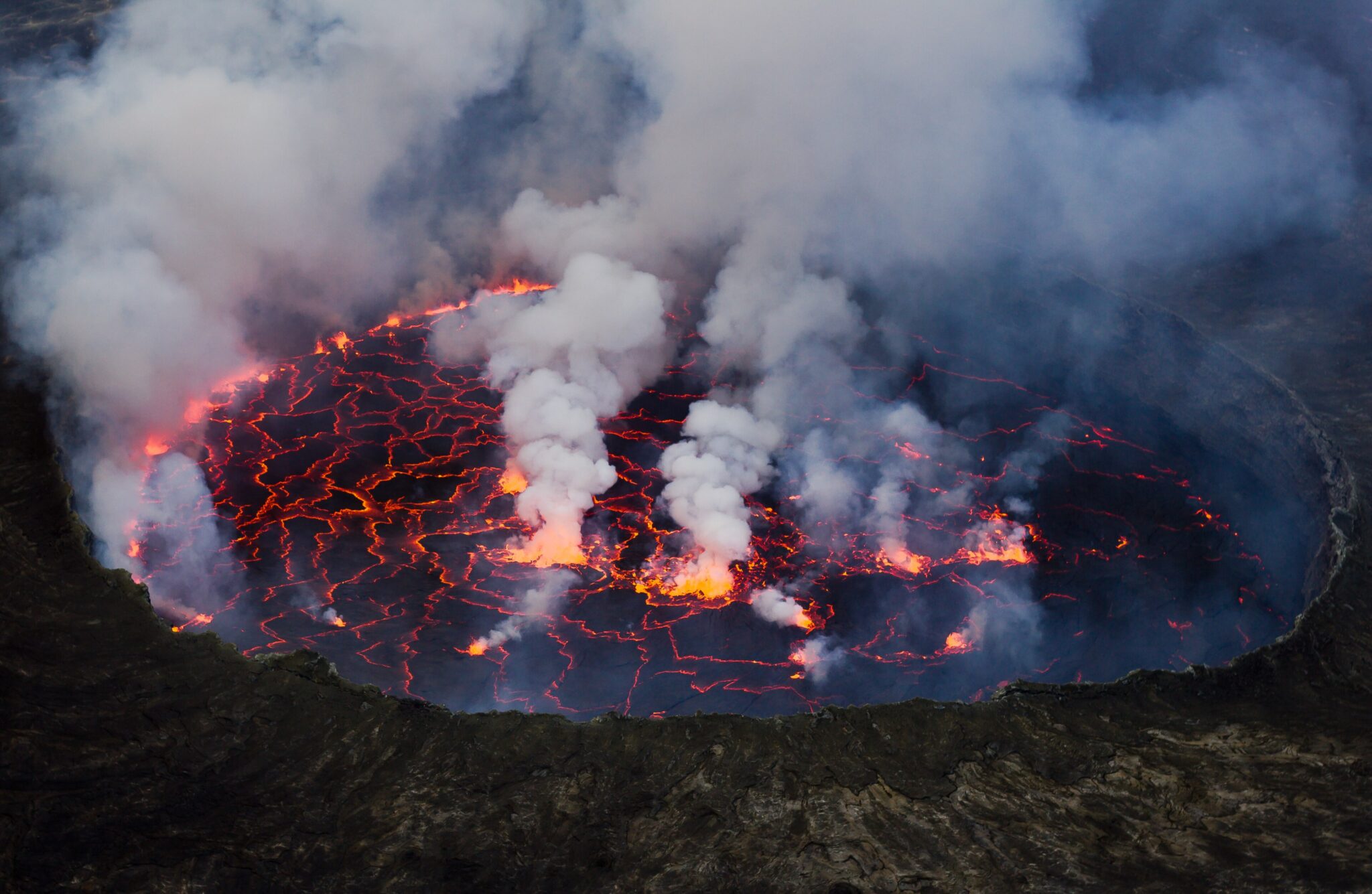
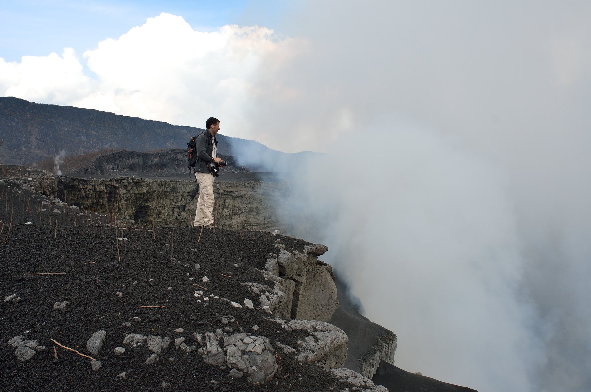
Nyiragongo Volcano
Nyiragongo is an active stratovolcano in the Virunga Mountains, rising to 3,470 m and sitting about 12 km north of Goma. Its main crater is roughly 2 km wide and the terrain is stark and volcanic, with fresh lava landscapes that feel immediate compared with most volcano destinations. The standard experience is structured and guided, built around the scale of the crater and the high-altitude viewpoint rather than “summit bagging” alone, which is why it remains one of the most memorable hikes in the region for strong hikers.
Most treks begin at Kibati Ranger Post at about 1,870 m and cover roughly 6.5 km each way to the rim, with the ascent commonly taking 4 to 6 hours and the descent around 4 hours, depending on group pace and conditions. Because you gain roughly 1,600 m of elevation in a relatively short distance, the climb can feel steep and the temperature shift is real, with cold wind at the top even when the lowlands are warm.
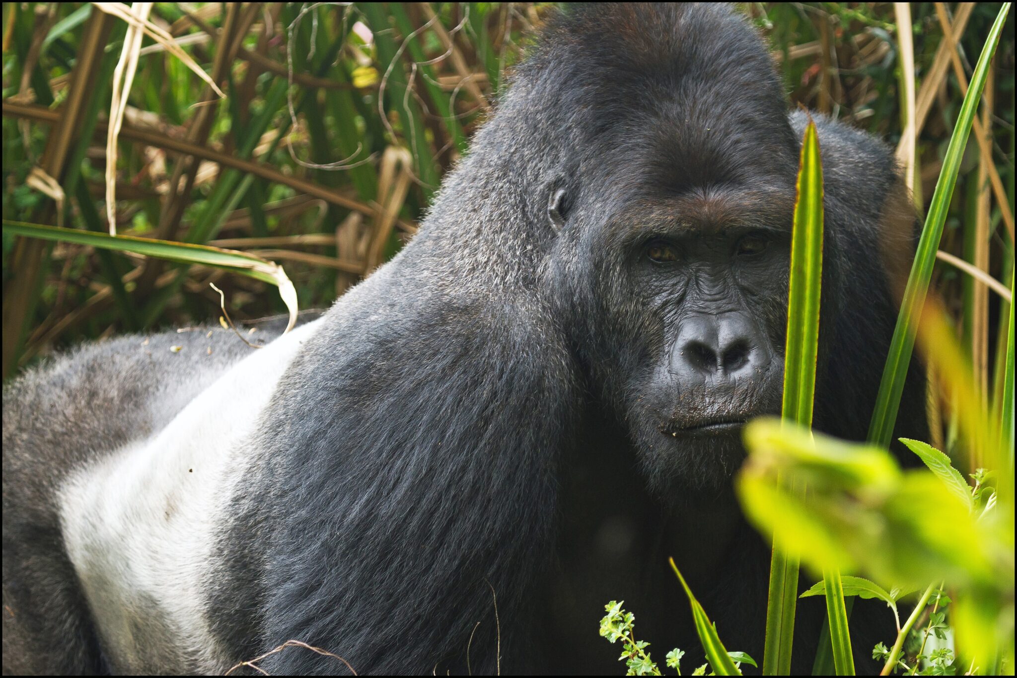
Kahuzi-Biéga National Park
Kahuzi-Biéga National Park is one of the Democratic Republic of the Congo’s most important rainforest reserves, protecting a vast block of lowland forest and a mountainous sector dominated by the extinct volcanoes Mount Kahuzi (about 3,308 m) and Mount Biéga (about 2,790 m). The park was created in 1970 and is best known as the flagship home of the eastern lowland (Grauer’s) gorilla, the largest gorilla subspecies. Landscapes range from roughly 600 m in the lowlands to over 3,000 m on the high ridges, which means you get two very different experiences in one park: muddy, dense rainforest trekking in the lowlands and cooler, more open montane hikes with big views in the high sector. Visits are guided and permit-based, and a typical gorilla trek can take anywhere from 2 to 6+ hours depending on where groups are located, with time near gorillas usually kept to about 1 hour for welfare and safety.
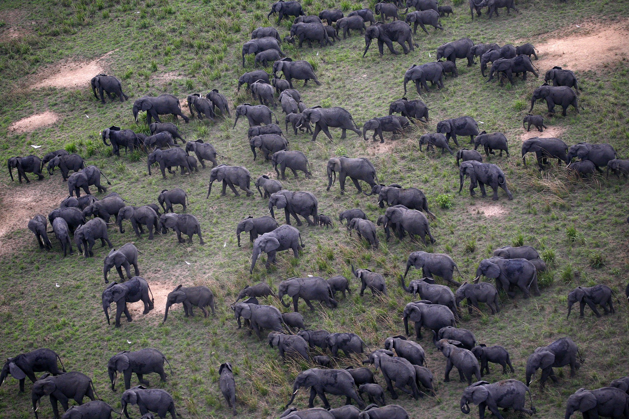
Garamba National Park
Garamba National Park is a remote protected savannah landscape in northeastern Democratic Republic of the Congo, established in 1938 and covering roughly 4,920 km². It is a UNESCO World Heritage Site (inscribed 1980) and is best known for classic Sudan-Guinean savannah scenery mixed with woodland and riverine forest, giving you long grassland horizons broken by gallery forests and seasonal watercourses. Historically, Garamba was central to large-mammal conservation and is famously linked to the last wild population of the northern white rhinoceros (now considered extinct in the wild). Today, the park’s reputation is tied to its sense of isolation and its remaining savannah wildlife, with elephants, buffalo, antelope species, and predators present in suitable areas, plus one of the better-known giraffe populations in this part of Central Africa.
Getting to Garamba is difficult and should be planned like an expedition. The practical gateway is usually Dungu, a regional town used to stage vehicles, fuel, and park coordination; many itineraries fly domestically from Kinshasa (often with a connection through a larger hub such as Kisangani) to reach the region, then continue overland by 4×4 to the park’s operational zone around Nagero.
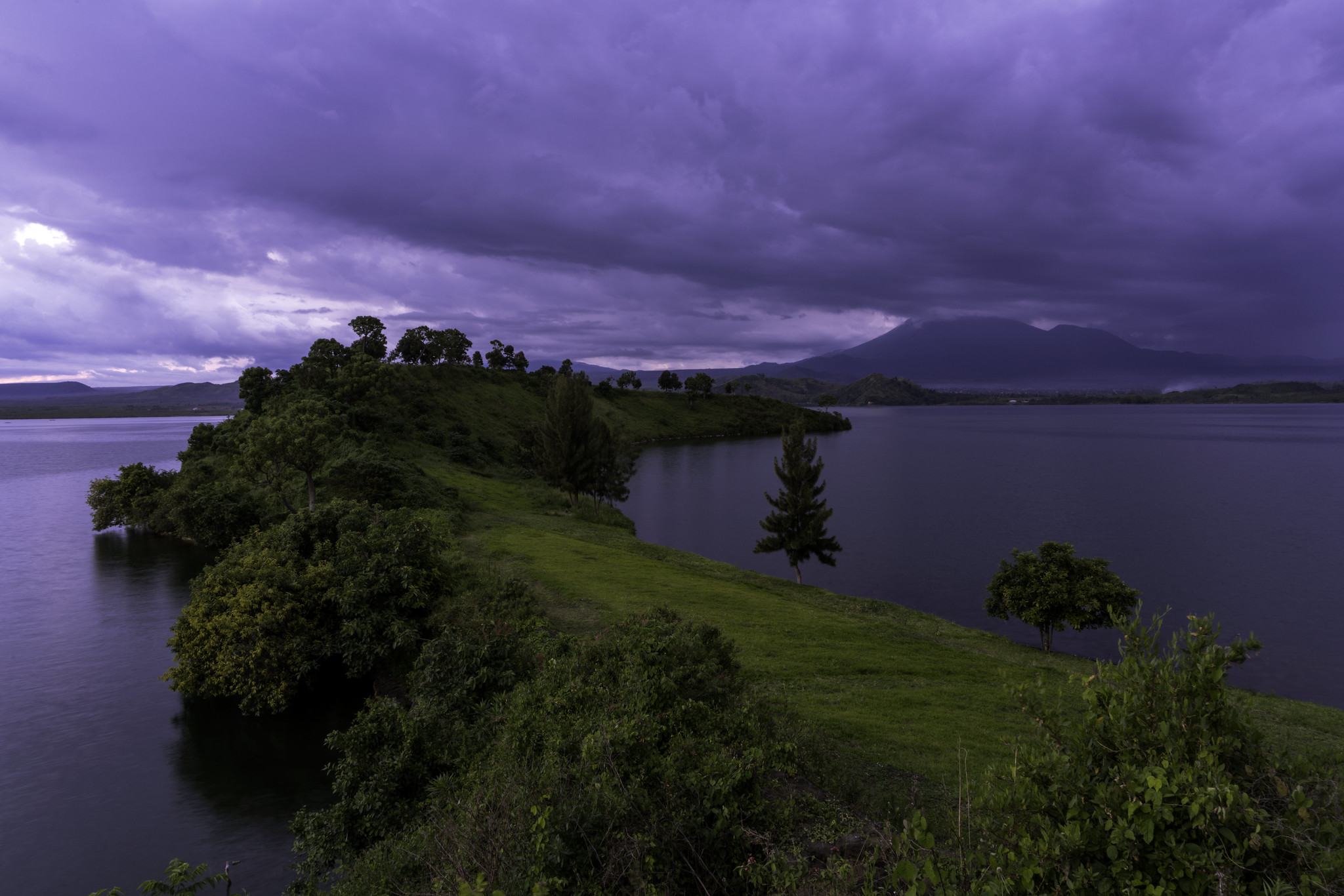
Lake Kivu (Goma area)
Lake Kivu is the natural “reset button” around Goma: a high-altitude lake at roughly 1,460 m with calmer water and softer scenery than the surrounding lava fields and volcano slopes. It is a large body of water by regional standards, covering about 2,700 km², stretching roughly 89 km north to south, and reaching depths of up to around 475 m. The shoreline near Goma works well for low-effort days: lakeside promenades, short waterfront walks, café stops, and easy boat rides that let you appreciate the steep green hills framing the water. Lake Kivu is also scientifically unusual because deep layers hold large amounts of dissolved gases, including methane, which is one reason the lake is frequently discussed in environmental and energy contexts.
Idjwi Island
Idjwi Island is the large, low-tourism island in the middle of Lake Kivu, known less for “attractions” and more for everyday rural life at scale. It is about 70 km long with an area of roughly 340 km², making it the second-largest lake island in Africa, and it supports a population commonly cited at around 250,000 (older estimates). The island is largely agricultural, so what you see is a lived landscape: hillside farms, banana and cassava plots, small lakeside landings, and compact villages where fishing and farming set the rhythm. If you enjoy slow travel, it rewards simple days of walking between communities, visiting local markets, and taking in the lake-and-hills scenery that feels far quieter than the mainland shores.

Best Cultural and Historical Sites
National Museum of the Democratic Republic of the Congo (Kinshasa)
The National Museum of the Democratic Republic of the Congo in Kinshasa is one of the most practical “orientation” stops in the country because it compresses centuries of history and cultural diversity into a clear, modern visit. The current museum opened to the public in 2019 after a 33-month build, funded at about US$21 million, and it was designed with three main public exhibition halls totaling roughly 6,000 m², with capacity to display up to about 12,000 objects at a time while larger holdings remain in storage. Expect well-presented ethnographic and historical material such as masks, musical instruments, ceremonial objects, tools, and textiles that make later market visits more readable, because you start recognizing regional styles, materials (wood, raffia, brass, iron), and the symbols that repeat across Congolese art traditions.
Getting there is straightforward if you plan around Kinshasa traffic. From central districts such as Gombe, it is typically a short taxi ride of roughly 15–30 minutes depending on congestion. From N’djili International Airport (FIH), the museum is about 17 km in straight-line distance, but the drive is longer in practice; allow 45–90 minutes based on time of day and road conditions. If you are arriving from Brazzaville, you usually cross the Congo River first, then continue by taxi in Kinshasa, commonly 30–60 minutes after the crossing depending on traffic and where you start on the Kinshasa side.
Académie des Beaux-Arts (Kinshasa)
The Académie des Beaux-Arts (ABA) is Kinshasa’s flagship art school and one of the country’s most influential institutions for contemporary visual culture. It was founded in 1943 as a Saint-Luc art school, moved to Kinshasa in 1949, and adopted the name Académie des Beaux-Arts in 1957, later being integrated into the national higher technical education system in 1981. On a visit, focus on the working atmosphere rather than “museum” expectations: studios and teaching spaces for painting, sculpture, graphic arts/visual communication, interior architecture, ceramics, and metalwork, plus an outdoor campus feel where you often see pieces-in-progress and finished works displayed around the grounds. It is especially rewarding if you care about modern Congolese aesthetics, because you are seeing the training pipeline behind many of the city’s painters, sculptors, and designers.
Stanley Falls (Boyoma Falls) near Kisangani
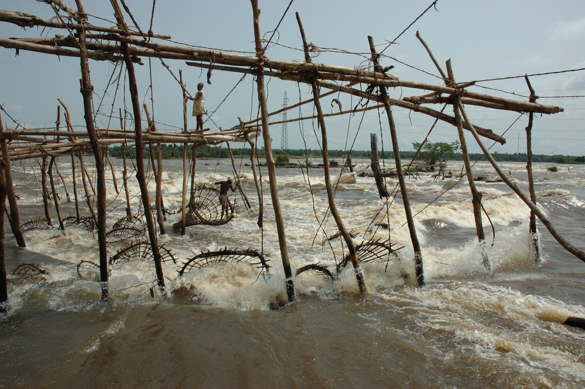
Stanley Falls, better known today as Boyoma Falls, are not a single waterfall but a chain of seven cataracts on the Lualaba River, the upper reach of the Congo River system. The rapids stretch for more than 100 km between Ubundu and Kisangani, with the river dropping about 60 to 61 m in total across the sequence. Individual drops are relatively low, often under 5 m each, but the scale comes from the river’s volume and width. The final cataract is the most visited and is often linked to the Wagenia fishing area, where traditional wooden tripod structures anchor large basket traps in fast water. The seventh cataract is also cited at roughly 730 m wide, and the discharge in this reach of the Congo system is commonly around 17,000 m³/s, which explains why the “power” feels outsized even without a towering vertical fall.
Hidden Gems and Off-the-Beaten-Path
Mount Nyamulagira
Mount Nyamulagira (also spelled Nyamuragira) is an active shield volcano in the Virunga Mountains, rising to about 3,058 m and sitting roughly 25 km north of Goma. Unlike the steeper Nyiragongo, Nyamulagira is broad and low-angled, with a summit caldera about 2.0 × 2.3 km in size and walls up to roughly 100 m high. It is often described as Africa’s most active volcano, with 40+ recorded eruptions since the late 19th century, and many events occur not only at the summit but also from flank fissures that can build short-lived cones and lava fields. For volcano-focused travelers, the appeal is the scale of fresh basalt landscapes, long lava tongues, and the “raw geology” feel that you rarely get this close to in such a large rainforest-volcano system.
Access is highly conditional and typically not offered as a standard trek, so it should be treated as an advanced, “only-if-possible” itinerary element. Most logistics start in Goma and depend on the operational status of Virunga-area routes, security conditions, and volcanic activity monitoring; if movement is permitted, the approach is usually by 4×4 transfer to a managed starting area and then a guided hike across rugged lava terrain.
Lomami National Park
Lomami National Park is one of the DRC’s newest large protected areas, officially gazetted in 2016 and covering roughly 8,879 km² of central Congo Basin forest. It protects a mix of lowland rainforest, swampy river corridors, and remote interior habitats that still see very little outside visitation, which is exactly why it appeals to conservation-minded travelers. The park is strongly associated with rare and endemic wildlife, most famously the lesula monkey (a species described by scientists in 2012), alongside other Congo Basin specialists such as forest primates, duikers, and rich birdlife. Rather than classic “game viewing,” the experience is closer to research-style forest travel: slow walks on narrow trails, listening and scanning for primates, and learning how conservation work functions in a landscape where human presence is limited and access is difficult.
Tchegera Island
Tchegera Island is a small, crescent-shaped volcanic caldera rim on Lake Kivu within Virunga National Park, designed for quiet, nature-focused stays rather than busy sightseeing. The island is compact at about 92,600 m² (roughly 9.3 hectares), rising only about 21 m above the lake, with dark volcanic rock and black-sand edges that make the scenery feel stark and dramatic. The main reasons to go are the atmosphere and views: calm, sheltered water in the island’s natural harbor for kayaking and paddleboarding, short nature walks for birding, and clear-night panoramas where Nyiragongo (3,470 m) and Nyamulagira (about 3,058 m) can be visible across the water. Accommodation is deliberately limited and high-comfort for a remote setting, with a tented camp of 6 en-suite tents (including hot showers and flush toilets) and a central dining area, which keeps the footprint small and the experience quiet.
Lusinga Plateau
The Lusinga Plateau is a high, open landscape in southeastern DRC (Haut-Katanga) where wide horizons, cooler air, and a strong sense of space replace the dense Congo Basin feel. Elevations in the Lusinga area commonly sit around 1,600 to 1,800 m, which gives it a noticeably different climate and vegetation mix, including grassland patches and miombo-type woodland on and around the plateau. The “things to see” here are primarily landscape-driven: escarpment edges and lookout points, rolling highland scenery, and the everyday reality of a remote park outpost environment. Lusinga is also known as a practical base for deeper forest-and-plateau expeditions in the wider Upemba–Kundelungu conservation zone, where travel is slow, distances feel larger than they look on a map, and the reward is the rare “unvisited Africa” atmosphere rather than polished tourism.
Travel Tips for the Democratic Republic of the Congo
Safety and General Advice
Travel in the Democratic Republic of the Congo (DRC) requires thorough preparation and flexibility. Conditions vary widely by region, and some provinces – particularly those in the east – may require special permits and security arrangements. Visitors should always travel with reputable tour operators or local guides, who can assist with logistics, permits, and safety updates. Staying informed through official travel advisories is essential before and during your trip.
A yellow fever vaccination is mandatory for entry, and malaria prophylaxis is strongly recommended due to widespread risk. Tap water is not safe to drink, so bottled or filtered water should be used at all times. Travelers should bring insect repellent, sunscreen, and a well-stocked personal medical kit. Medical facilities are limited outside major cities such as Kinshasa, Lubumbashi, and Goma, making comprehensive travel insurance with evacuation coverage vital.
Car Rental and Driving
An International Driving Permit is required in addition to your national driver’s license, and all documents should be carried at checkpoints, which are common along major routes. Driving in the DRC is on the right-hand side of the road. While roads in Kinshasa and a few major cities are paved, most routes are poorly maintained or unpaved, especially in rural regions. A 4×4 vehicle is essential for any travel beyond city limits, particularly during the rainy season. Self-driving is not recommended due to unpredictable conditions and a lack of signage; it is far safer to hire a local driver or travel with an organized tour.
Published January 23, 2026 • 17m to read