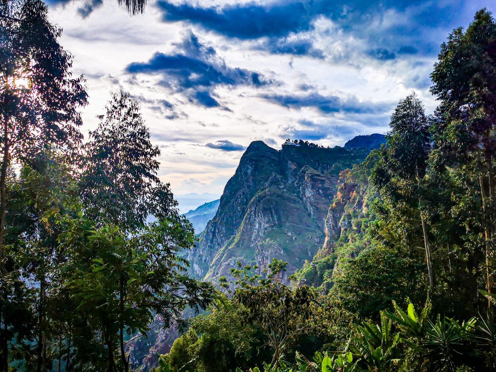
Tanzania offers one of Africa’s most complete travel experiences, combining the wildlife-rich plains of the Serengeti and Ngorongoro Crater with Mount Kilimanjaro, the continent’s highest peak, and the historic spice islands of Zanzibar. The variety allows you to structure a trip around classic game viewing, a mountain trek, cultural encounters with Maasai communities, and Indian Ocean beaches without feeling overstretched. Few destinations pack this much contrast into routes that work logistically.
The northern safari circuit is well-established and straightforward to navigate, making Tanzania accessible for first-time visitors to Africa. Timing matters if you’re interested in the Great Migration, which follows seasonal patterns across different regions. Kilimanjaro climbs require advance permits, and internal flights can be worthwhile for covering long distances efficiently. Beach extensions to Zanzibar are easy to arrange and provide a natural way to close out a trip. With realistic pacing and a well-sequenced itinerary, Tanzania delivers iconic wildlife moments, dramatic landscapes, and genuine warmth from local communities across very different environments.
Best Cities in Tanzania
Dar es Salaam
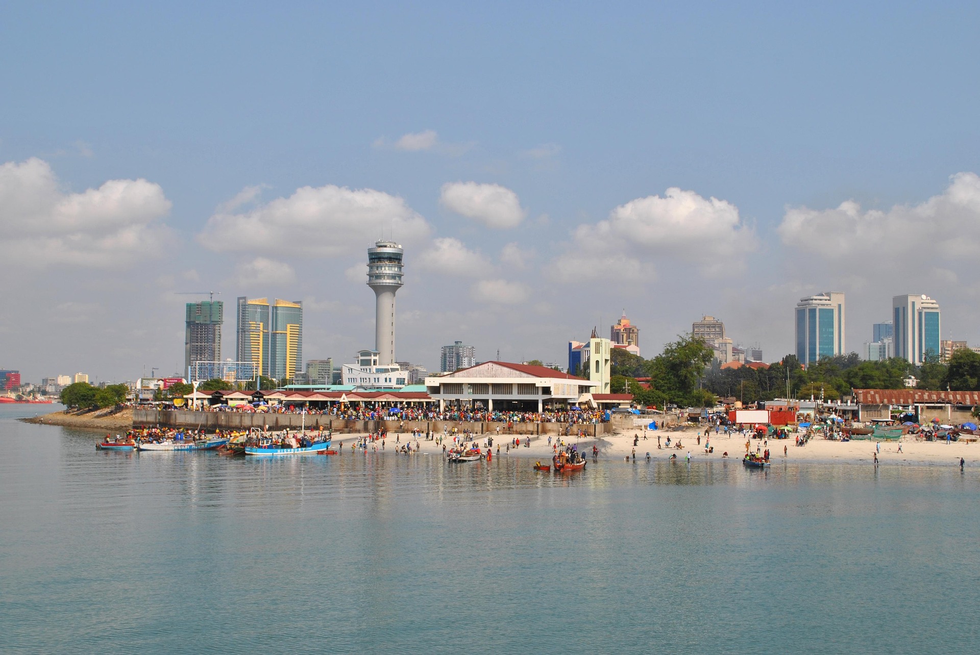
Dar es Salaam is best approached as Tanzania’s main logistics hub rather than a checklist city. It is the country’s largest city and primary international gateway, and it is where many routes converge: domestic flights, long-distance buses, and the fast boat connections to the islands. A sensible “first day” focus is compact and close to the center: Kariakoo Market for everyday city energy, the waterfront around the harbour, and a food-first introduction to coastal Swahili cooking such as grilled fish, seafood curries, pilau, and street snacks like mishkaki. If you want one cultural stop that fits easily into a short stay, the National Museum area is usually manageable without turning the day into constant transit.
For an easy, low-stress city layout, pick one daytime corridor and stay within it. Many visitors combine central Dar with the coastal neighbourhoods to the north, such as Oyster Bay and Msasani Peninsula, where you can do a relaxed café meal and a short shoreline walk. Plan around daylight hours, keep routes simple, and use reputable transport, ideally app-based ride-hailing or a trusted hotel taxi, especially after dark. Practical numbers help with planning: Julius Nyerere International Airport is roughly 10 to 15 km from the central business area in typical traffic, but peak-hour congestion can easily stretch a short transfer into 45 to 90 minutes, so it is worth building buffer time.
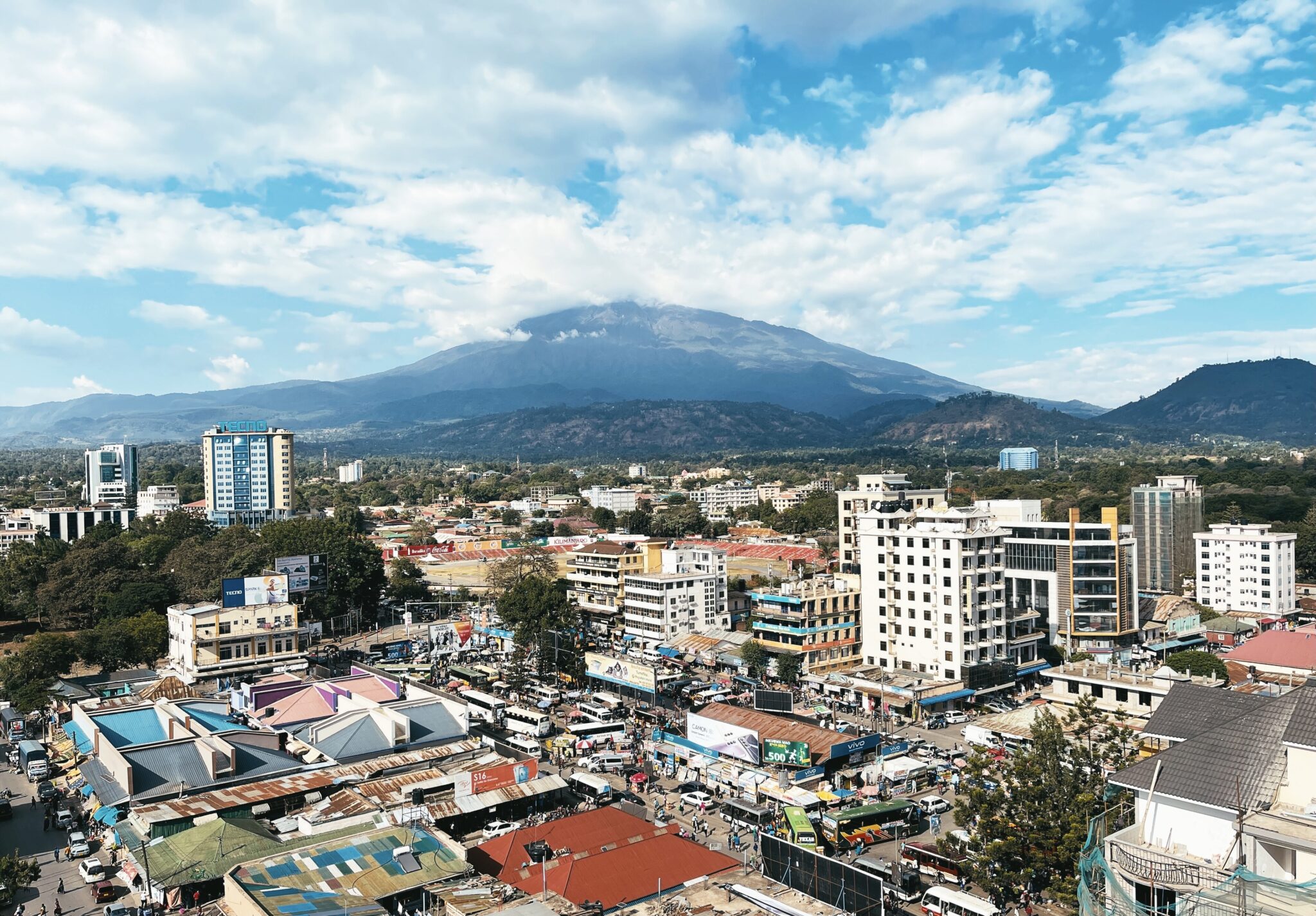
Arusha
Arusha is more enjoyable than its “safari base” reputation suggests, especially if you treat it as a compact highland city with strong everyday energy and a few genuinely worthwhile cultural stops. It sits at roughly 1,400 m elevation under Mount Meru, so mornings and evenings often feel cooler than the coast. The modern city grew from a German-era administrative post established in the early 1900s, later expanding under British rule, and it became nationally significant after independence as a political and diplomatic venue. Two landmark moments tied to the city are the Arusha Declaration (1967), which shaped Tanzania’s post-independence direction, and the Arusha Accords (1993) linked to efforts to end the conflict in Rwanda, both of which left Arusha with a “conference city” identity alongside its tourism role.
Inside the city, focus on places that give you texture without requiring long transit. Start around Arusha Clock Tower as a central reference point, then walk or take a short taxi hop to the main produce markets for a fast sense of daily life. For culture, the Arusha Declaration Museum adds political history in a manageable visit, while the Arusha Natural History Museum in the Old Boma area provides colonial-era context and regional natural history. If you want crafts and gifts, the curio markets commonly referred to as the Maasai Market are the most time-efficient option, and for a more curated browse, the Cultural Heritage Centre combines art, souvenirs, and a quick gallery-style look at Tanzanian material culture. In a single free afternoon, a realistic plan is one market, one museum, and one relaxed coffee stop, then an early night before a park departure.
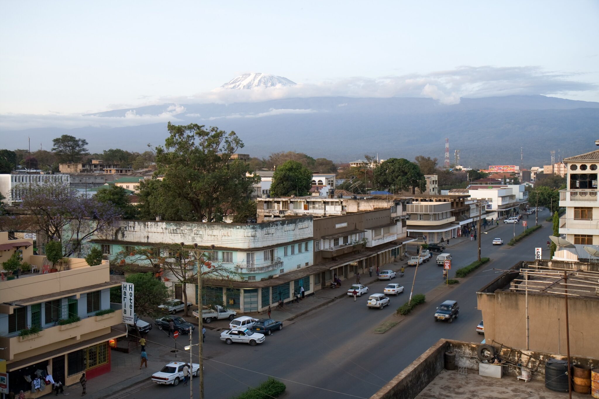
Moshi
Moshi is a compact, mountain-facing town that sits on the southern slopes of Mount Kilimanjaro, and it has a noticeably calmer, more “small-town” rhythm than Arusha despite being one of the country’s key trekking hubs. Historically, the area is closely tied to the Chagga communities who developed intensive hillside agriculture on volcanic soils, and the town expanded as a colonial-era administrative and trading centre linked to coffee. That legacy is still visible today in the surrounding plantations and in how Moshi functions: practical, outdoors-oriented, and built around gearing up, resting, and getting out into the foothills rather than chasing big-city nightlife.
For what to do in town, keep it local and low-effort. Start with a relaxed walk through the central streets and markets to get a feel for daily life, then pick one cultural stop that gives context: the small museums and heritage displays in town can add a useful layer if you want more than logistics. Moshi is also a good place for a “food and coffee” afternoon, because the region is one of Tanzania’s best-known coffee areas and cafés tend to lean into locally sourced beans and straightforward Swahili meals. If you want a viewpoint without a full excursion day, aim for a short walk in the greener outskirts in the late afternoon when skies are clearest, because Mount Kilimanjaro is most photogenic early and late, and midday cloud often hides the summit.
Stone Town
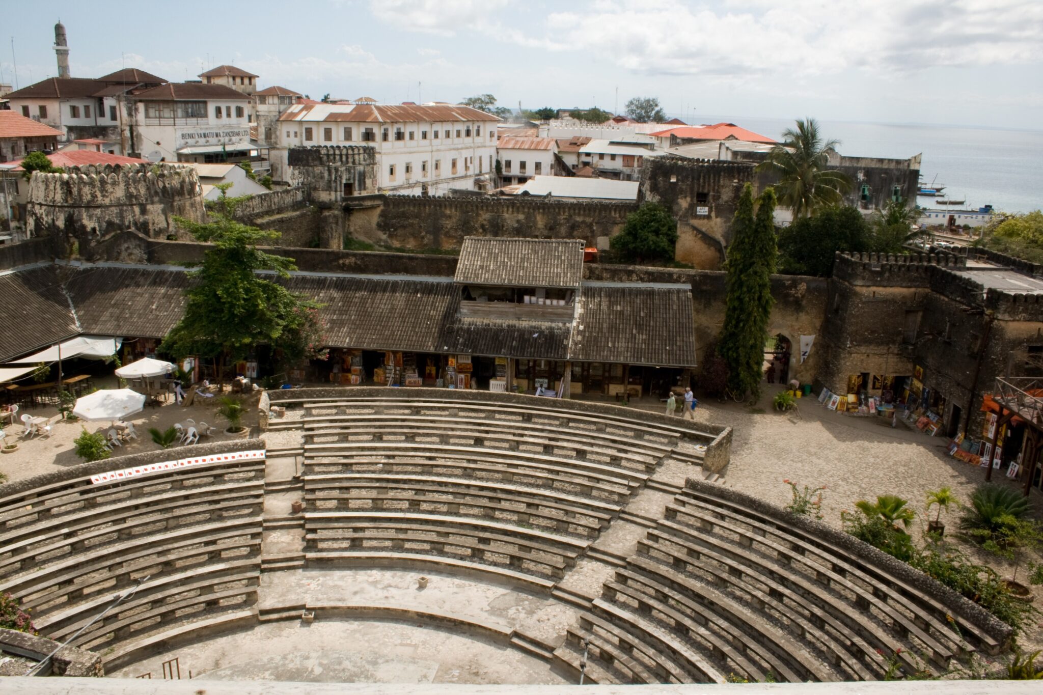
Stone Town is the historic core of Zanzibar City and a UNESCO World Heritage site (inscribed in 2000), best experienced as a slow, walkable maze rather than a set of single attractions. Its character comes from centuries of Indian Ocean trade and migration, blending Swahili coastal culture with Omani Arab influence, South Asian merchant heritage, and European-era layers. Much of the built fabric uses coral stone and lime, and the most memorable details are close-up: heavy carved wooden doors, shaded inner courtyards, balconies, and narrow lanes designed for foot traffic. Historically, Zanzibar became the seat of the Omani sultanate in the 19th century, and Stone Town’s grander waterfront buildings reflect the wealth of that era, tied to commodities like cloves, ivory, and shipping.
For what to see, keep your route compact because nearly everything sits within a roughly 2 km walk. Start at the waterfront near the Old Fort (Ngome Kongwe), then continue past the seafront to Forodhani Gardens, which is strongest in the late afternoon and early evening when the food stalls and promenade come alive. Add one or two indoor stops for context: Palace Museum (Beit el-Sahel) for royal and social history, and the Anglican Cathedral, Stone Town area for a deeper sense of how the city’s trade past shaped daily life. For everyday rhythm, Darajani Market is the most direct window into local shopping and produce, and it pairs well with a short, guided walk that helps you spot architectural details you would otherwise miss.
Best Natural Wonders and Wildlife Sites
Serengeti National Park
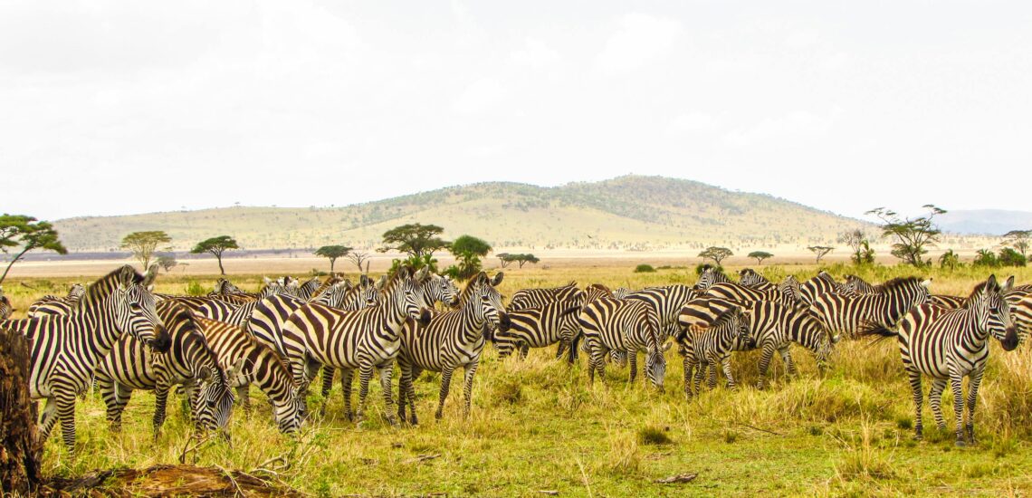
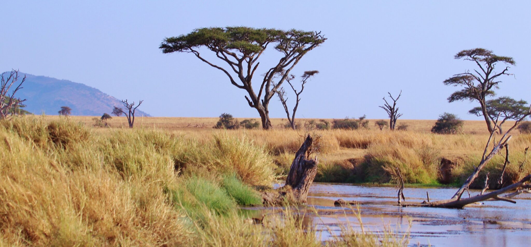
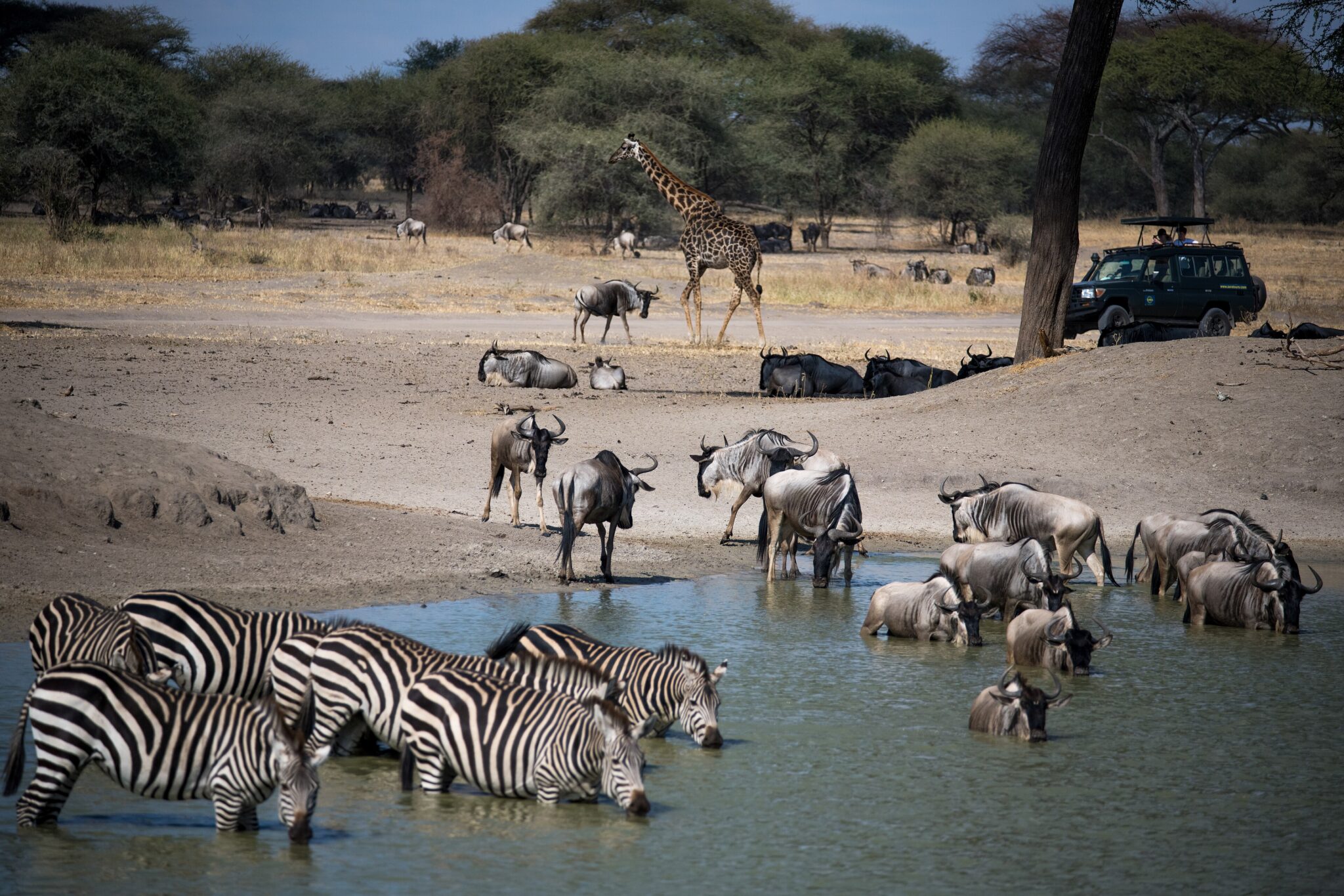
Serengeti National Park is one of Africa’s most recognisable safari landscapes because it delivers scale and consistency: vast open plains, strong predator populations, and wildlife densities that stay high across much of the year. The park covers roughly 14,750 km², and its classic experience is built around routine: early morning and late afternoon drives when big cats are most active, then a slower midday break when heat and haze increase. In the central Seronera area, sightings often include lion, leopard, and cheetah alongside large herds of zebra, buffalo, and antelope, with birds of prey and scavengers filling in the “always something happening” feel that makes the Serengeti so rewarding.
If Great Migration is a priority, planning is about geography, not just dates. The movement typically involves around 1.2 to 1.5 million wildebeest, plus hundreds of thousands of zebra and gazelles, spread across a huge ecosystem, so you are matching your base to where the herds tend to be. In broad terms, calving season is often January to February in the short-grass south (often linked with the Ndutu area on the ecosystem edge), while the long dry-season movement generally pushes herds northward, with dramatic river-crossing periods most often discussed in the July to September window, but never guaranteed on a specific day. The most reliable approach is to stay longer and stay mobile: 3 nights is a practical minimum, and 4 to 6 nights gives you the flexibility to shift areas if conditions change.
Getting there is usually via Arusha, either by road or by small aircraft to airstrips inside the park. By road, a common overland route transits the crater highlands and can take roughly 7 to 10 hours to reach the central Serengeti depending on stops, gate formalities, and road conditions, which is why many itineraries break the journey with an intermediate stop near Ngorongoro Conservation Area.
Ngorongoro Crater
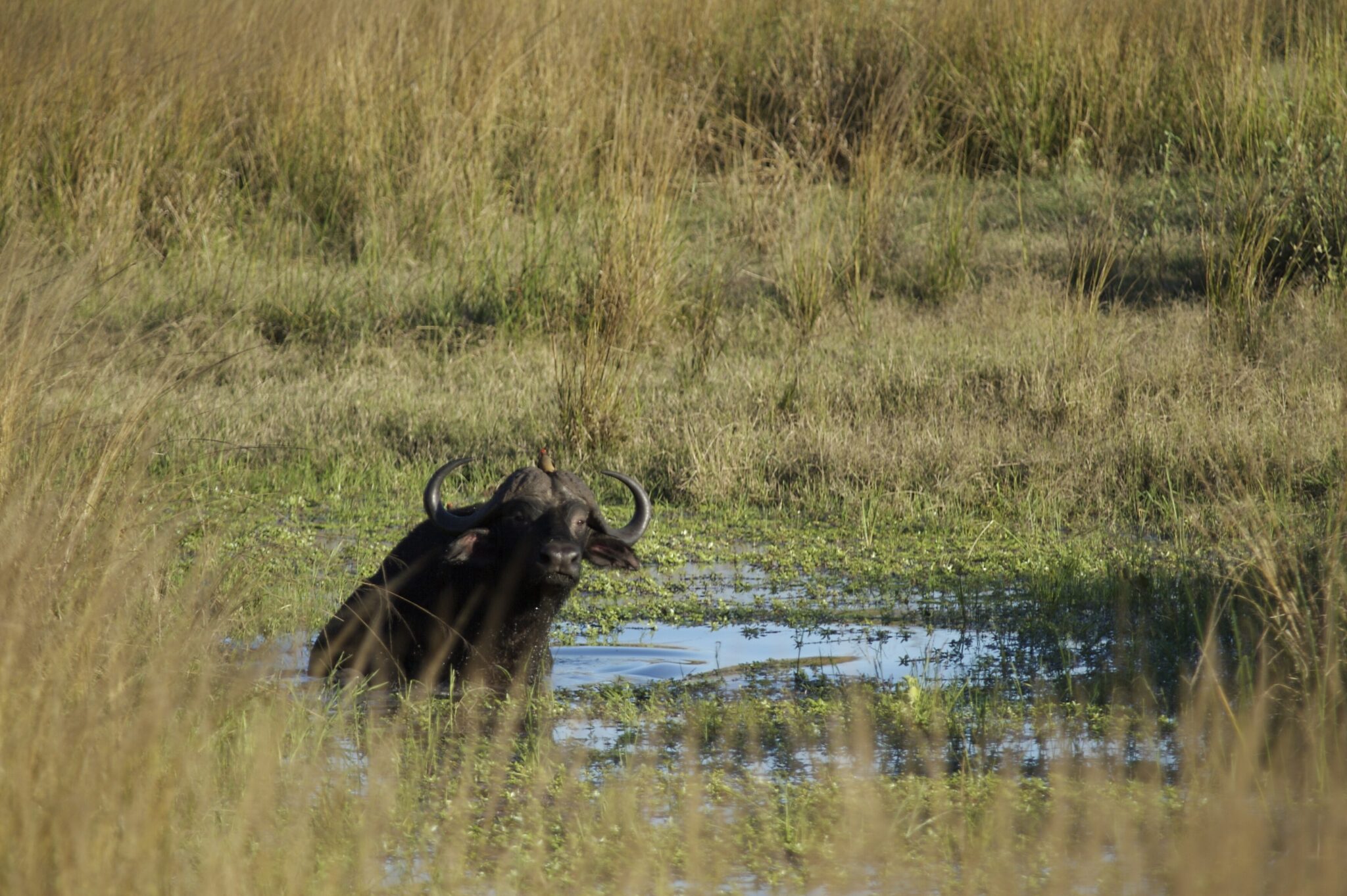
Ngorongoro Crater is one of the most concentrated safari environments in East Africa because it places a remarkable number of animals inside a single, enclosed landscape. The crater is the collapsed caldera of a large volcano, about 19 to 20 km across, with a floor area of roughly 260 km² and walls that rise around 600 m in places. That bowl shape creates a “high-impact” safari day: large herbivores, predators, and scavengers share the same limited space, so sightings come quickly, and the scenery is part of the spectacle, with steep green rims dropping down to grassland, acacia patches, and seasonal wetlands.
Wildlife viewing here often feels efficient. You can expect strong chances of seeing lion, hyena, large herds of zebra and wildebeest, and heavy concentrations of buffalo and antelope. The crater is also one of the more reliable places in the region to look for black rhino, although sightings are never guaranteed and depend on both luck and guide skill. The water and marsh areas attract hippos and large numbers of birds, so even a “limited time” visit tends to be varied. The trade-off is crowding: because the crater is famous and access is tightly controlled by the rim roads and descent routes, vehicles naturally cluster at popular sightings. From Arusha to the crater area, the drive is commonly around 180 to 200 km and often 3 to 4.5 hours depending on traffic and road conditions; from Lake Manyara National Park, it is usually 1.5 to 2.5 hours.
Tarangire National Park
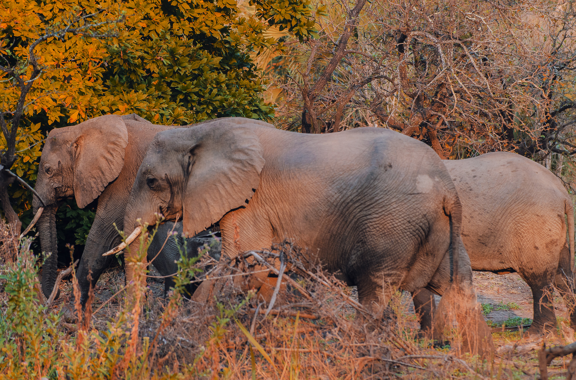
Tarangire National Park is often the most rewarding “first park” from Arusha because it delivers classic safari scenes without needing a long transfer, and it has a distinctive look compared with the open plains farther west. The park is shaped by the Tarangire River, which becomes a crucial dry-season lifeline. In the drier months, animals concentrate along the river corridor and remaining water sources, so game viewing can feel very productive, with frequent elephant encounters and strong chances of seeing buffalo, zebra, and a wide spread of antelope. The scenery is part of the signature: scattered baobabs, dry golden grass, and big skies that make even “quiet” moments feel cinematic, especially in early morning light.
Getting there is straightforward: from Arusha the road distance is typically around 110 to 140 km, commonly 2 to 3 hours depending on traffic and the exact gate and camp location. From Lake Manyara National Park, the drive is usually about 1.5 to 2.5 hours, making it easy to link the two on a northern circuit. If you are coming from Ngorongoro Crater, allow roughly 2.5 to 4 hours depending on road conditions and whether you route via Manyara.
Lake Manyara National Park
Lake Manyara National Park is a compact park with a surprisingly diverse set of habitats packed into a short drive, which is why it works well as a half-day or one-day safari stop between larger destinations. The landscape shifts quickly from groundwater forest with tall fig and mahogany trees to open floodplains, acacia woodland, and the lakeshore itself. The park is relatively small at roughly 325 km², with the lake occupying a large share of that area depending on season, so the experience is less about endless horizons and more about variety and scenery. You can see elephants in the forested sections, hippos in the water channels, and big troops of baboons moving through the trees, all in the same outing, which gives it a distinct “many ecosystems in one” feel.
From Arusha, the drive is typically about 120 to 140 km and roughly 2 to 2.5 hours depending on traffic and the gate you use. From Tarangire National Park, it is often 1.5 to 2.5 hours, making it a practical link if you want two shorter park days rather than rushing straight to the big headline parks. From Ngorongoro Crater, Manyara is commonly 1.5 to 2.5 hours by road, so it also works as a decompression stop after the crater’s intensity.
Ruaha National Park
Ruaha is one of Tanzania’s best parks for a true big-wilderness safari: expansive savanna and rocky hills, huge skies, and long stretches where you may not see another vehicle for hours. At roughly 20,000 km², it is among the country’s largest protected areas, and the scale is a major part of the experience. The park is anchored by the Great Ruaha River, which becomes a wildlife magnet in the dry season, drawing animals to the remaining pools and sandbanks. Expect strong elephant viewing, frequent encounters with buffalo and giraffe, excellent predator potential (lion and leopard are key targets), and a more “tracking and searching” style that suits travelers who enjoy the process as much as the sightings. Ruaha is also a serious birding destination, with well over 500 recorded species, especially around riverine trees and seasonal wetlands.
To visit well, plan at least 3 nights, and 4 to 6 nights is ideal if you want the park’s rhythm to settle in. The most productive windows are early morning and late afternoon; midday is often hot and slow, so it is better used for rest and river viewing from shaded points. Ruaha also suits travelers who want a slightly more exploratory feel: walking safaris are offered in some areas and can be a highlight because the landscape is varied and the visitor numbers are lower than the northern circuit. Dry season, typically June to October, is the easiest period for concentrated wildlife near water; the greener months can be beautiful and quieter, but thicker vegetation can make viewing less straightforward and some tracks may be slower after rain.
Katavi National Park
Katavi National Park is one of Tanzania’s most remote big-game parks and, for the right traveler, one of the most intense. It covers roughly 4,470 km² of floodplains, seasonal lakes, and miombo woodland, and in the late dry season the park’s water sources shrink dramatically. That is when wildlife can concentrate in a way that feels almost “compressed” into a few key areas: large buffalo herds, heavy hippo and crocodile presence in the remaining pools, and strong predator potential because so many animals are forced into predictable corridors. The scenery is not the postcard savanna of the north; it is broader, flatter, and more elemental, with big skies and a sense of scale that rewards patience and long hours in the field.
The best way to experience Katavi is to treat it as a wilderness immersion rather than a fast checklist safari. Plan at least 3 nights, and 4 to 6 nights is where the park starts to feel properly “yours,” because drives are longer, sightings are earned, and the atmosphere is a major part of the value. Timing matters: the most reliable window for dramatic concentrations is typically June to October, with August to October often delivering the most intense dry-season crowding of animals around the last water. Days should follow classic safari rhythm: dawn and late afternoon for movement and predators, then a slower midday break when heat and dust rise.
Nyerere National Park
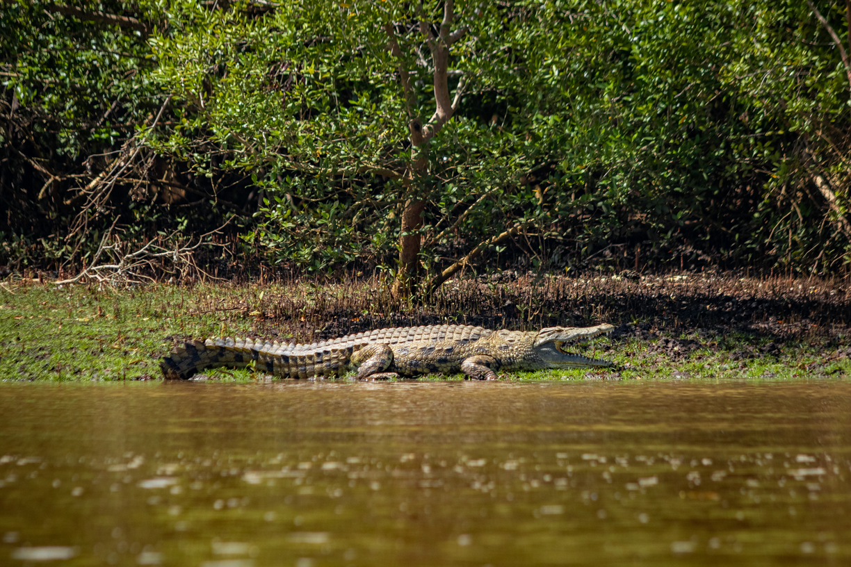
Nyerere National Park is one of Tanzania’s most expansive safari areas and stands out for the way water shapes the experience. The park is part of the wider Selous ecosystem and covers roughly 30,000 km², so it feels genuinely big-sky and untamed, with broad plains, palms, woodland, and river channels rather than the open grass “endless plain” look of the northern circuit. Wildlife viewing can be excellent, especially in the dry season when animals concentrate near permanent water. Expect strong chances of elephant and buffalo, plentiful hippos and crocodiles, and good predator potential including lion and, with luck and the right area, African wild dog. What makes it especially memorable is variety: classic game drives, walking safaris in designated zones, and boat-based viewing on the Rufiji River and its connected lakes, where you can watch animals come to drink and see birdlife at close range. A realistic, high-quality plan is 3 to 5 nights so you can combine at least one boat outing with multiple drives, instead of spending your best hours moving long distances inside the park.
To visit well, choose a reputable operator and treat distance as the main factor in itinerary design. Start early and work around the heat: dawn drives for predators and movement, a calmer midday break, then late-afternoon drives or a sunset boat trip for softer light and active wildlife near the water. In the wet season, the landscape can be lush and beautiful but travel times increase and wildlife disperses, so patience matters. For getting there, most travelers use Dar es Salaam as the primary gateway: scheduled light aircraft typically reach park airstrips in about 45 to 75 minutes airborne, which is the most time-efficient approach. Overland, the drive from Dar es Salaam is commonly around 5 to 7+ hours depending on the entry point and road conditions, so it is best if you have enough days to justify the slower transfer. From Zanzibar City, the usual approach is a short hop to the mainland first, then a connection onward, while Morogoro can function as a practical staging city for road itineraries if you prefer breaking up travel.
Mahale Mountains National Park
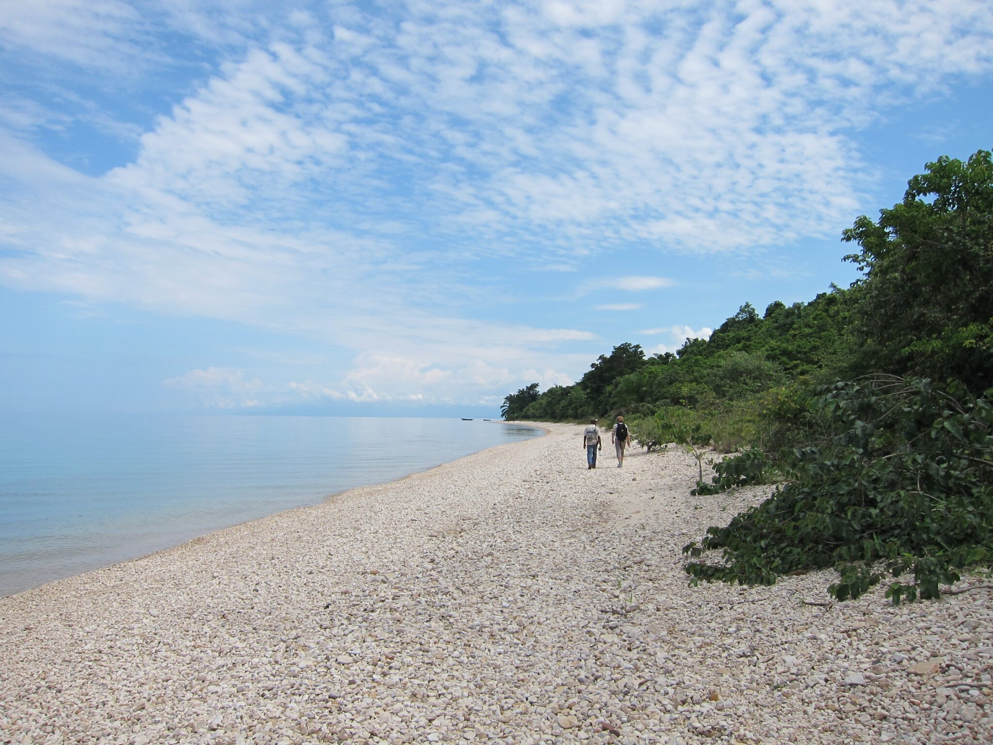
Mahale Mountains National Park is one of East Africa’s most striking combinations of primate trekking and wild lakeshore scenery, set on the forested slopes above Lake Tanganyika. The park is large by chimp standards at roughly 1,600 km², and it rises from the beach into steep mountain terrain, with Mount Nkungwe reaching about 2,462 m. The signature experience is tracking habituated chimpanzees through dense forest, often alongside sightings of red colobus and other monkeys, plus excellent birdlife and a genuine sense of isolation. Between treks, the setting is part of the reward: clear-water swims, empty beaches, and sunset views across one of the world’s deepest lakes. This is not a “quick stop” destination; it works best when you plan 3 to 5 nights so you have multiple trekking attempts and time to absorb the place.
The usual gateway is Kigoma, reached by domestic flights from Dar es Salaam or Arusha (air time commonly around 2 to 3 hours, depending on routing). From Kigoma, you normally continue by boat along the lakeshore: a faster private transfer is often in the 4 to 6 hour range, while slower public or scheduled services can take significantly longer and may not run frequently.
Gombe Stream National Park
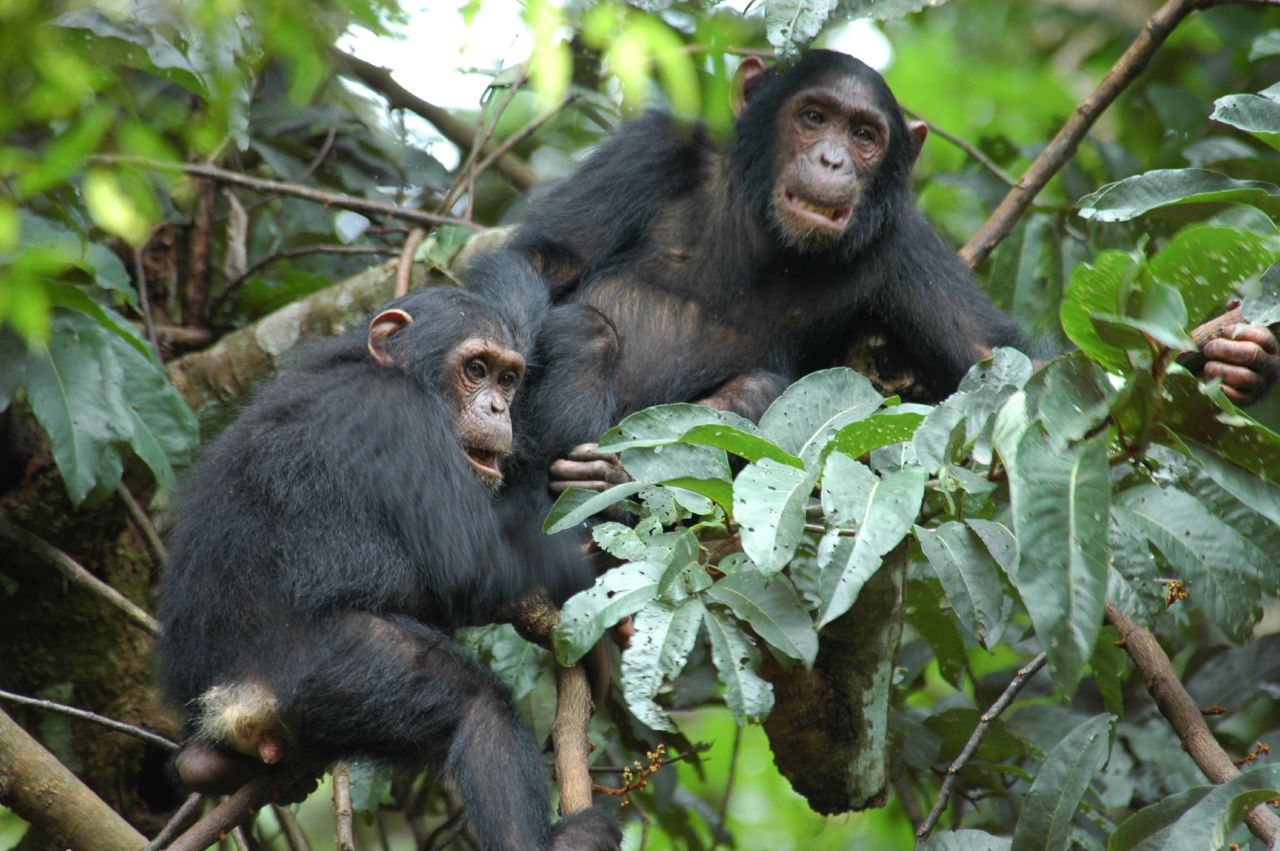
Gombe Stream National Park is a highly focused primate destination and one of Tanzania’s most historically important wildlife sites. It is very small at roughly 35 km², set between steep, forested valleys and the shoreline of Lake Tanganyika, which means the experience is compact, intense, and strongly shaped by day-to-day conditions. Gombe is famous for long-term chimpanzee research that began here in 1960, and the park was established in 1968, giving it a legacy that goes beyond tourism. You come for chimp trekking first, with a real chance to observe social behaviour, movement through the forest, and the dynamics of different individuals, rather than for wide-open savanna game drives.
Because the park is compact, the quality of guiding and your timing can strongly affect what you see. A trek can be relatively short on a good day, but it can also become a steep, humid hike of 2 to 6 hours if the chimps moved deeper into the valleys or higher onto the slopes. For a strong visit, plan at least 2 nights so you can attempt two treks, and 3 nights is better if you want flexibility for weather and recovery. Wear proper hiking shoes, bring long sleeves and trousers for scratchy vegetation, carry plenty of water, and expect slippery ground after rain. The most rewarding approach is to move quietly, keep patience high, and choose operators who prioritize responsible distances and calm observation over rushing a sighting.
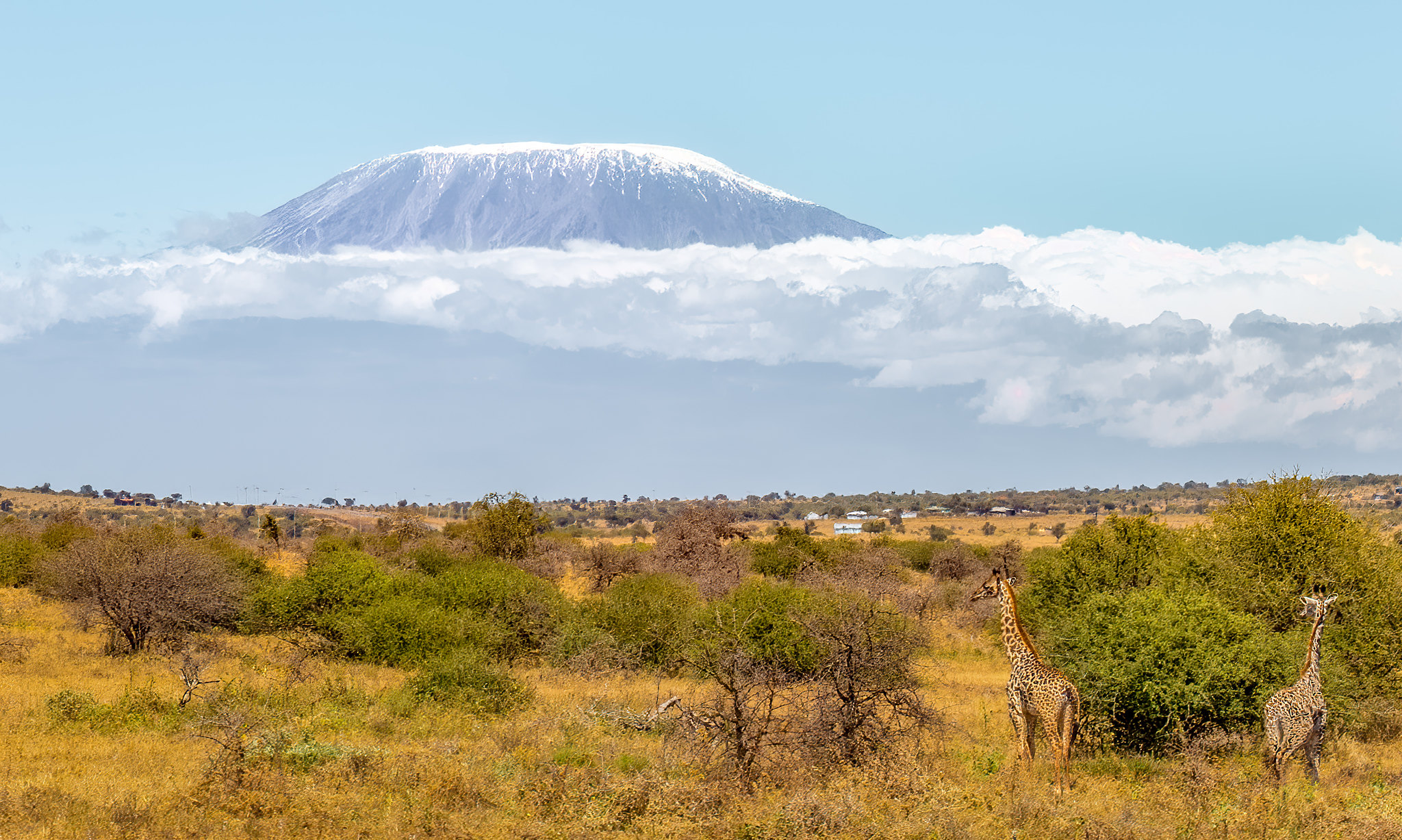
Mount Kilimanjaro
Mount Kilimanjaro is a 5,895 m stratovolcano and the highest mountain in Africa, famous because a single trek takes you through multiple ecosystems in one itinerary. Most climbs start in humid montane forest (often around 1,800 to 2,800 m), transition into heath and moorland, then cross alpine desert before the final summit push on volcanic scree and ice. The climb is non-technical on standard routes, but it is physiologically demanding because you gain a lot of altitude quickly, and the summit day often begins around midnight from a high camp near 4,600 to 4,800 m. Temperatures can drop well below freezing at altitude, and summit conditions can feel like -10°C to -20°C with windchill, even if the lower slopes are warm.
The biggest success factor is acclimatization, not fitness speed. As a practical rule, longer itineraries perform better: 7 to 9 days on the mountain usually gives your body more time to adapt than 5 to 6 days, and routes designed for gradual gains tend to be more forgiving. Popular options include Machame, Lemosho, Marangu, Rongai, the Northern Circuit, and Umbwe (steeper and generally less suitable if you want a more conservative acclimatization profile). Look for itineraries that include either an extra acclimatization day or a daily pattern that allows some “climb higher, sleep lower” movement. A reputable operator should also use realistic turnaround decisions, monitor symptoms consistently, and be willing to stop a summit attempt early if safety is trending the wrong way.
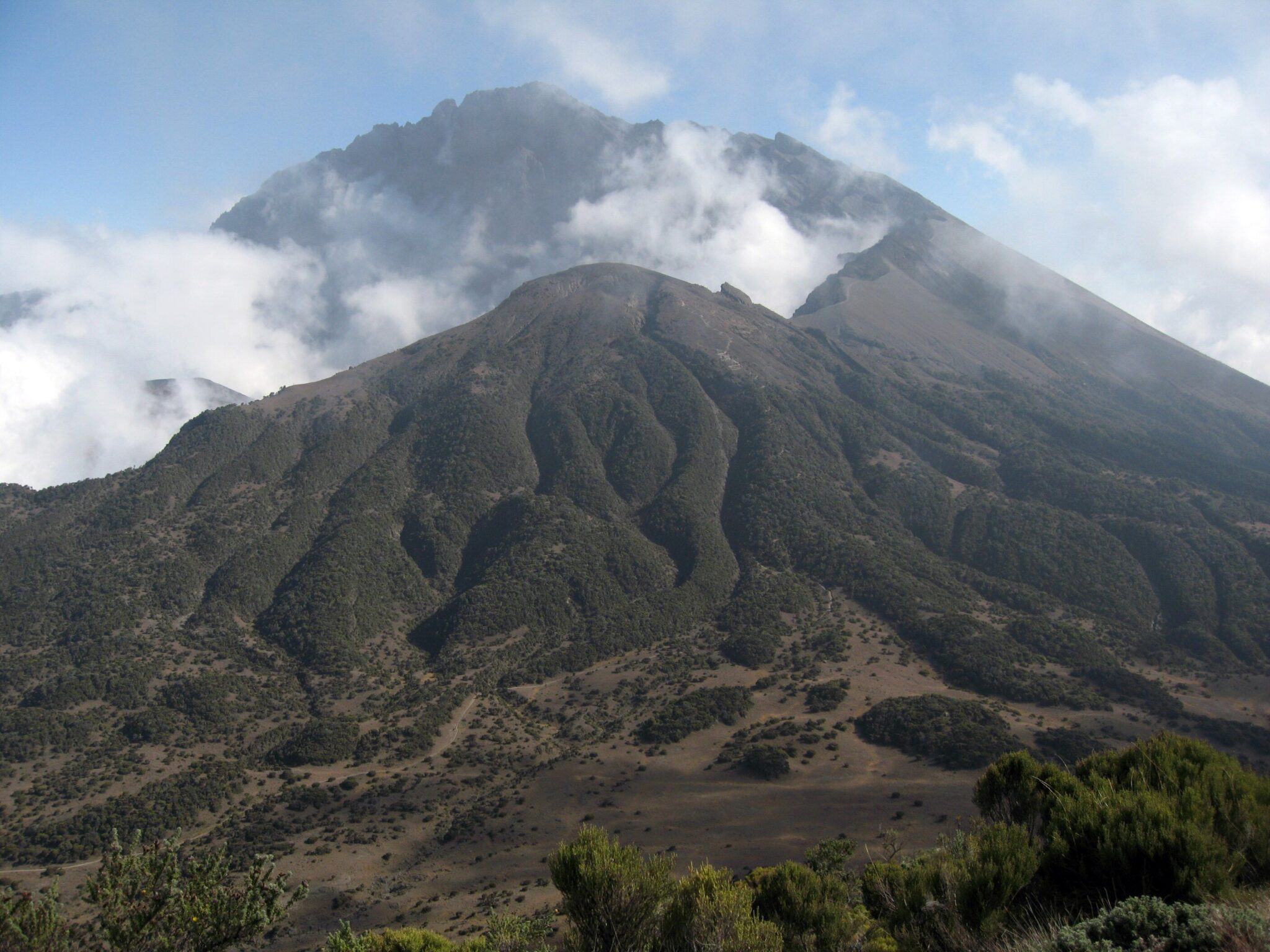
Mount Meru
Mount Meru is a serious, high-quality climb that often surprises travelers who arrive focused only on Mount Kilimanjaro. At about 4,566 m, it is Tanzania’s second-highest mountain and sits inside Arusha National Park, which gives the ascent a distinctive feel: you move from forested lower slopes into open highland scenery with frequent views back toward Kilimanjaro on clear days. The terrain is varied and dramatic, shaped by Meru’s volcanic history, with ridgelines, ash and rock sections, and a summit area that feels genuinely alpine. Compared with Kilimanjaro, the atmosphere is usually quieter, and the route can feel more “mountain” in character because there are steep sections, narrow ridges, and a stronger sense of exposure near the top.
As a standalone climb, Meru is commonly done in 3 to 4 days, which makes it realistic if you want a major hike without a full week-plus schedule. It also works well as acclimatization because it gets you above 4,000 m while keeping total days manageable, and it encourages a steady pace rather than a rush. Summit day is typically an early start, and conditions can be cold and windy near the top, so warm layers and gloves are essential even when Arusha feels mild. Because Meru is climbed within a national park, treks typically require an armed ranger accompaniment and operate on established hut-based staging, which keeps logistics structured but still feels adventurous on the upper slopes.
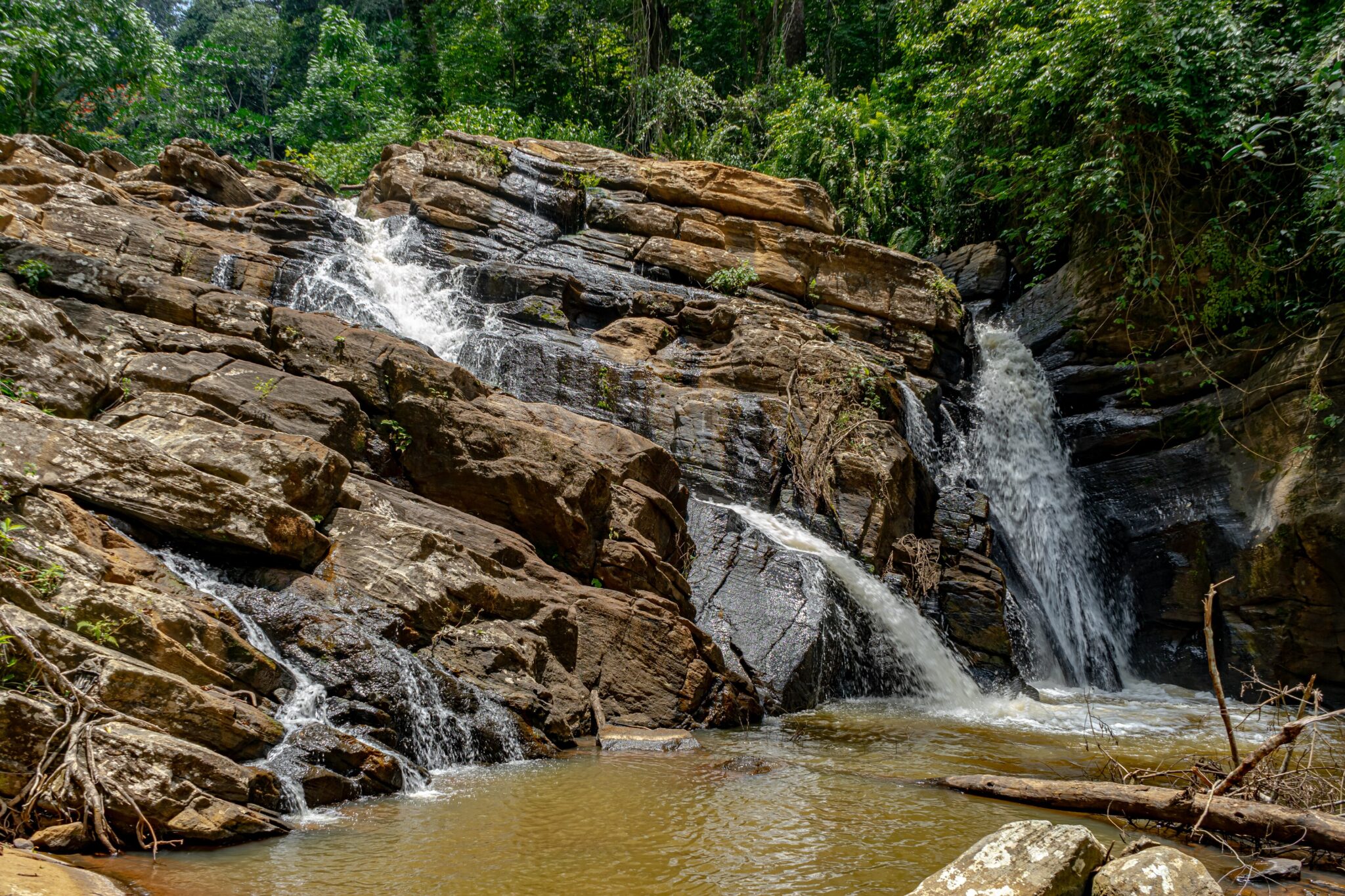
Materuni Waterfalls
Materuni Waterfalls is one of the easiest, most scenic half-day nature breaks from Moshi, set in the green lower slopes of Mount Kilimanjaro among banana and coffee farms. The appeal is how quickly it delivers “real landscape” without a hard hike: you get a village-and-foothills atmosphere, then a walk through lush vegetation to a tall cascade that is strongest after rainfall. Many visits pair the waterfall with a Materuni Village stop, which adds context on Chagga culture and small-scale agriculture and can include a simple coffee experience that fits naturally into a relaxed day.
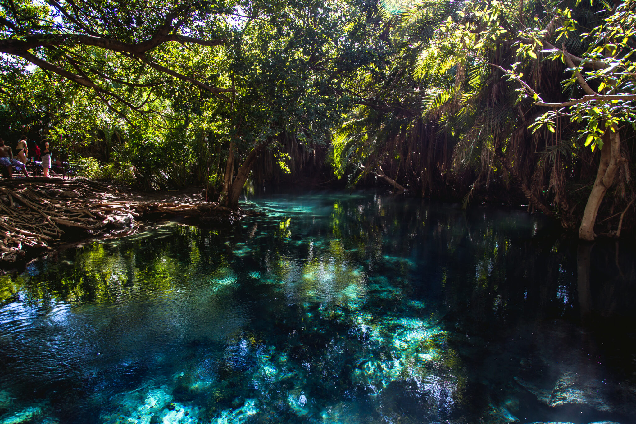
Chemka Hot Springs (Kikuletwa)
Chemka Hot Springs (Kikuletwa) is one of the most enjoyable “reset day” outings in the Kilimanjaro region because it is built around a simple idea done well: clear spring water in a shaded oasis where you can swim, float, and slow down after trekking or long drives. The main pool is fed by underground springs, so the water stays clear and refreshingly comfortable rather than feeling like a chlorinated resort pool. The setting is part of the appeal: palms and fig trees provide shade, ropes are often set up for easy jumps, and the vibe is social but relaxed if you arrive early. Plan on 2 to 4 hours on-site as the sweet spot, long enough for multiple swims and a calm break without turning it into a full-day effort.
Treat the visit as a straightforward, low-intensity outing. Go early for fewer people and smoother water, then settle into a simple routine: swim, rest in the shade, and have a light picnic-style meal. Bring swimwear, a quick-dry towel, water, and snacks, and protect valuables with a dry bag. Even though it is called “hot springs”, the water is typically best described as pleasantly warm to cool rather than sauna-hot, which is why it works so well in the midday sun. If you are sensitive to sun, bring a hat and sunscreen, because the open edges of the pool can feel exposed once the day warms up.
Best Beaches and Island Destinations
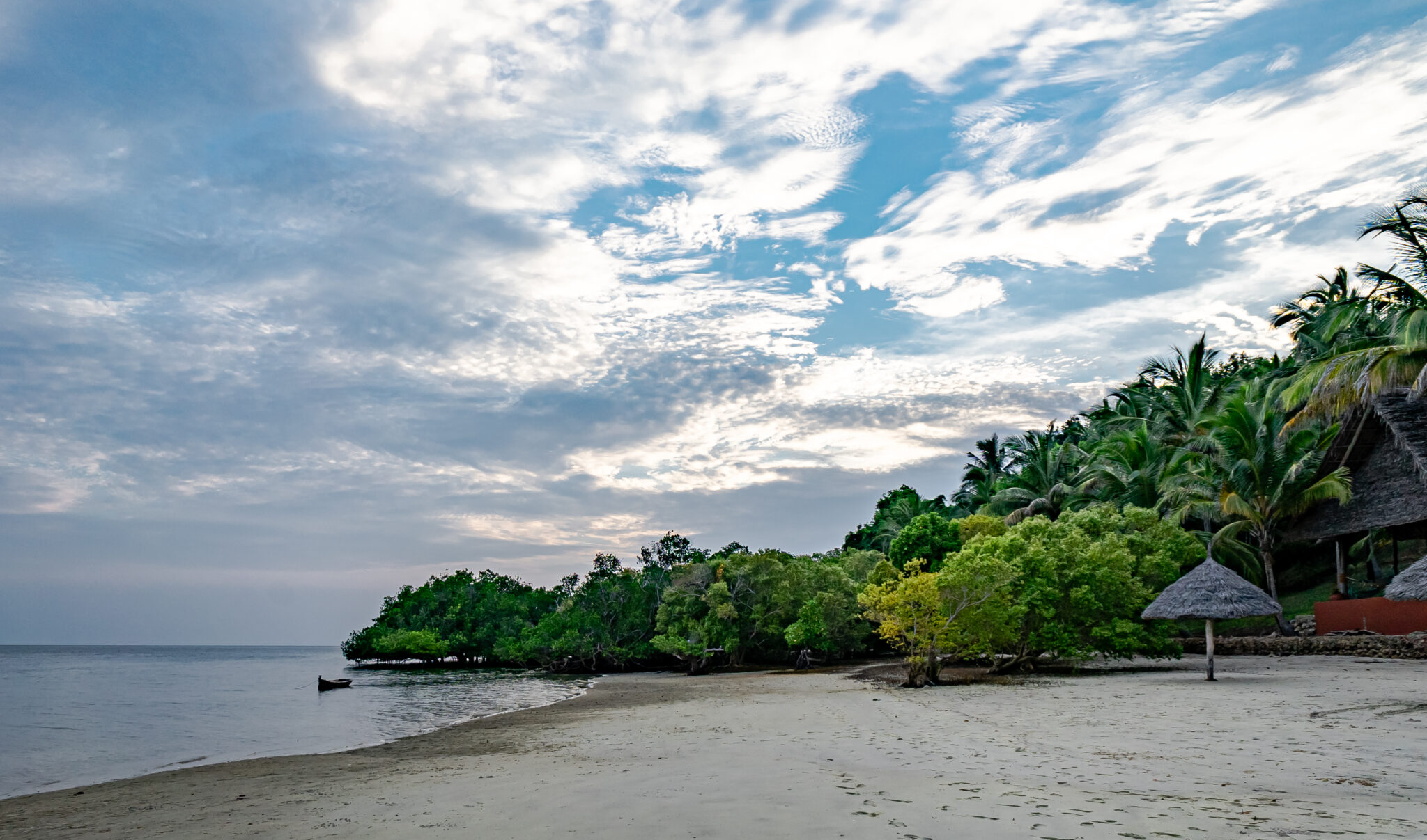
Zanzibar
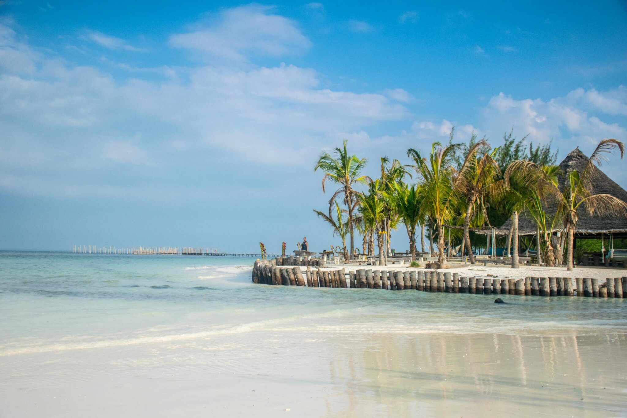
Zanzibar works best when you treat it as two trips in one: heritage in Zanzibar City (especially Stone Town) and then unstructured beach time. A balanced first plan is 1 to 2 nights in Stone Town for walking the old lanes, markets, and waterfront at sunset, then 3 to 7 nights on the coast depending on how much you want to slow down. For beaches, the north is the most “easy swimming” part of the island: Nungwi is lively with more restaurants and evening atmosphere, while Kendwa is known for wider sand and typically calmer, simpler beach days. On the east coast, Paje is the classic choice for long shorelines and wind sports, but the tidal change is much more noticeable there, at low tide the water can pull far out, exposing flats and making “walk-in” swimming less convenient for a few hours.
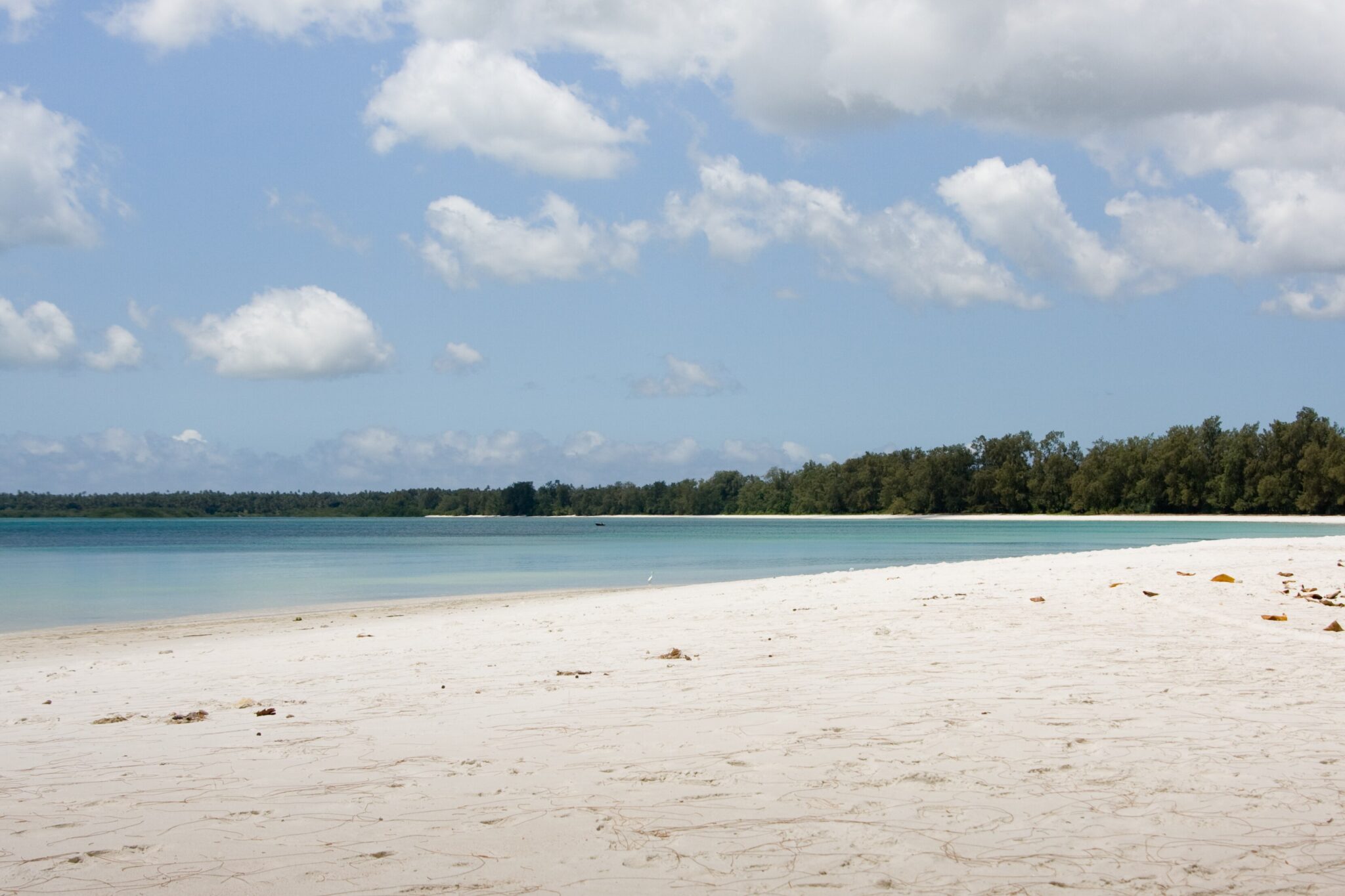
Mafia Island
Mafia Island is a low-key, nature-first island best known for clear-water snorkelling and diving inside the Mafia Island Marine Park, a protected seascape of roughly 822 km² established in 1995. Compared with the more built-up island circuits, Mafia’s appeal is its slower pace and the feeling that the ocean sets the schedule. Most days revolve around reefs, lagoons, and sandbanks: snorkelling over coral gardens, diving for turtles and reef fish, and simple boat trips that prioritise time on the water rather than a packed list of stops. Seasonality matters for marine life. Whale shark encounters are a key draw in the October to March window in many years, with peak conditions often in the November to February period, but visibility and sightings still depend on sea conditions and daily movement.
On land, the island adds gentle cultural and nature variety without pulling you away from the water focus. Kilindoni is the main town for everyday services and supplies, while the Chole Island area is a classic add-on for a quieter, historic feel, mangroves, and short boat hops into the marine park. Expect “simple but excellent” rather than nightlife: early swims, long lunches, and sunset dhow time.
Pemba Island
Pemba Island is noticeably greener than Zanzibar, with rolling hills, clove plantations, and a coastline cut into quiet coves and mangrove fringes. The island is roughly 70 km long and under 1,000 km² in area, and it feels deliberately low-key: fewer large resorts, fewer organized “packages,” and more of a lived-in, rural atmosphere. The best experiences are usually simple and outdoors-based, such as slow beach days on less-developed shores, short village and plantation visits to understand why cloves became central to local life, and unhurried sunset viewpoints that feel far from the busier island circuits.
Best Cultural and Historical Sites
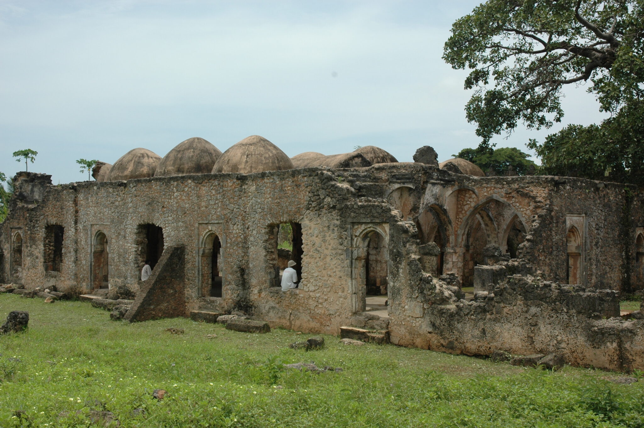
Kilwa Kisiwani Ruins
Kilwa Kisiwani Ruins is one of the highest-value heritage visits on the Swahili Coast because it captures how Indian Ocean trade shaped East Africa from roughly the 9th to the 16th centuries. At its peak, Kilwa was a wealthy port city connected to networks reaching Arabia, Persia, India, and beyond, trading in items such as gold and ivory that moved from the interior to the coast, and importing ceramics, glass, and textiles. On the ground, the ruins are striking for their coral-stone architecture and scale: the Great Mosque of Kilwa (with phases dating from around the 11th to 13th centuries) is one of the most important early stone-built mosques in the region, and the clifftop palace complex Husuni Kubwa (early 14th century) gives a clear sense of elite urban life, with large courtyards, vaulted spaces, and sea-facing positions chosen as much for power and visibility as for comfort. The site is often quiet, which makes it ideal for travelers who want time to absorb details rather than move in a crowd.
To visit well, plan 2 to 4 hours on the island and treat interpretation as essential. Many structures look like beautiful stone shells until a guide explains what you are seeing and how different periods overlap, including later disruption when Portuguese forces took the coast in the early 1500s and trade patterns shifted. Go in the cooler morning hours, carry water, wear shoes with grip for uneven coral-rock surfaces, and bring sun protection because shade is limited once you leave the boat landing.
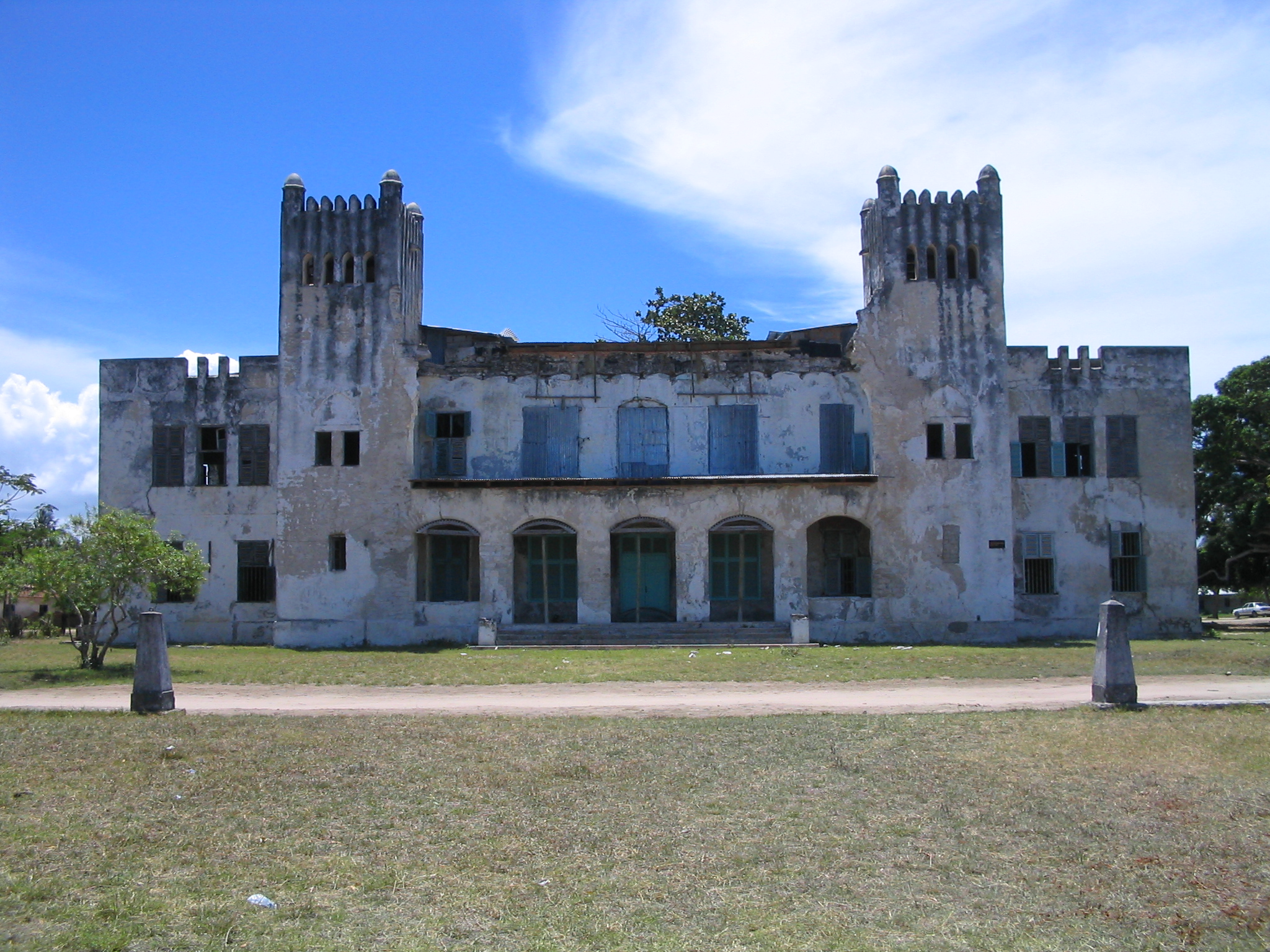
Bagamoyo
Bagamoyo is one of Tanzania’s most atmospheric Swahili Coast towns, valued for quiet heritage rather than “must-see” spectacle. In the late 19th century it grew into a major coastal hub linked to caravan trade routes from the interior, and it later became an early German administrative centre in East Africa. That layered past still shows in the town’s low-rise streetscape: weathered coral-stone buildings, scattered colonial-era remnants, and a coastal setting that encourages slow walking rather than a packed itinerary. It is a good stop if you want cultural depth without crowds, and it pairs well with a calm overnight that lets you see the town in softer morning and evening light.
The best way to experience Bagamoyo is on foot with a guide who can connect the dots between sites that might otherwise feel like isolated ruins. A strong, realistic plan is 2 to 4 hours for a guided heritage walk, then a relaxed late afternoon by the waterfront. Key stops often include the historic church and mission precincts, early colonial administrative areas, and the town’s older stone-house lanes where carved doors, courtyards, and decaying facades hint at periods of wealth and decline.
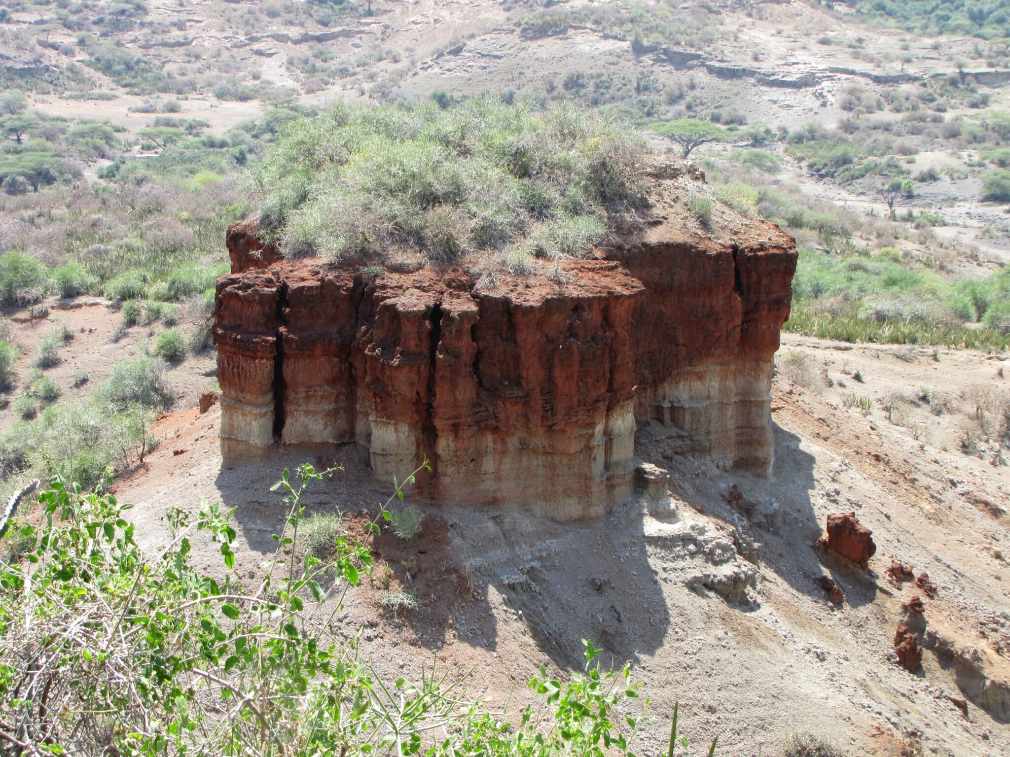
Olduvai Gorge
Olduvai Gorge is one of the most important places in the world for understanding early human history because it exposes a long sequence of sediment layers that record changing environments and human activity over immense time. The gorge lies within the Ngorongoro Conservation Area in the Great Rift Valley and is often described as roughly 40 to 50 km long with sections approaching 90 to 100 m in depth. What you are looking at is not a single “site”, but a landscape cut that reveals a natural timeline, with different layers associated with different periods of fauna, climate, and stone-tool traditions. The gorge is closely linked to discoveries associated with early hominins, including finds in the Australopithecus and early Homo record, and it is part of why this region is sometimes referred to as a key “cradle” zone for studying human evolution.
It is most rewarding when you treat it as a learning stop with time for explanation. Plan 60 to 90 minutes as a minimum if you want the visit to be more than a viewpoint: include the museum and an on-site briefing so you understand what the layers represent, what was found where, and why the context matters. If you are interested in archaeology, allow closer to 2 hours so you can take the exhibits slowly and connect the gorge to nearby paleoanthropology localities in the wider area.
Hidden Gems of Tanzania
Lake Natron
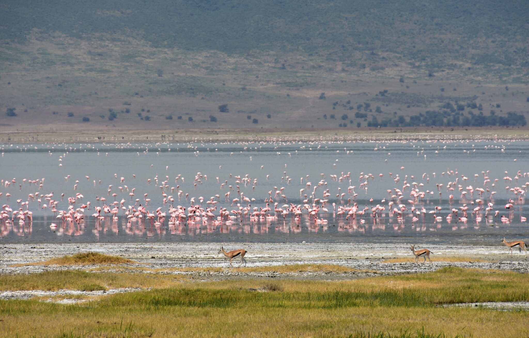
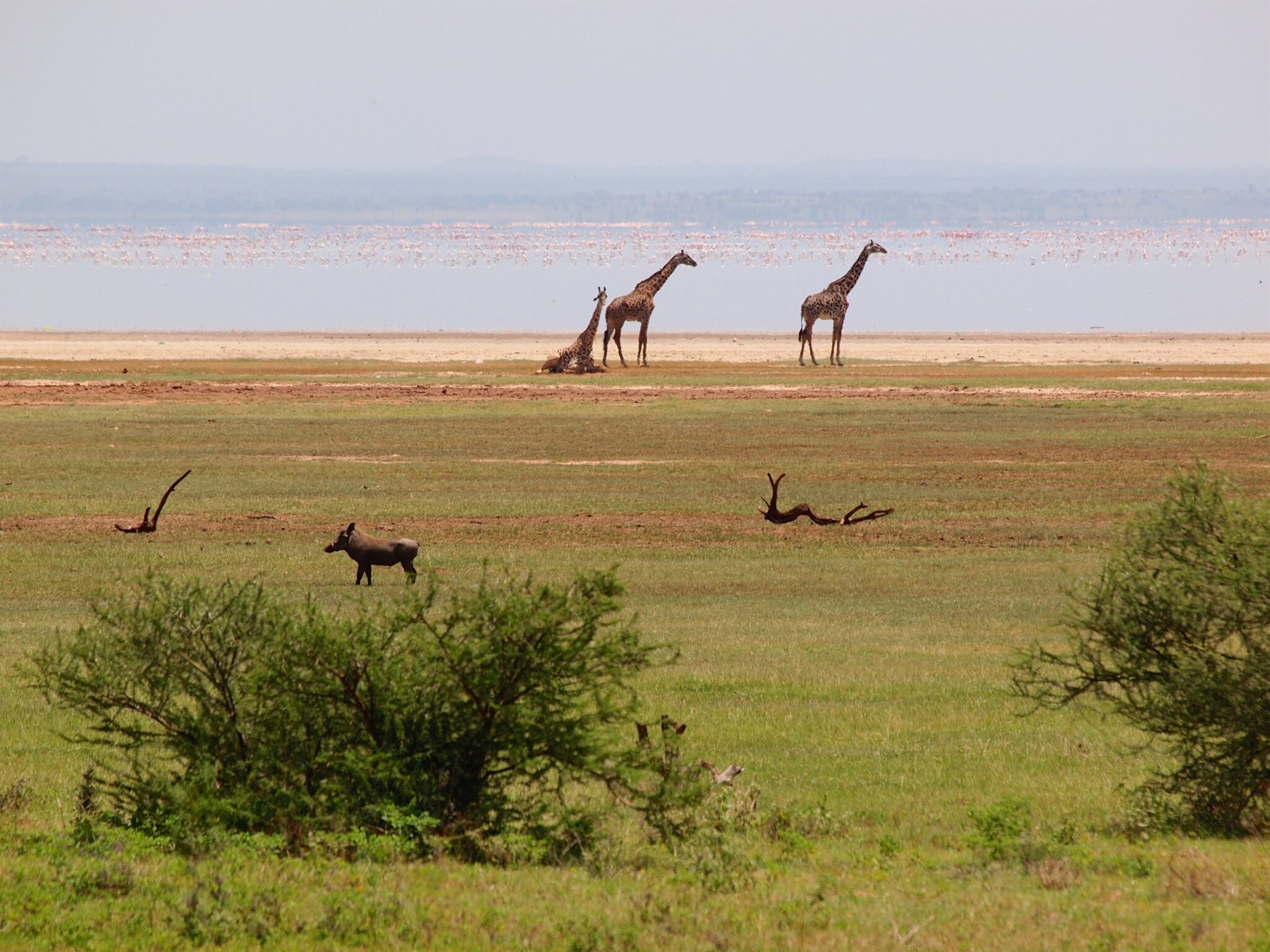
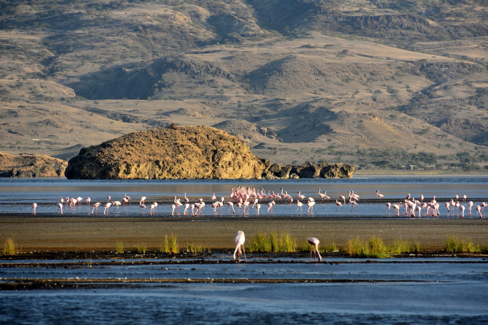
Lake Natron is one of northern Tanzania’s most unusual landscapes: a remote soda lake in the Rift Valley with intense reds and whites along the shoreline, sharp escarpments, and the cone of Ol Doinyo Lengai nearby. The lake is highly alkaline, with pH commonly reported above 10, and it is shallow and variable, roughly 57 km long and up to about 22 km wide in broader estimates, with salinity and water coverage changing sharply between dry and wet periods. It is also a key breeding area for lesser flamingos, which is why the scenery often includes pink bands and large congregations in season. This is not a “drive in, do a quick loop” destination. It is about stark geology, heat shimmer, big skies, and the feeling of being far from the main safari flow.
What to do is best kept simple and heat-aware. Many visits focus on flamingo viewing and Rift Valley scenery, plus a walk to the Engare Sero waterfalls and gorge (a cooler, shaded contrast to the open lake flats). For stronger hiking, the classic add-on is a night ascent of Ol Doinyo Lengai, rising to about 2,962 m, timed to avoid the worst heat and to reach viewpoints near sunrise, but it is steep and demanding and should be treated as a serious hike rather than an optional extra. Expect daytime temperatures to reach 35 to 40°C in hotter months, with very limited shade near the lake, so plan early starts, carry more water than you think you need, and avoid tight timetables. Infrastructure is basic and spread out, so a local guide and a reliable 4×4 plan make a major difference.
Mkomazi National Park
Mkomazi National Park is one of northern Tanzania’s quieter safari options, and its main advantage is exactly what you described: space, calm, and a more exploratory feel with fewer vehicles. The park lies in the rain-shadow of Mount Kilimanjaro and Usambara Mountains, so the landscapes tend to be drier and more open, with acacia woodland, savanna, and big, uncluttered views. Rather than “big headline drama”, Mkomazi rewards patient wildlife watching, long drives without traffic, and the sense that you are in a large protected area that many itineraries skip.
Wildlife viewing here is often about quality sightings in a low-crowd setting rather than constant action. You can expect antelope, giraffe, zebra, and elephants in the wider ecosystem, plus strong birdlife, especially for raptors and dry-country species. Mkomazi is also known for conservation work, and some visits prioritize learning about protection and reintroduction efforts alongside classic game drives, which can add depth if you want more than pure viewing. The park works well as a 1 to 2 night safari add-on: one afternoon drive on arrival, a full early morning, and then continue your route, which fits naturally into overland travel days without forcing long detours.
Saadani National Park
Saadani National Park is unusual in Tanzania because it genuinely blends safari with the coast: you can move from savanna and riverine habitat to ocean beaches within the same day. That mix is the point. The park’s wildlife viewing is typically about relaxed, low-pressure drives and river time rather than the high-density predator theatre of the northern circuit. Expect elephants, giraffe, buffalo, and a spread of antelope, plus hippos and crocodiles along the Wami River. Birdlife can be a strong supporting highlight because the park includes wetlands, river edges, and coastal zones in a compact area. The atmosphere is often calm and spacious, which suits travelers who want “some safari” plus beach time without a long inland journey.
Access is one of Saadani’s main advantages if you are based in or moving through Dar es Salaam or Zanzibar City. By road from Dar es Salaam, distances are often in the 160 to 220 km range depending on the entry point, with typical travel times around 4 to 6.5 hours because sections can be slow. From Bagamoyo, it is usually closer, often 2 to 4 hours depending on roads and routing. From Zanzibar, the practical approach is to connect to the mainland first and then continue overland; some itineraries also use small aircraft or boat transfers in certain seasons, but timing and conditions can affect reliability.
Lushoto
Lushoto is one of Tanzania’s best highland bases for travelers who want cool air and walking days, set in the West Usambara Mountains at roughly 1,300 to 1,600 m elevation. The town developed during the German colonial period as an administrative hill station, which is part of why it still feels organized and compact, with a calmer pace than the safari gateways. The scenery is the headline: steep green slopes, patchwork farms, forest fragments, and frequent ridge views that feel worlds away from the savanna parks and the coastal humidity. It is a good place to slow down for two to four nights and build your itinerary around short hikes rather than long drives.
What to do in and around Lushoto is mainly outdoors, and the best experiences come from choosing one or two strong walks rather than trying to “bag” every viewpoint. Popular routes include the viewpoints and cliff edges near Irente, where you can get wide panoramas over the plains, and village-to-village trails that pass through farms, banana groves, and forested sections. A typical half-day hike runs 3 to 5 hours, while a full-day loop can reach 6 to 8 hours depending on elevation and pace.
Amani Nature Reserve
Amani Nature Reserve is one of the best places in Tanzania for true rainforest atmosphere without crowds, set in the East Usambara Mountains where warm, moist air from the Indian Ocean helps sustain dense evergreen forest. It is valued for biodiversity, especially birds, butterflies, and amphibians, and the overall experience is less about “one big sight” and more about immersion: shaded trails, huge trees, mossy trunks, constant bird calls, and sudden breaks in the canopy where misty hills roll away. The reserve is also tied to an interesting research legacy, with historic botanical and agricultural work in the wider Amani area, which is part of why the settlement and forest edges feel like a blend of nature and long-term study rather than pure tourism.
The best way to visit is with local support, because logistics shape the day as much as the walking does. Trails can be muddy and slippery after rain, and route choices depend on what you want: short forest loops for atmosphere, longer birding-focused walks at first light, or village-and-forest combinations that add cultural context. Plan for a “slow and observant” pace rather than long distances. A half-day visit can work, but a full day is more rewarding if you want serious birding, because activity peaks early and the forest takes time to read.
Travel Tips for Tanzania
Safety and General Advice
Tanzania is one of Africa’s premier safari and beach destinations, known for its world-class wildlife parks and the tropical allure of Zanzibar. The country is welcoming and generally safe for visitors, though normal precautions should be taken in cities and crowded markets. Booking safari and park activities through reputable operators ensures reliability, safety, and adherence to conservation regulations. Advance reservations are particularly important during high season in parks like Serengeti and Ngorongoro.
A yellow fever vaccination may be required depending on your travel route, particularly if arriving from an endemic country. Malaria prophylaxis is strongly recommended for most regions, including coastal and lowland areas, where the risk is highest. Tap water is not safe to drink, so stick to bottled or filtered water at all times. Travelers should bring insect repellent, sunscreen, and a small medical kit. Comprehensive travel insurance with medical evacuation coverage is advisable, especially for those visiting remote safari destinations.
Car Rental and Driving
An International Driving Permit is recommended alongside your national driver’s license, and both should be carried at all times, especially at police checkpoints or when renting vehicles. Driving in Tanzania is on the left-hand side of the road. A 4×4 vehicle is essential for national park routes, unpaved roads, and rural regions, especially during the rainy season. Night driving outside towns is not recommended due to limited visibility and the possibility of encountering wildlife or livestock on the roads. Travelers who are unfamiliar with local driving conditions often prefer to hire a driver-guide, which enhances safety and navigation.
Published February 03, 2026 • 32m to read