Guinea, also known as Guinea-Conakry, is a West African country defined by its strong geography and cultural depth. Mountain plateaus give rise to major West African rivers, while forests, waterfalls, and savannahs shape everyday life far beyond the capital. Along the Atlantic coast, fishing communities and port towns contrast with the highlands of Fouta Djallon and the forested regions in the south.
Largely untouched by mass tourism, Guinea offers a direct look at traditional village life, regional music styles, and long-standing customs that remain part of daily routines. Travelers can hike through river valleys, visit rural markets, explore waterfalls, or experience local festivals rooted in centuries-old traditions. For those interested in nature, culture, and places that remain largely unexplored, Guinea provides a genuine and grounded travel experience in West Africa.
Best Cities in Guinea
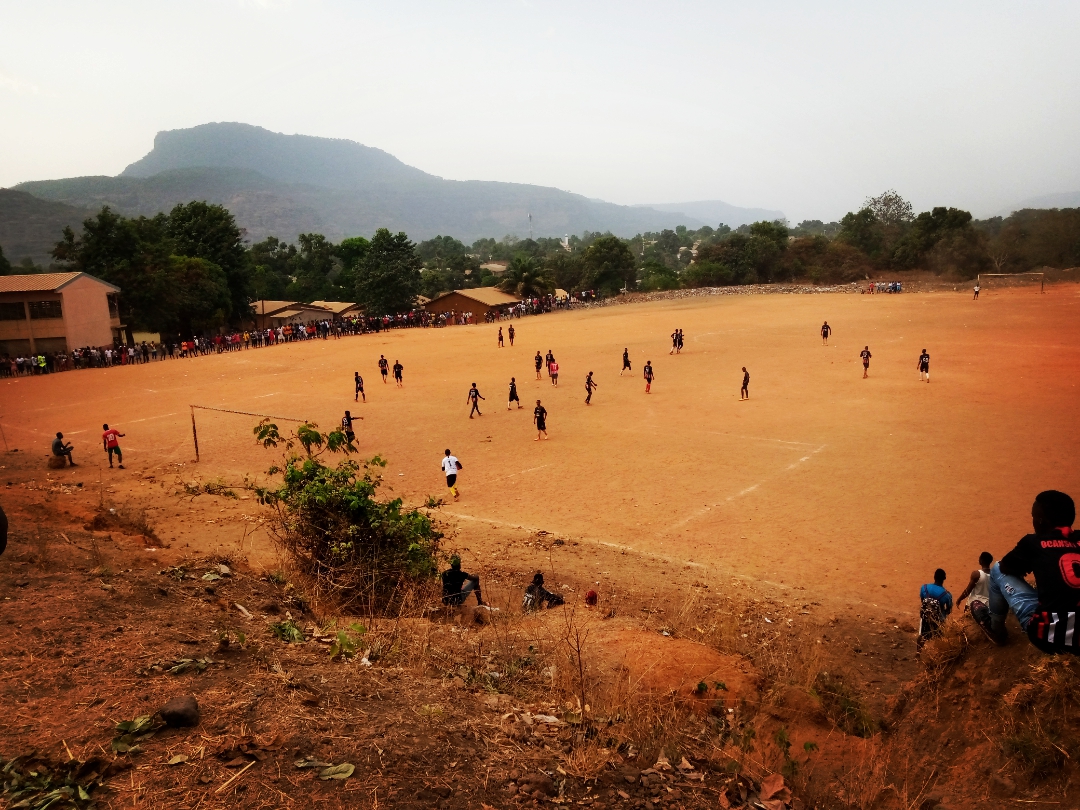
Conakry
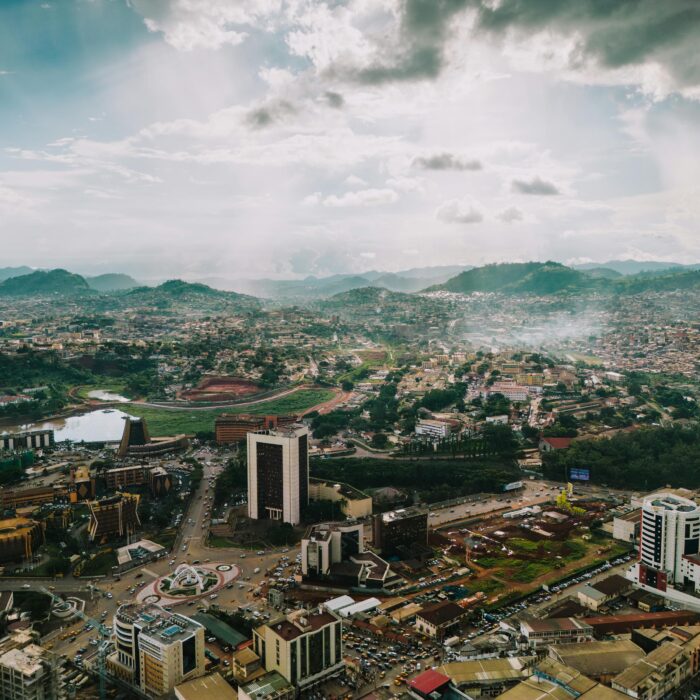
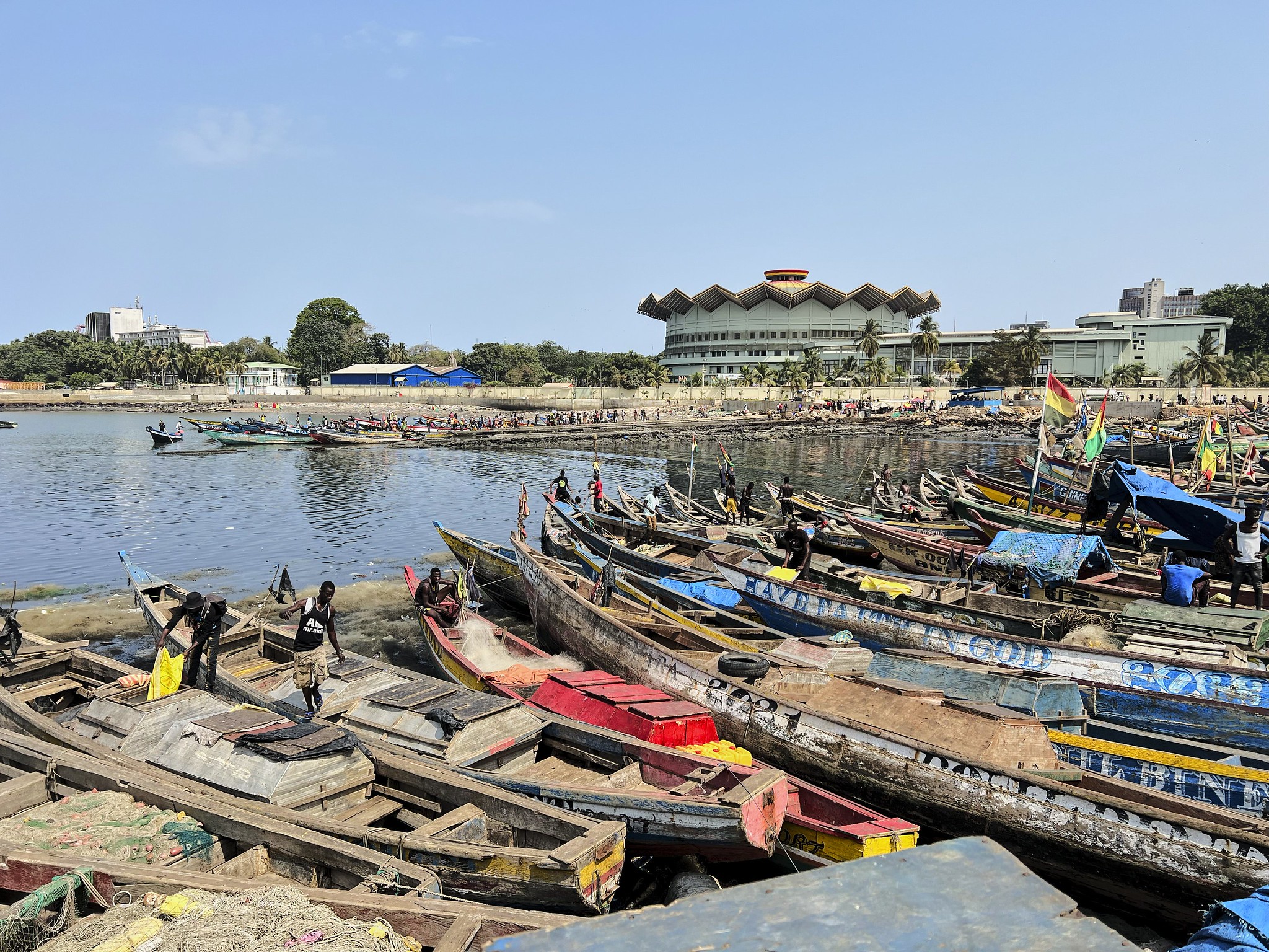
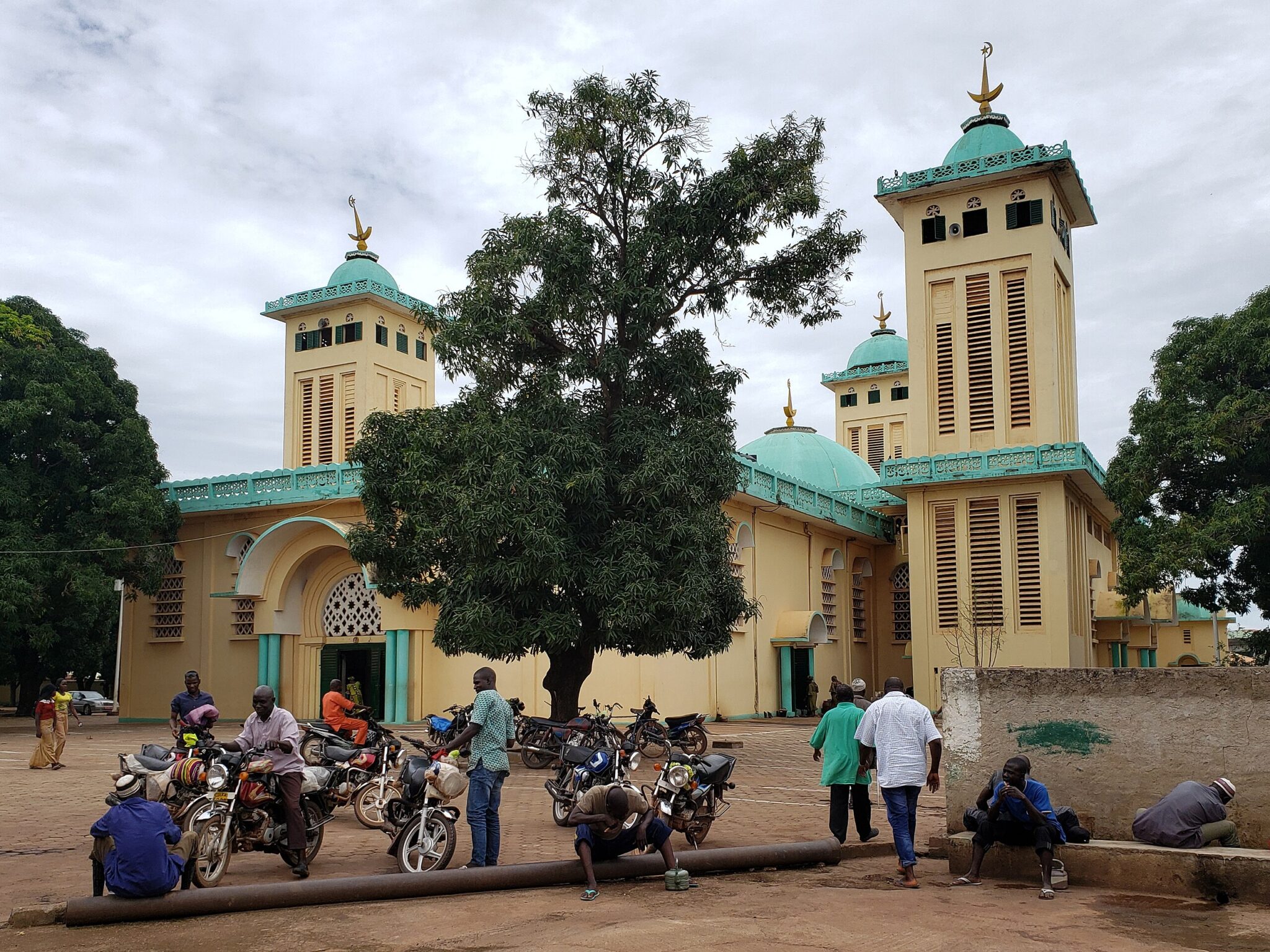
Conakry is Guinea’s coastal capital, located on a narrow peninsula that stretches into the Atlantic Ocean. The city functions as the country’s main political, economic, and transport hub, with its port handling most international trade. Visitors can start with the National Museum of Guinea, which provides a practical overview of Guinea’s major ethnic groups through exhibits of traditional masks, tools, textiles, and musical instruments. The Grand Mosque of Conakry is a major religious landmark and one of the largest mosques in West Africa, reflecting the country’s predominantly Muslim population.
Daily life in Conakry is closely tied to trade and informal commerce, best observed at Marché Madina, a vast open-air market where food, clothing, household goods, and local products are sold. The market also serves as an important supply center for much of the city. For short trips outside the urban area, ferries depart from Conakry’s port to the Îles de Los, a small island group known for quiet beaches and fishing villages. Transport within the city relies mainly on taxis and minibuses, while Conakry International Airport connects the capital with regional and international destinations.
Kindia
Kindia is a regional city in western Guinea, located about 135 kilometers northeast of Conakry and set among low mountains and fertile valleys. It is an important agricultural center, supplying fruit and vegetables to the capital, and is especially known for bananas, pineapples, and citrus grown in the surrounding area. Local markets provide a practical view of everyday trade and regional produce, while nearby waterfalls and forested hills make the city a convenient base for short excursions into nature.
Kindia also serves as the main access point to Mount Gangan, a prominent peak regarded as sacred in local traditions. While the mountain itself is not developed for mass tourism, guided visits can be arranged through local contacts for those interested in cultural context and hiking. Transport to Kindia is straightforward by road from Conakry, using shared taxis or minibuses, and the city is often used as a stopover for travelers continuing deeper into Guinea’s interior.
Kankan
Kankan is one of the country’s most important cultural and economic centers. Located along the Milo River near the border with Mali, it has long been a focal point of Malinké history, trade, and learning. The city is known for its role in preserving Malinké language, oral traditions, and music, which remain central to daily life. Kankan is also a respected center of Islamic education, with many Quranic schools and mosques that reflect its long-standing religious influence.
As a transport hub for eastern Guinea, Kankan serves as a practical base for travel into surrounding rural areas, where village life and traditional customs are still widely practiced. Visitors can observe local music and dance performances during community events and religious celebrations, which often follow seasonal and agricultural cycles. Kankan can be reached by long-distance road travel from Conakry or by regional routes connecting it to other parts of Upper Guinea.
Labé
Labé is the main urban center of the Fouta Djallon, a mountainous plateau in central Guinea known for its cooler temperatures and fertile landscapes. The city plays an important role in Fulani culture and education, with a strong presence of Islamic learning and traditional social structures. Compared to Guinea’s lowland regions, Labé has a more moderate climate, which makes it a comfortable stop for travelers moving through the interior of the country.
Labé is widely used as a base for exploring the surrounding highlands, where waterfalls, river gorges, and small villages are spread across the plateau. Many nearby sites are reached by road or short hikes, often with the help of local guides who provide access to villages and explain local customs. Transport to Labé is mainly by road from Conakry or other regional centers.
N’Zérékoré
N’Zérékoré is the main city of Forest Guinea, located in the southeastern part of the country near the borders with Liberia and Côte d’Ivoire. The city serves as an administrative, commercial, and transport center for the forested regions, bringing together multiple ethnic groups with distinct languages, traditions, and social structures. Cultural life in the area is closely linked to forest environments, with traditional mask ceremonies and rituals that remain part of community events and seasonal celebrations.
N’Zérékoré is also the primary gateway to some of Guinea’s most ecologically significant areas, including tropical rainforests and protected landscapes. From the city, travelers can reach forest villages and nearby nature reserves with the help of local transport and guides, as infrastructure outside the city is limited. Road connections link N’Zérékoré with other parts of Guinea, though travel times can be long, especially during the rainy season.
Best Natural Wonders in Guinea
Fouta Djallon Highlands
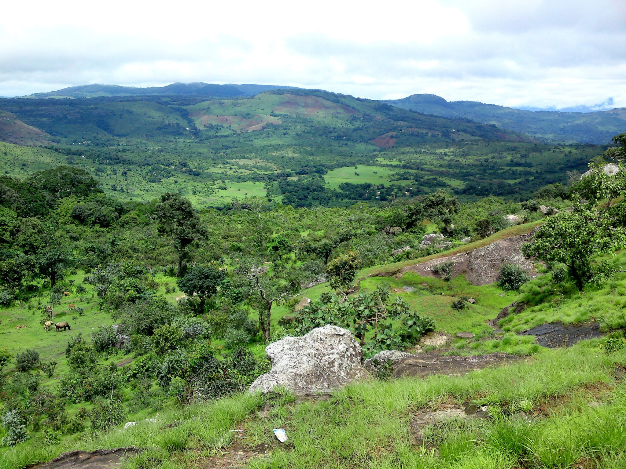
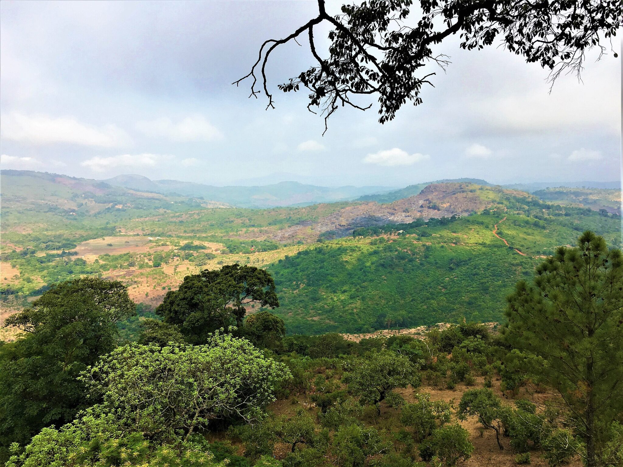
The Fouta Djallon Highlands form a large mountainous plateau in central Guinea and are considered the country’s most important natural region. Characterized by elevated grasslands, deep river valleys, cliffs, and a dense network of streams and waterfalls, the area plays a critical hydrological role in West Africa. Several major rivers originate here, including the Niger, Senegal, and Gambia, making the region essential for ecosystems and agriculture far beyond Guinea’s borders. The high elevation results in cooler temperatures than the surrounding lowlands, which shapes both settlement patterns and farming practices.
The region is predominantly inhabited by Fulani communities, whose pastoral traditions, village layouts, and land use remain closely tied to the landscape. Travel in the Fouta Djallon is focused on trekking and overland exploration, often involving walking between villages, crossing rivers, and navigating unpaved roads. Multi-day hikes are common, typically arranged with local guides who assist with routes, accommodation, and community access. The main entry points are towns such as Labé or Dalaba, reached by road from Conakry, after which travel continues on foot or by local vehicles into more remote areas of the highlands.
Mount Nimba Strict Nature Reserve
The Mount Nimba Strict Nature Reserve is a transboundary protected area shared by Guinea, Côte d’Ivoire, and Liberia, and is recognized as a UNESCO World Heritage Site for its exceptional ecological value. The reserve covers a mountainous zone with steep slopes, montane forests, rocky ridges, and high-altitude grasslands. It supports a high number of endemic species, including rare plants, amphibians, and insects found nowhere else, as well as populations of chimpanzees and other forest wildlife adapted to this unique environment.
Access to Mount Nimba is tightly regulated due to its protected status, and independent travel is generally not permitted. Visits usually require authorization and are conducted with local guides or research-linked organizations. Trails are physically demanding and conditions can change quickly due to altitude and weather, making the reserve suitable only for well-prepared travelers with an interest in ecology and conservation. The main access routes are from southeastern Guinea, typically via N’Zérékoré, followed by overland travel to designated entry points near the reserve boundary.
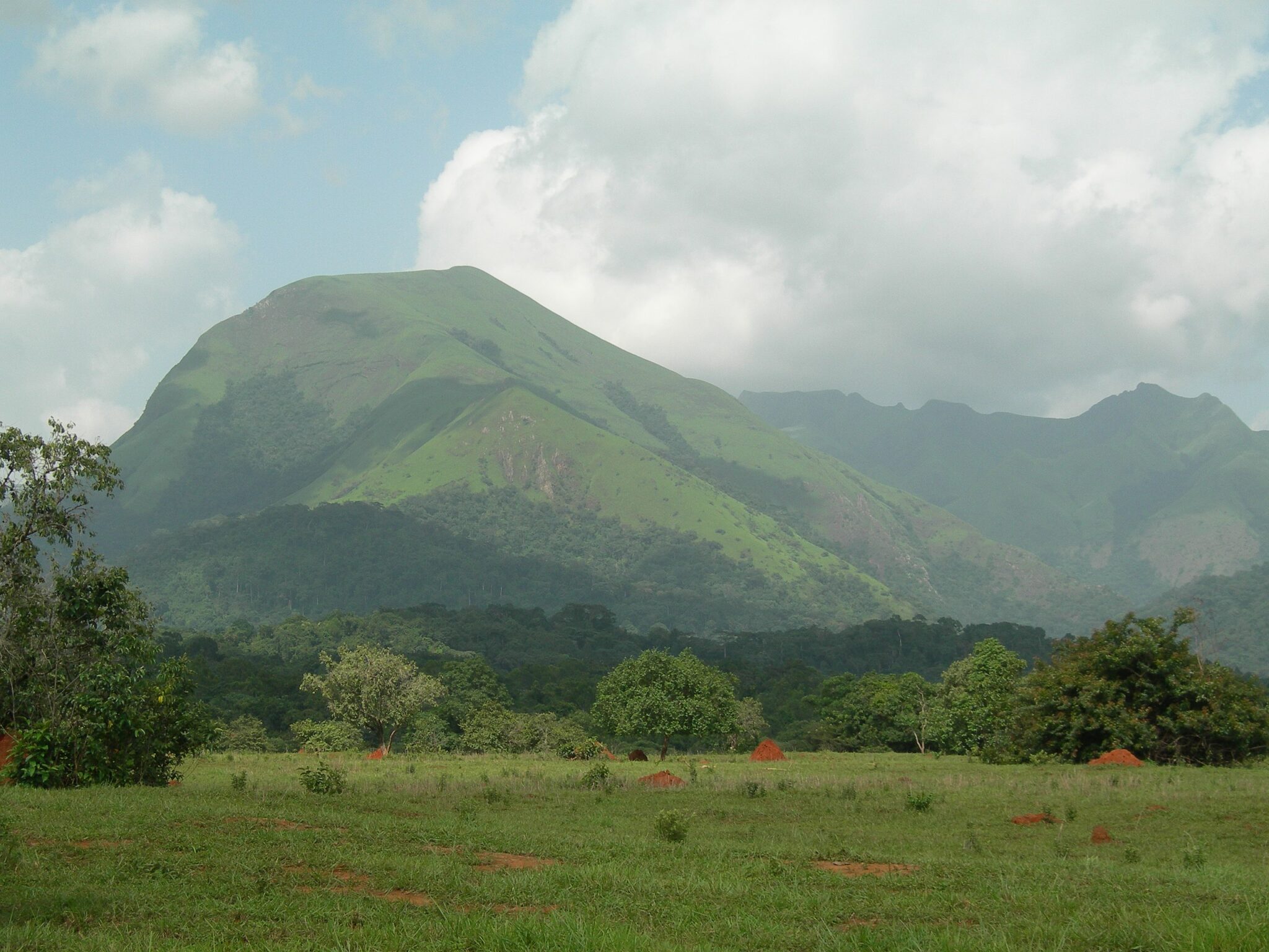
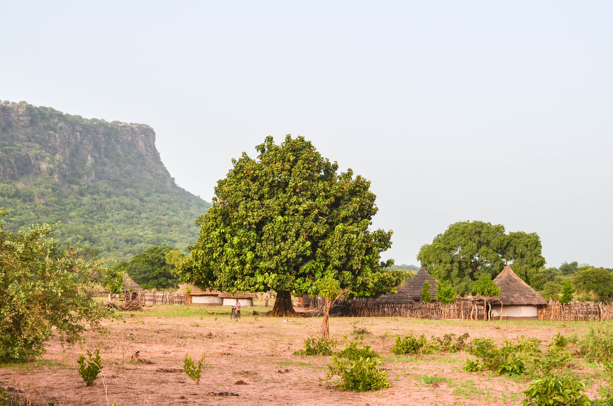
Mount Gangan
Mount Gangan is a prominent mountain located near the city of Kindia in western Guinea and holds cultural significance in local belief systems. The mountain is associated with spiritual practices and traditional narratives, and access is usually arranged with the involvement of local guides or community representatives. Its slopes are covered with forest and rocky sections, reflecting the transition between Guinea’s coastal lowlands and inland highlands.
The climb to the summit is considered manageable for travelers with basic hiking experience and does not require technical equipment. From the top, visitors can observe wide views of surrounding hills, farmland, and forested areas.
Best Waterfalls and Scenic Areas
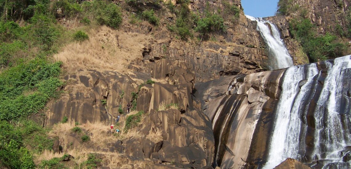
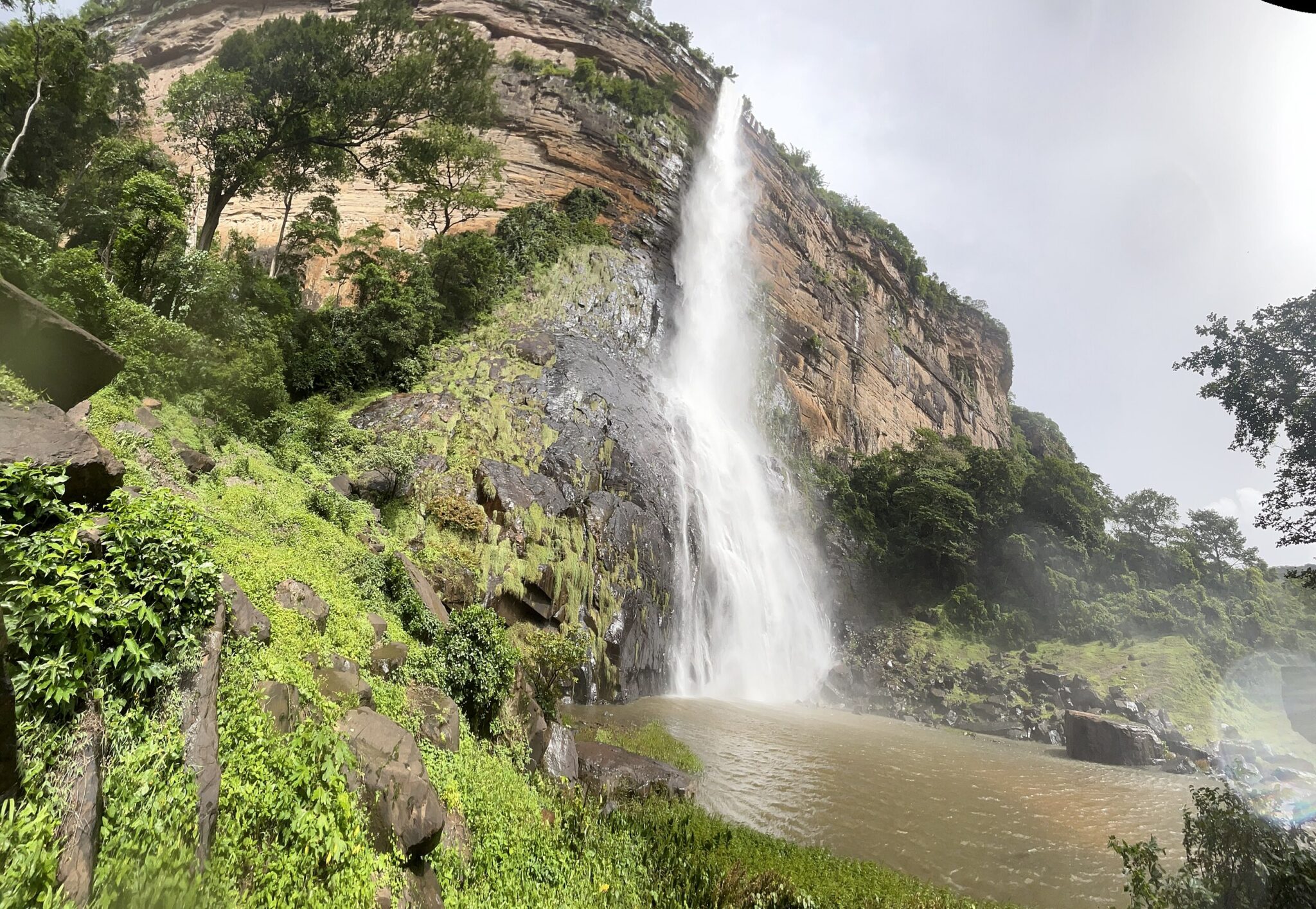
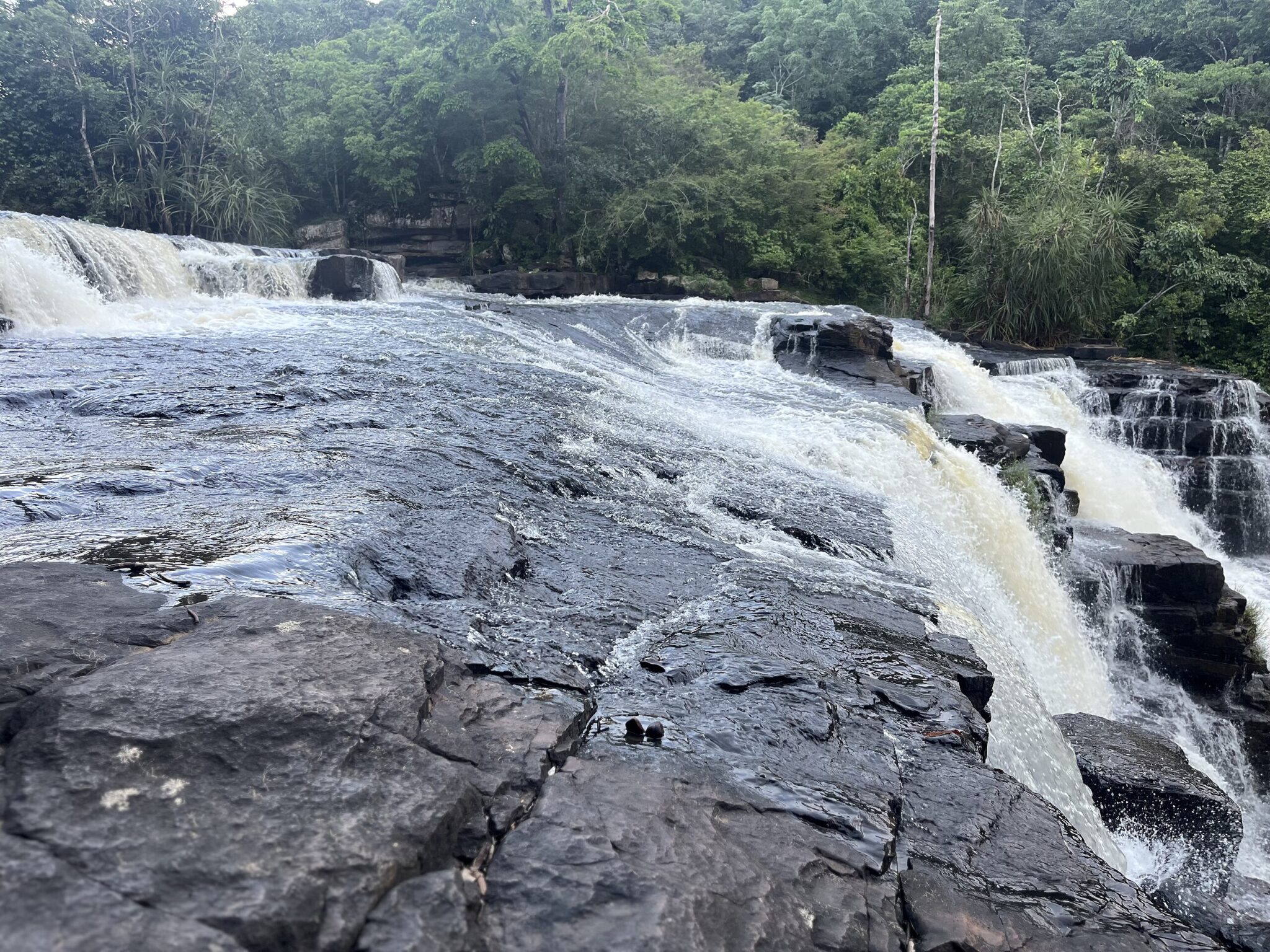
Ditinn Waterfall
Ditinn Waterfall is located near the town of Dalaba in the Fouta Djallon highlands and is considered one of the tallest waterfalls in Guinea. The water drops from high cliffs into a deep basin surrounded by forested slopes, creating a distinctive landscape shaped by erosion and seasonal water flow. During the rainy season, the volume of water increases significantly, making the falls especially striking, while in the dry season the surrounding terrain and rock formations become more visible.
Access to Ditinn Waterfall usually involves traveling by road to Dalaba, followed by a guided walk to the viewpoint and base of the falls. The paths can be uneven and slippery, particularly after rainfall, so local guides are recommended for navigation and safety. Visits are typically combined with other nearby sites in the Fouta Djallon.
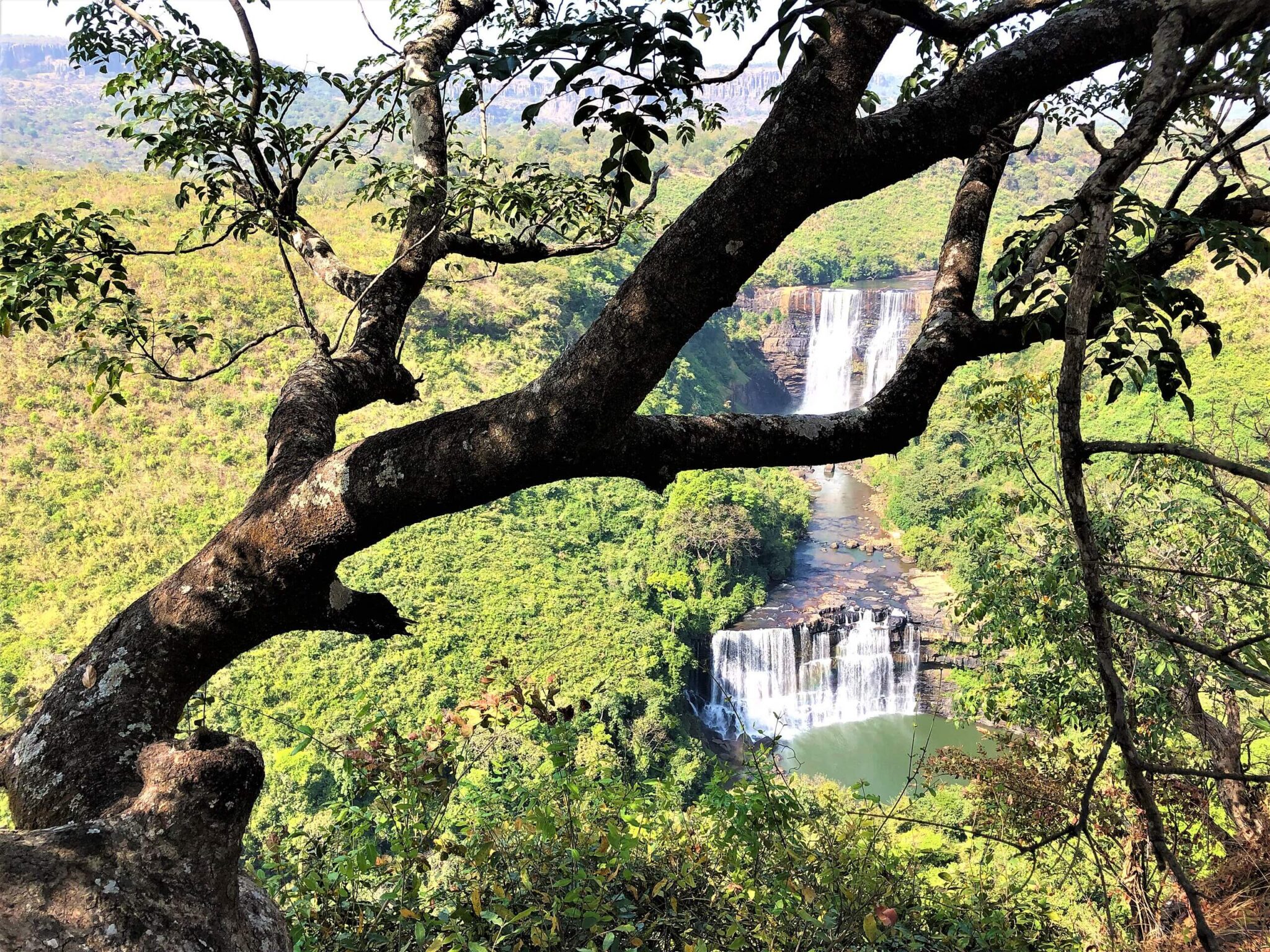
Kambadaga Falls
Kambadaga Falls are located a short distance from the city of Labé in the Fouta Djallon highlands and consist of several cascades flowing over broad rocky terraces. The waterfall system is fed by seasonal rivers, and its appearance changes significantly throughout the year. During the rainy season, water volumes increase dramatically, creating powerful flows that spread across multiple channels, while in the dry season the rock formations and stepped structure of the falls become more visible.
The site is easily reached from Labé by road, followed by a short walk to the viewing areas, making it one of the most accessible natural attractions in the region. Local visitors often come during periods of high water, and the area is suitable for short stops rather than extended hikes. Basic facilities are limited, so visits are usually organized independently or with local guides as part of broader exploration of the Fouta Djallon.
Saala Falls
Saala Falls is a small and relatively secluded waterfall located within the forested landscapes of the Fouta Djallon region. Unlike larger and more visited waterfalls, it is surrounded by dense vegetation and quiet rural scenery, making it a suitable stop for travelers interested in less frequented natural sites. The waterfall flows into a shallow basin and is most active during the rainy season, while remaining accessible year-round. Access to Saala Falls typically involves traveling to nearby villages by road, followed by a short hike along footpaths used by local residents. These paths are generally easy to follow but can be muddy after rain, so local guidance is helpful.
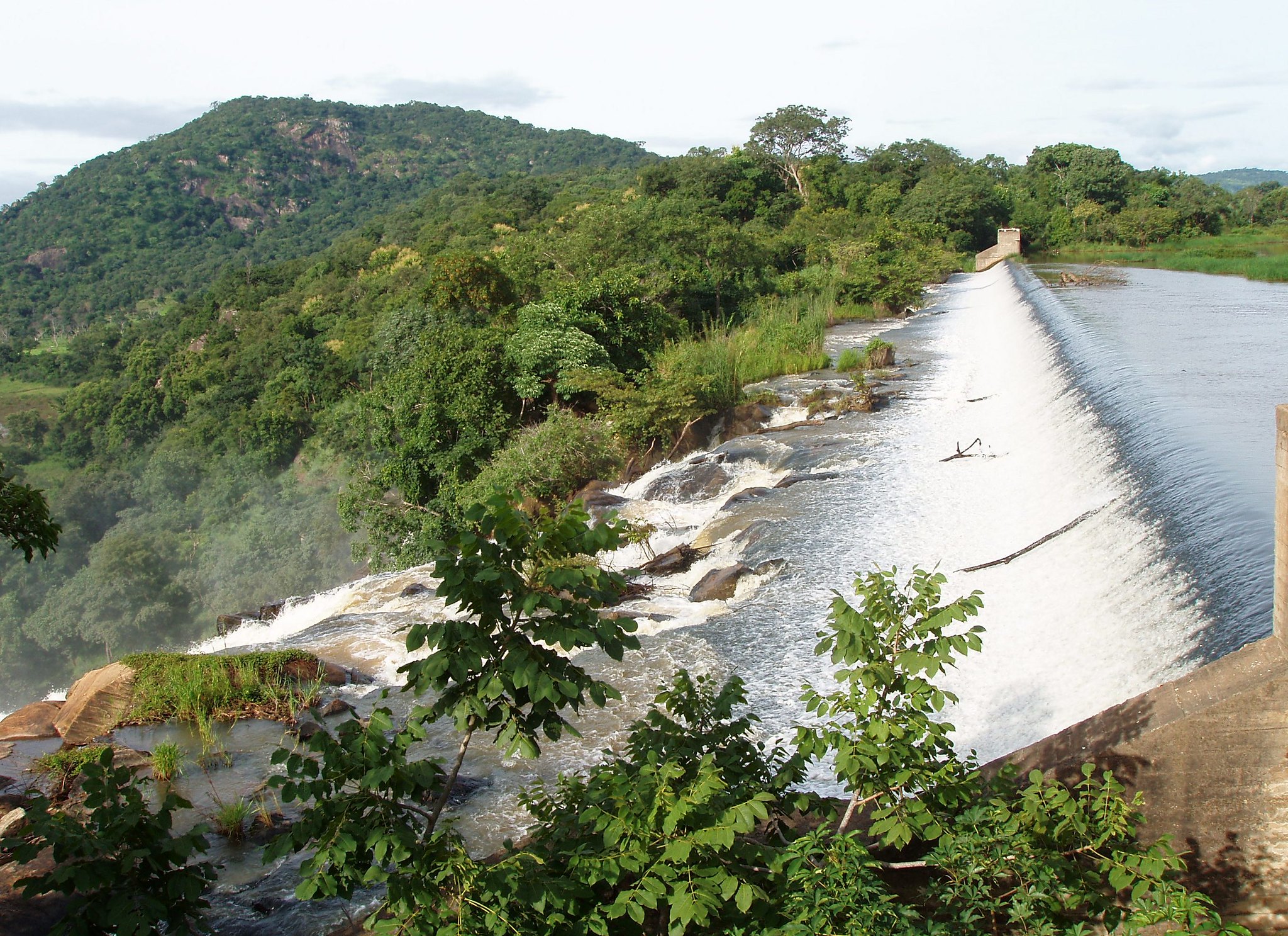
Tinkisso River Valley
The Tinkisso River Valley is located near the town of Dabola in central Guinea and follows the course of the Tinkisso River, a tributary of the Niger River. The river passes through open valleys, savanna landscapes, and cultivated land, shaping local settlement patterns and seasonal farming. Communities along the river rely on it for irrigation, fishing, and domestic use, and its banks are often lined with small fields and grazing areas.
Travel through the Tinkisso River Valley is mainly overland, using regional roads that connect Dabola with surrounding towns and villages. While there are no developed tourist facilities, the area offers opportunities for informal walks along the river and observation of rural life. The valley is typically explored as part of broader travel through Upper Guinea.
Best Coastal and Island Destinations
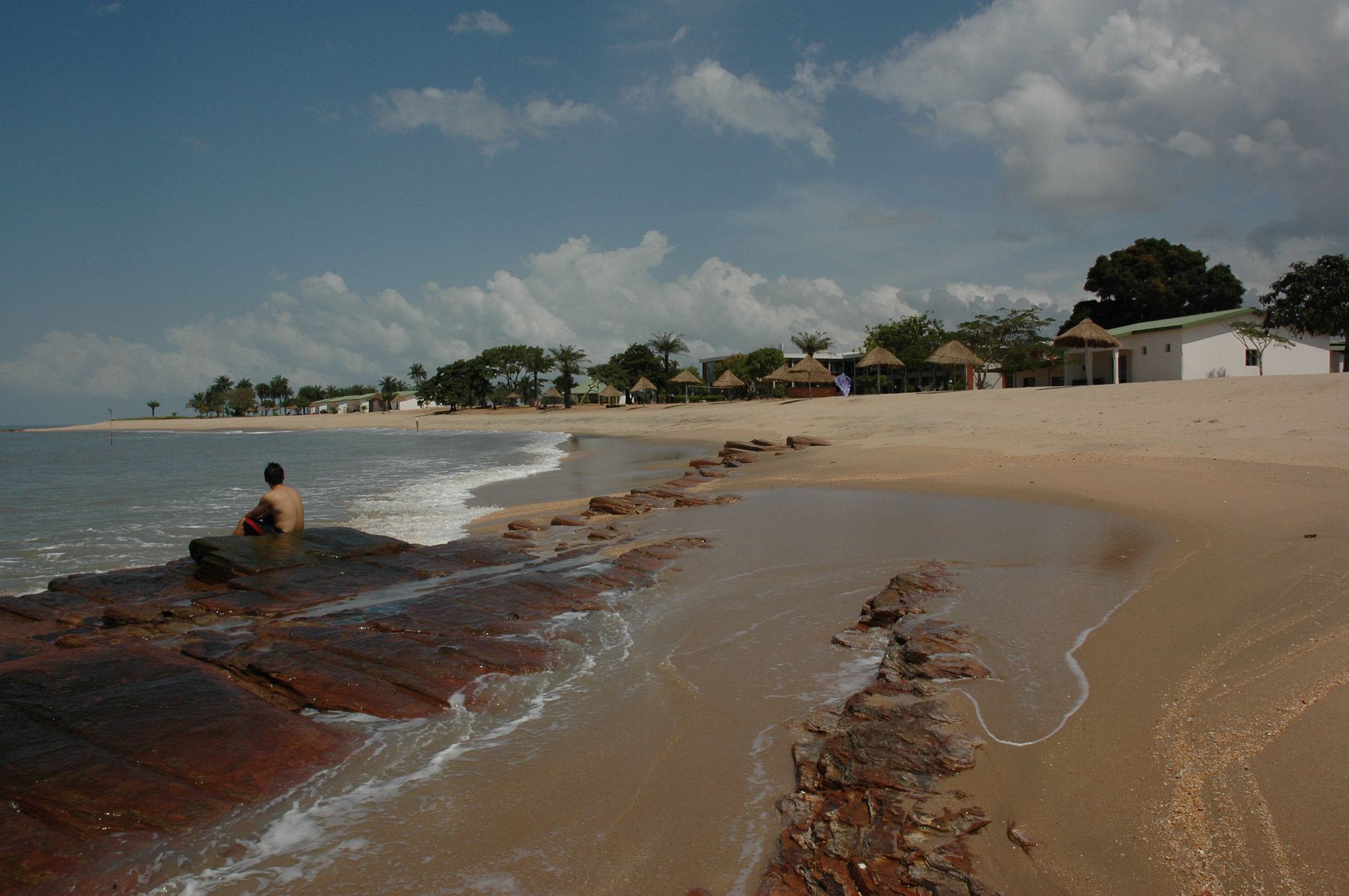
Îles de Los (Los Islands)
The Îles de Los are a small group of islands located just off the coast of Conakry and are among the easiest natural destinations to reach from the capital. The main inhabited islands include Kassa, Room, and Tamara, each offering beaches, fishing villages, and remnants of colonial-era buildings. The islands have a slower pace of life than the mainland, with local communities largely dependent on fishing and small-scale trade.
Access to the Los Islands is by boat or ferry from Conakry’s port, with travel times typically under one hour depending on the island and sea conditions. Most visitors come for swimming, snorkeling, and short beach stays, as the surrounding waters are relatively clear and calm during much of the year. Accommodation options are limited and simple, making the islands best suited for day trips or short overnight stays rather than extended travel.
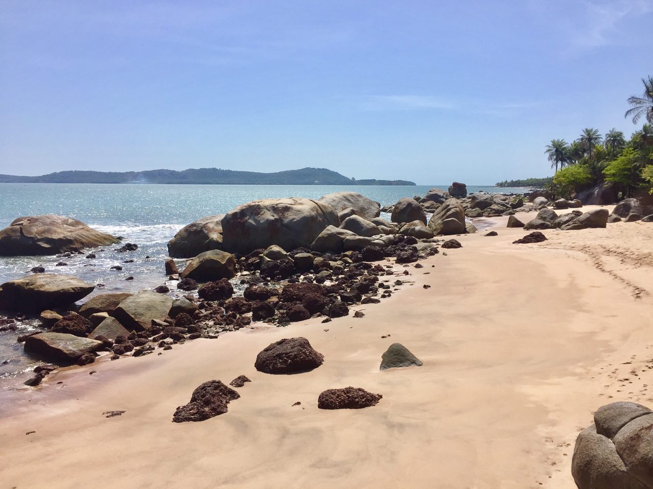
Bel Air & Benty Coast
Bel Air and the Benty Coast are located south of Conakry along Guinea’s Atlantic shoreline and remain largely outside established tourism routes. The coastline in this area is defined by long sandy beaches, mangrove-lined channels, and estuaries that support fishing and small-scale agriculture. Settlements are primarily fishing communities where daily life follows tidal cycles, boat landings, and local markets, offering insight into coastal livelihoods that have changed little over time. Access to these areas is mainly by road from Conakry, followed by local tracks that can be difficult during the rainy season. Infrastructure is limited, with few formal accommodations, so visits are usually short or arranged through local contacts.
Hidden Gems in Guinea
Dalaba
Dalaba is a highland town in the Fouta Djallon region and sits at a higher elevation than much of central Guinea, giving it cooler temperatures throughout the year. During the colonial period, it was developed as a hill station, and some older buildings and town layouts still reflect this history. The town functions today as a regional center, providing basic services and accommodation for travelers moving through the highlands.
Dalaba is commonly used as a base for visiting nearby waterfalls, including sites such as Ditinn, as well as surrounding villages and viewpoints across the plateau. Access is by road from Conakry or Labé, and while travel times can be long, the route passes through varied highland landscapes.
Dinguiraye
Dinguiraye is a town in northern Guinea known for its role in Islamic learning and its historical association with influential religious leaders who shaped spiritual and social life in the region. The town has long served as a center for Quranic education, and mosques and religious schools remain central to community life. Its cultural importance extends beyond the town itself, influencing surrounding areas of Upper Guinea.
The landscape around Dinguiraye is characterized by rolling hills, savanna vegetation, and scattered rural settlements. Agriculture and livestock herding are the main livelihoods, and daily life follows seasonal patterns linked to rainfall and farming cycles. Dinguiraye is reached by road from larger regional centers such as Kankan.
Beyla
Beyla is a town in southeastern Guinea, located near the Mount Nimba region and close to the borders with Côte d’Ivoire and Liberia. It functions as a local administrative and transport center for surrounding rural areas, with an economy based largely on agriculture and small-scale trade. The town itself is modest in size but plays an important logistical role for travel deeper into the forested landscapes of the region. Beyla is commonly used as an access point for nearby forests and conservation zones, including areas connected to Mount Nimba’s broader ecosystem. Travel beyond the town typically requires four-wheel-drive vehicles and local guides, as road conditions can be challenging, especially during the rainy season.
Boké Region
The Boké Region is located in northwestern Guinea and is best known for its extensive bauxite reserves, which play a major role in the national economy. Beyond mining areas, the region includes river systems, low plateaus, and rural landscapes shaped by agriculture and fishing. Settlements range from small towns to traditional villages where daily life is closely tied to local resources and seasonal cycles.
Travel in the Boké Region is primarily overland, with road connections from Conakry and neighboring regions, though conditions vary outside main routes. While tourism infrastructure is limited, visitors can explore riverbanks, local markets, and cultural sites that reflect long-established traditions.
Travel Tips for Guinea
Travel Insurance & Safety
Comprehensive travel insurance is essential for visiting Guinea. Your policy should include medical and evacuation coverage, as healthcare facilities are limited outside Conakry. Travelers planning rural or extended overland trips will find evacuation coverage particularly important, as distances between major towns can be long and infrastructure underdeveloped.
Guinea is generally safe and welcoming, though infrastructure remains basic in many regions. Visitors should take standard precautions and stay informed about local conditions before traveling between provinces. A yellow fever vaccination is required for entry, and malaria prophylaxis is strongly recommended. Tap water is not safe to drink, so always rely on bottled or filtered water. Mosquito repellent, sunscreen, and a small medical kit are recommended for travel in both urban and rural areas.
Transportation & Driving
Travel around Guinea can be challenging but rewarding for those prepared for adventure. Shared taxis and minibuses form the backbone of public transport, connecting cities and towns across the country. Roads can be rough, especially in the interior and mountainous regions, and domestic flights are limited. For greater flexibility, renting a vehicle with a driver is advisable for long-distance or remote journeys.
Driving in Guinea is on the right-hand side of the road. Many rural and mountain routes require a 4×4 vehicle, particularly during the rainy season when roads can become muddy or impassable. Travelers should expect frequent police checkpoints, where patience and politeness go a long way. Always carry your passport, license, and vehicle documents. An International Driving Permit is required alongside your national driver’s license for anyone wishing to drive in the country.
Published January 04, 2026 • 15m to read