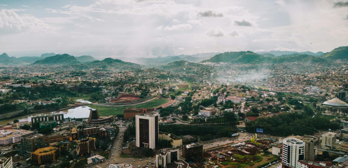
Cameroon is often called “Africa in Miniature” because of the range of landscapes found within its borders. Along the coast are Atlantic beaches and dense rainforest, while inland the land rises into cooler highlands before opening into wide savannahs and Sahel-like regions in the north. Few countries in Africa offer such geographic variety in a single journey. Cultural diversity is just as striking, with many ethnic groups, languages, and regional cuisines that shift noticeably as you travel from south to north.
Cameroon rewards travelers who enjoy contrast and are comfortable with practical, on-the-ground travel. Distances can be longer than they appear, road conditions change with the seasons, and careful route planning is important. With a flexible itinerary and attention to local conditions, travelers can experience rainforests, mountains, wildlife areas, and everyday life across very different regions. For those seeking variety rather than polished tourism, Cameroon offers a broad and deeply local view of Central Africa.
Best Cities in Cameroon
Yaounde
Yaoundé is Cameroon’s political capital, built across a series of hills, and it usually feels less hectic than Douala. It is a practical place to get oriented because key institutions are concentrated here, including the National Museum, which gives basic context on the country’s history, major cultural groups, and how the modern state developed. For a straightforward city panorama, Mount Fébé is one of the easiest viewpoints, and morning is often the best time for clearer visibility before heat and haze build. Within the city, taxis and ride-hailing are the most common ways to move around, while traffic can still be slow at peak hours, so it helps to plan visits by nearby areas.
Most travelers arrive via Yaoundé Nsimalen International Airport and use the city as a logistics stop before heading to other regions. It is a good place to sort essentials such as a local SIM, cash, and any practical arrangements that become harder in smaller towns, including reliable drivers for longer road trips. If you need permits or confirmations for onward travel, handle them here, and keep some flexibility in timing because intercity transport and road conditions can change with weather, checkpoints, and local demand.
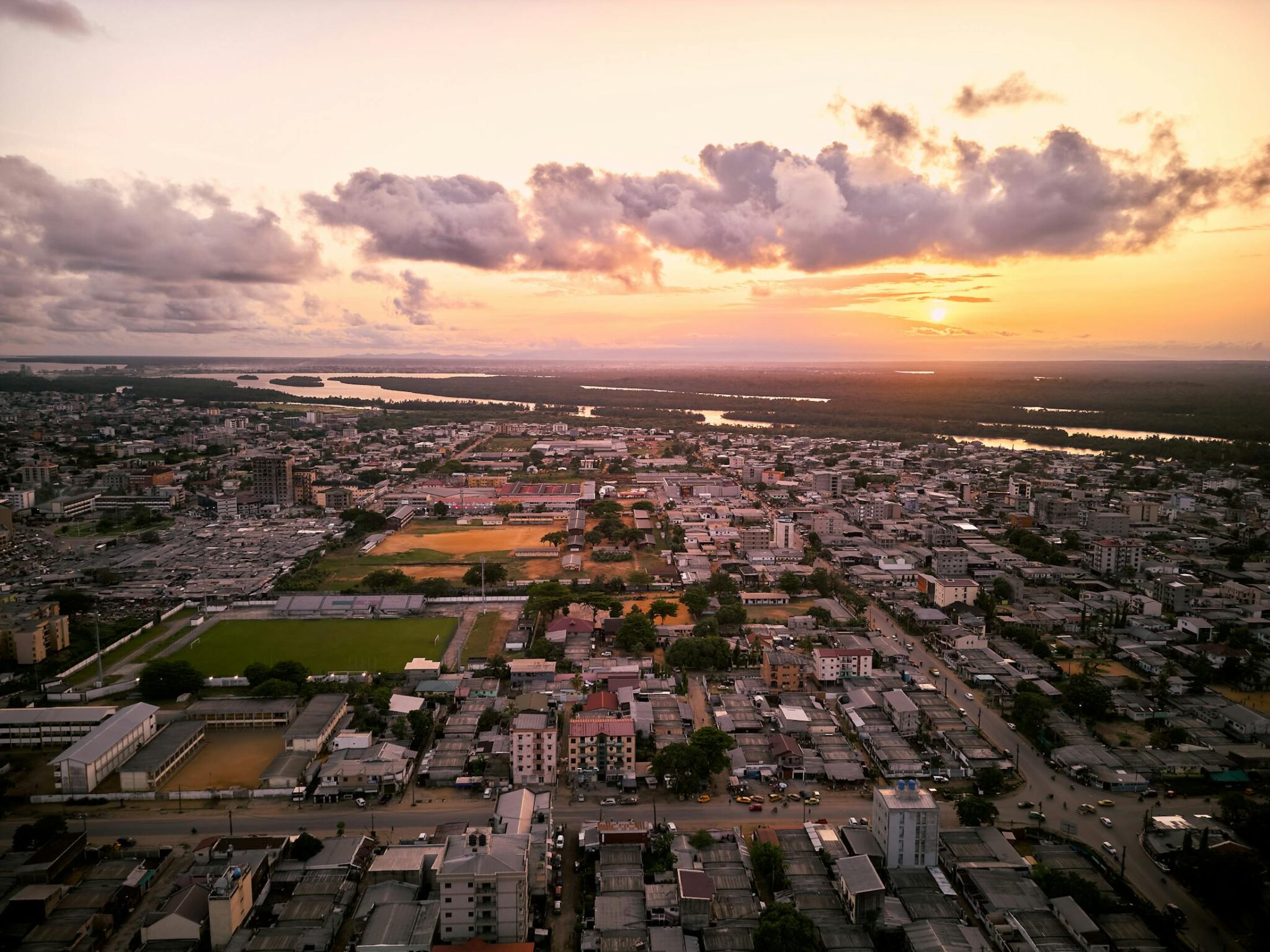
Douala
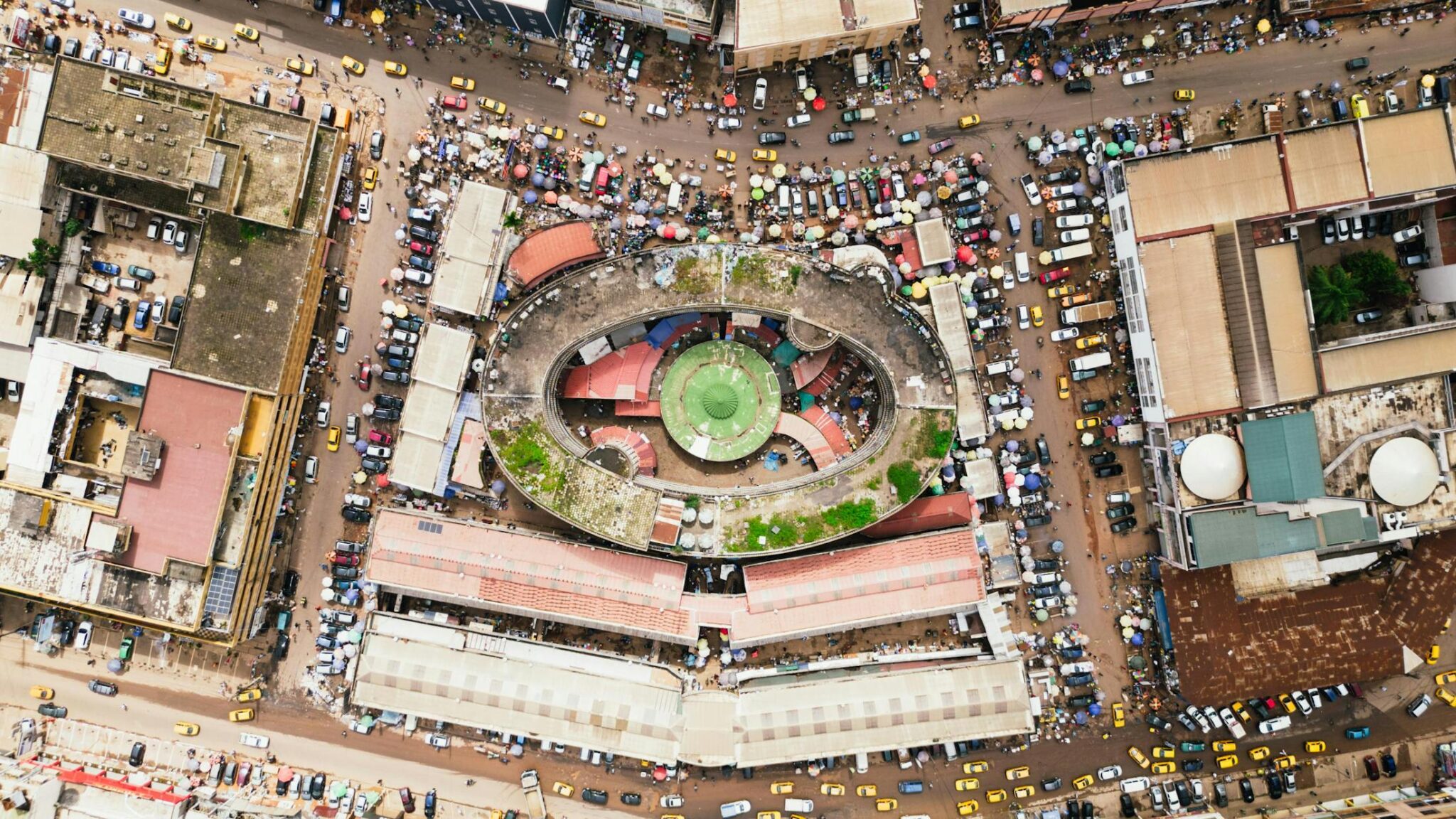
Douala is Cameroon’s economic hub and main port, set along the Wouri River, and the city’s pace is driven by trade, transport, and constant movement between markets, warehouses, and busy neighborhoods. For visitors, the most informative stops are the market areas and food streets where you can see how the commercial city works day to day, and evenings can be useful for sampling restaurants and live music that reflect Douala’s mix of coastal and inland influences. It is also the main arrival point for many travelers via Douala International Airport, which makes it a common base for organizing coastal trips even if you do not plan to stay long.
Traffic planning is the main practical issue. Short distances can take much longer than expected, so group activities by neighborhood and keep buffers for airport transfers and appointments. If you are doing day trips toward the coast, leave early, confirm road conditions the same day, and aim to return before evening congestion builds on the main routes back into the city.
Bafoussam
Bafoussam is the main city of Cameroon’s western highlands and a useful base for exploring the Grassfields, where traditional chiefdoms and royal institutions remain influential. The city itself is largely functional, with busy markets and transport hubs, but it’s a good place to organize short trips to nearby towns and villages where you can visit chiefdom compounds, learn about local governance and ceremony, and see crafts linked to Grassfields identity. Experiences are usually strongest when arranged with a guide who can handle introductions and explain etiquette, since many cultural sites are living institutions rather than tourist attractions. Getting to Bafoussam is typically by road from Douala or Yaoundé, and travel times depend on traffic and mountain road conditions. Within the region, taxis and hired cars are the most practical way to move between villages and cultural sites, especially if you want to fit multiple stops into a day.
Garoua
Garoua is the main city in northern Cameroon, set on the Benoué River, and it is one of the most practical bases for travel into the northern savannah zone. The city’s daily life is closely tied to river transport, fishing, and regional trade, and spending time near the riverfront and central markets gives a clear sense of how goods and people move through this part of the country. The landscape around Garoua is drier and more open than the south, so the city often feels like a transition point between the greener highlands and the Sahel-facing north. Most travelers use Garoua as a staging point for northern wildlife areas, arranging onward transport and guides for park visits from the city. Garoua is reachable by domestic flights from the south or by long overland routes, and local taxis are the easiest way to move around once you arrive.
Maroua
Maroua is the main city in Cameroon’s Far North, where the landscape and daily rhythm shift toward a Sahelian environment with drier air, more open horizons, and a stronger Islamic cultural presence than in the south. The most useful way to experience the city is through its markets and central streets, where regional trade, textiles, food staples, and everyday crafts show how Maroua connects to border regions and rural settlements. It is also a practical base for excursions toward the Mandara Mountains, where short hikes and village visits can be arranged to see mountain landscapes and local settlement patterns.
Travelers usually reach Maroua overland from Garoua or by domestic flight to the nearby airport, then move around the city by taxi or motorbike taxi. For day trips into the Mandara zone, it helps to hire a driver and, if possible, a local guide who can handle routes and introductions in villages. Dress conservatively and keep your approach low key in public spaces, ask before photographing people, and plan outings early because heat builds quickly and distances can take longer than expected on northern roads.
Best Beaches Destinations
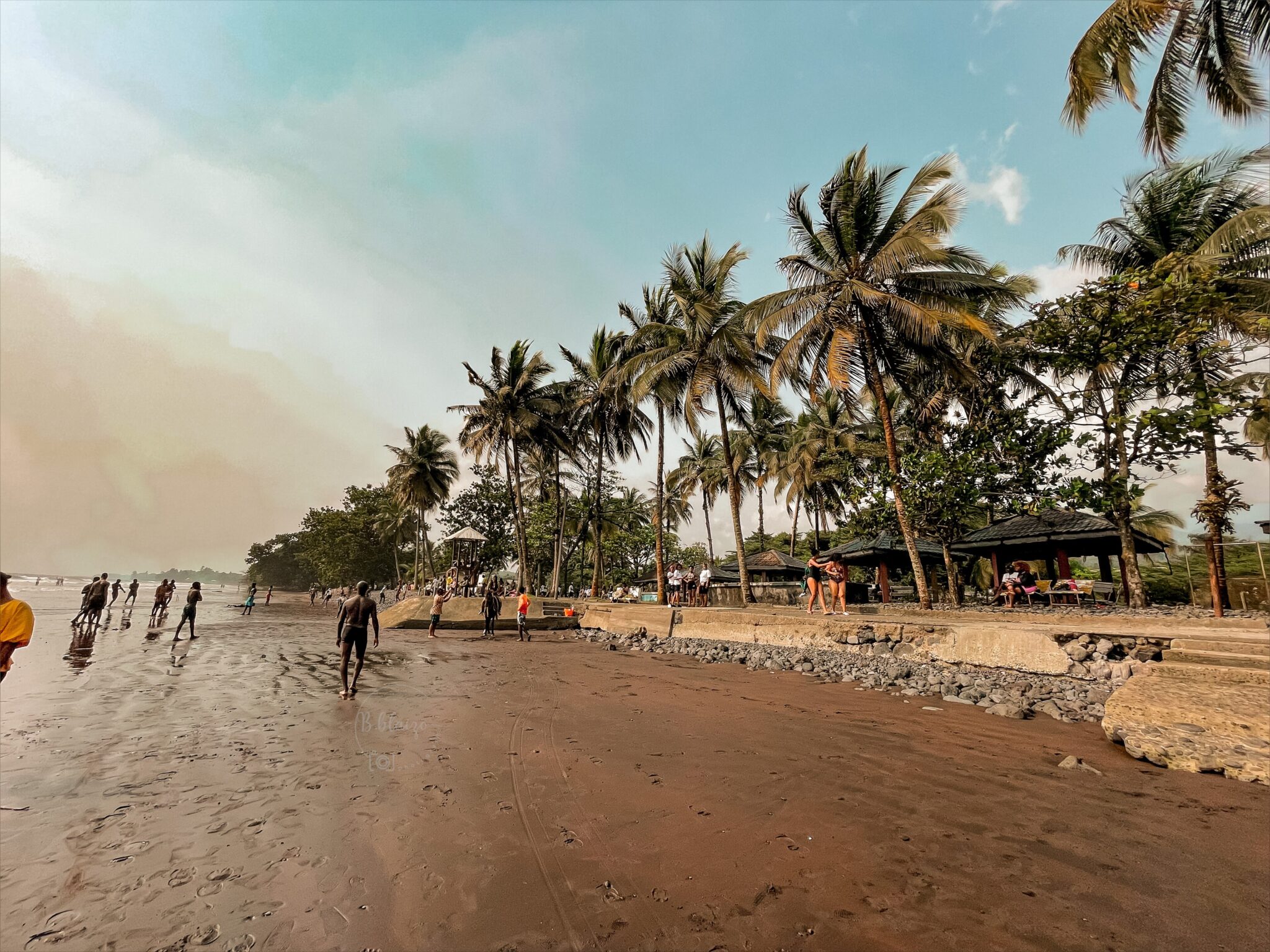
Limbe
Limbe is a coastal city in southwest Cameroon at the base of Mount Cameroon, and it is known for black volcanic sand beaches and a shoreline shaped by lava rock and strong Atlantic surf. The beach experience here is usually about walking, watching fishing activity, and spending time at simple waterfront spots rather than resort-style swimming, since waves and currents can be strong. For a quick cultural and nature stop in town, the Limbe Botanic Garden and the Limbe Wildlife Centre are two of the most practical visits, and they fit well into a half day if you want something beyond the beach.
Limbe also works well as a base for short nature outings because you can combine the coast with trips toward the mountain zone around Buea, where hikes and longer Mount Cameroon treks are typically organized with local guides. Most travelers reach Limbe by road from Douala, either by bus or hired car, and once you arrive, taxis and motorbike taxis are the easiest way to move between beaches, the center, and nearby trail areas. Sea conditions can change quickly, so if you plan to swim, choose calmer stretches, ask locals about currents, and be extra cautious after heavy rain when water flow and surf can shift.
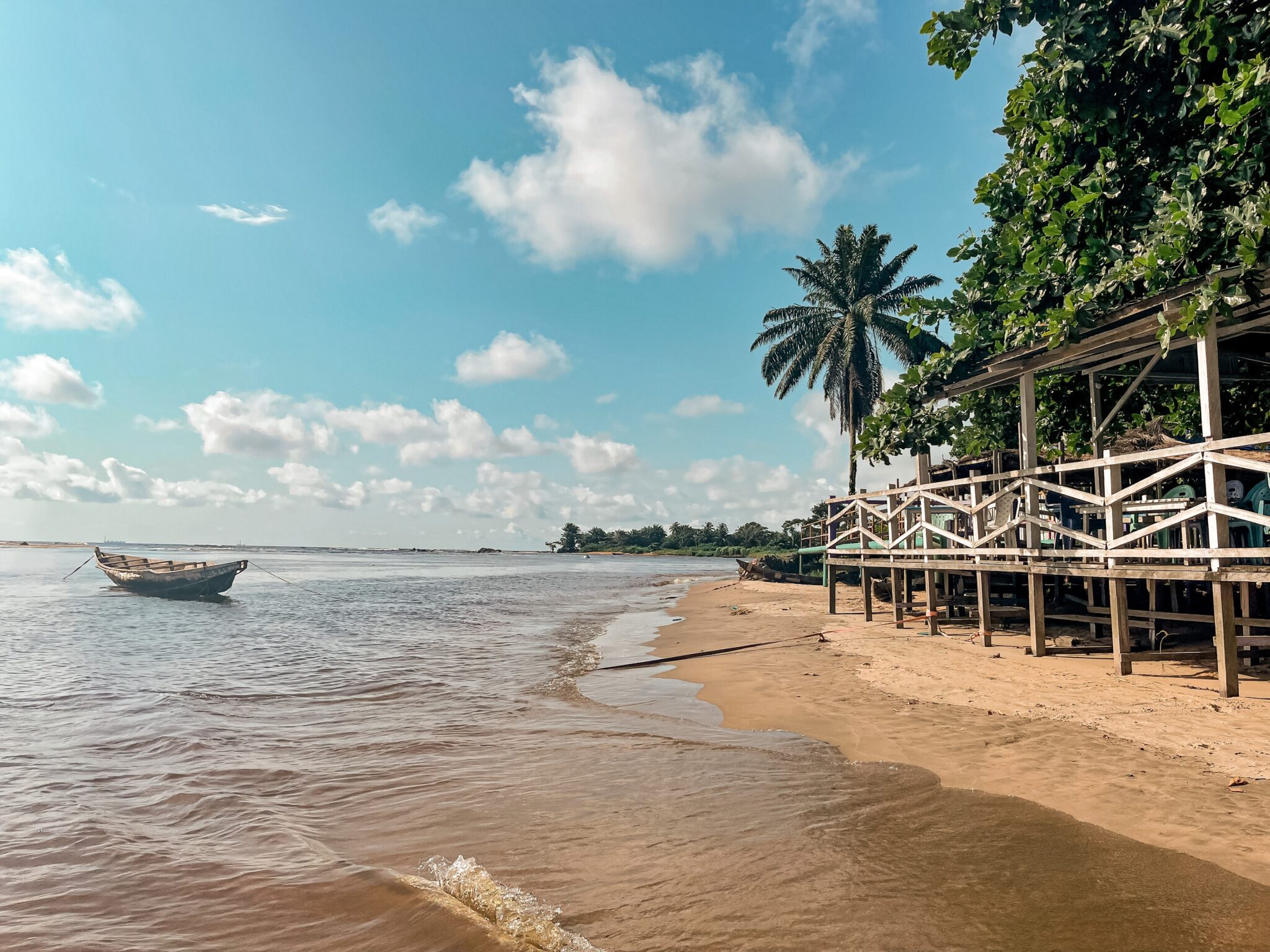
Kribi
Kribi is Cameroon’s best-known beach town on the Atlantic coast, with long stretches of pale sand, palm-lined waterfronts, and a simple holiday setup centered on beach walks and seafood dining. The town is easy to navigate, and most visitors spend time on the main beaches near the center, then explore quieter sections a short drive away where the coastline feels less built up. A key nearby outing is the Lobe Waterfalls, where the river drops toward the ocean and you can visit by short road transfer from Kribi, usually with a local boat ride or guided walk depending on the access point. Most travelers reach Kribi by road from Douala or Yaoundé, using buses, shared taxis, or a hired car if you want flexibility for stops.
Campo Beach
Campo Beach is a quieter stretch of coast in southern Cameroon near the Equatorial Guinea border, where the shoreline is shaped more by fishing life and river-mouth landscapes than by resort development. The visit is usually about slow beach time, walking along less crowded sand, and observing coastal routines such as boat landings and small markets, rather than organized activities. It can also work as a base for exploring nearby natural areas if you have your own transport, since distances between settlements are larger and services are sparse.
Getting to Campo is mainly by road from Kribi or Douala, and travel times can be longer than expected because the last sections may be slower and road conditions vary with weather. Infrastructure is simple, so bring essentials with you, including enough cash, basic medicines, and anything specific you need for several days, and expect that power cuts and weaker mobile coverage can happen.
Douala Bonaberi Coast
The Douala Bonaberi coast refers to the river estuary and waterfront outing areas around Douala and Bonaberi on the Wouri River, where people go for short breaks rather than for open ocean beaches. The main appeal is local food, music, and a view of working river life, with boats, fishing activity, and busy waterfront spaces that feel different from the city’s streets. These spots are usually informal and change over time, so the “best place” is often whatever is active that day, especially on weekends.
Getting there is simple from central Douala by taxi or motorbike taxi, crossing into Bonaberi and continuing to riverfront areas recommended by locals. For a smoother visit, go with a local contact who knows which locations are operating, what hours make sense, and which areas are best avoided after dark. Plan extra time for traffic and bridge approaches, carry cash for small payments.
Best Natural Wonders and National Parks
Mount Cameroon
Mount Cameroon rises above the coastal cities of Buea and Limbe and is the highest peak in West and Central Africa, so hikes give fast changes from lowland vegetation to cooler, more exposed ground at higher altitude. Most visitors start from Buea, where local guide services and park arrangements are easiest to find, and choose either a shorter out and back hike to viewpoints and lava landscapes or a full summit attempt that usually takes one long day for very fit hikers, or two days with an overnight stop depending on the route and conditions. Even without reaching the top, partial hikes can give clear views over the coast and a good sense of the mountain’s scale.
Plan the mountain as a guided activity rather than an independent walk. Weather can shift quickly with rain, mist, and temperature drops, so bring a light rain layer and a warm layer, plus shoes with good grip for loose volcanic rock and muddy sections. Start early to reduce heat and improve visibility, carry enough water and snacks, and expect that guides may recommend changing plans if clouds and rain reduce safety. If you are coming from Douala, you can reach Buea by road, and if you are staying in Limbe, day trips to lower slopes are straightforward, while summit attempts usually work better with a night in Buea to start before dawn.
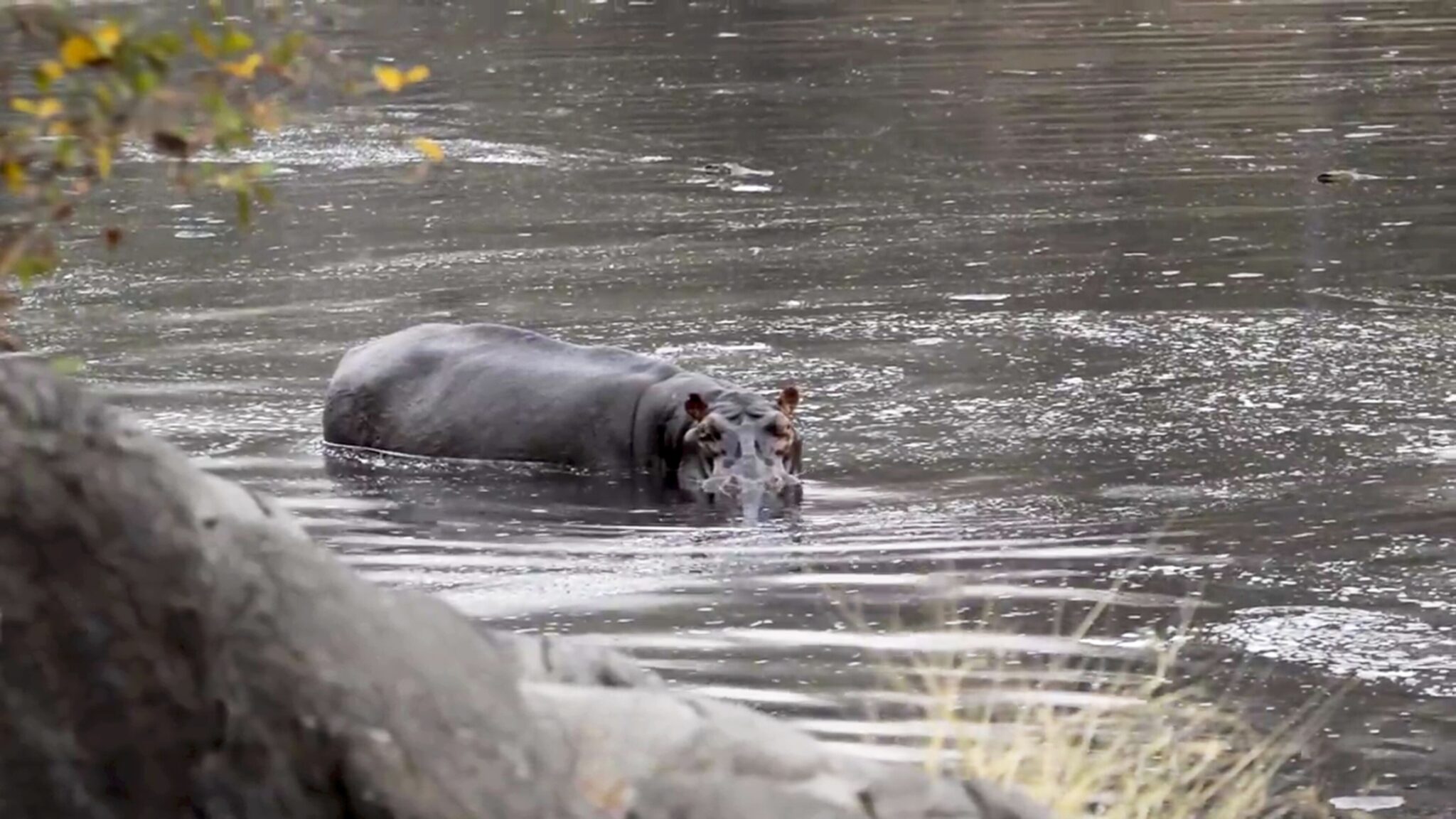
Waza National Park
Waza National Park is in Cameroon’s Far North near the town of Waza and close to the border with Chad, protecting a Sahel savannah landscape of open plains, seasonal wetlands, and sparse woodland. Visits are usually organized as guided game drives on park tracks, with the best chances for sightings around water points and floodplain edges where animals and birds concentrate. What you see depends on season and recent conditions, but the park isNE and the Waza Logone floodplain area are especially relevant for birdlife and for understanding how wildlife uses water in the dry months.
Most travelers reach Waza by road from Maroua, which is the main regional base for transport, supplies, and arranging a vehicle and guide, since independent driving inside the park is not recommended. Plan to start early and do drives in the cooler morning and late afternoon, then rest during midday heat, and expect dust on open vehicles in the dry season, so eye protection and a face covering can make the day more comfortable. Because services are limited, carry water, keep cash for fees and guiding, and confirm current access and track conditions locally before you set out.
Benoue National Park
Benoué National Park is in northern Cameroon south of Garoua and protects a mix of savannah, open woodland, and riverine habitat along the Benoué River. The river adds variety to visits because it creates greener corridors that attract birds and wildlife, so drives often focus on tracks near water and on open plains where visibility is better. The experience is usually quieter than more famous safari circuits, and it works well for travelers who prioritize landscapes and birdwatching alongside the chance of seeing larger mammals when conditions are good.
Most travelers use Garoua as the staging point, then continue by road toward the park with a driver and guide arranged through a lodge, tour operator, or local contacts. Logistics matter because road conditions, permits, and guiding quality can vary, so it helps to confirm current access and the availability of rangers or guides before you commit to dates.
Korup National Park
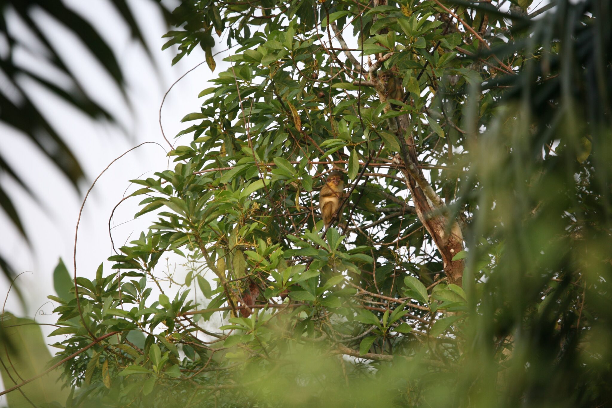
Korup National Park is in southwest Cameroon near the Nigerian border and protects an old-growth rainforest known for very high biodiversity and dense, layered forest structure. Visits are usually organized as guided walks on forest trails and around research and visitor zones, where the main rewards are seeing towering trees, listening for primates, and spotting birds, butterflies, and forest plants rather than expecting frequent large-animal sightings. Some routes include simple suspension bridges and river crossings that give a clearer view of the canopy and the forest floor, and the overall experience is about time spent inside intact rainforest.
Rainforest travel here is slow and weather-dependent, so plan shorter distances per day and expect muddy paths, humidity, and sudden heavy rain. Access is typically overland from regional hubs like Buea or Limbe toward Mundemba, where park arrangements and guides are organized, and onward transport can be delayed by road conditions. Wear quick-drying clothing and shoes with grip, bring insect repellent and enough water.
Dja Faunal Reserve
Dja Faunal Reserve is a large protected rainforest in southern Cameroon, valued for conservation and for protecting a wide range of forest habitats along the Dja River. Visits are usually focused on guided forest walks and time around research or community access zones, where the main experience is rainforest immersion, learning about conservation work, and watching for primates, birds, and forest signs rather than expecting frequent clear wildlife sightings. Dense vegetation limits visibility, so the trip is best approached as an ecosystem experience where tracks, calls, and guides’ knowledge matter as much as what you see directly. Access takes time and planning, typically by road from Yaoundé toward towns on the reserve’s outskirts, then onward on slower routes that can be affected by rain and road conditions.
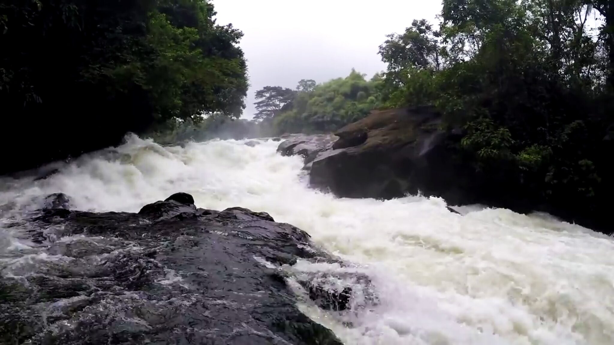
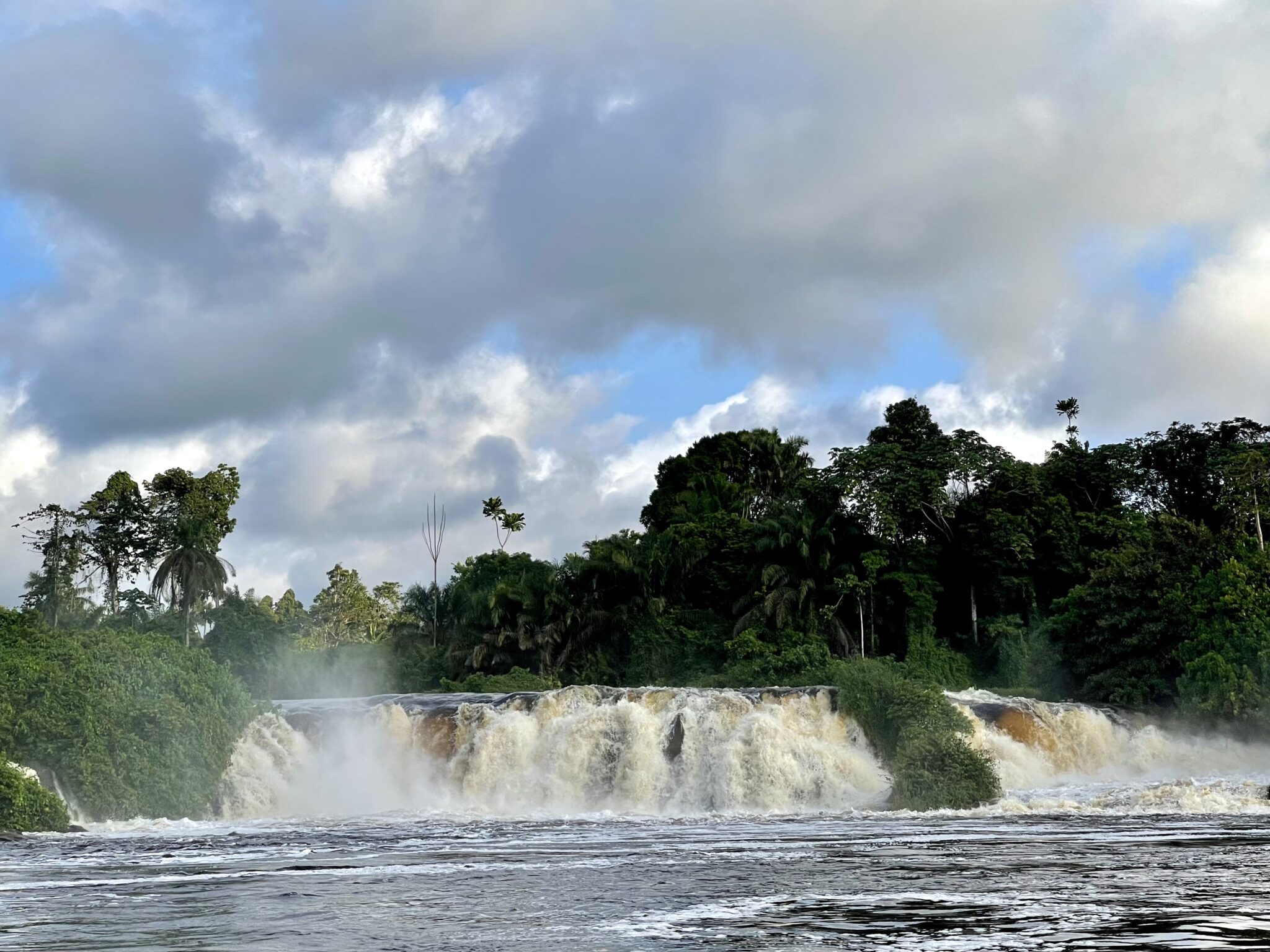
Ekom Nkam Waterfalls
Ekom Nkam Waterfalls are in Cameroon’s Littoral highlands near Nkongsamba and Melong, where the Nkam River drops in several powerful curtains through forested terrain. The main viewpoint is close to the falls, and there is usually a short descent on footpaths to see the water from lower angles, depending on current access and path conditions. Because the area is rural and not heavily developed for tourism, the visit is more about the waterfall itself and the surrounding forest landscape than about facilities.
Most travelers reach Ekom Nkam by road from Douala to Nkongsamba or Melong, then continue on smaller roads toward the entrance area, using a hired car or taxi for the last stretch since public transport can be indirect. Go during or soon after the rainy season if you want the strongest flow, but expect slippery, muddy paths and more insects, so closed shoes with good grip are important. It also helps to arrive earlier in the day for cooler temperatures and to allow time for slow road sections, and to budget small cash for entry and a local guide, which makes navigation and safety easier.
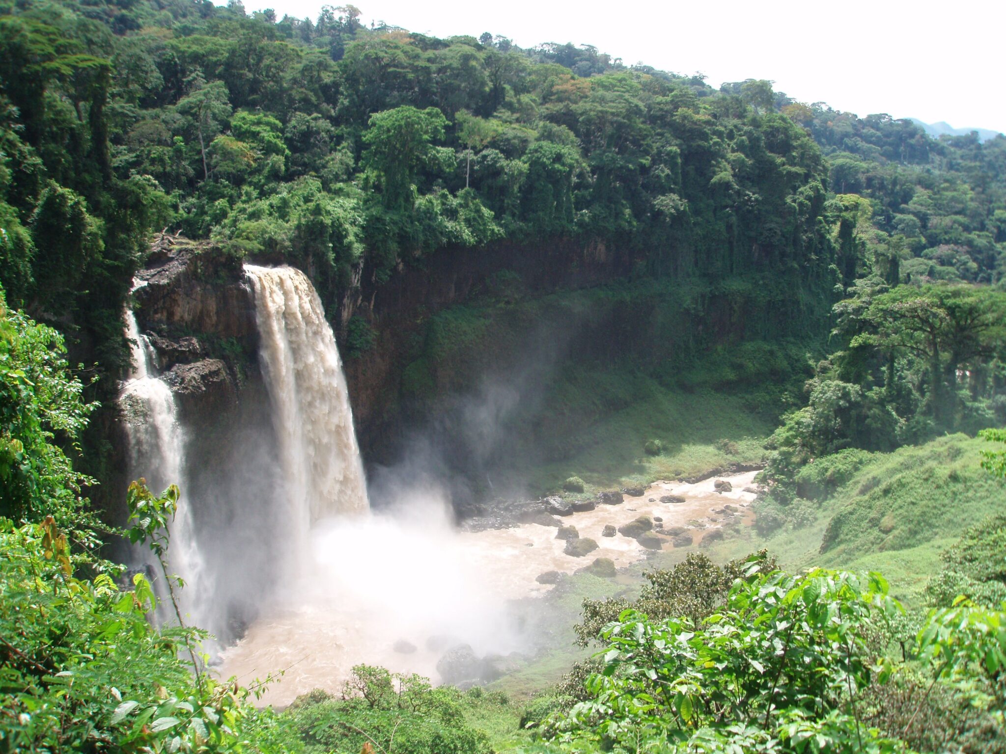
Lobe Waterfalls
Lobé Waterfalls are a short trip from Kribi and are unusual because the Lobé River drops over rock ledges close to where it reaches the Atlantic, so you can see fresh water and ocean scenery in the same place. Visits typically involve reaching the river area by road, then walking along the banks and, in many cases, taking a short canoe ride with a local guide to view different sections of the falls and nearby forest edges. The site is best as a half-day outing, with time for photos, a slow walk, and a simple meal in the area.
From Kribi, it’s easiest to go by taxi or hired car, and leaving early helps avoid the busiest hours, especially on weekends and holidays. Combine the visit with a quieter beach stop either before or after, since the coast around Kribi has less crowded stretches a short drive from the center. Wear shoes with grip because rocks and paths can be slippery, and keep electronics protected from spray if you get close to the falls or use a canoe.
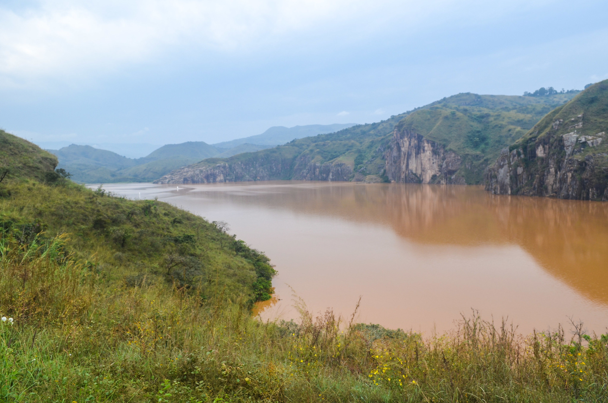
Lake Nyos
Lake Nyos is a crater lake in northwestern Cameroon set in a remote highland landscape, known mainly for its volcanic geology rather than for leisure activities. The lake sits in a steep-sided crater and is best appreciated from viewpoints around the rim, where you can understand the scale of the basin and how the surrounding terrain was formed. A visit is usually quiet and educational, focused on the landscape and local explanations rather than on spending time by the water.
Reaching Lake Nyos typically involves overland travel from regional towns in the Northwest, followed by slower roads into the highlands, so it helps to plan daylight travel and allow buffer time. Visit with a knowledgeable local guide who can explain the site responsibly, help with route choices, and set expectations about where you can safely go and what is appropriate to do on site.
Campo Maan National Park
Campo Ma’an National Park is in southern Cameroon near the Atlantic coast and the Equatorial Guinea border, and it protects a mix of lowland rainforest, rivers, and coastal forest zones. Visits are usually organized around guided forest walks to learn about the ecosystem and look for signs of wildlife such as primates and forest elephants, with the understanding that visibility is limited in dense forest and sightings are never guaranteed. Some itineraries also include river sections and nearby coastal areas where you can see how forest and shoreline landscapes meet, depending on the route and local access conditions.
Most travelers approach the park via Kribi and Campo by road, using a hired car or a local driver because public transport can be slow and irregular once you leave main highways. Treat Campo Ma’an as a logistics destination: arrange guides and permissions in advance, plan for slow travel in wet conditions, and bring basics like water, cash, insect repellent, and waterproof protection for electronics.
Best Historical Sites
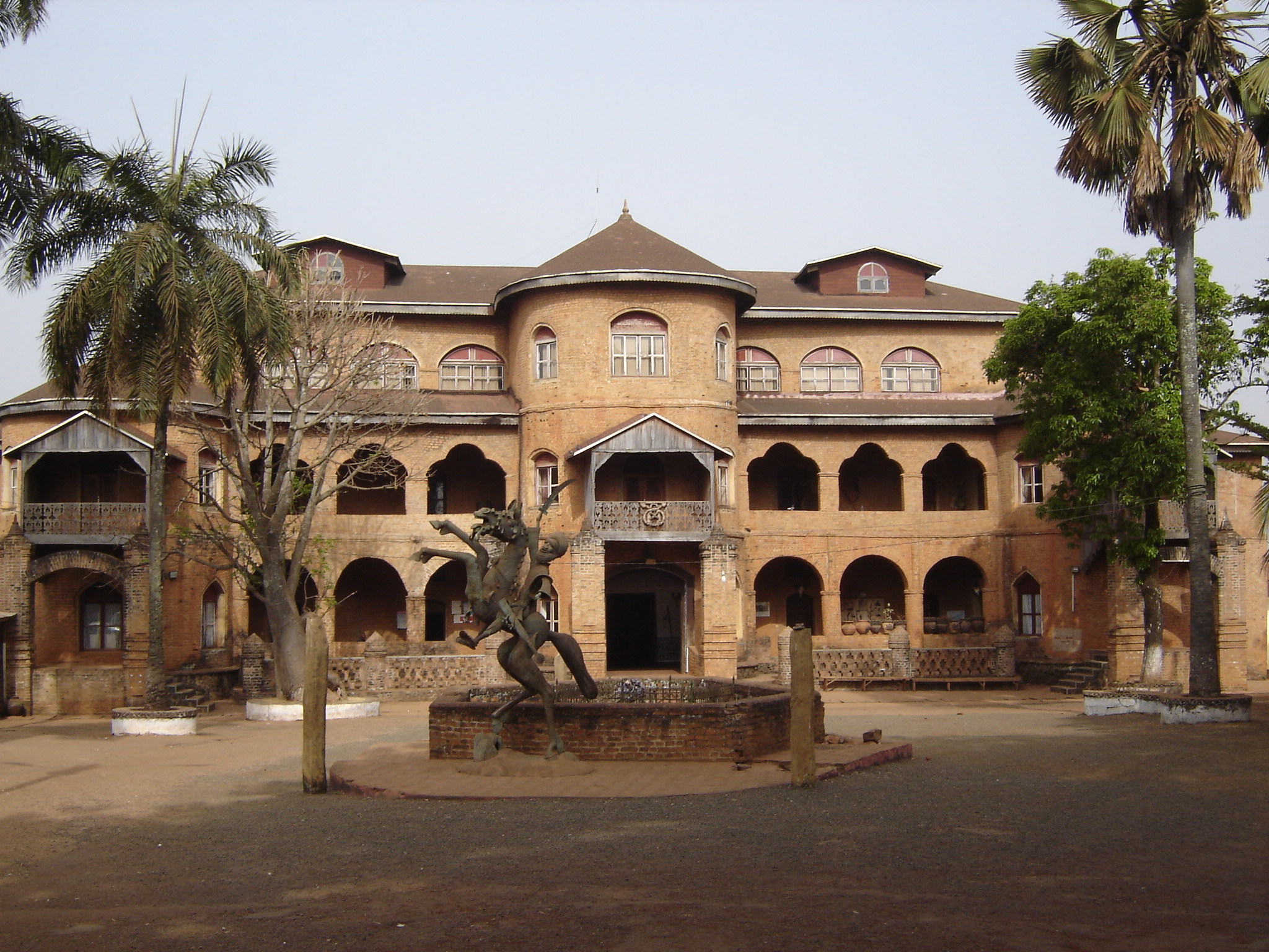
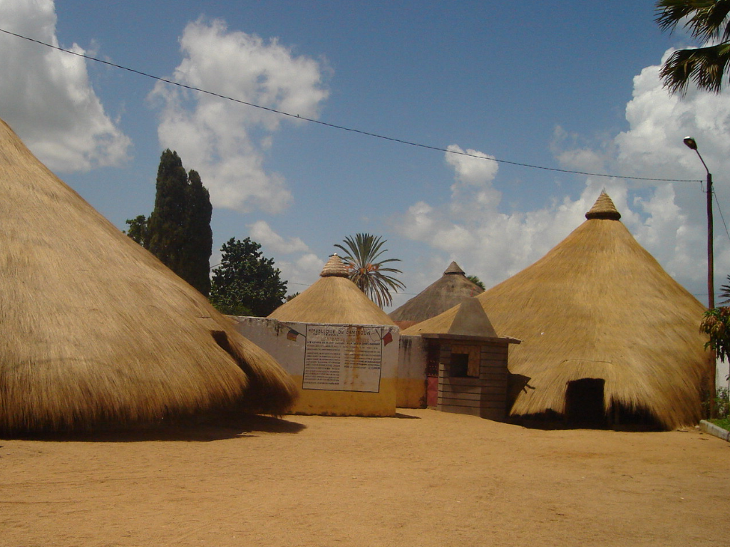
Foumban
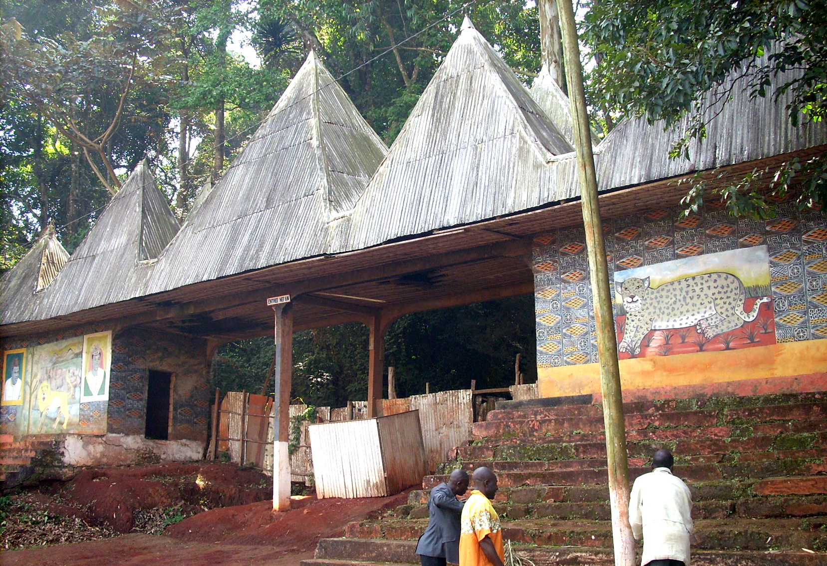
Foumban is the historic center of the Bamum Kingdom in Cameroon’s West Region and one of the best places in the country to get clear cultural context through a visit rather than through general city wandering. The Royal Palace and its museum collections are the main stops, helping you understand Bamum political history, court symbolism, and the region’s strong artistic traditions. Around town, craft workshops and market areas are a practical way to see how carving, metalwork, and weaving remain part of the local economy, and it is often possible to watch artisans at work if you ask politely.
Foumban is usually reached by road from Bafoussam or via routes through the western highlands, and most visitors use a taxi or hired car to move between the palace area and craft quarters. If you plan to buy crafts, take time to compare workmanship and finishes across a few stalls or workshops, and ask what motifs represent and how items are used in ceremonies or daily life. Agree prices clearly before ordering custom work, and pack purchases carefully, since many pieces are fragile and transport can be bumpy on mountain roads.
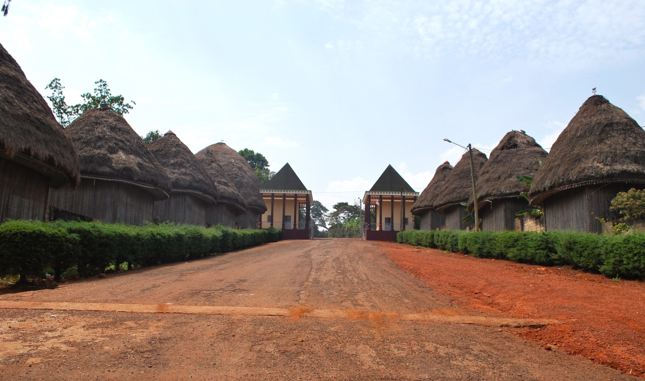
Bandjoun
Bandjoun is a Grassfields chiefdom area in Cameroon’s western highlands, known for royal compounds and community institutions that still play an active role in local governance and cultural life. Visits usually focus on understanding how chieftaincy structures work today, how ceremonial spaces are organized, and how traditions are maintained through councils, festivals, and craft production linked to the court. The experience is most meaningful when you have explanation on site, since many spaces look simple at first glance but carry specific social rules and historical meaning.
Bandjoun is typically visited as a short trip from Bafoussam or Foumban by road, using a hired car or taxi, and it can be combined with other chiefdom visits in the region if you have time. Arrange your visit through a local guide or community contact rather than arriving unannounced, since access can depend on protocol, the availability of representatives, and whether ceremonies are taking place.
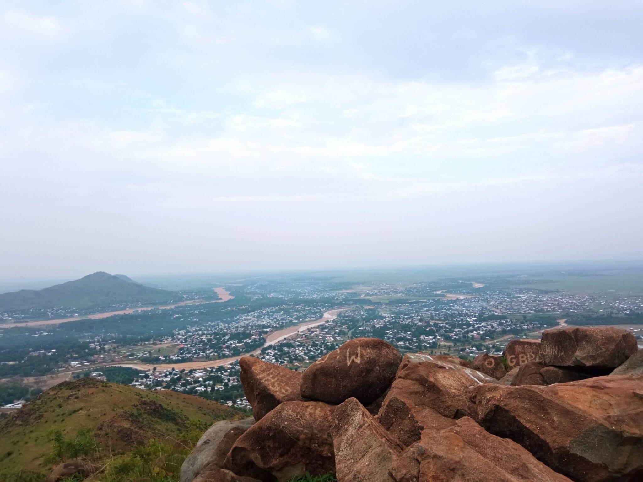
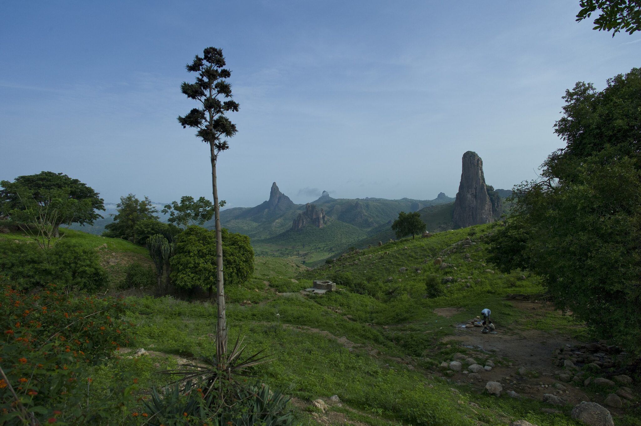
Rhumsiki
Rhumsiki is a village in Cameroon’s Far North in the Mandara Mountains, known for sharp volcanic rock formations, scenic viewpoints, and traditional compounds built to fit the rugged terrain. The visit usually centers on short hikes to nearby lookouts and walks through the village area to see how settlement patterns and daily life adapt to steep slopes and limited water. The surrounding landscape feels “sculpted” because of tall basalt plugs and eroded ridges, and even a few hours on foot can give wide views over the mountain valleys and the Sahel plain below.
Most travelers reach Rhumsiki by road from Maroua as a day trip or an overnight stop, using a hired driver because public transport can be irregular and slow in the mountains. Start early for cooler temperatures and clearer views, and carry cash, water, and basic snacks since services are limited outside the main village.
Ngaoundere
Ngaoundéré is a major city in Cameroon’s Adamawa Region, set in a transition zone between greener highlands and the savannah north, with a strong Fulani cultural presence reflected in local food, dress, and daily rhythms. For travelers, the city is less about specific sights and more about its role as a practical stop where you can experience a different regional identity through markets and street life, while also using it as a base to reset between ecological zones. Its cooler elevation compared with the Far North can also make it a comfortable pause on long itineraries.
The city is one of Cameroon’s key transport hubs, linking north and south by road and rail, so it is commonly used for breaking up long overland routes. Within town, taxis are the easiest way to move around, and it is a good place to organize cash, a SIM top-up, and onward tickets or a driver for the next leg.
Best Highlands Landscapes
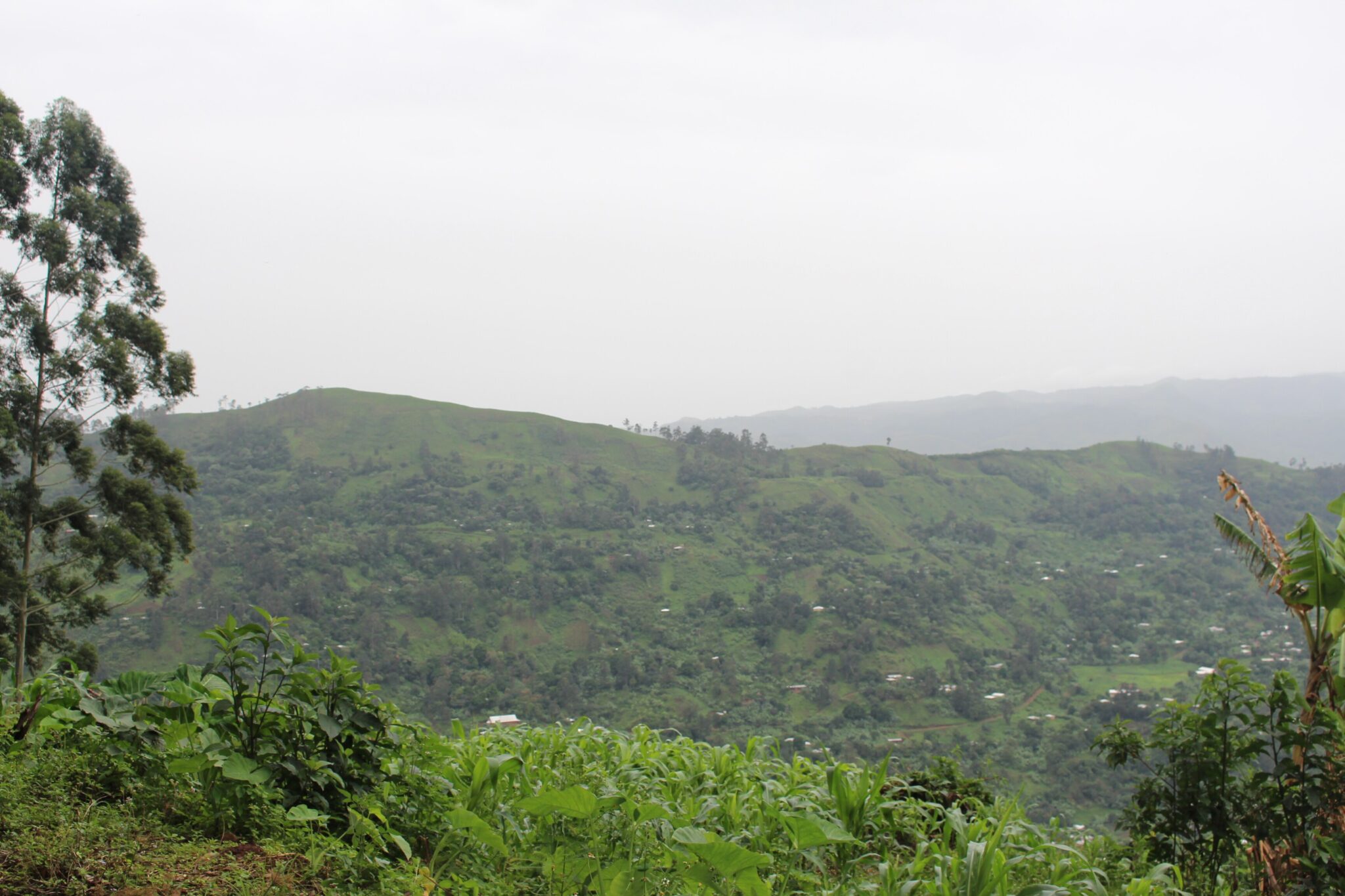
Bamenda Highlands
The Bamenda Highlands are in Cameroon’s Northwest, centered on Bamenda as the main service town, with surrounding hills, farming valleys, and Grassfields communities where traditional leadership and local craft remain important. The best experiences are usually simple and local: spending time in markets to see highland produce and everyday trade, visiting villages to understand how compounds and community life are organized, and doing short hikes to viewpoints on nearby ridges. If you have time for a longer outing, the Mount Oku area and Lake Oku are often included for cooler highland scenery and forest walks, but these trips work best with a local guide because routes and access points are not always obvious.
Adamawa Plateau
The Adamawa Plateau is a broad highland region in central Cameroon that forms a transition between the forested south and the drier north, with open grasslands, cattle herds, and a strong Fulani cultural presence. Travel here is mainly about landscapes and daily life rather than major landmarks, with wide horizons, grazing zones, and market towns where livestock trade, dairy production, and long-distance transport routes shape the rhythm of the region. It can be especially rewarding if you enjoy slow travel, roadside stops, and spending time in local markets to understand how pastoral economies work.
Travel Tips for Cameroon
Safety and General Advice
Cameroon offers remarkable cultural and geographic diversity, but travel conditions vary widely by region. The southern and coastal areas, including Yaoundé and Douala, are the most visited and generally safe for travelers. However, some northern and border regions may experience instability, so it’s essential to stay informed and seek local guidance when planning routes. Checking official travel advisories before departure is highly recommended.
Health and Vaccinations
A yellow fever vaccination is required for entry into Cameroon, and malaria prophylaxis is strongly recommended. Tap water is not safe to drink, so always rely onbottled or filtered water. Travelers should also bring insect repellent and sunscreen, as well as a small medical kit for rural travel. Healthcare facilities are adequate in major cities but limited outside urban areas, so comprehensive travel insurance with evacuation coverage is strongly advised.
Car Rental and Driving
Cameroon’s transportation network is extensive but can be inconsistent in quality. An International Driving Permit is required alongside your national driver’s license, and all documents should be carried at checkpoints, which are common throughout the country. Driving in Cameroon is on the right-hand side of the road. Road quality varies greatly between regions — while main highways in the south are generally well-paved, rural and northern routes can be rough or unpaved. A 4×4 vehicle is recommended for reaching national parks, mountain areas, and remote villages. Because traffic and local driving habits can be unpredictable, hiring a driver is often safer and more convenient than self-driving.
Published January 11, 2026 • 21m to read