Algeria is the largest country in Africa and offers an unusually wide range of landscapes and historic sites, yet it remains one of the region’s least explored destinations. Along the Mediterranean coast, cities such as Algiers combine French era boulevards with Ottoman palaces and old medinas that reflect centuries of trade and cultural exchange. Inland, the high plateaus and mountain ranges hold Roman cities that are still remarkably intact, including Timgad and Djemila, where streets, arches, and temples give a clear sense of daily life in antiquity. Farther south, the landscape shifts toward the Sahara, where rock art, dune fields, and remote settlements reveal some of the oldest traces of human presence in North Africa.
Travelers are drawn to Algeria’s sense of space and authenticity, whether they explore coastal neighborhoods, desert towns, or archaeological sites far from major routes. The Sahara offers quiet, open horizons and access to regions such as Tassili n’Ajjer, noted for its prehistoric rock paintings and dramatic sandstone formations. In many places, visitors encounter few crowds, making it possible to experience cities and natural areas at a slow, attentive pace.
Best Cities in Algeria
Algiers
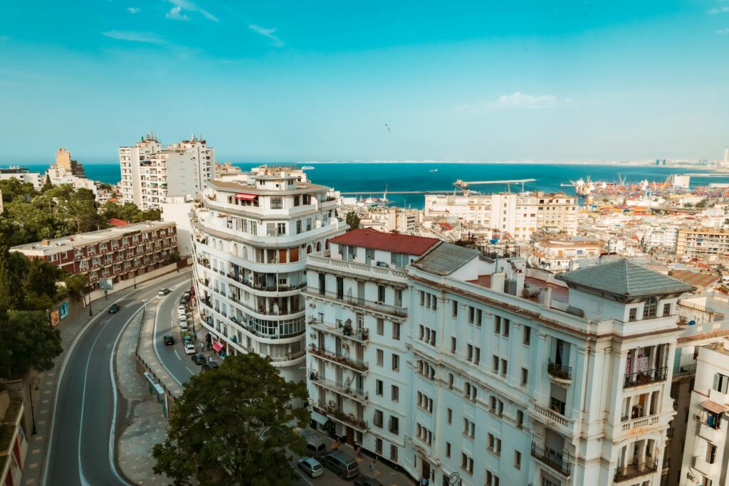
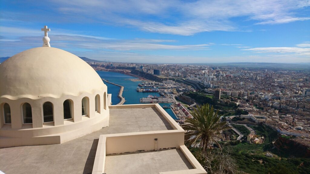
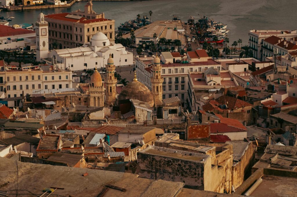
Algiers combines a deep historic core with a spacious modern waterfront, giving the city two very different but complementary sides. The Casbah is the heart of old Algiers, rising steeply above the port in a network of alleys, stairways, and traditional houses. Exploring it on foot reveals Ottoman era palaces, small mosques, and family run workshops that still practice crafts such as metalwork and wood carving. Key sites, including the Ketchaoua Mosque and the Palace of the Dey, show the city’s long role as a political and cultural center of the Maghreb. Because the Casbah is a living neighborhood, visiting with a local guide helps you navigate and understand its layered history.
Below the old city, the waterfront and modern districts offer a more open, European influenced layout. Boulevard Che Guevara runs along the bay with cafés and promenades that are busiest in the late afternoon. The Botanical Garden of Hamma, one of the largest in North Africa, sits nearby and provides shaded paths and views toward the Martyrs’ Memorial on the hillside. The basilica of Notre Dame d’Afrique, reached by a short taxi ride, overlooks the Mediterranean and highlights Algiers’ blend of French and North African architectural styles.
Oran
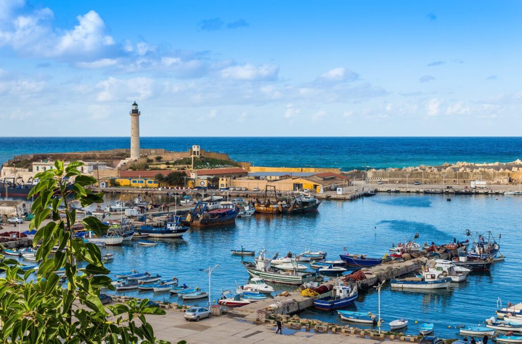
Oran is one of Algeria’s most energetic cities, shaped by its port, its musical heritage, and a mix of Andalusian, Ottoman, and French influences. The city center is easy to navigate, with Place du 1er Novembre at its core and major streets radiating toward markets, cafés, and the waterfront. Landmarks such as the Abdelkader Mosque and the city’s colonial era buildings illustrate the layers of history that define Oran’s identity. The Old Spanish Quarter, though quieter, still shows traces of early fortifications and hillside streets that once connected the port to surrounding settlements.
For broader views, the road up to Fort Santa Cruz leads to one of the city’s best vantage points, with panoramas of the bay, the city rooftops, and the surrounding hills. The nearby chapel adds another dimension to the site’s history and is often included in the same visit. Oran also has a strong coastal appeal, with beaches like Les Andalouses and Aïn El Turck providing swimming, seaside restaurants, and a relaxed break from the urban atmosphere. The city is well connected by rail, air, and road, making it a convenient base for exploring Algeria’s northwest coast.
Constantine
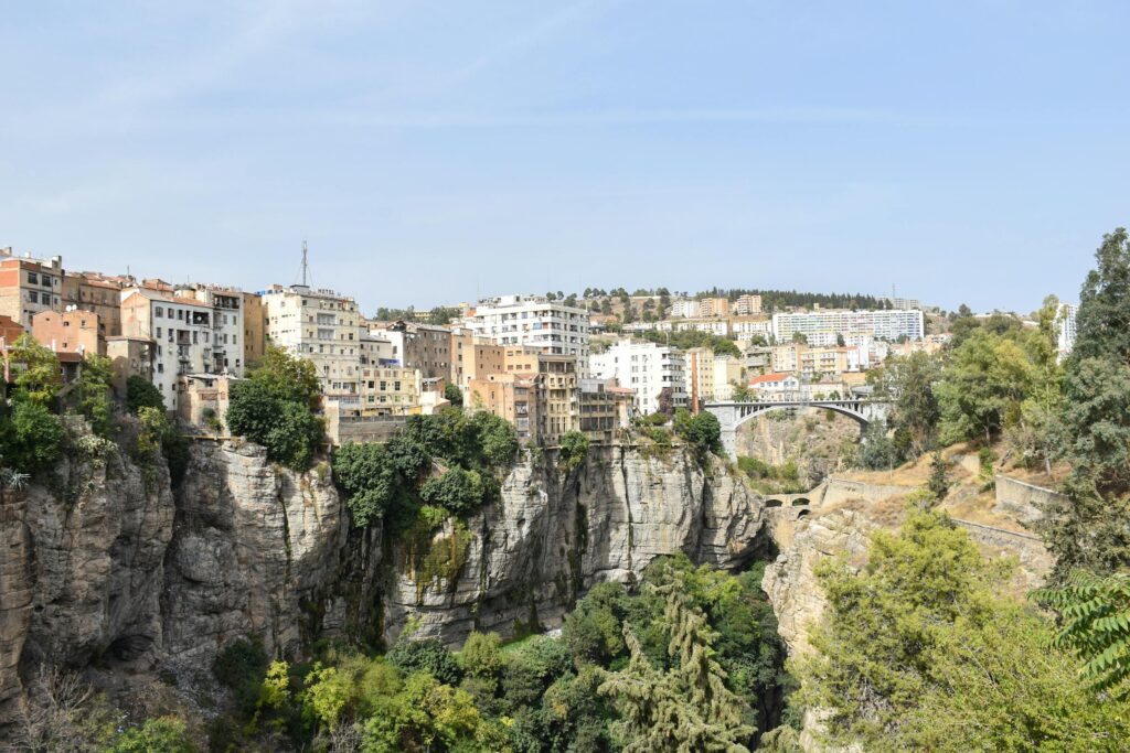
Constantine is shaped by its extraordinary geography, with neighborhoods perched on cliffs and linked by bridges that span the deep Rhumel Gorge. Walking across these bridges is one of the city’s defining experiences, especially on the Sidi M’Cid Bridge, which gives sweeping views of the plateau and the river far below. The city center sits on a high rock outcrop, and narrow streets lead to viewpoints where you can see how the gorge cuts directly through the landscape. Cable cars also connect some districts, making it easier to move between the upper and lower parts of the city.
Constantine’s monuments reflect a long and varied past. The Emir Abdelkader Mosque is one of Algeria’s most important religious buildings, known for its large dome and marble interiors. The Palace of Ahmed Bey, with its painted ceilings and courtyards, shows the refinement of early nineteenth century architecture before French rule. At the Museum of Cirta, archaeological finds trace the region from its Numidian and Roman periods to later Islamic and Ottoman eras.
Tlemcen
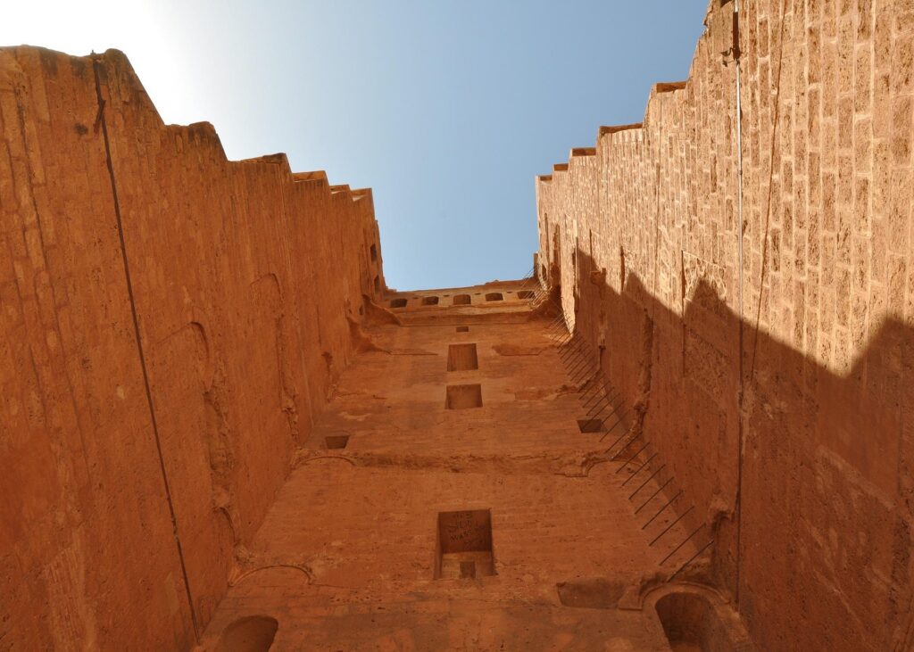
Tlemcen is one of Algeria’s most graceful historic cities, shaped by centuries of Andalusian and Maghrebi influence. Its medina is compact and easy to explore, with the Great Mosque of Tlemcen standing as its most important landmark. Dating to the 11th century, the mosque is known for its arches, ornate mihrab, and well preserved Almoravid design. Nearby, the El Mechouar Palace has been carefully restored and gives visitors access to courtyards, galleries, and rooms that once formed the seat of royal power. On the outskirts, the Mansura Tower rises above open plains, the last remnant of a vast medieval complex that once dominated the region.
The city sits close to Tlemcen National Park, where dense forests, waterfalls, and limestone formations provide a natural counterpart to Tlemcen’s urban calm. Aïn Fezza’s caves highlight the region’s geology, and the waterfalls at Cascades d’El Ourit are a popular stop when water levels are high.
Annaba
Annaba sits on Algeria’s northeastern coast and combines sandy beaches, Roman heritage, and a deep connection to Saint Augustine. The ruins of ancient Hippo Regius lie just outside the modern city, with mosaics, baths, and early Christian sites that trace Augustine’s life and work. Above the city, the Basilica of St. Augustine is one of Annaba’s most striking landmarks. Its hilltop location provides quiet views over the bay and the surrounding countryside, making it a good place to start or end a day of sightseeing.
For a change of pace, Annaba’s coastline offers several accessible beaches, with Ras el Hamra among the most popular for swimming and relaxed afternoons. Inland, a short drive leads to the forested mountains around Seraïdi, where cooler temperatures and viewpoints provide a contrast to the coast. The city’s compact center has cafés, markets, and a walkable waterfront, and its location close to the Tunisian border makes it a useful stop on overland routes through the region.
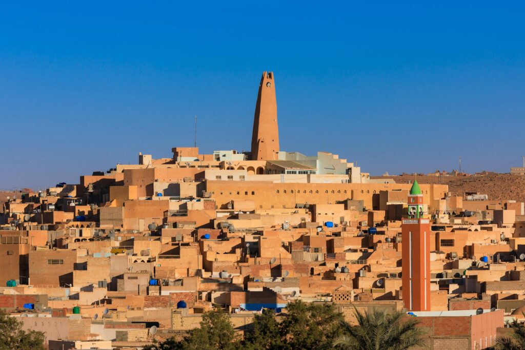
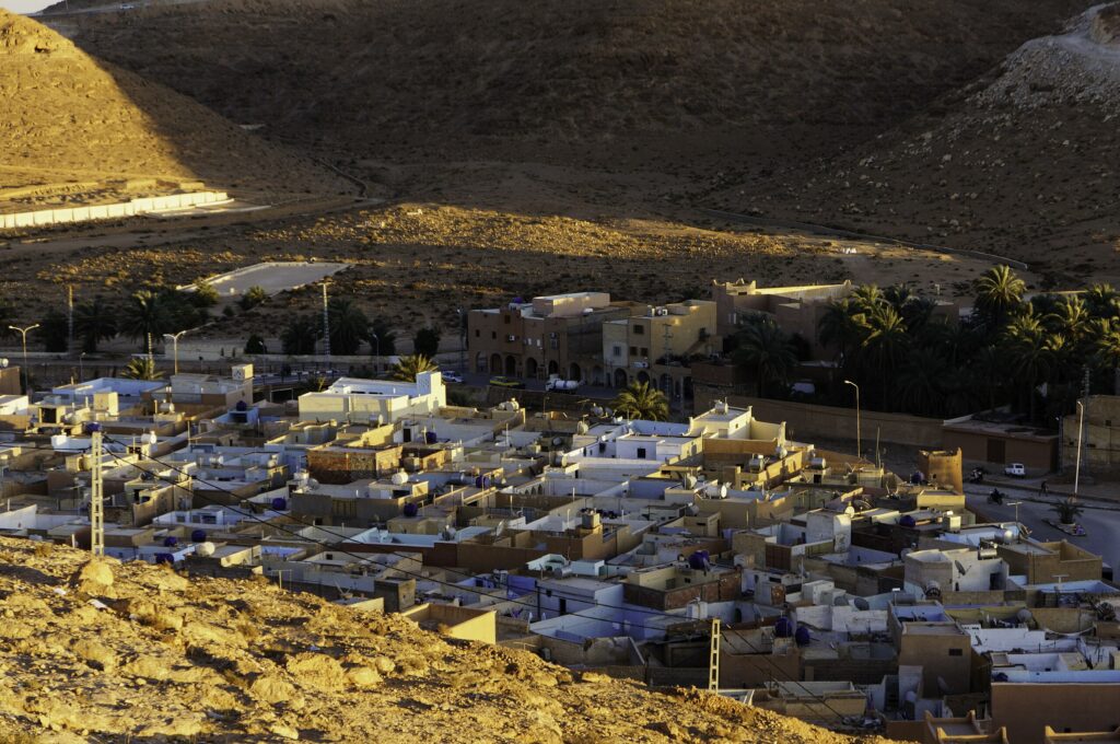
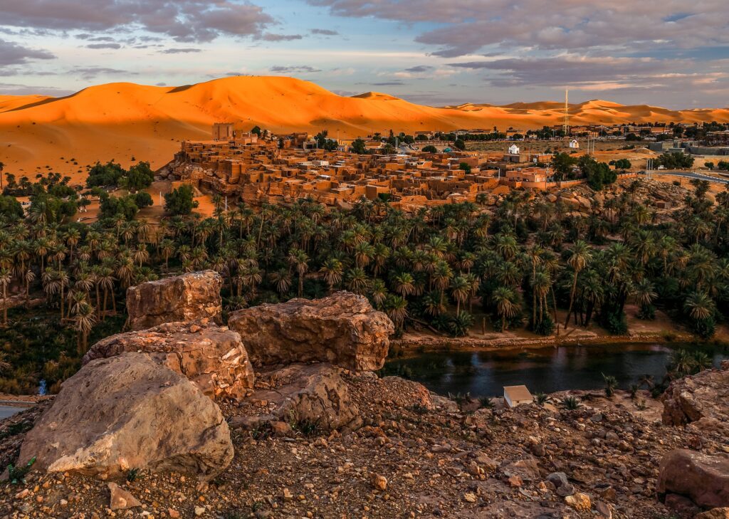
Ghardaïa
Ghardaïa is the best known town in the M’zab Valley, a UNESCO listed region where desert architecture and Ibadi Berber traditions have been preserved with remarkable continuity. The town rises in concentric circles around a central mosque, with white and ochre houses forming a layout designed for shade, community life, and protection from the desert climate. Its covered markets are some of the most atmospheric in Algeria, offering woven carpets, leather goods, and crafts specific to M’zab culture. Visiting with a local guide helps explain the social rules and customs that continue to shape daily life.
The surrounding towns of Beni Isguen, Melika, and El Atteuf show similar patterns of urban design, each with its own character. Beni Isguen is especially known for its traditional auction market and carefully regulated access, while El Atteuf holds one of the region’s oldest mosques. These settlements are close together and easily explored in a half or full day. Ghardaïa is reached by flights from Algiers or by long distance road travel, and once in the valley, walking routes and short drives connect the towns.
Best Historical and Archaeological Sites
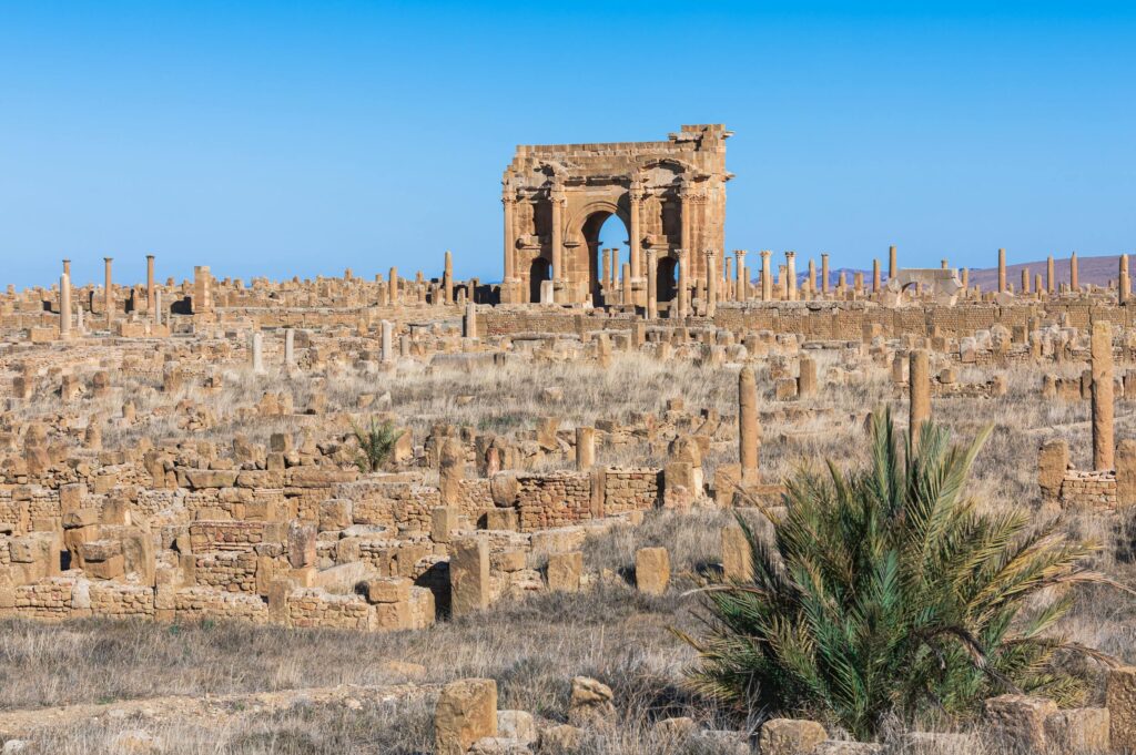
Timgad
Timgad is one of the most complete Roman cities in North Africa, founded by Emperor Trajan in the 1st century AD as a military colony. Its perfectly planned grid layout is still clearly visible, making it easy to walk along streets that once connected homes, baths, temples, and marketplaces. The Arch of Trajan stands at the eastern entrance and remains one of the site’s most striking features, framing views of the surrounding hills. Nearby, the library, basilicas, and forum reveal how public life was organized, while the theater is still well defined and occasionally used for cultural events.
Because the ruins cover a wide area, it is best to explore Timgad slowly, allowing time to understand the city’s structure and the quality of its stonework. A small museum near the entrance displays mosaics and artifacts unearthed from the site. Timgad is usually reached from Batna by car or taxi, with the drive taking less than an hour.
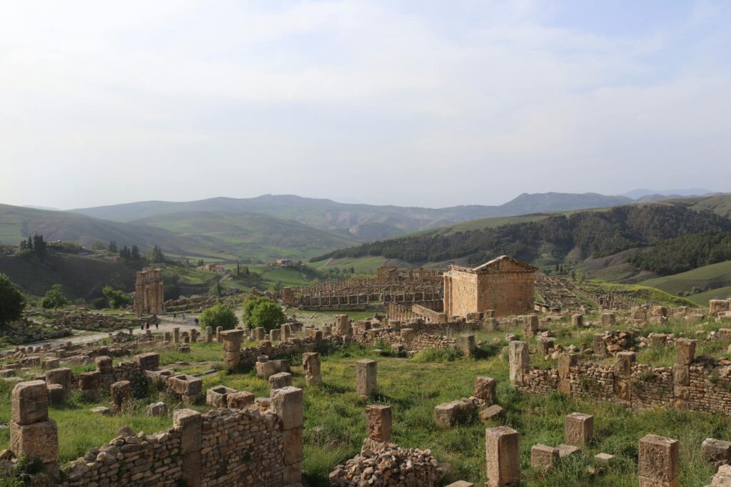
Djemila
Djemila, known in antiquity as Cuicul, is one of Algeria’s most atmospheric Roman sites thanks to its mountain setting and exceptionally preserved structures. The city sits on a high plateau surrounded by green hills, and its layout adapts to the natural contours of the landscape rather than following a strict grid. Walking through the site takes you past the Forum, baths, residential quarters, and temples that still clearly express the life of a Roman provincial town. The Temple of Septimius Severus stands out for its size and commanding position, offering views across both the ruins and the surrounding valley.
The on site museum holds an outstanding collection of mosaics, many of them remarkably vivid and detailed, depicting scenes from daily life, mythology, and local nature. These works complement the archaeological remains and help place the city in its cultural context. Djemila is typically reached by road from Sétif or Constantine, making it a manageable half day or full day excursion.
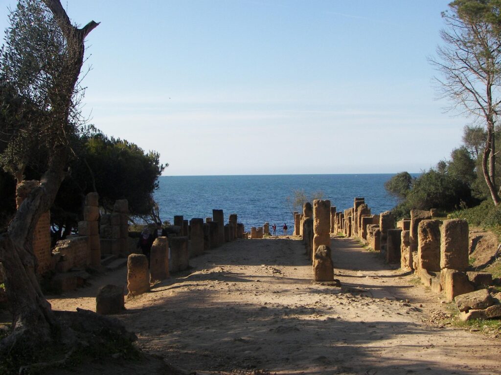
Tipasa
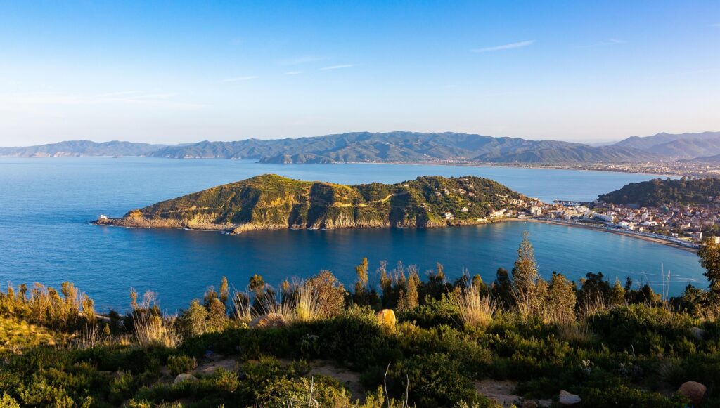
Tipasa is one of Algeria’s most scenic archaeological sites, set directly on the Mediterranean with ruins spread across low cliffs, cypress groves, and quiet coves. The site reflects several layers of settlement, beginning with Phoenician traders and later expanding into a substantial Roman town with villas, baths, basilicas, and a well positioned forum. Many of the mosaics and foundations are still visible, and walking the coastal paths gives views of both the ancient harbor and the open sea. The combination of archaeology and natural setting makes Tipasa feel far less formal than many Roman sites, inviting slow exploration.
A short drive inland stands the Royal Mausoleum of Mauretania, a large circular tomb believed to hold Cleopatra Selene and King Juba II. The monument sits on a hilltop and is visible from afar, with panoramic views over the surrounding countryside and coastline. Most travelers reach Tipasa by car or taxi from Algiers in about an hour, making it an easy day trip. The coastal town itself has cafés and seafood restaurants, and the open layout of the archaeological park encourages wandering between the ruins, shoreline, and shaded areas.
Cherchell
Cherchell sits west of Algiers on a calm stretch of Mediterranean coast and was once the capital of the Kingdom of Mauretania under King Juba II and Cleopatra Selene. The town’s long history is clear in its archaeological remains, which include sections of ancient streets, temple foundations, and scattered columns that hint at its former prosperity. Cherchell’s two small but well curated museums hold some of the country’s finest Roman era mosaics and statues, many of them found locally, making the town especially appealing to travelers interested in classical history.
The modern center is easy to explore on foot, with the port, museums, and archaeological areas located close together. Coastal breezes and views of the surrounding hills add a pleasant backdrop to a half day visit. Cherchell is typically reached by car from Algiers in under two hours, often combined with a trip to nearby Tipasa or the Royal Mausoleum of Mauretania.
The Casbah of Algiers
The Casbah of Algiers is both a historic district and a functioning community, built on a hillside that rises sharply above the modern city and port. Its narrow alleys, stairways, and densely packed homes create a layout that has changed little since the Ottoman period. Walking through the Casbah reveals palaces such as Dar Mustapha Pacha and Dar Hassan Pacha, modest family houses with carved wooden doors, and small neighborhood mosques that anchor daily life. Many of these structures still follow traditional designs intended to keep interiors cool and private.
The Casbah is also a major symbol of Algeria’s struggle for independence, with several houses and streets associated with key episodes of resistance. Visiting with a local guide helps explain these historical layers and makes navigating the steep, winding passages easier. Despite its designation as a UNESCO World Heritage Site, the Casbah remains a lived in neighborhood, with artisans, markets, and community gatherings contributing to its character.
Best Natural Wonders in Algeria
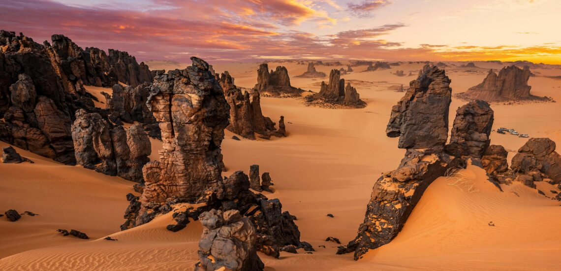
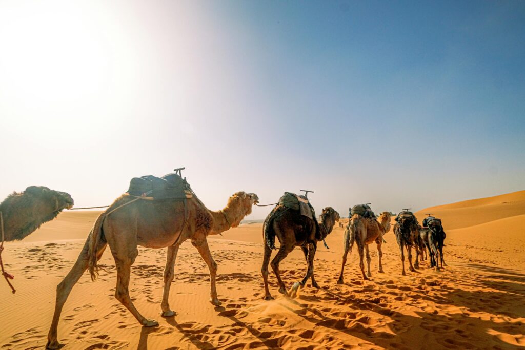
The Sahara Desert
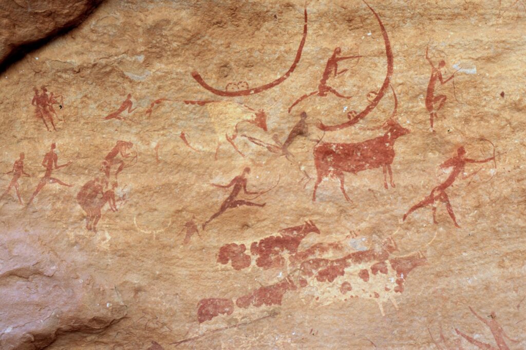
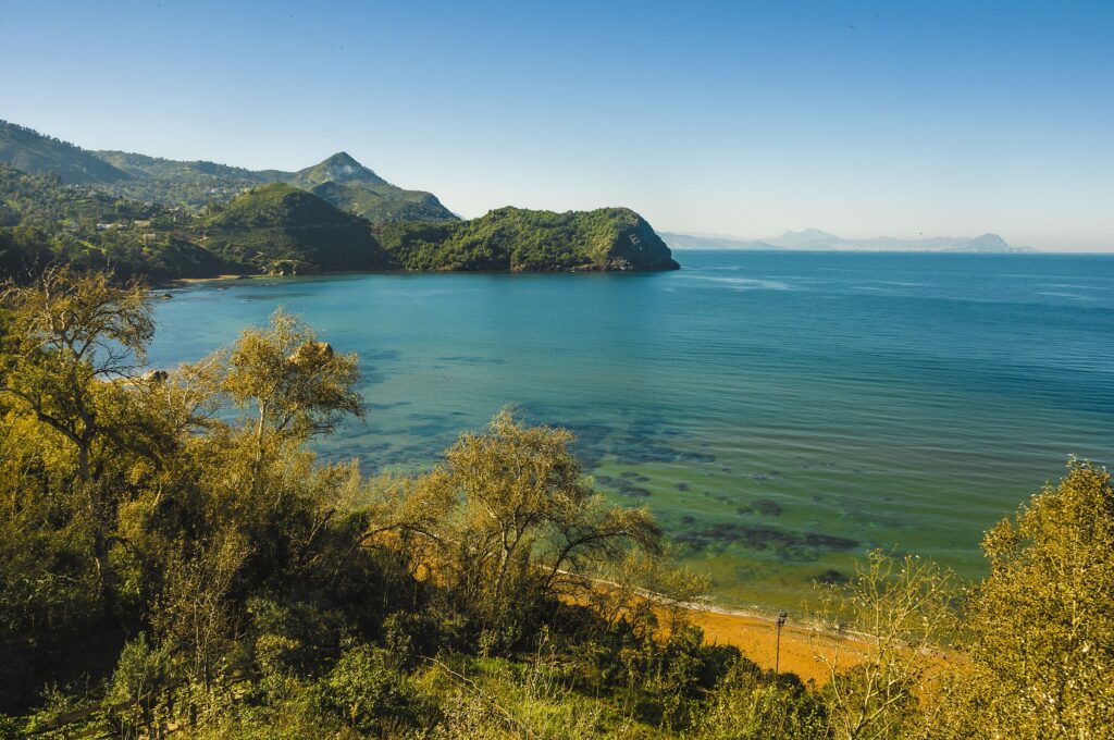
The Sahara covers most of Algeria and offers a range of landscapes that feel very different from one another. Tassili n’Ajjer is one of the most remarkable areas, known for sandstone formations that resemble natural sculptures and for thousands of prehistoric rock paintings that document early life in the region. Access is usually from Djanet, where guided treks lead into canyons, plateaus, and rock shelters. Farther southwest, the Hoggar Mountains rise in dark volcanic peaks around Tamanrasset. This region is tied to Tuareg culture and offers remote trails, high plateaus, and viewpoints such as Assekrem, associated with the legacy of Charles de Foucauld.
Oases add another layer to Algeria’s desert geography. Timimoun is one of the most atmospheric, with red mud brick architecture, a large palm grove, and salt lakes that create strong contrasts in color and light. The town is quiet and lends itself to slow exploration of ksours, markets, and surrounding viewpoints. Taghit, farther north in the Saoura Valley, sits at the foot of sweeping dunes that change color through the day and are easy to reach from the village. Both areas offer opportunities for dune walks, 4×4 outings, and evenings under clear desert skies.
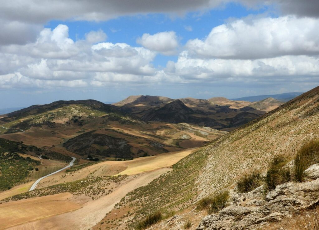
Atlas Mountains
The Atlas Mountains in northern Algeria offer a clear contrast to the country’s desert regions, with cooler air, dense forests, and high valleys shaped by seasonal rivers. The ranges are well suited for hiking, picnicking, and 4×4 exploration, with routes that move between cedar groves, rocky ridges, and small agricultural terraces. Many areas remain quiet and lightly developed, allowing visitors to experience mountain landscapes at a slower pace than in urban centers.
Kabylie, east of Algiers and anchored by towns such as Tizi Ouzou, is the most accessible part of the mountains. The region is known for its strong Berber identity, traditional villages built along the slopes, and a landscape of wooded hills that open into panoramic viewpoints. Waterfalls and natural springs are scattered throughout the area, especially around places like Yakouren and the Djurdjura National Park. Because Kabylie is close to the coast, day trips from Algiers or Béjaïa are straightforward, and local guesthouses provide a base for longer stays.
Tassili n’Ajjer Plateau
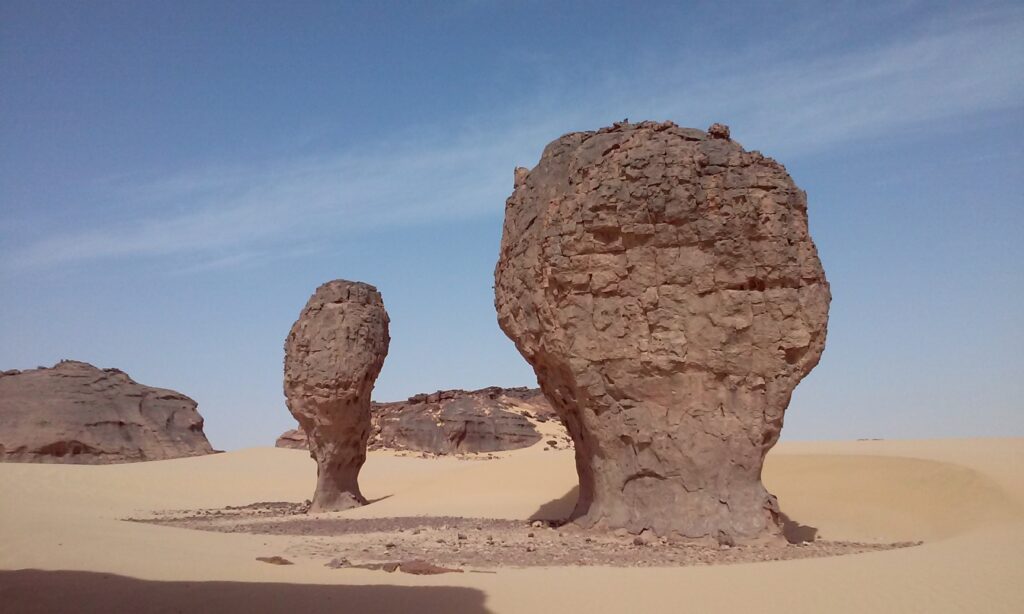
Tassili n’Ajjer is one of the world’s great open-air museums, a high sandstone plateau in southeastern Algeria known for more than 15,000 prehistoric rock paintings and engravings. Some of these artworks date back 10,000 years and depict wildlife, human figures, pastoral scenes, and long-vanished rivers, offering a vivid record of how the Sahara once looked before it became a desert. The landscape itself is equally striking. Wind and erosion have carved the rock into arches, pillars, and narrow canyons that make large sections of the plateau feel like a natural sculpture garden.
Reaching Tassili n’Ajjer almost always involves a guided expedition from Djanet, the main gateway town. From there, multi day treks or 4×4 journeys take travelers into the plateau’s protected zones, with nights spent in camps under exceptionally clear skies. The routes pass through gorges, high plateaus, and ancient shelter sites containing some of the region’s most important rock art.
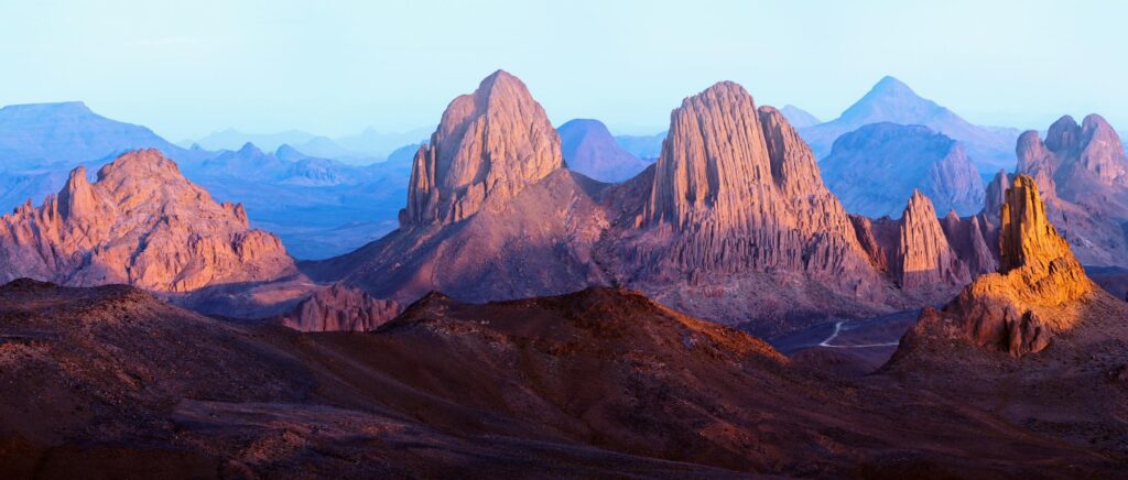
Hoggar Mountains
The Hoggar Mountains rise in southern Algeria and are centered around Tamanrasset, which serves as the main access point for travel in the region. The terrain consists of volcanic peaks and open desert valleys, reached by 4×4 routes or guided treks that start from the town. The area is closely linked to Tuareg communities, and some excursions include visits to local camps or villages.
The Assekrem Plateau is the most visited part of the range. A rough track leads from Tamanrasset to a lookout point used for observing sunrise and sunset. The small hermitage of Charles de Foucauld operates as a simple rest stop for visitors. Conditions can be cold and windy, especially at night, so most trips are planned with guides who manage transport, navigation, and safety.
M’zab Valley
The M’zab Valley consists of fortified towns designed to function in a dry desert environment. Their compact layout, shared public spaces, and uniform building methods form an early example of practical desert planning. Walking through the towns shows how communities organized housing, water use, and trade to manage limited resources.
Key settlements such as Ghardaïa, Beni Isguen, and El Atteuf follow similar principles, with a central mosque, surrounding residential quarters, and markets under covered passageways. Local regulations still guide daily life, making the valley an active demonstration of long-standing social and architectural systems.
Best Coastal and Mediterranean Destinations
Bejaïa
Bejaïa sits on Algeria’s eastern coast and provides direct access to both the shoreline and nearby highlands. Cap Carbon is the main natural landmark, reached by a road that leads to a lighthouse and viewing areas above the sea. Yemma Gouraya National Park surrounds the city and offers hiking routes that connect forested slopes, ridges, and points overlooking the bay. Within Bejaïa, markets, cafés, and the waterfront form the core areas for daily activity, and several beaches lie a short drive from the center.
Skikda
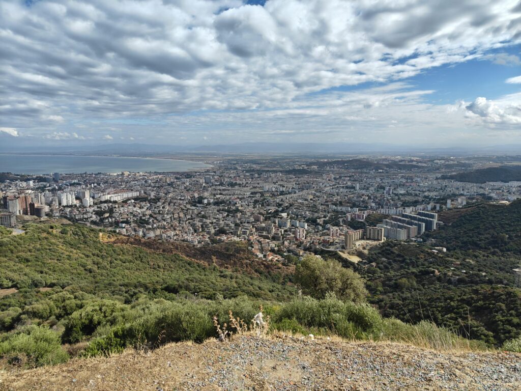
Skikda is a port city on Algeria’s northeastern coast, known for its broad bay, beaches, and a compact center built around the waterfront. The city’s layout reflects both its modern role as a transport hub and its earlier period under French administration, with a train station by Le Corbusier and public squares that link the port to residential districts. Nearby beaches such as La Marsa and Jeannette Beach attract visitors in summer, and coastal roads offer access to small fishing communities and viewpoints along the Gulf of Skikda.
Skikda is reached by road or rail from Constantine and Annaba, and its port serves regional maritime routes. Travelers use the city as a base for coastal day trips, swimming, and visits to surrounding hills, which hold forested areas suitable for short walks and picnics.
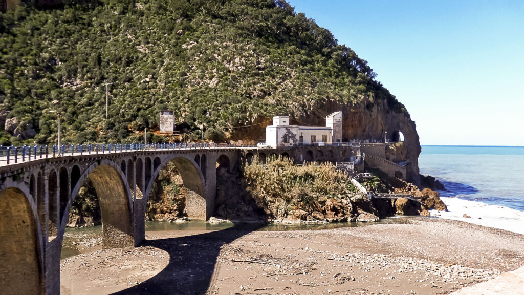
Jijel
Jijel lies on Algeria’s northeastern coast and is known for its combination of shoreline and dense vegetation. The Caverns of Jijel are a main point of interest, with walkways that pass through rock formations close to the sea. Taza National Park extends inland and includes forests, cliffs, and short trails suitable for half-day visits. The city functions as a starting point for exploring nearby beaches and natural areas, and its road connections make it straightforward to travel to other towns along the coast.
Mostaganem
Mostaganem is a coastal city known for its Andalusian-influenced urban layout and cultural traditions. The old quarters contain narrow streets, small mosques, and buildings that reflect earlier periods of migration and trade. Local venues often host traditional music, and the city’s markets and restaurants focus on regional seafood. Several beaches lie near the center and are easily reached by local transport or taxi.
Hidden Gems of Algeria
Tamanrasset
Tamanrasset is the main access point for exploring southern Algeria’s desert and highland regions, and it remains one of the most direct ways to learn about Tuareg customs, crafts, and seasonal movements. The town has a central market, small workshops, and local gathering spots where travelers can observe daily life and organize supplies for longer routes. Many visitors use Tamanrasset as a base for multi-day trips into the Hoggar Mountains, where 4×4 tracks and trekking routes lead to volcanic peaks, plateaus, and remote valleys. From here, excursions to the Assekrem Plateau provide opportunities for sunrise and sunset viewing, and overnight stays at shelters near the hermitage add context to the area’s historical connections.
Tamanrasset is reached primarily by domestic flights from Algiers and other northern cities, with overland travel possible but time-consuming due to distance. Once in town, local guides and drivers arrange transport into surrounding areas, as independent travel is limited by terrain and navigation requirements.
Taghit
Taghit is one of the most accessible dune environments in Algeria, with high sand ridges rising directly behind the oasis. Visitors come to walk along the dune line, explore the palm groves, and visit the old ksar that overlooks the village. The area supports simple 4×4 excursions, short hikes, and quiet evenings in guesthouses on the edge of the desert. Taghit is reached by road or domestic flights to Béchar, followed by a drive of about an hour. It works well as a first introduction to the western Sahara, offering easy routes into the surrounding valleys and dune fields.
Timimoun
Timimoun lies farther east and serves as a base for exploring a wide network of oases and salt lakes. Its ksars follow traditional architectural patterns that help regulate heat and make the town practical for walking between markets, viewpoints, and surrounding palm groves. Many travelers use Timimoun as a starting point for 4×4 circuits that pass abandoned villages, seasonal lakes, and open desert plains.

El Oued
El Oued, often called the City of a Thousand Domes, is known for its building style in which rounded roofs and smooth walls help manage heat and drifting sand. Walking through the center shows how these domed structures form entire residential blocks, markets, and administrative areas, creating a distinctive urban landscape adapted to the Sahara. The city is also a regional trading point for dates, woven goods, and everyday items brought in from nearby oases. El Oued is reached by road from Touggourt and Biskra or by domestic flights that connect it with northern Algeria. Visitors come to see how the architecture functions in a desert setting, to explore local markets, and to use the city as a base for short trips into surrounding dune areas.
Travel Tips for Algeria
Travel Insurance & Safety
Given Algeria’s vast landscapes and the remoteness of many attractions, comprehensive travel insurance is highly recommended. Ensure your policy includes medical coverage and evacuation, particularly if you plan to travel into the Sahara Desert or take part in extended overland tours. While healthcare in large cities such as Algiers and Oran is adequate, facilities in smaller towns and desert regions can be limited, making insurance essential for peace of mind.
Most major tourist areas in Algeria are safe and stable, but it is always wise to check current travel advisories before setting out, especially if you plan to visit remote regions. Travelers should dress modestly, particularly in conservative or rural areas, to show respect for local culture and avoid unwanted attention. Tap water in large cities is generally treated and safe for brushing teeth, though many visitors prefer to stick with bottled water elsewhere.
Transportation & Driving
Covering large distances in Algeria often requires domestic flights, which connect Algiers with major cities such as Oran, Constantine, and Tamanrasset. In the more populated north, buses and trains provide reliable and affordable service between towns. For those heading into the desert, proper preparation is essential – a 4×4 vehicle, experienced driver or guide, and navigation equipment are necessary, as routes are long, conditions can vary, and services are sparse.
Driving in Algeria is on the right-hand side of the road. Coastal and urban roads are usually in good condition, but desert and mountain routes can be rough, with limited signage. Travelers planning to rent a car must carry their national license together with an International Driving Permit. Always bring your passport, insurance papers, and vehicle documents, as police checkpoints are routine.
Published December 07, 2025 • 19m to read