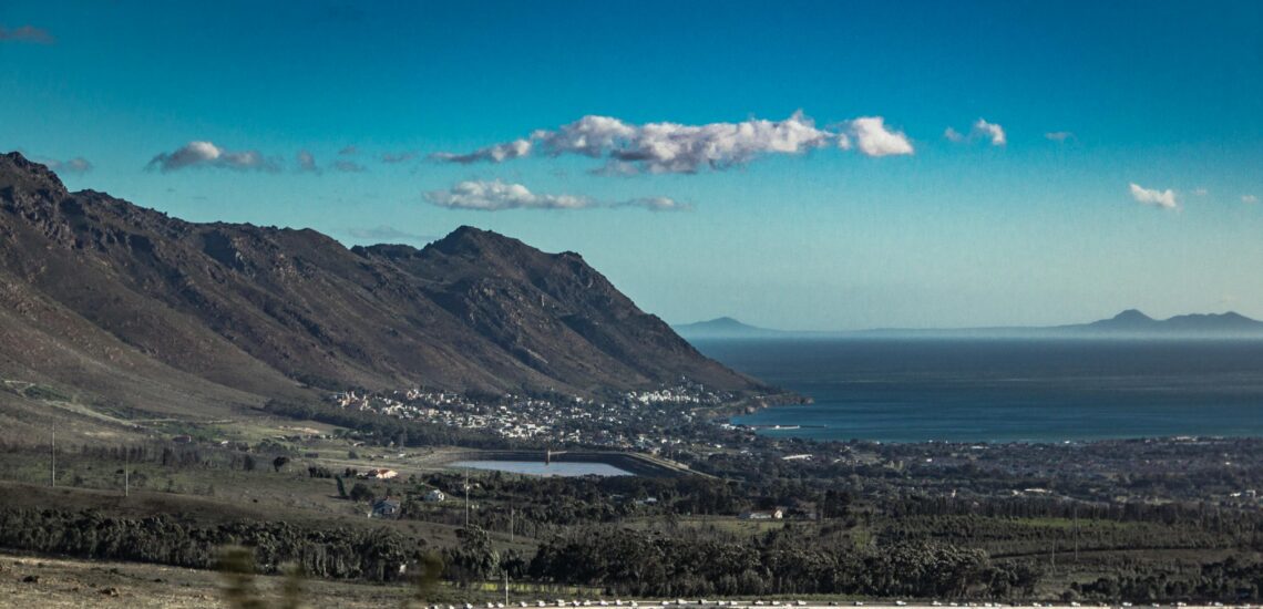
South Africa is one of the most diverse travel destinations on the continent, offering a wide range of landscapes and experiences within a single country. Major cities sit alongside dramatic coastlines, mountain ranges, vineyards, and some of Africa’s most established wildlife parks. This variety makes South Africa suitable for many travel styles, from classic safaris and scenic road trips to food, wine, hiking, and cultural exploration.
What sets South Africa apart is how easy it is to travel compared to many other destinations in the region. Tourism infrastructure is well developed, self-driving is common on many routes, and accommodation options cover every budget level. Travelers can mix guided activities with independent exploration, but planning remains important. Distances can be deceptive, and trips are most rewarding when you focus on fewer regions and allow enough time to experience each one properly.
Best Cities in South Africa
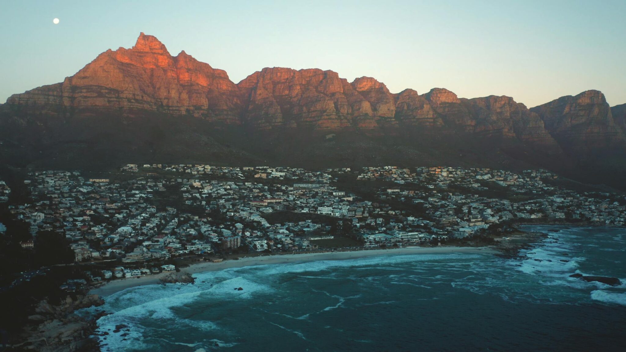
Cape Town
Cape Town is easy to structure around a few clear areas. Go up Table Mountain for the wide city and ocean view, then add Lion’s Head if you want a shorter hike with a full loop and a sunset option. In the city, walk the V&A Waterfront for the harbor, boat trips, and museums, then continue to Bo-Kaap for a compact on-foot route through the neighborhood and its history. For the coast, use the Sea Point Promenade for a long flat walk, then move to Clifton and Camps Bay for beach time and evening light; if you have a car, Chapman’s Peak Drive adds multiple viewpoints without a long hike.
For half-day and day trips, the simplest high-impact options are on two lines. South: Cape Point and the Cape of Good Hope area for cliffs and short trails, often combined with Simon’s Town and Boulders Beach for the penguins on False Bay. East: the Winelands, with Stellenbosch about 50 km from central Cape Town and usually 45 to 70 minutes by road, for cellar tastings and estate lunches. Getting there is most efficient by car or rideshare for city zones; from Cape Town International Airport the center is about 20 km and often 20 to 40 minutes, and from other South African hubs flying is the practical option, with typical flight times around 2 hours from Johannesburg.
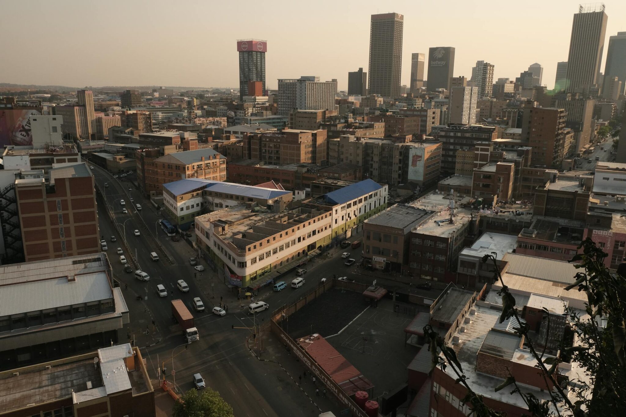
Johannesburg
Johannesburg is South Africa’s largest city and a practical place to understand the country’s recent history through specific sites. Start with Constitution Hill, where guided visits cover the former prison complex and the Constitutional Court, then pair it with the Apartheid Museum for a structured, chronological overview that many visitors spend 2 to 4 hours in. Add the Mandela House in Soweto for a smaller, more personal museum stop, and if time allows, include the Hector Pieterson Memorial and Museum nearby to connect the area to the 1976 events. For contemporary culture, focus on Maboneng for galleries, street art, and cafés in a walkable pocket, and use Rosebank for the major art museum cluster and a concentrated dining scene. A simple, high-impact city view is the Top of Africa observation deck at the Carlton Centre, which gives a skyline look and helps you read the city’s scale.
Johannesburg also works as a base because distances to key day trips are manageable. The Cradle of Humankind UNESCO area is roughly 50 km from central Johannesburg and usually about 45 to 90 minutes by road depending on traffic; it combines visitor centers and cave-related sites with short walks. Pretoria is about 60 km and often 45 to 75 minutes by road for monuments and museums, and Pilanesberg National Park is around 170 to 200 km, commonly 2.5 to 3.5 hours by car, making it one of the more realistic “safari in a day” options from the city. For getting in, most visitors arrive via O.R. Tambo International Airport, about 20 to 30 km from central areas, often 25 to 60 minutes by road.
Pretoria (Tshwane)
Pretoria (Tshwane) is South Africa’s administrative capital and a compact day out focused on monuments, museums, and large green spaces. Begin at the Union Buildings for the city’s main viewpoint and formal gardens, then continue to the Voortrekker Monument for its museum displays and elevated panorama across the metro area. For a museum stop with broad national context, the Ditsong National Museum of Cultural History and the nearby Melrose House are practical options in the central area, and Freedom Park adds a second, more contemporary layer that many visitors combine with the Union Buildings in the same day. If you are there in jacaranda season, the experience is mostly street-level: neighborhoods like Brooklyn and Arcadia are known for dense plantings, and a slow walk or short drive turns into a route of repeated purple canopies rather than a single “must-see” point.
Pretoria is usually simplest as a half-day or full-day trip from Johannesburg. The city center and Hatfield/Rosebank-side areas are roughly 50 to 70 km from central Johannesburg and commonly 45 to 90 minutes by road depending on traffic; the Gautrain also links Johannesburg, Sandton, and Hatfield stations, then you can use rideshare for specific sites. From O.R. Tambo International Airport, Pretoria is roughly 45 to 55 km and often 45 to 75 minutes by road. If you are combining it with the Cradle of Humankind, plan it as two separate blocks, because the Cradle area sits northwest of Johannesburg and is typically 45 to 90 minutes from central Johannesburg by road, while Pretoria is northeast, so doing both in one day can turn into long transfer time. A clean plan is one major monument, one museum, and then a park stop such as the Pretoria National Botanical Garden to finish without rushing.

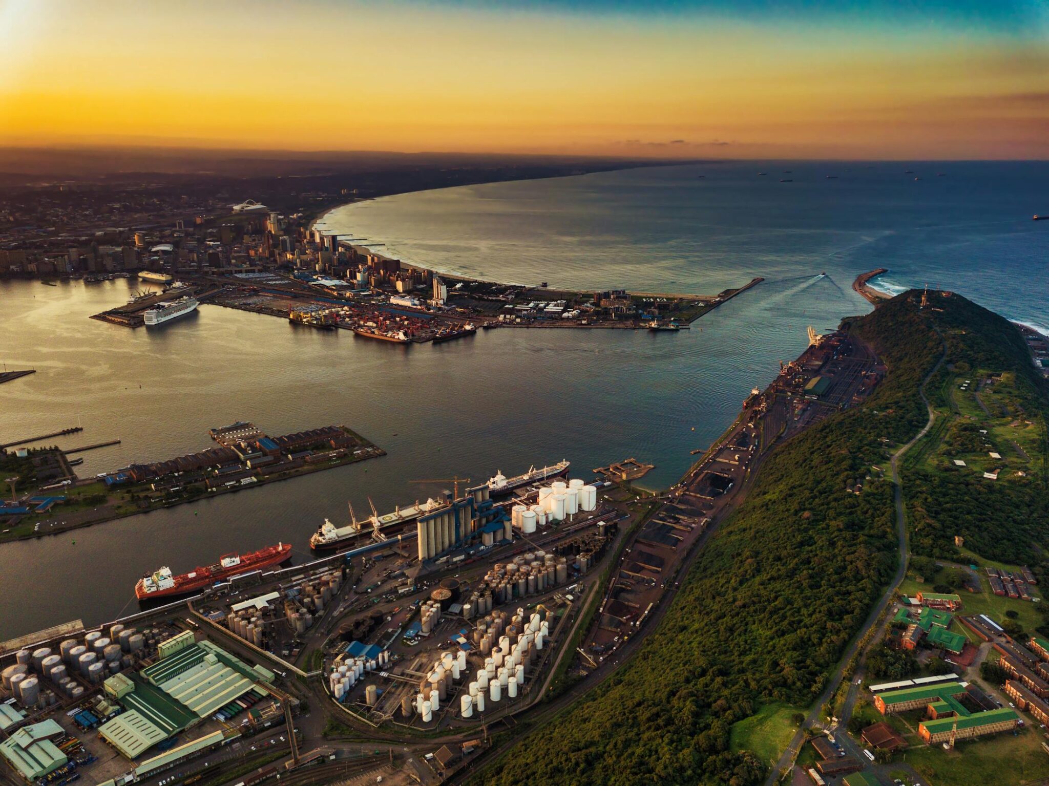
Durban
Durban is built around the Indian Ocean and a daily routine that mixes beachfront time with food. The main walk is the Golden Mile, a long seafront strip that links beaches, piers, and the promenade, and it works well early morning or late afternoon. For set activities, uShaka Marine World combines an aquarium with waterpark facilities, and Moses Mabhida Stadium offers a SkyCar ride and high-angle views across the city and coastline. Add the Durban Botanic Gardens for a slower stop near the center, then focus on the food culture in and around the CBD and markets such as Victoria Street Market. A practical tasting route is to try a classic bunny chow, then compare it with a more formal curry house meal, because Durban’s Indian-influenced cuisine is one of the city’s main reasons to stop.
As a base, Durban is efficient for short coastal moves and longer day trips if you start early. Umhlanga and its lighthouse area sit about 20 km north of the center and are often 25 to 45 minutes by road depending on traffic, while King Shaka International Airport is roughly 35 km from central Durban and commonly 30 to 45 minutes by car. For bigger excursions, iSimangaliso Wetland Park around St Lucia is roughly 230 km and often about 2.5 to 3.5 hours by road, and Hluhluwe-iMfolozi Park is commonly around 280 km and about 3 to 4 hours, making a very early start important if you want meaningful time in the park. The Drakensberg is usually a longer inland transfer rather than a quick outing, with many gateways around 200 to 250 km away and often 3 to 4.5 hours by road.
Best Natural Wonders Sites
Kruger National Park
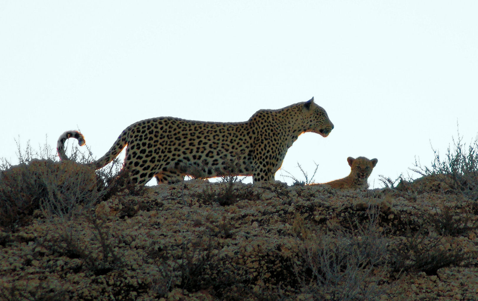
Kruger National Park covers about 19,500 km² and stretches roughly 360 km north to south, so it rewards a plan built around one region rather than trying to “do it all”. The main activity is game driving on a dense public road network, with a mix of paved and gravel routes, regular viewpoints, and picnic sites. Many visitors structure days around sunrise and late-afternoon drives, then use midday for short camp-area loops, hide and waterhole stops, and rest. You can self-drive at low speeds and stop often for tracks, birdlife, and river crossings, while guided drives add value for predator tracking and behavior context, especially around dawn and dusk. Typical “core” sightings are elephant, buffalo, zebra, giraffe, hippo, crocodile, and a long bird list, with lion and leopard more dependent on timing, patience, and location.
Access is straightforward from major hubs. Most international and domestic connections route via Johannesburg, then you either fly to Kruger Mpumalanga International (near Mbombela/Nelspruit) or to Skukuza Airport inside the park, or you drive, commonly around 4.5 to 6.5 hours from Johannesburg to the southern gates depending on route and traffic. Cape Town and Durban are usually best handled by a flight to the Kruger region, then a car pickup for gate and camp access.
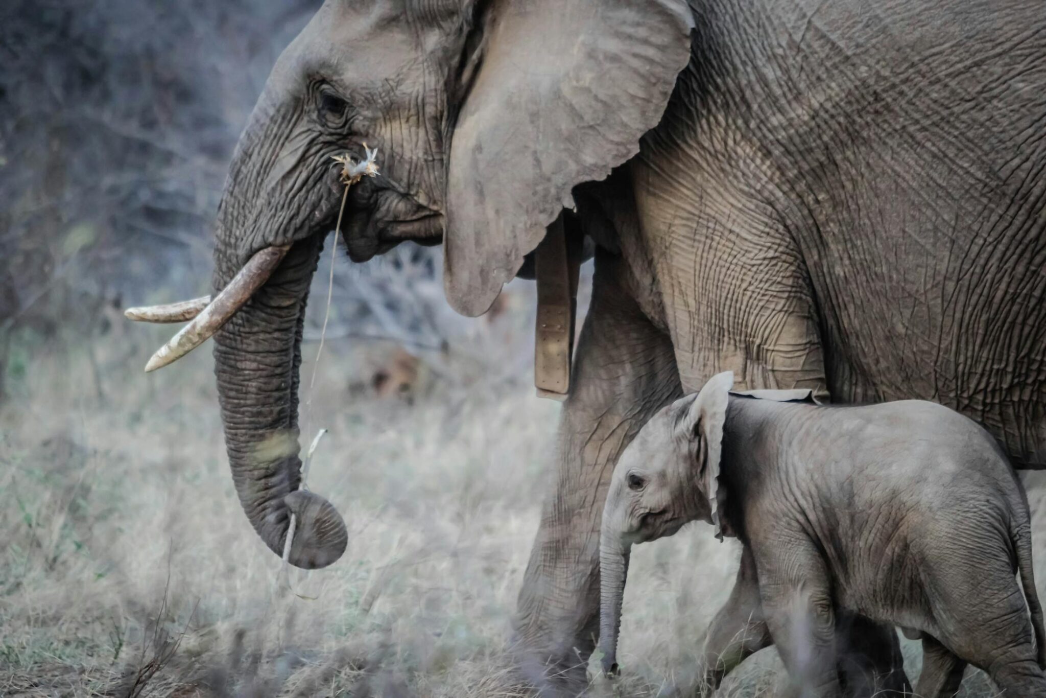
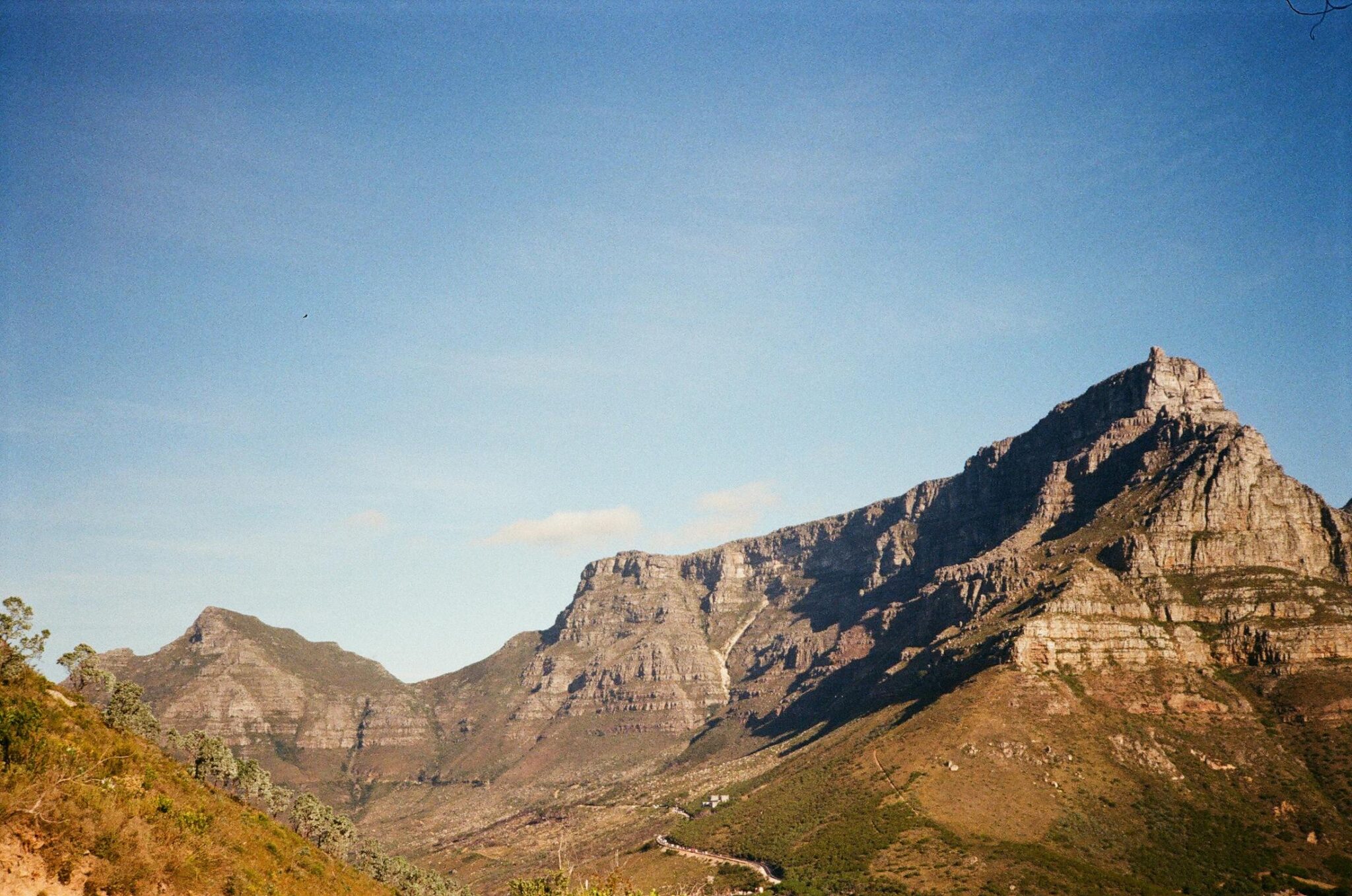
Table Mountain National Park
Table Mountain National Park links Cape Town’s main mountain skyline with most of the Cape Peninsula, so you can combine city stops with nature in the same day. The Table Mountain massif reaches about 1,085 m at Maclear’s Beacon, and the park’s best-known activities are short to medium hikes and viewpoint loops. Common routes include Platteklip Gorge for a direct ascent, Skeleton Gorge via Kirstenbosch for a shaded climb with ladders and steps, and easier contour paths such as the Pipe Track for steady views without a summit. The park also includes the Cape Point section, where you can walk to viewpoints near the lighthouse, add a longer coastal route toward the Cape of Good Hope sign, and include beaches like Diaz Beach if conditions and tides suit. On the False Bay side, Boulders near Simon’s Town is part of the park system and is one of the few places where you can see African penguins at close range on boardwalks.
Getting around is simple if you treat it as zones. Table Mountain cableway access and major trailheads are close to central Cape Town, often 10 to 25 minutes by road depending on traffic, and Kirstenbosch is commonly about 20 to 35 minutes from the city bowl. For the full-peninsula day, Cape Point is roughly 60 km from central Cape Town and usually 1.5 to 2.5 hours one way by car, so it works best with an early start and a loop that returns via Chapman’s Peak Drive or the False Bay coast. Boulders is roughly 40 km from central Cape Town and often 50 to 90 minutes by road; a public-transport option is taking the train line toward Simon’s Town, then a short taxi or rideshare to the entrance.
iSimangaliso Wetland Park
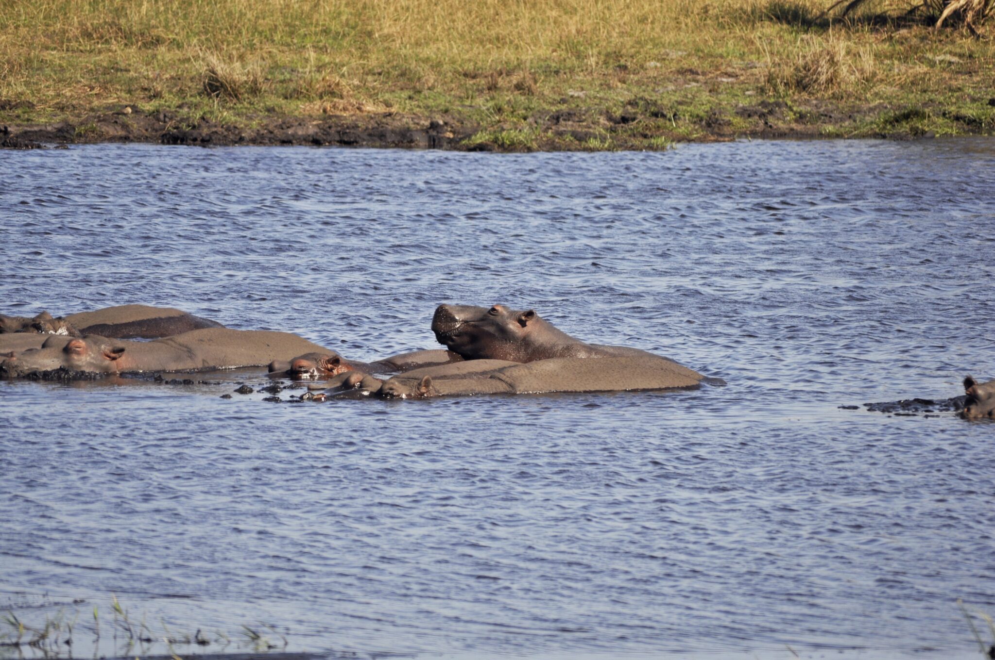
iSimangaliso Wetland Park is a UNESCO World Heritage Site (inscribed in 1999) that protects a long, connected system of habitats: Lake St Lucia and its estuary, freshwater lakes, swamp forest, and a coastal dune belt on the Indian Ocean. The park covers about 3,280 km² and extends for roughly 220 km along the coast, so the main “sight” is the landscape change as you move between sections rather than a single loop. From St Lucia you can take an estuary cruise to see hippos and crocodiles and to focus on birdlife (the area is known for high species diversity), then drive short internal routes for viewpoints, hides, and stops around the lake edges. On the coastal side, Cape Vidal is the classic day area for beach time plus short walks, and in season some beaches are used for turtle nesting, which is typically handled via guided night outings to limit impact.
Addo Elephant National Park
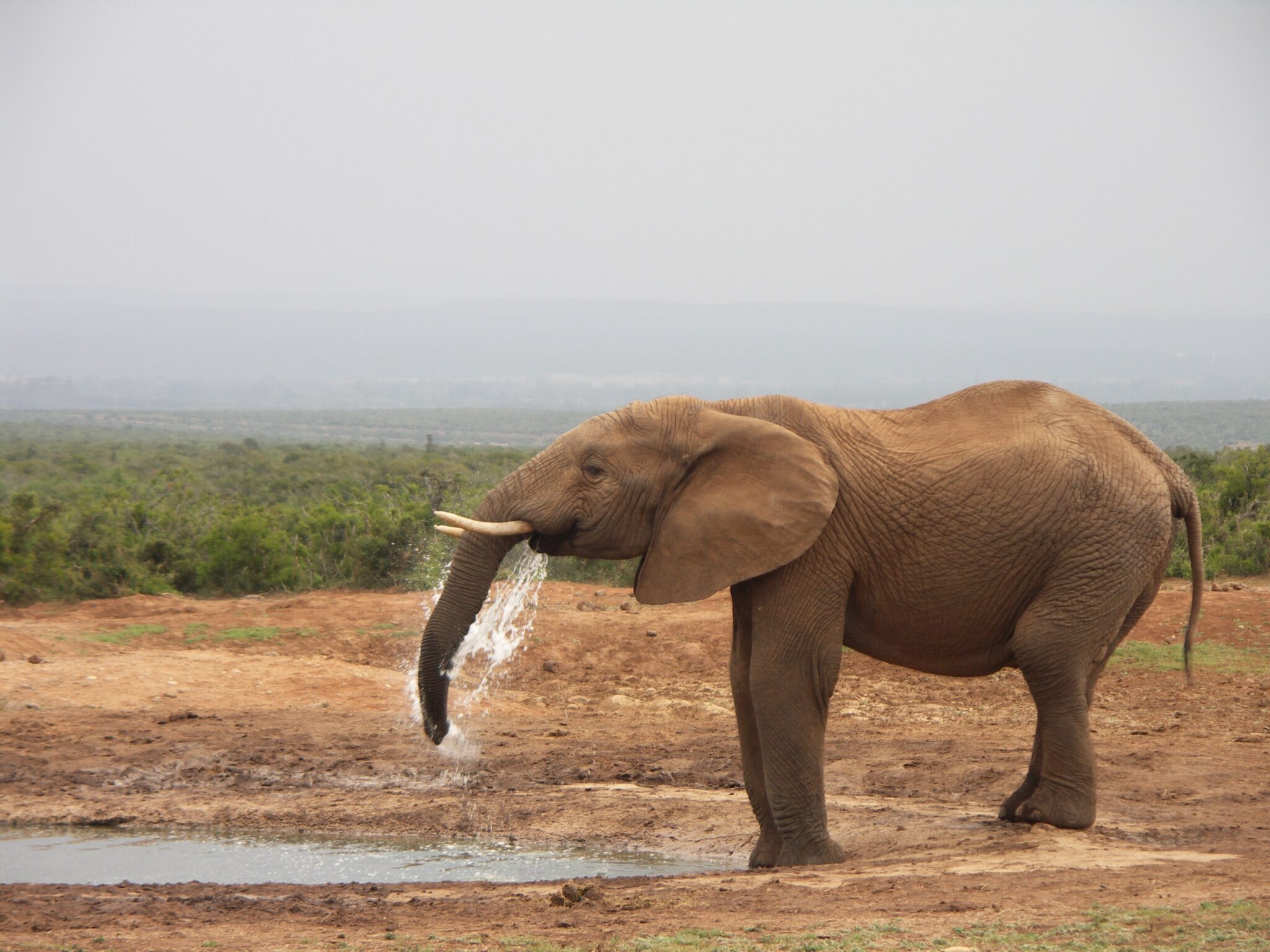
Addo Elephant National Park is a key safari stop in the Eastern Cape, created in 1931 and now covering roughly 1,640 km² across its wider protected areas. The main game-viewing section is known for high elephant density, and it also supports buffalo, black rhino, lion, zebra, warthog, and many antelope species, plus a strong bird list. The simplest way to experience Addo is self-drive on a network of tar and gravel roads with low speed limits, using waterholes as anchor points: stay 20 to 40 minutes at each, scan both the approach roads and the water’s edge, then move slowly to the next. If elephants are your priority, plan your loop so you revisit the same water points later in the day, because herds often cycle through more than once.
Addo is easy to reach from Gqeberha (Port Elizabeth), which is the closest major hub with an airport. The main camp area is about 70 km from central Gqeberha and is typically around 1 to 1.25 hours by road, while the southern Matyholweni entrance is closer at about 45 km and often 35 to 50 minutes, depending on traffic. From other nearby bases, it is commonly around 1.5 to 2.5 hours from Jeffreys Bay (roughly 140 to 160 km) and about 3.5 to 5 hours from Knysna or Plettenberg Bay on the Garden Route (often 300 to 370 km, depending on the exact start point).
The Best Places on the Coast
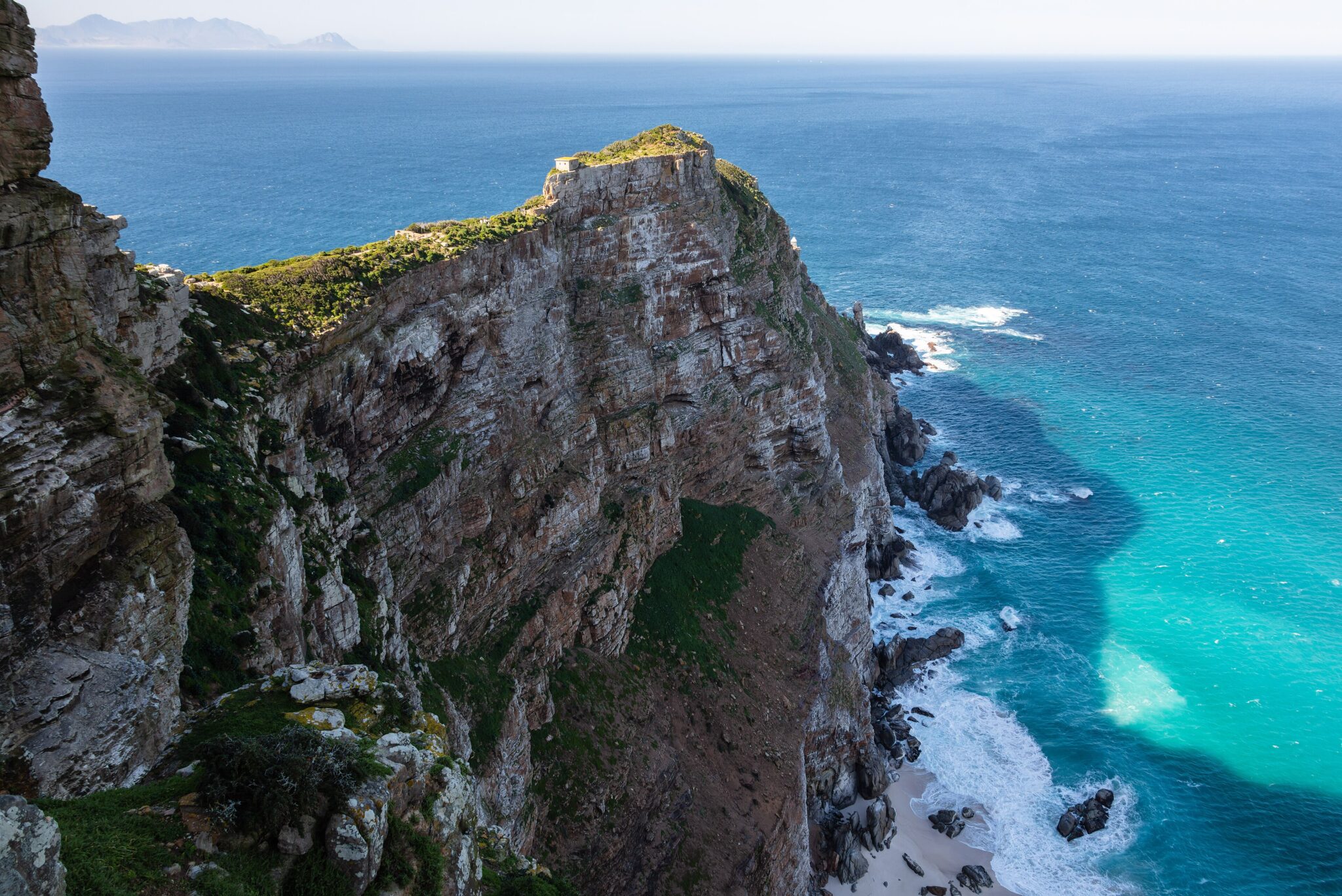
Cape Point
Cape Point sits in the southern section of Table Mountain National Park and is one of the Cape Peninsula’s main coastal viewpoints, with high cliffs, a narrow promontory, and long sightlines over both the Atlantic and False Bay sides. The standard visit combines the main viewpoint area near the lighthouse with short walks to adjacent lookouts, then one longer path to get away from the busiest points. A practical add-on is the walk toward the Cape of Good Hope sign and nearby viewpoints, which gives more open scenery and a better sense of the peninsula’s shape. Expect strong wind and fast weather shifts, plus wildlife such as baboons, so keep food secured and give animals space.
From central Cape Town, Cape Point is roughly 60 to 70 km and usually 1.5 to 2.5 hours by road one way, depending on traffic and the coastal route you choose. Many visitors do it as a loop: down via the Atlantic side through Hout Bay and Chapman’s Peak Drive for viewpoints, then back via the False Bay side through Simon’s Town and Kalk Bay for breaks and shorter transfers.
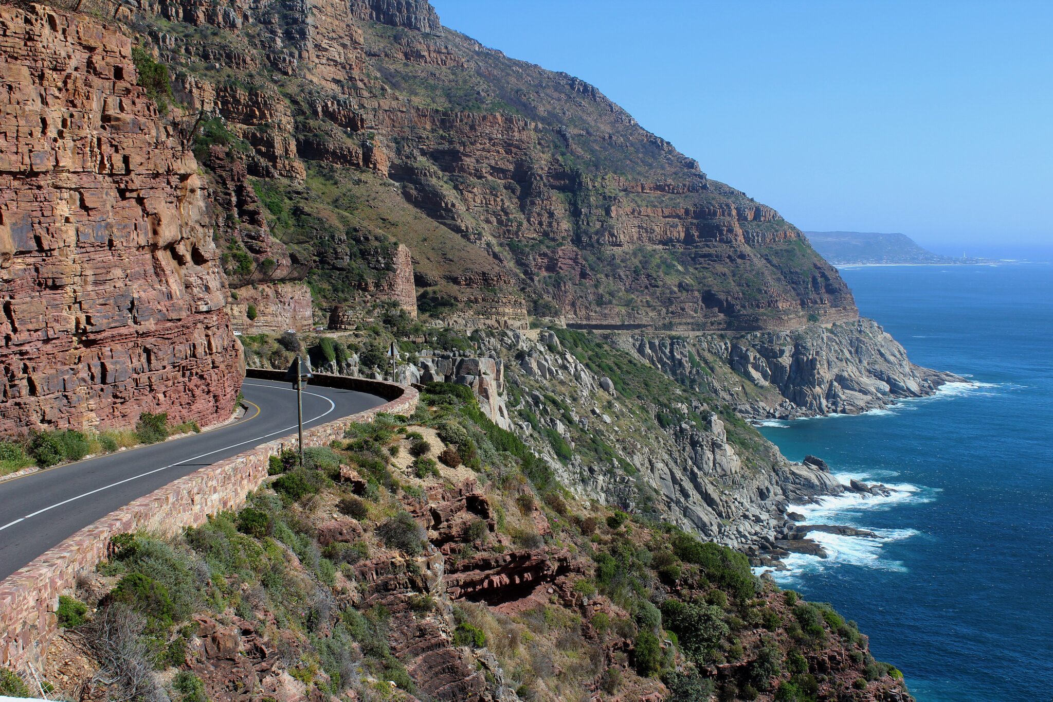
Chapman’s Peak Drive
Chapman’s Peak Drive is a short but high-impact coastal road carved into the cliffs between Hout Bay and Noordhoek, designed for slow driving with frequent stops rather than a quick transfer. The route is about 9 km long and includes multiple signed viewpoints and pull-offs where you can walk a few minutes for wider angles over the Atlantic, the rocky shoreline, and the sweep of the bay. It works well as a late-afternoon segment when the light drops across the water, but it is also useful earlier in the day as part of a peninsula loop because the viewpoints give immediate context for the Cape’s geography. If you want more than road scenery, pair it with a short hike nearby, such as a section of the trail network above Hout Bay or a beach walk at Noordhoek to add time on foot without committing to a long mountain route.
Access is simple from Cape Town: Hout Bay is roughly 20 to 25 km from the city center and often 30 to 50 minutes by road, and the drive itself then connects you toward Noordhoek and the south peninsula. If you are running a full Cape Peninsula day, a common flow is Cape Town to Hout Bay, Chapman’s Peak to Noordhoek, then continue toward Cape Point, and return via Simon’s Town and Muizenberg or Kalk Bay for an easier stop schedule.
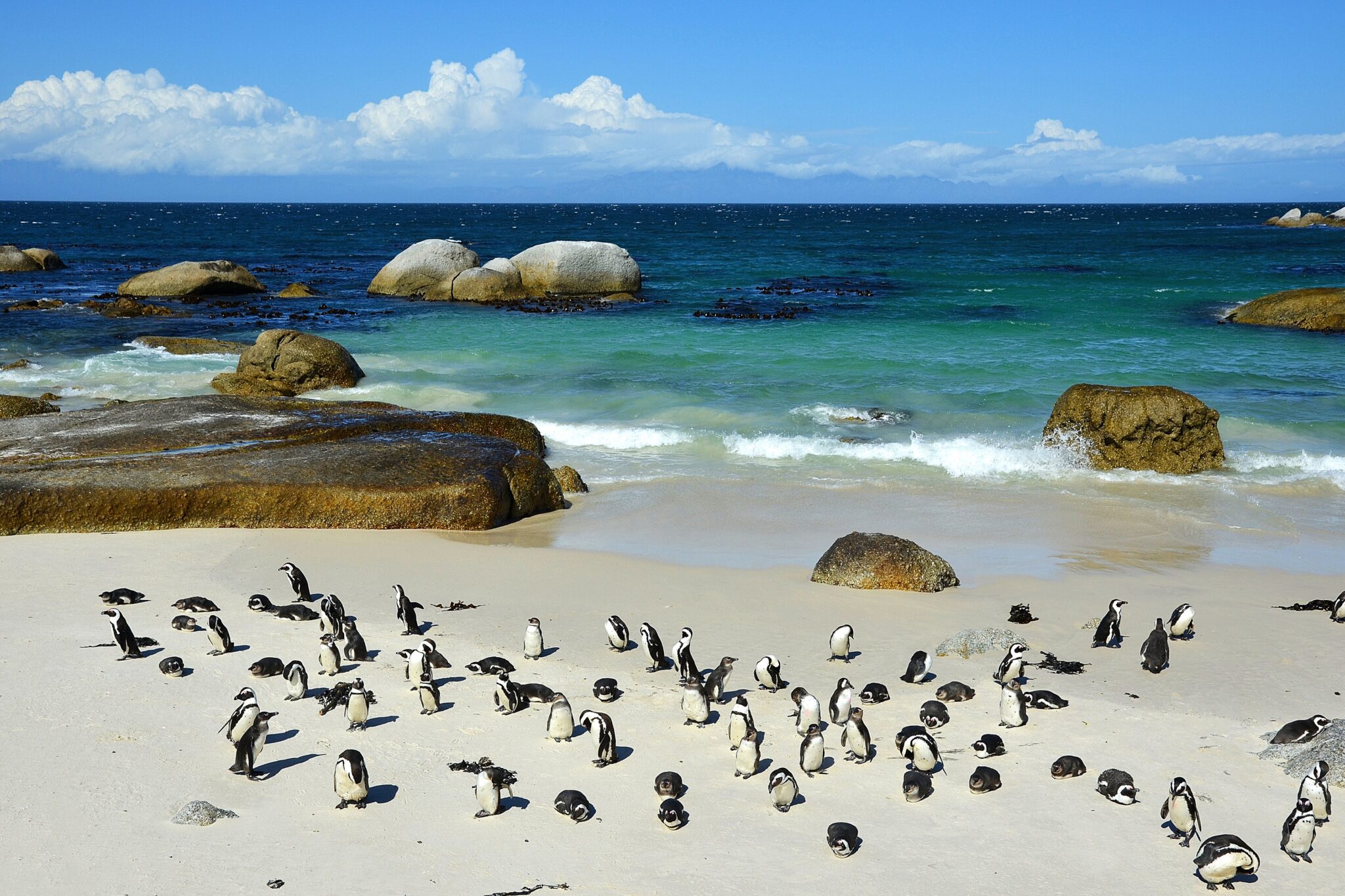
Boulders Beach
Boulders Beach, near Simon’s Town on the False Bay side of the Cape Peninsula, is one of the most reliable places to see African penguins on foot. The experience is split between a boardwalk viewing area where penguins move between vegetation and the shore, and sheltered coves where you can see them in the water and on the sand without needing a boat. Plan 45 to 90 minutes for the stop depending on crowd levels, and combine it with nearby Simon’s Town harbor for a short walk and an easy meal, or with a longer peninsula day that continues to Cape Point. The main impressions are proximity and routine: you see penguins at close range, hear the colony, and watch short cycles of feeding and returning from the sea.
Getting there is straightforward by road, and it fits naturally into common Cape Peninsula loops. From central Cape Town, Boulders is roughly 40 to 45 km and often 50 to 90 minutes by car depending on traffic, while from Muizenberg it is usually around 25 to 35 minutes and from Simon’s Town center about 5 to 10 minutes. Many visitors pair it with Kalk Bay for a coastal stop and then continue south, or do it on the return from Cape Point to break up the drive.
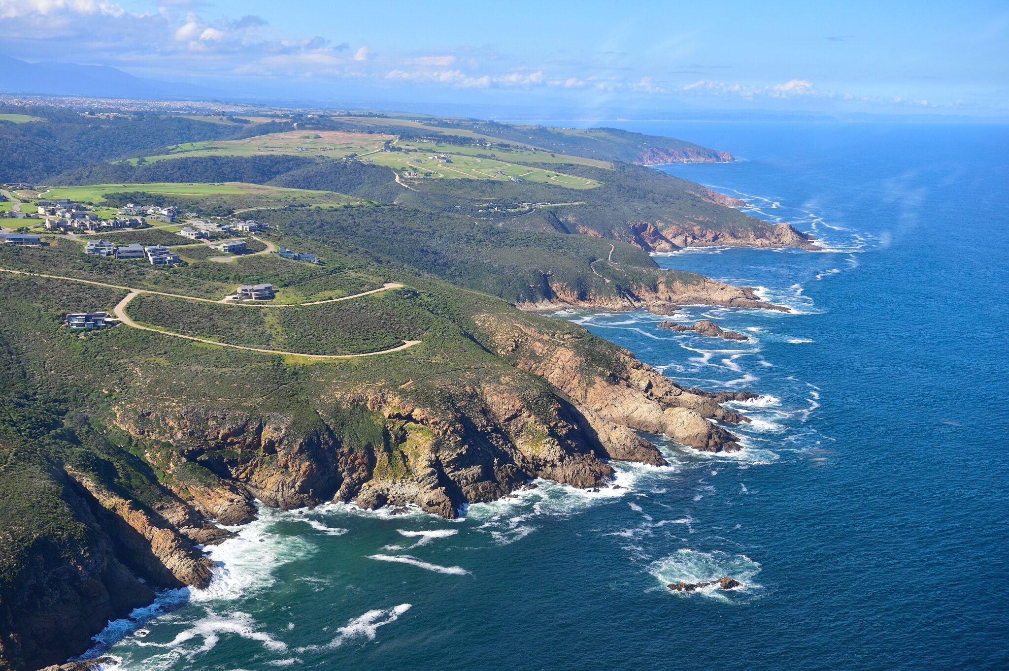
Garden Route and Tsitsikamma
The Garden Route is a self-drive corridor on South Africa’s southern coast, commonly planned between Mossel Bay and Storms River, roughly 200 to 300 km depending on where you start and finish. It works best as a sequence of short drives linking towns and nature stops rather than one continuous push. Typical bases are Wilderness, Knysna, and Plettenberg Bay: Wilderness for lagoon walks and paddling, Knysna for the lagoon waterfront and the Knysna Heads viewpoints at the narrow entrance to the estuary, and Plettenberg Bay for beaches and reserve hikes. A practical “do” list is a lagoon cruise or kayak session, one coastal viewpoint stop, and one on-foot loop each day, so you get time for short trails, forest sections, and coastal platforms without spending the whole day in the car.
Tsitsikamma is the high-value nature stop on the eastern end, centered on the Storms River Mouth area, where the suspension bridges and river-mouth viewpoints are the quick win, and short hikes add depth. Many visitors do a compact walk of about 2 km around the mouth and bridges, or choose a longer out-and-back coastal trail of roughly 6 km if conditions are calm; for multi-day hikers, the Otter Trail is about 42 km over 5 days and needs planning. Access is simple on the N2: Cape Town to Mossel Bay is about 390 km and often 4.5 to 5.5 hours by road, George to Knysna is about 55 km and roughly 45 to 70 minutes, Knysna to Storms River is about 170 km and usually 2 to 2.5 hours, and Storms River to Gqeberha is about 185 km and often 2 to 2.5 hours. If you want a better pace, plan 4 to 7 days with 2 or 3 bases, then keep each day to one main town area plus one park or trail focus.
Best Mountains and Inland Landscapes
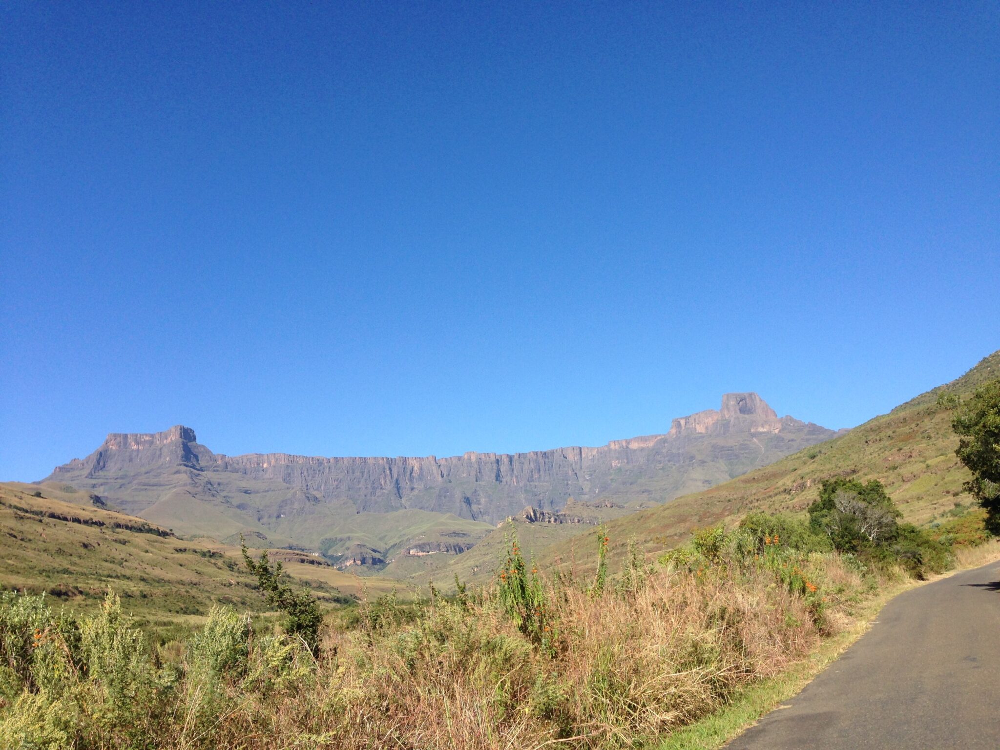
Drakensberg Amphitheatre (Royal Natal area)
The Drakensberg Amphitheatre in the Royal Natal area is a long cliff wall on the escarpment edge, often described as more than 5 km in length, with cliff faces rising roughly 1,000 m or more above the valleys. The best-known viewpoint targets the Tugela Falls system, which has a total drop commonly cited at 948 m across multiple tiers. Most visitors plan either a gorge-level hike for river scenery and rock walls, or an escarpment-level hike for the “top of the Amphitheatre” perspective. Expect altitude effects and fast temperature swings: trailheads can be around 1,400–1,600 m in Royal Natal, while escarpment routes approach 3,000 m, so even on clear days it can feel cold and windy on exposed sections.
For a full-day hike from Royal Natal, the Tugela Gorge trail is typically planned as about 14 km return, often 5–7 hours depending on water levels and pace, with several stream crossings and a final gorge section where footing can be slow after rain. For the classic Amphitheatre rim viewpoint, many hikers use the Sentinel route via the Witsieshoek area, starting from the Sentinel car park and climbing roughly 500–600 m in elevation; the usual out-and-back is often around 12–14 km, with chain ladders on the steeper section and a higher exposure factor, so it is not ideal in strong wind or storms.
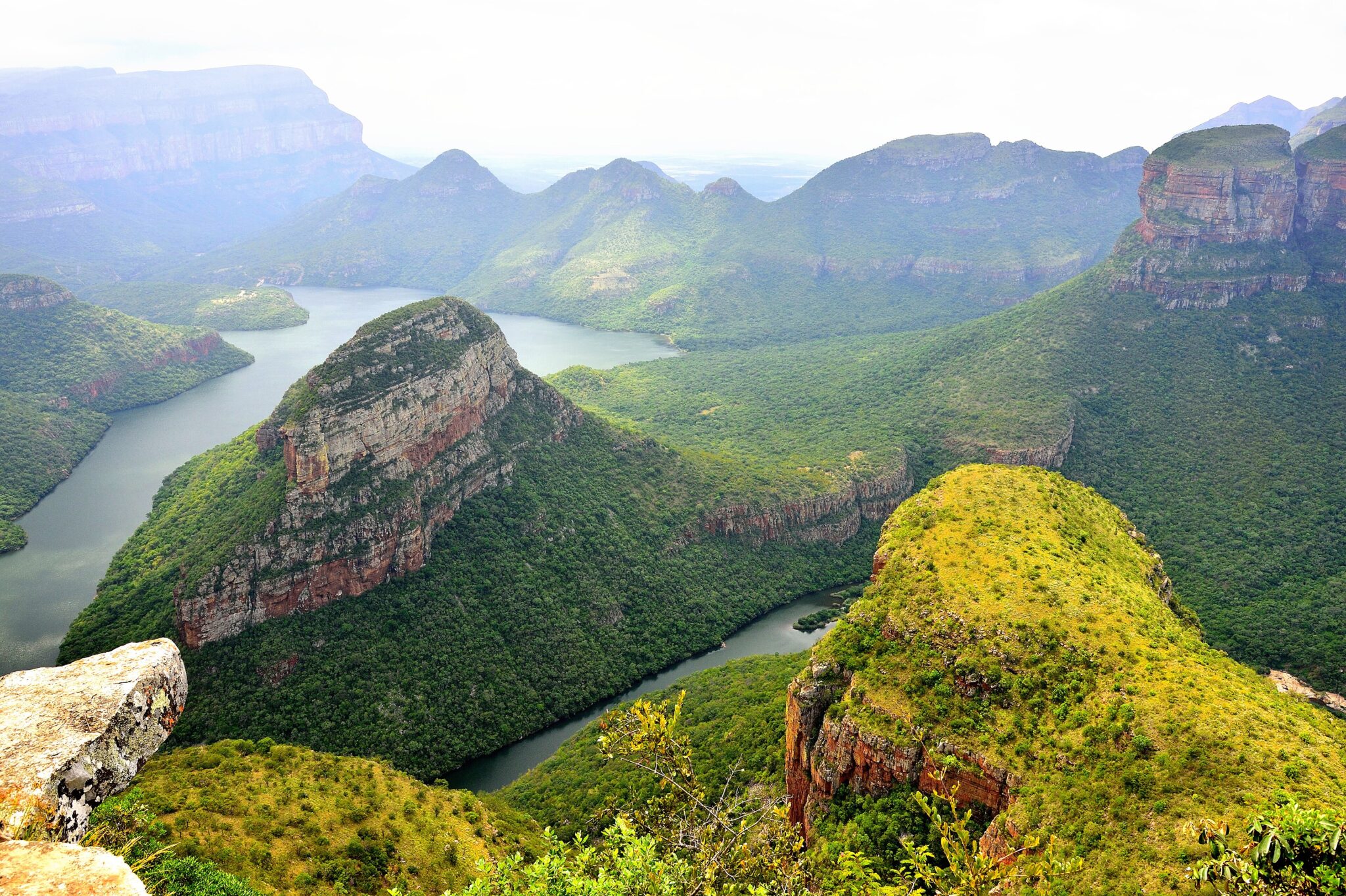
Blyde River Canyon
Blyde River Canyon is one of the key scenic areas on South Africa’s Mpumalanga escarpment, often visited as part of the Panorama Route when traveling to or from Kruger. The canyon is commonly described as around 26 km long and in places close to 800 m deep, so the main experience is altitude and scale from road-accessible viewpoints rather than long hiking days. The classic stops are God’s Window for a wide escarpment drop, Bourke’s Luck Potholes for rounded rock formations carved by river flow at the confluence, and the Three Rondavels viewpoint for a clear look across the canyon toward the distinctive “hut-shaped” peaks. If you want one on-foot segment without committing to a full trail day, add a short walk at one viewpoint area or a quick loop near Bourke’s Luck to slow the pace and avoid turning the day into constant parking and driving.
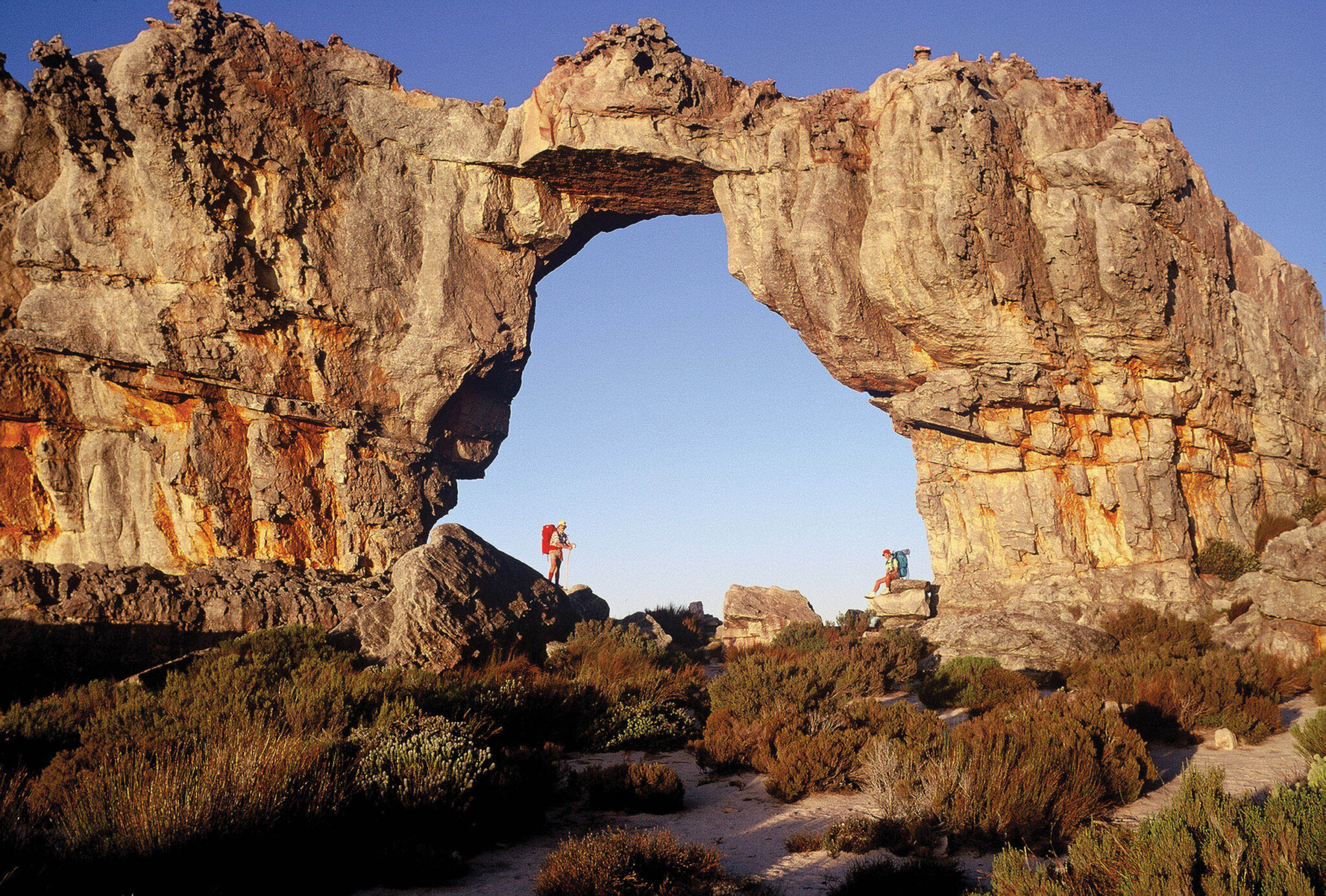
Cederberg
The Cederberg is a rugged mountain region in the Western Cape, known for long hiking days, sandstone formations, and a sparse settlement pattern that keeps the pace slow. The main experiences are on-foot: short walks to rock formations and longer routes to high ridgelines and natural pools, with well-known stops such as Wolfberg Cracks and the Wolfberg Arch for a half-day hike, and Malta Falls for a seasonal waterfall walk in the wetter months. Rock art sites are another key reason to visit, with guided access in some areas and strict rules around touching or photographing in certain places. Nights are a major part of the appeal because light pollution is low in much of the region, so camps and farm stays often become “stargazing bases” rather than places you only sleep between drives.
Best Cultural and Historical Sites
Robben Island
Robben Island is a key heritage site off Cape Town, most closely associated with the political imprisonment of Nelson Mandela and many other anti-apartheid activists. The visit is structured and time-based: you travel by ferry, then join a guided tour that typically combines a bus loop around the island with a focused stop at the former prison complex. The core value is context rather than scenery, and it works best if you treat it as the main activity of the day and avoid stacking too many other headline stops around it. Many visitors find the experience more grounded if they spend time afterward in the city center or Waterfront area rather than rushing straight into another tour.
Access is by ferry from the V&A Waterfront, and the day hinges on sea conditions. The crossing is relatively short, but wind and swell can disrupt schedules or reduce departures, so planning a buffer is practical. From most central Cape Town hotels to the Waterfront is usually a 5 to 15 km transfer, often 10 to 30 minutes by road depending on traffic, which makes an early check-in straightforward if you stay in the City Bowl, De Waterkant, or Green Point. A good routine is to arrive early, keep your schedule flexible for the return time, and plan a low-effort activity afterward, such as a waterfront walk or a museum visit, so the day still works if timings shift.
Apartheid Museum (Johannesburg)
The Apartheid Museum in Johannesburg is one of the most direct ways to understand South Africa’s 20th-century political system and how it shaped daily life. The visit is structured as a chronological walk through policy, resistance, state violence, and transition, using photographs, film, documents, and large-scale installations rather than “quick highlight” displays. Many visitors spend about 2 to 4 hours inside, depending on how much time they give to video sections and themed galleries, and it tends to land better when you move at a steady pace and take breaks instead of trying to cover every panel quickly. If you want to build context, pairing it with Constitution Hill on a different day creates a clearer link between past detention systems and the modern constitutional framework. Logistics are straightforward, but timing matters because the museum experience is dense. It is located in the south of Johannesburg near major arterials, and travel time is usually about 15 to 30 minutes from central areas like Rosebank or Sandton in light traffic, and 25 to 45 minutes in heavier periods.
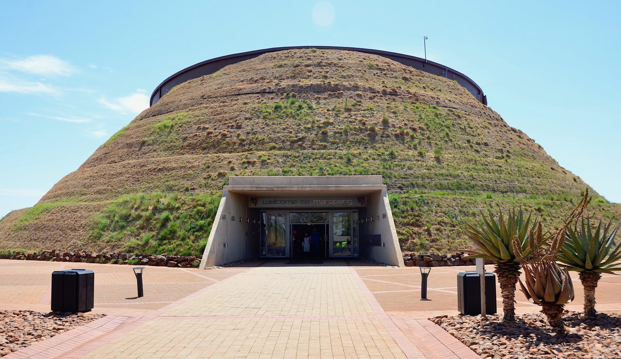
Cradle of Humankind
The Cradle of Humankind is a UNESCO-listed paleoanthropological landscape northwest of Johannesburg, known for fossil-bearing cave systems and research that shaped modern understanding of early hominins. The typical visitor focus is the main interpretation center and one cave-based experience, where exhibits explain how fossils are dated, how excavation works, and why the area matters in the wider story of human evolution. Plan 3 to 5 hours on site to move through the museum sections at a normal pace and allow for a guided component, rather than treating it as a quick stop. If you want one extra activity nearby, choose either a second, short nature walk or a single additional museum-style stop, but avoid stacking many small attractions because the value here comes from time spent with the material.
From Johannesburg, the Cradle area is usually about 45 to 60 km from Sandton or Rosebank and commonly 45 to 90 minutes by road depending on traffic and the exact site you are visiting. From Pretoria, it is often about 70 to 100 km and typically 1 to 1.75 hours by car. The easiest way to do it is self-drive or a pre-booked day tour, since public transport coverage is limited once you leave the metro areas. Start earlier in the day to avoid compressed timing, keep water and sun protection on hand for time outdoors, and plan one relaxed stop afterward back in the city rather than trying to combine the Cradle with multiple major Johannesburg attractions in the same afternoon.
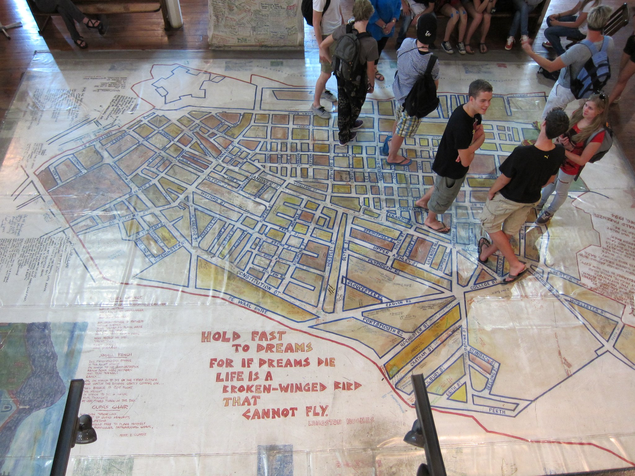
District Six Museum (Cape Town)
District Six Museum in central Cape Town focuses on the forced removals that reshaped the city under apartheid-era policies, using maps, photographs, recorded testimonies, and community-curated displays to connect individual family stories to urban planning decisions. Plan about 1 to 2 hours inside, longer if you read closely and spend time with the floor map and neighborhood street references, which help you understand how the area was laid out before demolition. It works well as a counterpoint to Cape Town’s viewpoint-heavy itinerary, because it shifts the day from scenery to lived history and makes later walks through the city feel more grounded. Logistically, it is easy to combine with nearby areas on foot. From the City Bowl and Gardens neighborhood it is typically a 10 to 25 minute walk, and from the V&A Waterfront it is usually about 4 to 6 km, often 10 to 20 minutes by car depending on traffic.
Hidden Gems of South Africa
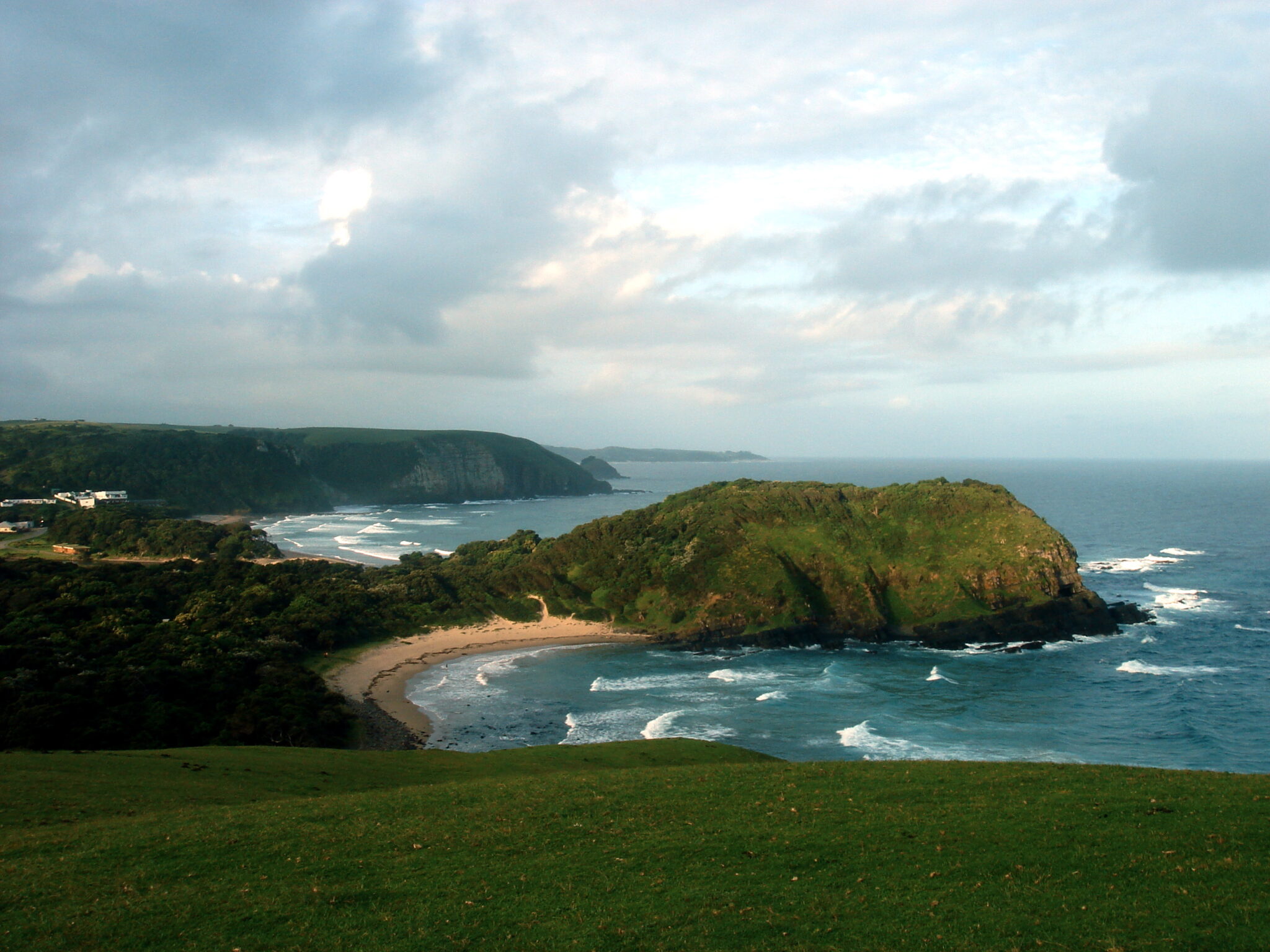
Wild Coast
The Wild Coast is a long stretch of Eastern Cape coastline where the main draw is the landscape and daily rhythm rather than a checklist of attractions: long beaches, river mouths, green hills, and headlands backed by Xhosa villages. Coffee Bay is a common base for short coastal walks and viewpoint stops, and the Hole in the Wall area near Coffee Bay is the signature formation, reached by a hike that many travelers do as a half-day outing with time to stop at cliffs, streams, and smaller coves along the way. The impressions are simple and consistent: big surf sound, empty shoreline sections, cattle on the hills, and night skies with limited light pollution. If you want another high-impact stop, the Dwesa-Cwebe area and parts of the coast around Port St Johns add more river scenery and cliff-top walking, but they work best when you commit to staying put rather than “passing through.”
Travel planning matters more here than on the Garden Route because road quality and weather can change the day. A practical approach is to base yourself in one place, then do walking routes out and back, keeping driving to the minimum. Mthatha is the main regional hub for supplies, and Coffee Bay is typically about 80 to 100 km away, often 1.5 to 2.5 hours by road depending on conditions.
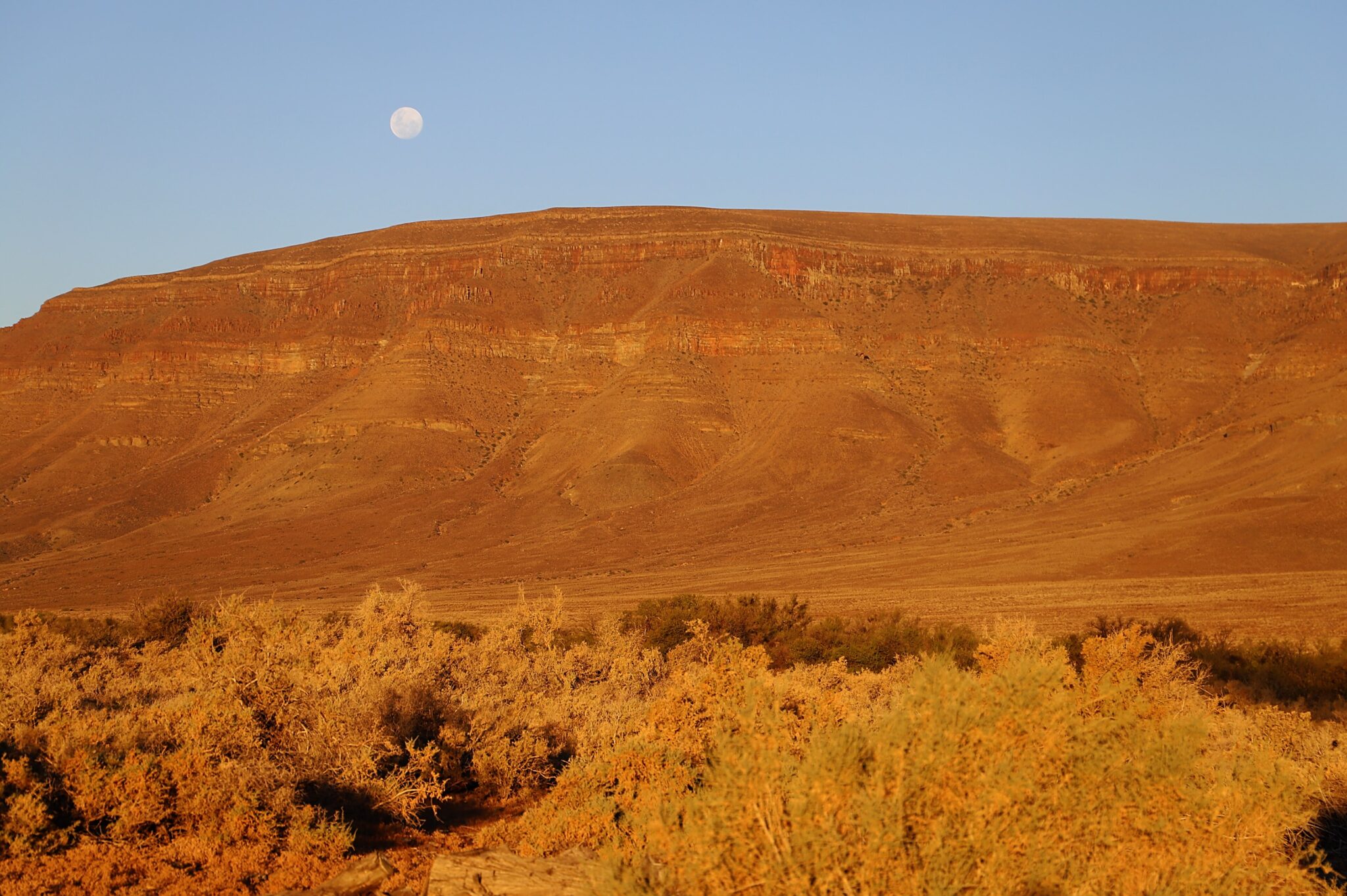
Tankwa Karoo National Park
Tankwa Karoo National Park is a remote semi-desert reserve focused on space, light, and quiet rather than high wildlife density. It covers roughly 1,400 km² of open plains framed by escarpment edges, and the core activity is slow driving on gravel roads with frequent stops for horizon views, dry riverbeds, and shifting textures in the rock and saltbush. Wildlife is present but tends to be low-key: you may see antelope adapted to arid areas, smaller mammals, and a strong mix of birds of prey and ground birds, but the main “reward” is the landscape itself. Tankwa is also known for night skies with very little light pollution, which makes it a high-value stop for astrophotography and long, still evenings outside.
Access is usually by car from Cape Town via the interior, commonly about 300 to 350 km and around 4.5 to 6 hours depending on route choice and road conditions, with the last major fuel and supply points before the park in towns like Ceres or Calvinia. Driving inside the park is slower than distances suggest because corrugations and loose gravel reduce average speeds, so a good plan is one main scenic drive plus one short walk rather than trying to cover every track.
Kgalagadi Transfrontier Park (South African side)
Kgalagadi Transfrontier Park on the South African side delivers a desert-safari rhythm built around long riverbeds, dunes, and wide horizons rather than dense bush. The main driving routes follow the usually dry Nossob and Auob river valleys, where animals concentrate around shade, sparse vegetation, and water points, which is why predator sightings can be strong compared with many greener parks. Expect a different style of viewing: you scan far ahead on open tracks, stop for long periods at waterholes, and work the same sections repeatedly to pick up movement. Typical highlights include lion adapted to arid conditions, cheetah and leopard sightings that often rely on patience, and frequent raptor activity, with late afternoon and early morning giving the clearest patterns of movement.
Access is more remote than Kruger, so planning is part of the experience. Most visitors enter via the Twee Rivieren gate, which is the logistical hub for permits and supplies, then base in camps such as Nossob or Mata-Mata to reduce daily driving distances. From Upington, a common gateway with flights, Twee Rivieren is roughly 250 to 280 km and usually about 3 to 4 hours by road depending on conditions and stops; from Kimberley it is often around 500 to 600 km and about 6 to 8 hours. Inside the park, distances between camps are large and average speeds are low on gravel, so longer stays work better than “one-night” plans: with 3 to 5 nights you can repeat the same prime sections at sunrise and late afternoon, learn which water points are active, and avoid turning the visit into constant transit.
Mapungubwe National Park
Mapungubwe National Park is a quieter northern safari option that blends riverine scenery with one of South Africa’s most important heritage landscapes. It sits near the confluence region of the Limpopo and Shashe systems and is linked to the Mapungubwe kingdom, a major Iron Age state that connected inland southern Africa to long-distance trade networks. The visit works best when you mix one history-focused stop with one landscape-focused stop: spend time in the interpretation areas and heritage displays to understand the site’s significance, then drive a loop for riverine habitats, sandstone outcrops, and viewpoints. The signature “impression” here is contrast, from baobab country and open woodland to elevated lookouts that read as geology first and safari second.
Travel Tips for South Africa
Safety and General Advice
South Africa is one of Africa’s most visited and diverse destinations, offering everything from world-class cities to wildlife-rich parks and scenic coastlines. While the country is welcoming and well-equipped for tourism, safety awareness is important, particularly in urban areas. Travelers should avoid isolated neighborhoods at night, keep valuables out of sight, and use reputable transport services. Careful route planning and local advice can make travel both safe and comfortable.
A yellow fever vaccination may be required depending on your travel route, particularly if arriving from an endemic country. Malaria risk exists in parts of the northeast, including some areas of the Kruger National Park, so seek medical advice before your trip. Tap water is generally safe to drink in major cities and tourist regions, but bottled water is advisable in rural or remote areas. Travelers should also bring insect repellent, sunscreen, and any prescribed medication, as sun exposure and long drives are common during outdoor activities.
Car Rental and Driving
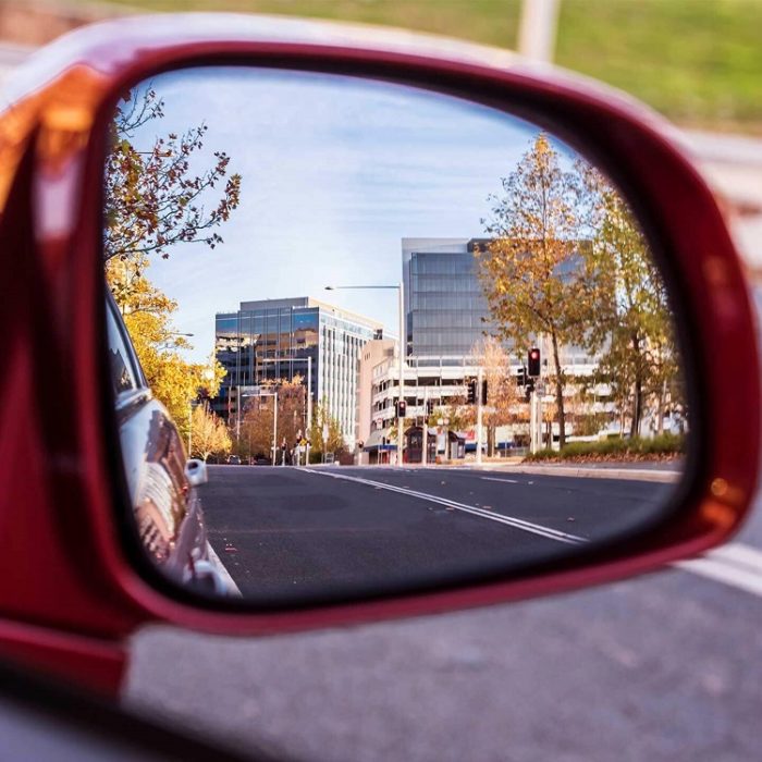
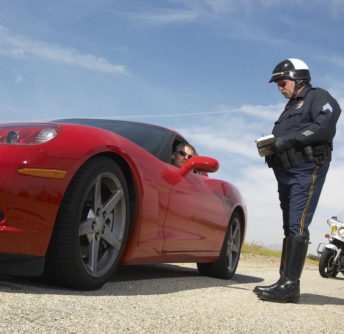
An International Driving Permit is recommended alongside your national driver’s license, and both should be carried when renting vehicles or passing road checks. Road signage is clear, and driving standards are good by regional comparison, making South Africa ideal for confident, cautious drivers. Driving in South Africa is on the left-hand side of the road. Highways and major roads are generally well-maintained, but rural routes can vary in condition. Night driving outside cities is not advised due to the presence of wildlife and reduced visibility. A 4×4 vehicle may be useful for off-road adventures or visits to less-developed areas. Always keep vehicle doors locked and windows closed when stopped at intersections in cities.
Published January 25, 2026 • 25m to read