Niger is a vast country in West Africa shaped by desert landscapes, historic trade routes, and long-standing nomadic traditions. Much of its territory lies within the Sahara, where caravan cities once played a key role in trans-Saharan trade linking West and North Africa. This history is still visible in old settlements, desert tracks, and cultural practices passed down through generations.
The country’s geography includes wide desert plains, rocky massifs such as the Aïr Mountains, and riverlands along the Niger River that support agriculture and urban life. Niger is home to diverse communities, including Tuareg, Hausa, and Zarma-Songhai peoples, each with distinct customs, music, and craftsmanship. Travel requires careful planning and awareness of conditions, but Niger offers a rare opportunity to understand desert cultures, deep history, and landscapes that remain largely unchanged.
Best Cities in Niger
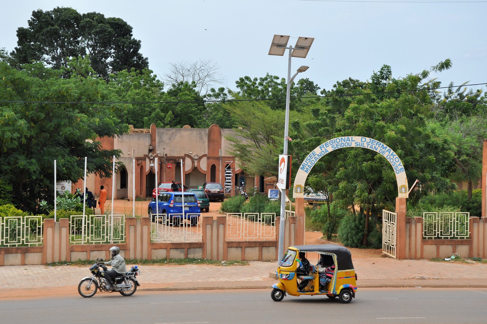
Niamey
Niamey lies along the Niger River and serves as Niger’s political and cultural center. The city’s layout is relatively open, with administrative districts, riverfront neighborhoods, and markets connected by broad roads. The National Museum of Niger is one of the most wide-ranging museums in West Africa; its exhibits include traditional dwellings, ethnographic collections, archaeological material, and on-site artisan workshops where metalworkers, leatherworkers, and potters demonstrate their craft. The Grand Mosque is another important landmark, and its minaret offers views over the surrounding districts when open to visitors. The Grand Market provides a direct look at urban commerce, with traders selling clothing, spices, tools, and everyday goods from across the country.
The Niger River shapes much of Niamey’s daily rhythm. Paths along the riverbank allow for evening walks and observation of fishing activity, irrigation systems, and boat transport to nearby islands used for farming. Some visitors arrange short boat trips to see how agriculture and river life operate just beyond the urban core.

Agadez
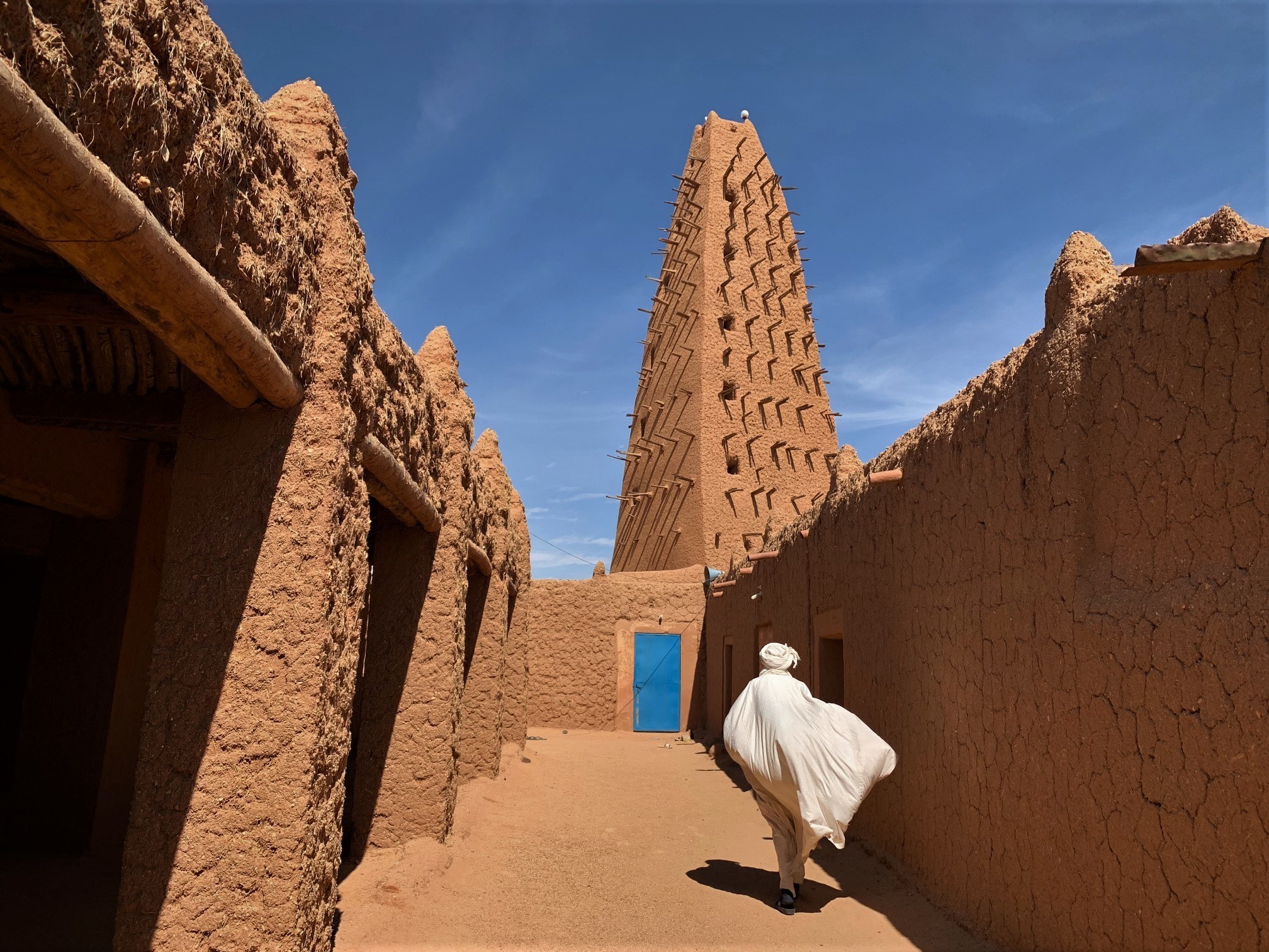
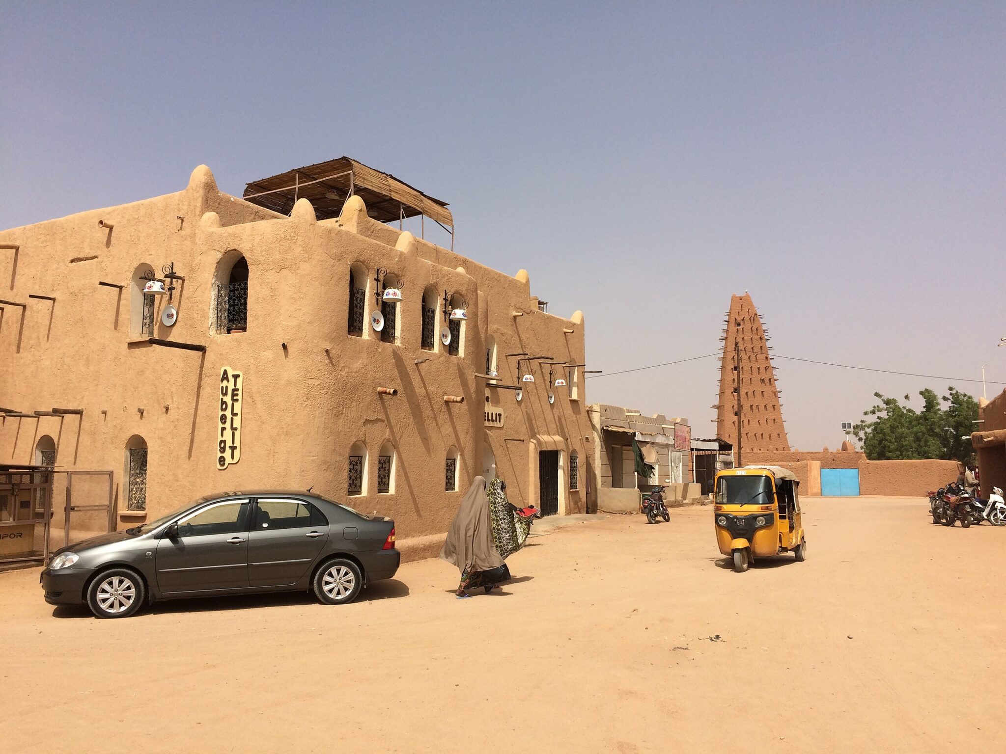
Agadez is the main urban center of northern Niger and historically served as a crossroads for trans-Saharan caravans linking West Africa with Libya and Algeria. The city’s Historic Centre, a UNESCO World Heritage Site, is built from earthen materials and follows an urban layout that reflects centuries of trade, craft production, and Islamic scholarship. The Great Mosque of Agadez, with its tall tapered minaret made of mud-brick and wooden beams, is the city’s most prominent landmark and remains an active place of worship.
Agadez is also a major center of Tuareg culture. Silversmiths, leatherworkers, and blacksmiths maintain long-standing craft traditions in small workshops across the old city. Markets sell jewelry, tools, clothing, and everyday goods produced for both local use and regional trade. The city functions as the primary logistical base for travel into the surrounding desert, including expeditions to the Aïr Mountains, remote oases, and former caravan routes. Transport, guides, and supplies for these journeys are typically arranged in Agadez due to its infrastructure and experienced local operators.
Zinder
Zinder, located in southeastern Niger, was the capital of the Damagaram Sultanate before the colonial era and remains one of the country’s most historically significant cities. The old royal compound, including the Sultan’s Palace, provides insight into pre-colonial political structures, architectural design, and the administrative layout that supported the sultanate’s authority. Nearby mosques and public squares help illustrate how religious and civic life were organized around the palace.
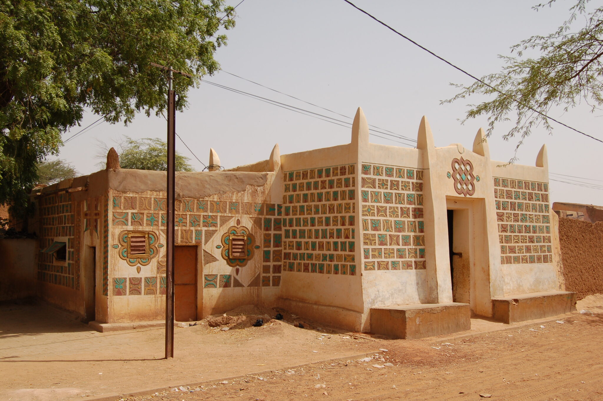
The Birni district – the historic core of Zinder – is made up of narrow streets lined with mud-brick houses, craft workshops, and small trading stalls. In this area, visitors can observe leatherworkers, metalworkers, tailors, and traders whose practices reflect long-standing Hausa cultural traditions. The markets offer a clear view of regional exchange, with goods arriving from rural villages and cross-border trade routes. Zinder is reached by road or domestic flights from Niamey.
Dosso
Dosso is an important cultural center in southwestern Niger and the heartland of the Zarma people. The town has long been associated with one of the country’s most influential traditional chieftaincies, whose authority and ceremonial functions continue to play a role in regional governance. The Dosso Regional Museum provides an overview of local kingdoms, political structures, and ritual practices, with exhibits covering royal regalia, musical instruments, household items, and archival photographs. Visiting the museum helps explain how the Zarma chieftaincy developed and how it interacts with modern administrative systems.
The town regularly hosts traditional gatherings, processions, and community meetings, especially during major events linked to the chief’s court. These occasions highlight continuity between past and present, showing how cultural protocols remain active in public life. Dosso is situated along major road routes between Niamey and the country’s southern and eastern regions, making it a practical stop for travelers moving toward Zinder, Maradi, or the border with Benin.
Best Historical and Archaeological Sites
Historic Centre of Agadez
The Historic Centre of Agadez illustrates how a desert city adapted its architecture and urban planning to the demands of life along trans-Saharan caravan routes. The old town is built almost entirely from earthen bricks reinforced with timber, a construction method suited to extreme heat, limited rainfall, and frequent sand-bearing winds. Homes, mosques, and market buildings follow narrow street patterns that reduce sun exposure and help guide movement through the city, showing how practicality shaped the overall layout. The Great Mosque and its tall mud-brick minaret dominate the skyline and remain central to community life.
Many structures in the old city continue to serve their original residential or commercial functions, making Agadez a living example of Sahelian urban heritage. Workshops operated by silversmiths, leatherworkers, and carpenters provide insight into local craft traditions tied historically to caravan trade. Visitors typically explore the old centre on foot with local guides who explain how neighborhoods developed around clan networks, trade activities, and water sources.
Zinder Sultanate Complex
The Sultanate Complex in Zinder is one of the most important examples of Hausa royal architecture in Niger. The palace compound includes courtyards, reception halls, administrative rooms, and residential areas arranged according to long-standing principles of Hausa political organization. Built with mud-brick and decorated with geometric motifs, the structures illustrate how architectural choices supported governance, social hierarchy, and ceremonial life. Several areas of the complex remain in active use, allowing visitors to see how traditional authority continues to function alongside modern administrative systems.
Guided visits provide context on the role of the sultan in regional leadership, dispute mediation, and Islamic scholarship. Explanations often cover the historical relationship between the palace, nearby mosques, and the Birni quarter, where craftsmen and traders worked under royal patronage. Because the complex is part of a living institution, access follows established protocols and includes designated routes through public sections of the palace.
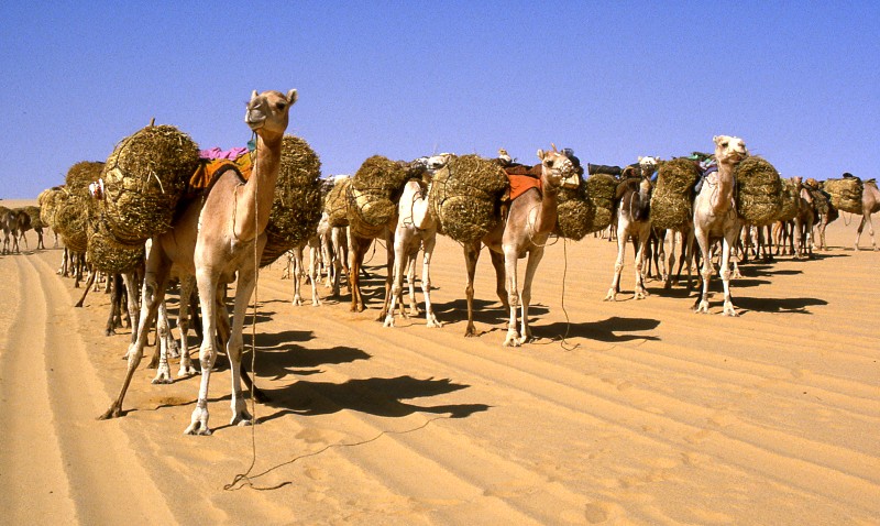
Ancient Caravan Routes
Ancient caravan routes once crossed the length of Niger, linking the Niger River basin with North Africa, the Mediterranean, and the wider Sahara. These paths carried salt, gold, leather goods, textiles, and agricultural products, while returning with manufactured items, books, and religious scholarship. Towns such as Agadez, Zinder, and Bilma grew around wells, trading posts, and rest points, forming nodes that supported both long-distance caravans and local pastoral communities. The movement of goods along these routes helped shape linguistic exchange, craft traditions, and the spread of Islamic learning across the region.
Although modern transport has replaced camel caravans, many elements of the historical network remain visible. Old wells, caravan staging grounds, and trade compounds still exist in desert-edge towns, and oral histories record how families organized caravans, managed resources, and navigated across long stretches of desert. Travellers exploring Niger’s historic centers can trace these influences through architecture, local markets, and craft production.
Best Natural Wonders in Niger
Aïr Mountains
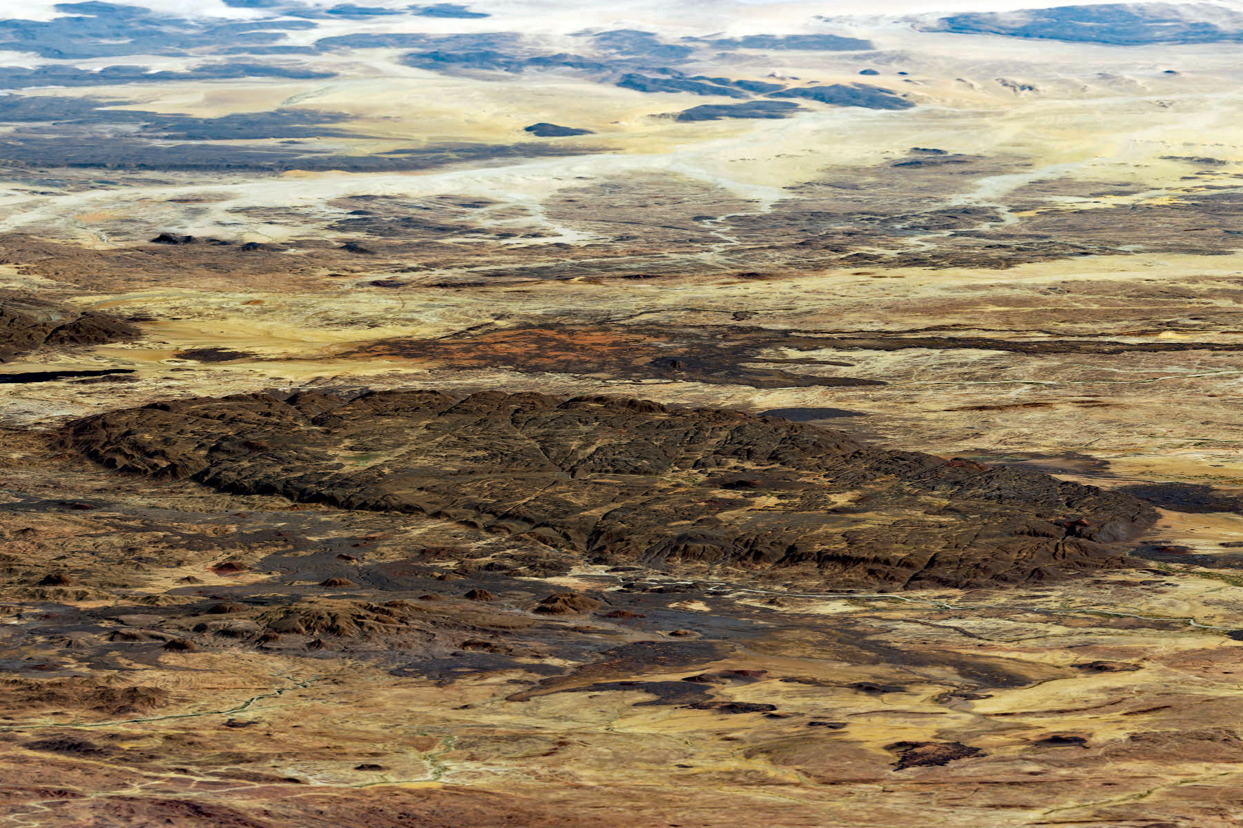
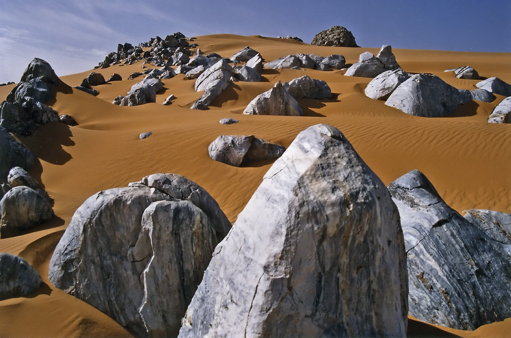
The Aïr Mountains form a highland massif in northern Niger, rising from the surrounding Sahara with granite peaks, volcanic ridges, and canyons that hold seasonal water sources. These highlands create pockets of fertile land where oases support agriculture, herding, and long-standing Tuareg settlements. Villages rely on wells, small gardens, and grazing areas adapted to the mountain climate, offering visitors a view of how communities manage resources in an otherwise arid region. The varied terrain also provides opportunities for hiking routes that follow valleys, plateaus, and rock formations shaped over millions of years.
The region contains numerous prehistoric rock art sites located on canyon walls and open plateaus. These engravings and paintings depict animals, hunting scenes, and human activity from periods when the Sahara was greener, providing important archaeological evidence of early life in the central Sahara. Access to the Aïr Mountains is generally arranged from Agadez, which serves as the main base for securing guides, vehicles, and supplies.
Ténéré Natural Reserves
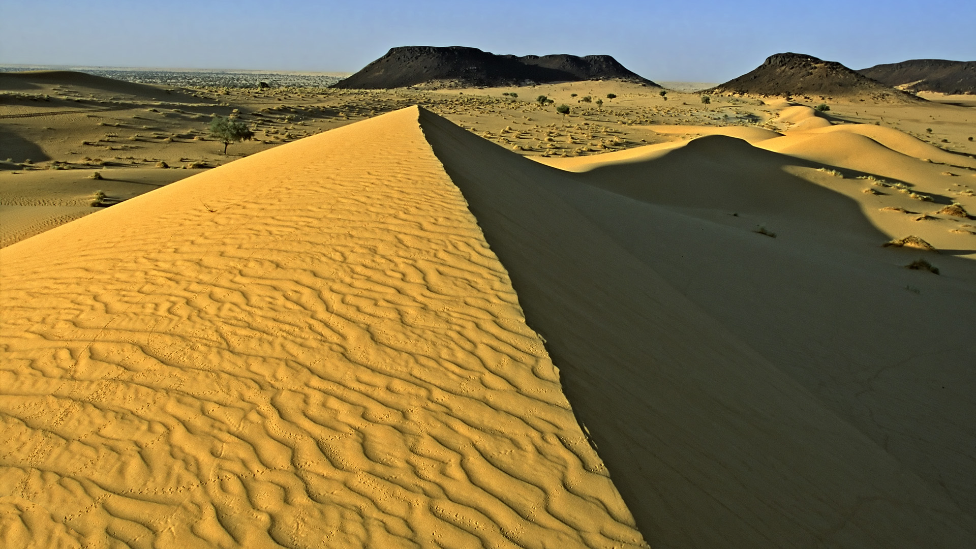
The Ténéré Natural Reserve covers a large expanse of the central Sahara in northeastern Niger and forms the desert portion of the Aïr and Ténéré UNESCO World Heritage Site. The reserve is defined by dune seas, gravel plains, and isolated rock outcrops that illustrate how wind, heat, and minimal rainfall shape one of the harshest environments in Africa. The landscape once supported key sections of trans-Saharan caravan routes, and traces of former encampments, ancient wells, and migration paths remain scattered across the area.
Despite its arid conditions, the Ténéré hosts wildlife adapted to extreme environments. Small and dispersed populations of desert antelope, reptiles, and bird species survive around rare water points and seasonal grazing patches. Human activity is limited to nomadic and semi-nomadic groups who rely on deep knowledge of wells, seasonal vegetation, and long-distance travel. Access to the reserve is usually arranged from Agadez with experienced guides, as navigation and safety require planning, equipment, and knowledge of remote terrain.
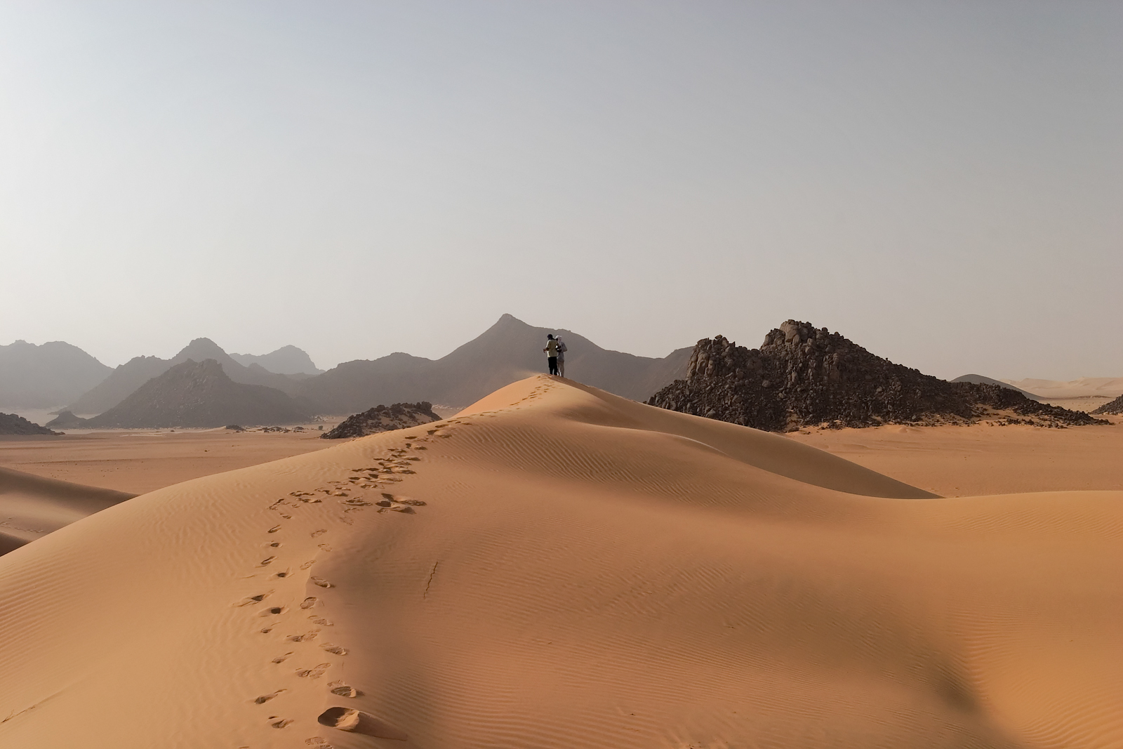
Ténéré Desert
The Ténéré Desert occupies a large section of northeastern Niger and is known for its vast dune fields, open gravel plains, and extremely low population density. Historically, it formed part of major trans-Saharan routes used by Tuareg caravans transporting salt and other goods between Niger and North Africa. The area is also associated with the former Tree of Ténéré, once the only marked reference point for travelers crossing this isolated stretch of the Sahara and now represented by a metal sculpture marking its location. Travel in the Ténéré is typically done through organized expeditions using 4×4 vehicles or camel caravans, as navigation and distances require experience and preparation. Multi-day journeys provide opportunities to observe dune movement, geological formations, and night skies with minimal light interference.
Tin Toumma National Nature Reserve
Tin Toumma National Nature Reserve lies in eastern Niger and covers a large expanse of desert and semi-desert terrain near the borders with Chad and Nigeria. The reserve protects one of the most important habitats for desert-adapted wildlife in the central Sahara. It is especially significant as a refuge for critically endangered species such as the addax antelope, which survives in small, dispersed populations across remote areas of the reserve. Other wildlife includes dorcas gazelles, foxes, reptiles, and bird species adapted to arid conditions.
The landscape consists of gravel plains, isolated rocky outcrops, and dune fields shaped by strong winds, creating a mosaic of habitats that support different forms of desert life. Human presence is limited to nomadic pastoralists who move seasonally in search of grazing, relying on deep knowledge of wells and vegetation cycles. Access to Tin Toumma is restricted and requires coordination with local authorities and conservation organizations, as the area is remote and infrastructure is minimal.
Best Cultural Landscapes
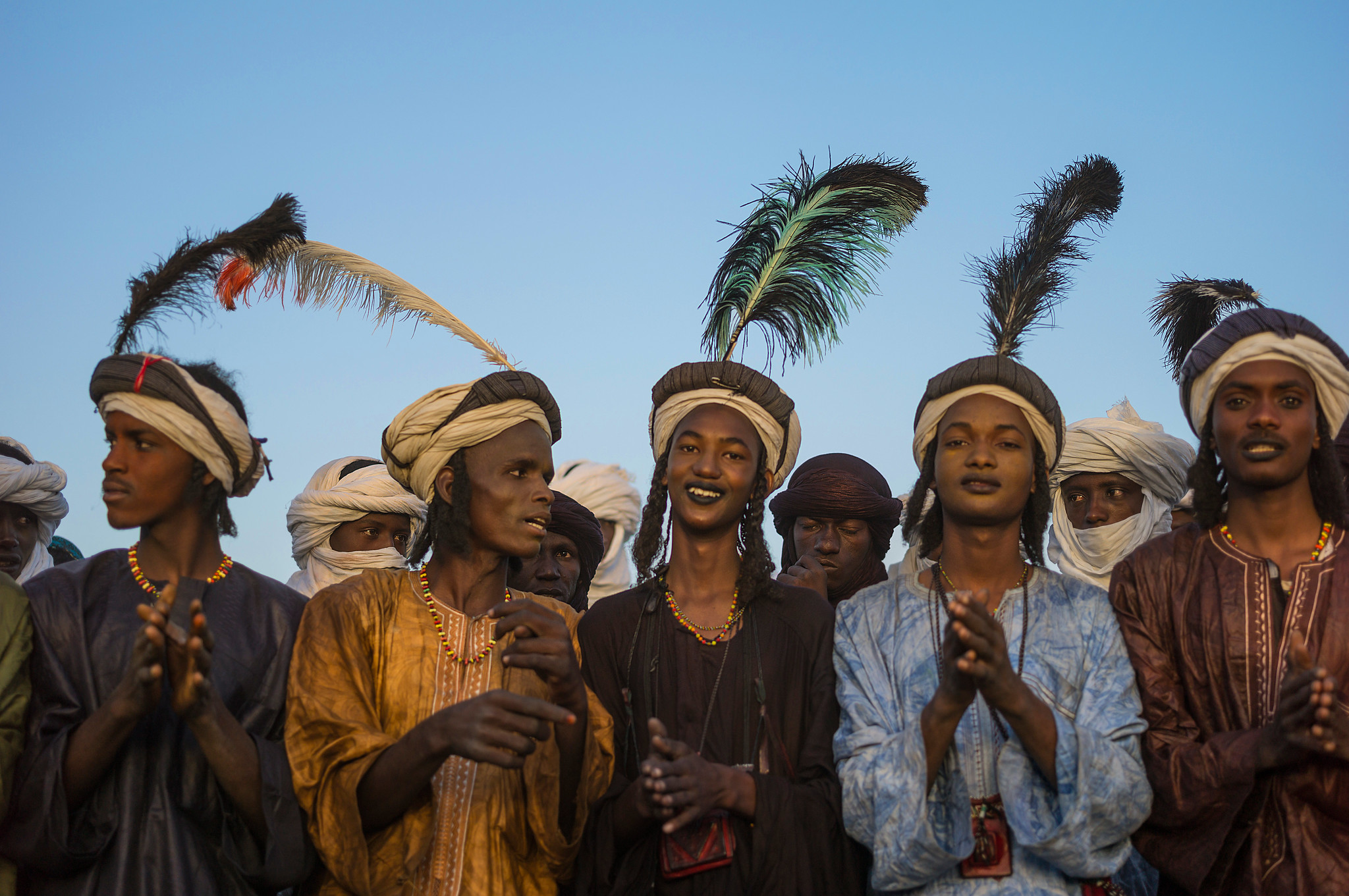
Tuareg Regions
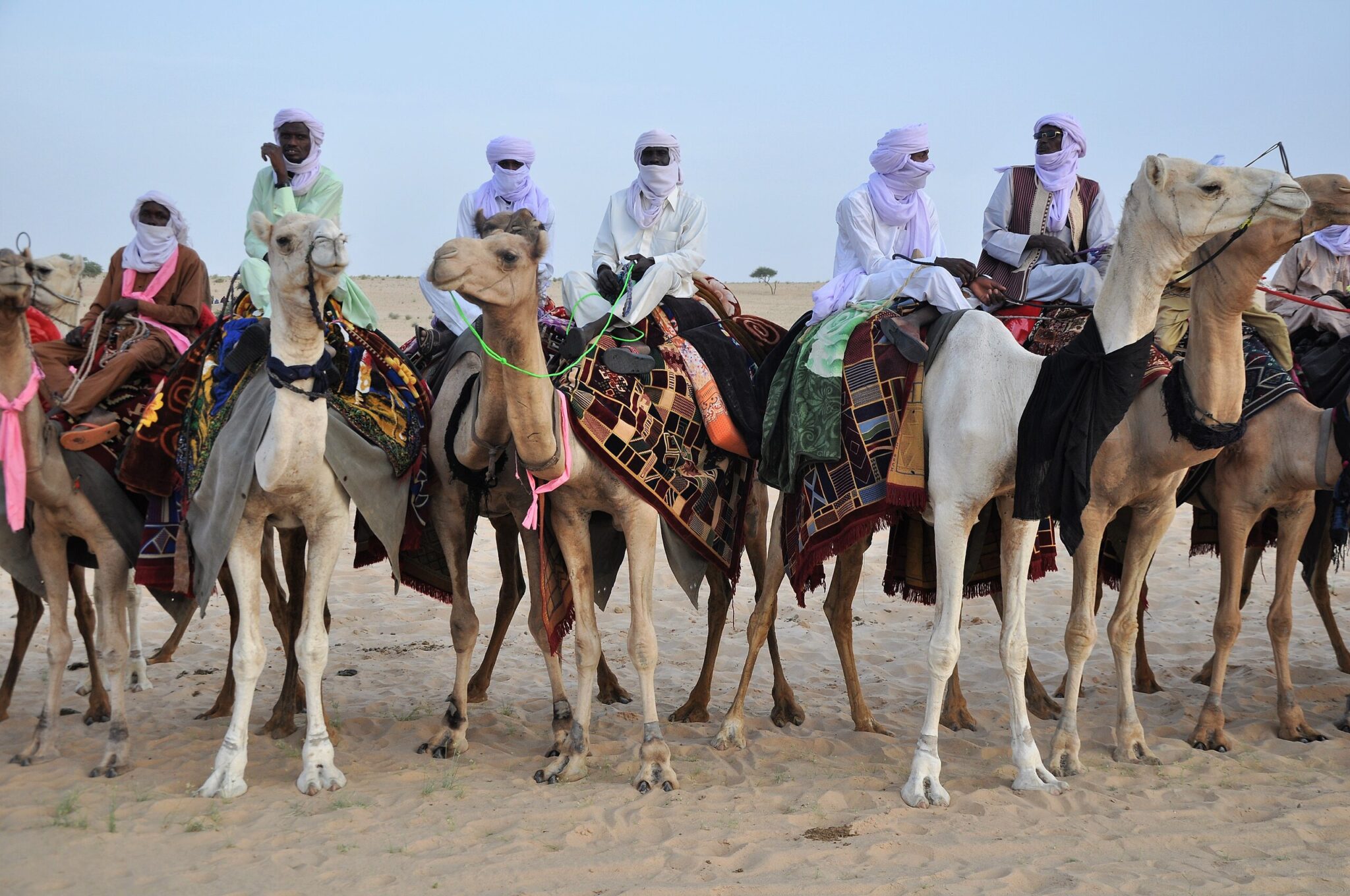
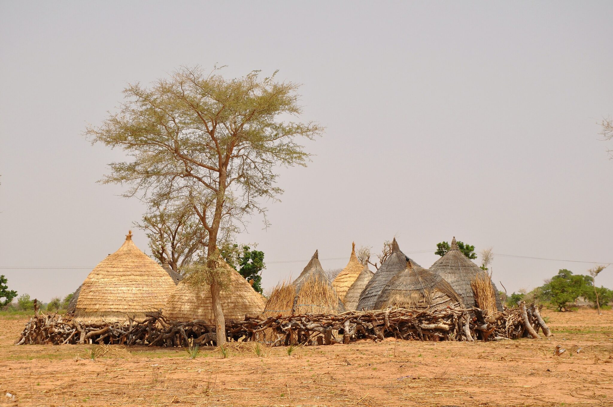
Tuareg regions in northern Niger extend across the Aïr Mountains, the Ténéré Desert, and surrounding pastoral zones. Communities in these areas maintain long-standing traditions shaped by mobility, desert travel, and clan-based social organization. Clothing dyed with indigo, silver jewelry, leatherwork, and metal tools are produced using techniques passed down through family workshops, reflecting both practical needs and cultural identity. These crafts continue to supply local markets and are an important economic link between nomadic and urban centers.
Oral culture remains central to Tuareg society. Poetry, storytelling, and music – often performed with instruments such as the tehardent – convey history, lineage, and values associated with travel, land stewardship, and community ties. Seasonal gatherings and festivals bring together families from dispersed encampments, reinforcing social connections and allowing for exchange of goods and information. Visitors typically encounter Tuareg traditions in towns like Agadez or in rural settlements connected to pastoral routes.
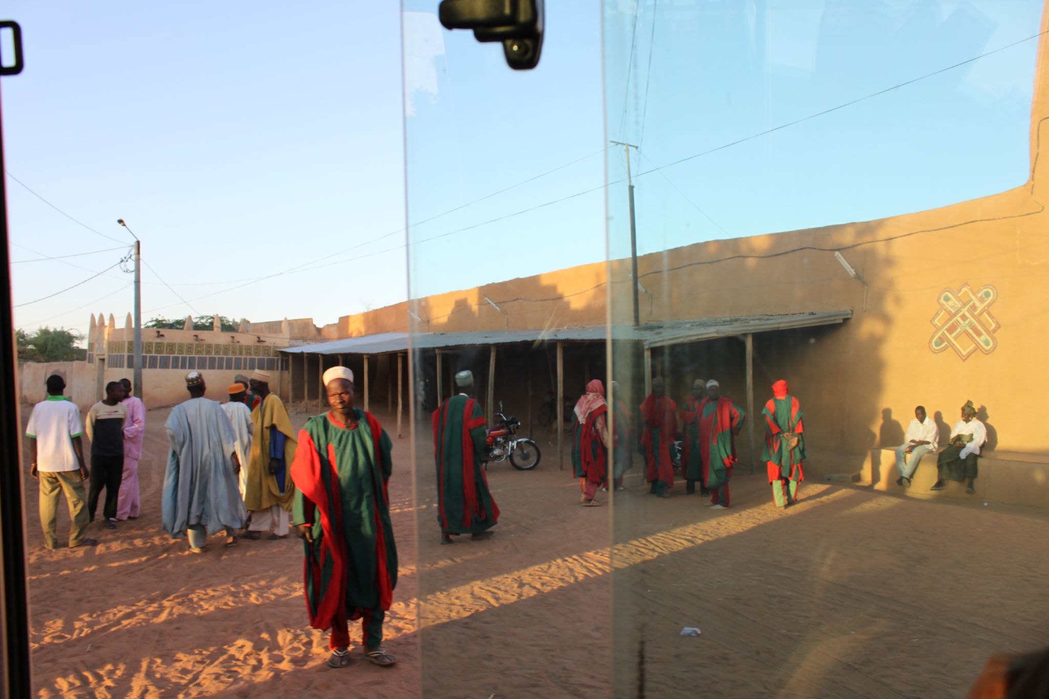
Hausa Cultural Areas
Southern Niger forms part of the wider Hausa cultural region, which extends across national borders into northern Nigeria and parts of Benin. The area is known for long-established trade networks, Islamic scholarship, and distinctive urban layouts characterized by mud-brick houses, enclosed courtyards, and narrow streets. Markets in towns such as Zinder and Maradi are central to daily economic life, supplying textiles, leather goods, metalwork, grains, and locally crafted household items. The use of brightly patterned fabrics is widespread, with tailors and dyers playing important roles in community commerce.
Religious and educational centers contribute to the region’s cultural identity. Mosques, Quranic schools, and community meeting spaces support traditions of learning and governance that predate colonial rule. Festivals and public events – often tied to agricultural cycles or religious observances – highlight music, dance, and craftmaking rooted in Hausa heritage. Visitors who explore these towns can observe how historical trade routes, architectural styles, and artisanal production continue to shape everyday life.
Zarma-Songhai Communities
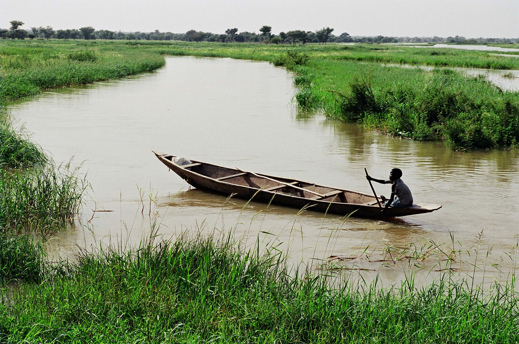
Zarma and Songhai communities living along the Niger River rely on a combination of fishing, floodplain farming, and small-scale river trade. Villages are typically positioned near channels or seasonal basins where water levels support rice, millet, and vegetable cultivation during the retreat of the annual floods. Fishing remains a major livelihood, with families using nets, traps, and wooden boats adapted to shifting currents and sandbanks. Local markets in river towns serve as exchange points for fish, grain, pottery, and tools produced in nearby settlements.
Cultural life along the river incorporates music, dance, and community rituals tied to seasonal water cycles. Ceremonies may mark the start of the flood, successful harvests, or transitions within family and social groups. Riverfront gathering spaces, mosques, and communal meeting areas help structure daily interaction and decision-making. Visitors who travel through the Niger Valley – often from Niamey, Tillabéri, or Dosso – can explore riverside villages with local guides to learn how water management, agriculture, and oral traditions shape community organization.
Best Nature Destinations
W National Park
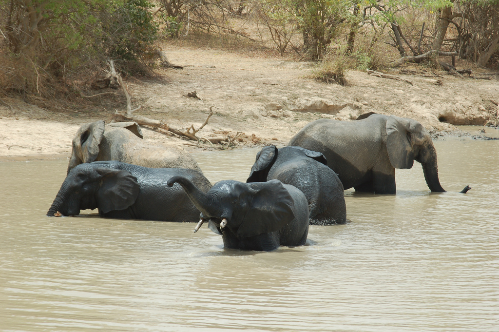
W National Park is a large protected area shared by Niger, Benin, and Burkina Faso and is recognized by UNESCO for its ecological significance. The park covers savanna, gallery forests, wetlands, and sections of the Niger River, supporting wildlife such as elephants, various antelope species, baboons, hippos, and a range of predators including lions. Birdlife is especially diverse due to the presence of riverine habitats and seasonal floodplains. Wildlife sightings vary by season, with the dry months generally providing the best viewing opportunities around remaining water sources.
Access from southern Niger – typically through the regions near Gaya or the Niger River corridor – requires advance planning, as roads, permits, and guiding services must be arranged before entering the park. Visitors usually travel with licensed guides familiar with current conditions, wildlife movements, and cross-border regulations. Safari activities include vehicle-based drives, river viewing points, and stops at designated observation areas.
Niger River Valley
The Niger River Valley forms one of the most productive regions in Niger, supporting agriculture, fishing, and transport along its banks. Seasonal floods create fertile plains where communities cultivate rice, millet, and vegetables as the water recedes. Fishing is carried out with nets, traps, and wooden boats, and riverbank markets serve as exchange points for fish, grain, and locally made tools. Villages positioned close to the river rely on these cycles, structuring daily life around planting seasons, low-water periods, and navigation routes.
Boat trips along sections of the river offer insight into this landscape. Travelers may observe fishermen working at dawn or dusk, hippos emerging from deeper channels, and bird species that use reed beds and shallow waters for feeding. Some itineraries include stops in riverside communities, where guides explain irrigation methods, flood receding agriculture, and the role of the river in local trade networks.
Hidden Gems in Niger
In Gall
In Gall is an important cultural site in northern Niger, known for its long-standing salt extraction practices and for seasonal gatherings that draw Tuareg communities from across the region. The surrounding plains contain shallow salt deposits where families work during the dry season, producing salt blocks that have historically been transported by caravan to markets in Niger and neighboring countries. Observing the extraction areas provides insight into techniques adapted to the arid environment and the economic networks linked to salt production.
Each year, In Gall also hosts major community events, including the Cure Salée, when pastoral groups gather at the end of the rainy season. During this period, herders bring livestock to graze on temporary pastures, and families participate in ceremonies, markets, and social meetings that reinforce regional ties. The town becomes a focal point for exchanges of information, goods, and cultural traditions.
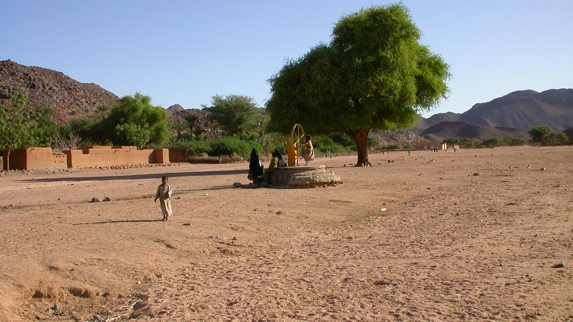
Timia Oasis
Timia is a highland oasis located within the Aïr Mountains, where natural springs support palm groves, orchards, and small agricultural plots. The presence of reliable water has allowed local communities to cultivate dates, citrus, and other crops in an environment otherwise surrounded by desert terrain. Walking through the valley gives visitors a clear sense of how irrigation channels, terraced gardens, and traditional farming methods sustain daily life in a remote mountain setting.
The oasis is also a practical stop on expeditions through the Aïr region. Local households host visitors, and guides lead short walks to nearby springs, viewpoints, and small villages connected by footpaths. Timia is typically accessed by 4×4 from Agadez as part of multi-day routes that combine oases, rock formations, and archaeological sites.
Iferouane
Iferouane is a small settlement on the northern edge of the Aïr Mountains and functions as an outpost for communities living between the highlands and the surrounding desert. The town contains stone and mud-brick buildings built to withstand temperature changes and limited rainfall, reflecting long-standing adaptation to an isolated environment. Daily life centers on small markets, wells, and workshops where basic tools and goods are produced for local use and for travelers passing through.
Iferouane is also a starting point for excursions deeper into the Aïr region and toward the Ténéré Desert. Guides based in the town arrange routes to nearby valleys, rock formations, and seasonal grazing zones used by pastoral families. Travelers often stop in Iferouane to rest, organize supplies, and learn about how Tuareg households manage water, livestock, and movement across a difficult landscape. The town is reached by 4×4 from Agadez as part of multi-day expeditions and is valued for its role as a gateway between mountain terrain and open desert.
Tahoua
Tahoua is a central Nigerien town positioned between the agricultural zones of the south and the desert regions to the north, making it an important stop along long-distance road routes. Its markets supply goods arriving from both directions – grain, livestock, leatherwork, and tools from rural areas, and salt, textiles, and caravan products transported from northern trading hubs. Walking through the market districts gives visitors an understanding of how commerce, transport services, and regional migration patterns shape daily life in the Sahel.
The town also hosts cultural activities tied to Fulani and Tuareg communities that move seasonally through the region. Festivals, livestock fairs, and community gatherings reflect a mix of pastoral and agricultural traditions. Because of its location, Tahoua often serves as a transit point for travelers heading toward Agadez, the Aïr Mountains, or southeasterly routes to Maradi and Zinder.
Travel Tips for Niger
Travel Insurance & Safety
Comprehensive travel insurance is essential for visiting Niger. Your policy should include emergency medical and evacuation coverage, as healthcare facilities outside the capital, Niamey, are limited and distances between major towns are vast. Travelers venturing into remote or desert regions should ensure their insurance covers off-road expeditions and adventure travel.
The security situation in Niger varies significantly by region, so it’s important to check updated travel advisories before planning your trip. Travel with experienced local guides, particularly in desert areas or rural communities, where knowledge of routes and local customs is crucial. A yellow fever vaccination is required for entry, and malaria prophylaxis is strongly recommended. Tap water is not safe to drink, so bottled or filtered water should always be used. Sunscreen, hats, and plenty of hydration are vital when traveling in the desert, where temperatures can be extreme.
Transportation & Driving
Domestic flights are limited, so most travel between regions relies on shared taxis and minibuses, which connect major towns and trading centers. In the north, organized 4×4 expeditions are the only safe and practical way to travel through the Sahara and Aïr Mountains. Planning ahead and traveling with reputable operators is essential due to the distances involved and limited roadside assistance.
Driving in Niger is on the right-hand side of the road. Road conditions vary widely – while main highways near Niamey are generally paved, many rural and desert routes are unpaved and require a 4×4 vehicle. An International Driving Permit is required along with your national license, and drivers should carry all documents at all times. Police and military checkpoints are common; remain polite, cooperative, and patient during inspections.
Published January 04, 2026 • 19m to read