Malawi is often considered one of Southern Africa’s most approachable and welcoming destinations. It appeals to travelers who value a slower pace, local interaction, and nature experiences without heavy visitor pressure. The country is centered around Lake Malawi, a vast freshwater lake that shapes daily life and travel alike, offering clear waters, relaxed beach settings, and an atmosphere well suited to unhurried stays.
In recent years, Malawi has also developed a stronger safari profile, allowing visitors to combine lakeside time with wildlife viewing in well-managed reserves. This makes it particularly suitable for a compact itinerary. With realistic planning, travelers can spend time on the lake and still include one or two national parks without excessive transfers. Malawi delivers a balanced experience focused on ease, nature, and genuine local character rather than fast-paced sightseeing.
Best Cities in Malawi
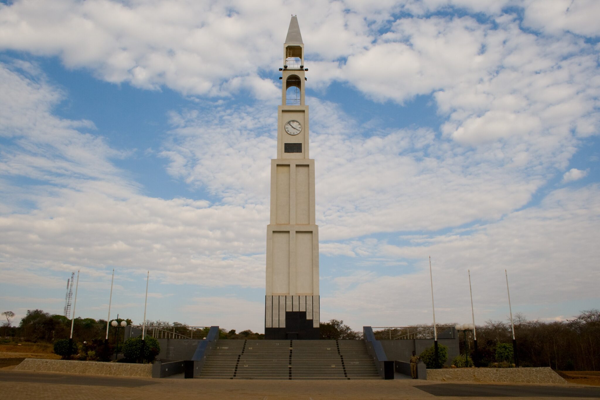
Lilongwe
Lilongwe is primarily a transit capital, but it works well for a compact, purposeful stop that mixes practical errands with a quick dose of local atmosphere. The city is commonly experienced in two halves: Old Town for everyday street life and markets, and the newer City Centre for wider boulevards, government buildings, and easier-to-navigate services. For a fast, high-impact visit, spend 60 to 90 minutes around the main market area in Old Town to see produce, textiles, and day-to-day trading, then switch to a calmer setting at the Lilongwe Wildlife Centre, a protected woodland of roughly 70 hectares inside the city with a raised boardwalk and marked walking loops that are typically around 2 km, 3.5 km, and 4.8 km, making it realistic to fit a short walk even on an arrival or departure day.
To visit efficiently, plan Lilongwe as a daylight stop: handle cash, SIM card, and supplies first, then do sightseeing while you still have energy and time. Kamuzu International Airport is about 25 to 30 km from the city, and transfers commonly take 30 to 60 minutes depending on traffic. For onward travel by road, typical distances and driving times are approximately 100 km and 1.5 to 2.5 hours to Salima on the lakeshore, about 90 to 100 km and 2 to 3 hours to Dedza (useful for the border route toward Zambia), roughly 300 to 330 km and 4.5 to 6 hours to Blantyre, and about 350 km and 5 to 7 hours to Mzuzu in the north.
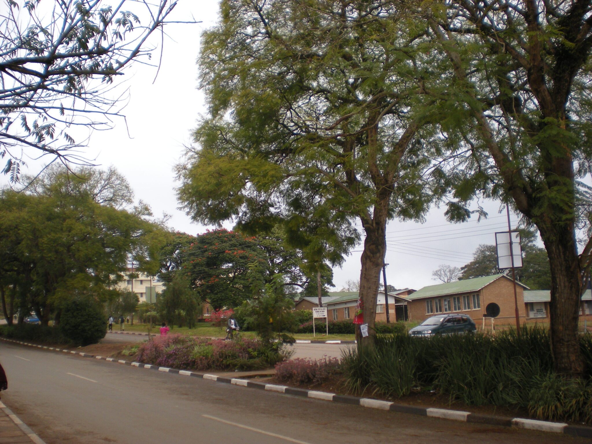
Blantyre
Blantyre is Malawi’s commercial capital and, unlike Lilongwe, it has a more layered, older feel thanks to its colonial-era core and the city’s long role as a trading centre. A smart short visit is to anchor around Mandala House for a quick heritage stop, then add one or two nearby highlights depending on your interests: the Society of Malawi and its small museum collections for local context, the Limbe Market area for busy everyday city energy, and a short hike or viewpoint on one of the hills that frame the city, such as Michiru, Soche, or Ndirande, which can give wide views over the Blantyre-Limbe basin at roughly 1,000 m elevation. Blantyre is also one of the easiest places in the country to mix culture with a good meal in a single outing, then move on without losing a full day.
Practically, treat Blantyre as a gateway to the south and the highlands rather than a long urban stay. Chileka International Airport is close, roughly 15 km from the main commercial areas, so arrivals and departures can be efficient. For nearby escapes, Zomba Plateau is about 60 km and typically 1 to 1.5 hours by road, Mount Mulanje is roughly 65 to 90 km (often 1.5 to 2.5 hours depending on your trailhead), Thyolo tea country is about 35 to 45 km (around 1 to 1.5 hours), and Majete Wildlife Reserve is commonly reached in about 60 to 70 km (roughly 1.5 to 2.5 hours depending on the approach). From Lilongwe, Blantyre is around 300 to 330 km and usually 4.5 to 6.5 hours by road in good conditions, so plan the long leg in daylight and keep a buffer for slower sections and urban traffic.
Mzuzu
Mzuzu is the main service and transport hub of northern Malawi, sitting on the M1 at roughly 1,200 to 1,300 m above sea level, which gives it cooler temperatures than the lakeshore and makes it a sensible break point on long overland routes. Most travelers use it to restock, sort cash, and arrange onward transport rather than for sightseeing, but it still offers a quick window into northern urban life through its busy markets and the small craft and trading areas tied to the region’s coffee, tea, and timber economy. If you have a couple of hours, a simple, low-effort plan is to do your logistics first, then take a short local walk or viewpoint stop on the hills around the city to get a sense of the highland setting before dropping down toward the lake.
From Mzuzu, the key draw is how quickly it connects you to standout northern experiences. Nkhata Bay is about 55 to 60 km away and usually 1.5 to 2.5 hours by road, depending on traffic and road conditions as you descend toward the lakeshore. Livingstonia is roughly 90 to 110 km and typically 2.5 to 4 hours, and the final approach involves steep climbs and switchbacks, so daylight travel matters. Nyika National Park is commonly reached via Rumphi, with total distances often around 110 to 150 km to park gates and lodges, but driving times can stretch to 4 to 7 hours because the last sections are slower and can be rougher, especially after rain. If you are pushing farther north, Karonga is around 230 km and often 4.5 to 6 hours on the M1.
Best Natural Wonders and Wildlife Sites
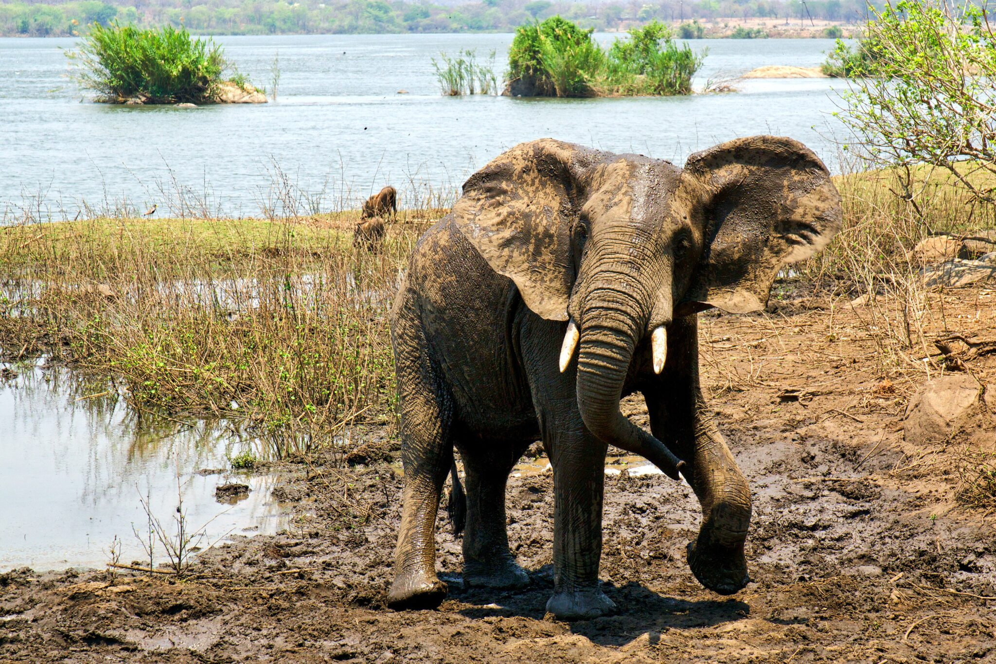
Liwonde National Park
Liwonde National Park is Malawi’s premier safari area and a strong choice if you want high wildlife density in a compact, easy-to-navigate landscape. The park covers roughly 548 km² along the Shire River, which is the main reason it feels so productive: animals funnel toward water, especially in the dry season, so sightings tend to be frequent and close. Elephant encounters are a highlight, and you also have a solid chance of seeing hippos and crocodiles from both land and water. Antelope species are common, and the park is widely regarded for birdlife as well, with riverine habitats supporting large numbers of waterbirds and raptors. The key difference here is the safari rhythm: a boat safari on the Shire gives you eye-level viewing of wildlife at the banks, then game drives add the wider savanna perspective.

Majete Wildlife Reserve
Majete Wildlife Reserve is one of Malawi’s most impressive conservation turnarounds and a strong southern safari option if you prefer quieter roads and a more exclusive feel. The reserve covers roughly 700 km² and is managed with a clear focus on protection, habitat recovery, and steady reintroductions, which is why sightings can feel “earned” and rewarding rather than staged. Wildlife viewing is often best along river lines and in open patches where animals concentrate, and many visitors come specifically for the combination of solid big game chances and consistently high guiding standards. Because vehicle numbers are generally lower than in larger regional safari circuits, drives can feel more personal, with longer time on sightings and less competition at key locations.
From Blantyre, it is typically around 60 to 80 km depending on your camp or gate, and commonly 1.5 to 2.5 hours by road. It also links well with other southern highlights: the tea and forest landscapes around Thyolo are often about 1 to 2 hours away, and Mount Mulanje trailheads are usually reachable in roughly 2 to 3.5 hours depending on where you start and finish. If you are coming from Liwonde National Park, allow roughly 3 to 5 hours by road in most cases, with timings shaped by road conditions and the exact route.
Nyika National Park
Nyika National Park is Malawi’s most distinctive safari landscape: a high-altitude plateau of broad grasslands and rounded hills that sits well above 2,000 m in many areas, with the highest point, Nganda Hill, rising to about 2,607 m. The result is a cooler, often misty “mountain safari” setting that feels closer to a highland hike than a classic lowland big-game circuit. Wildlife is typically spread out rather than concentrated, so the experience leans toward scenery and slower exploration: you are more likely to spend time with antelope herds, scan open slopes for zebra and other grazers, and build the day around viewpoints, short walks, and long drives through open country. Birdlife is a major draw, especially in forest edges, dambos, and rocky sections where you can rack up a high species count over a couple of days.
Getting there is part of the commitment, and planning your approach matters. Most overland routes funnel through Rumphi or Mzuzu: from Mzuzu to the Nyika area you are often looking at roughly 110 to 150 km in total, but driving time can easily stretch to 4 to 7 hours because the last section is slower and can be rough, especially after rain. From Nkhata Bay on Lake Malawi, allow roughly 5 to 8 hours depending on your exact start point and road conditions. If you are coming from Lilongwe, the full road journey to the Nyika region is commonly in the 550 to 600 km range, which usually means 10 to 12 hours total and is best split with an overnight stop. In the rainy season, build extra buffer for delays, start early, and aim to arrive well before dusk, as visibility can drop quickly once fog and low cloud roll in.
Nkhotakota Wildlife Reserve
Nkhotakota Wildlife Reserve is one of Malawi’s largest protected areas, covering roughly 1,800 km², and it feels notably wilder and less “packaged” than the country’s flagship parks. The terrain is a mix of wooded hills, river valleys, and broad stretches of miombo woodland, so the experience is often about tracking, time on the radio with guides, and appreciating the sense of space rather than ticking off a rapid-fire species list. Visitor numbers are typically low, which can make drives feel like genuine exploration, but it also means you should expect longer periods between headline sightings. When conditions align, the reward is a more intimate wilderness atmosphere, with a strong emphasis on guiding skill, reading spoor, and understanding how animals move through thick cover and toward water.
Access is easier than it looks on a map, but it can still take time. From Lilongwe, Nkhotakota town on the lakeshore side is roughly 190 to 210 km and usually about 3.5 to 5 hours by road, and you should add extra time for any final reserve access roads, which can be slower. From Salima it is typically around 70 to 90 km, often 1.5 to 2.5 hours, making it a practical link if you are moving between the central lakeshore and a safari segment. From Mzuzu, allow roughly 3.5 to 6 hours depending on route and road conditions. In the rainy season, build more buffer than usual, start early, and aim to arrive with daylight in hand, as delays are more common and the last stretches can be slower.
Mount Mulanje
Mount Mulanje is Malawi’s most dramatic mountain massif, rising abruptly from the surrounding plains to a high granite plateau with multiple peaks. The highest point, Sapitwa Peak, reaches about 3,002 m, which makes Mulanje one of the highest mountains in south-central Africa and a real step up from the country’s lowland heat. The trekking is the main draw: you can do steep day hikes to viewpoints and waterfalls on the lower slopes, or commit to multi-day routes that climb onto the plateau for wide horizons, pine forests, rocky basins, and clear streams. Even a short walk quickly shifts the atmosphere, with cooler air, frequent cloud build-up, and big changes in vegetation as you gain altitude.
For most visitors, the practical base is Mulanje Boma and the trailheads around Likhubula, where you can arrange entry, guides, and basic logistics. Day options often include waterfall hikes and ridge viewpoints that take 2 to 6 hours depending on pace and elevation gain, while plateau treks commonly run 2 to 5 days and can be tailored to fitness and weather. If you are aiming for higher routes, start early to use the clearest part of the day, then expect mist and showers to be more likely in the afternoon, especially in the wet season. Nights and early mornings can feel cold at altitude even when the lowlands are warm, so warm layers matter more than people expect.

Zomba Plateau
Zomba Plateau is one of southern Malawi’s best easy-access highland escapes, rising above the town of Zomba to a cool, forested tableland with big viewpoints and a network of walking and driving routes. The plateau reaches roughly 2,000 to 2,100 m at its higher points, which brings noticeably lower temperatures than the Shire Valley and makes it comfortable for active days even when the lowlands feel hot. The classic focus is the viewpoints: on clear mornings you can look out over Zomba town and across the plains, while the interior of the plateau feels greener and quieter, with pine stands, patches of indigenous forest, streams, and waterfalls that create a very different mood from Malawi’s lakeshore and savanna landscapes.
It works well as a one-day outdoor stop because you can scale the effort. Many visitors combine a short drive up with a 2 to 4 hour walk to one or two viewpoints plus a waterfall or forest loop, then return the same day without needing trekking gear beyond good shoes and a light jacket. Go early for the best light and the widest views, since cloud and mist often build later, especially in the warmer and wetter months.

Best Lakes and Scenic Landscapes
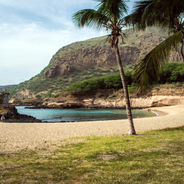
Lake Malawi National Park
Lake Malawi National Park at Cape Maclear is the classic “lake reset” after overland travel or a safari segment, combining an easy beach rhythm with a genuine protected-area setting. The park, established in 1980 and recognized as a UNESCO World Heritage Site, protects a mix of rocky shoreline, forested slopes, and clear inshore water where visibility is often at its best in calmer conditions. The headline experience is simple: swimming, snorkeling, and short boat outings over rock reefs where you can see colorful cichlid fish, a group for which Lake Malawi is globally famous. The water is typically warmest from roughly October to April, while the drier months often bring clearer skies and steadier days for boat trips.
What to do here is intentionally low-intensity. A good balance is one snorkeling session from shore, one short boat trip to a nearby bay or rocky island for better fish viewing, and an early walk up to a viewpoint above the village for wide lake panoramas. If you like paddling, kayaking in the early morning is usually calmer before afternoon winds pick up. Evenings are usually about lakeside dinners and sunset light rather than nightlife. The practical point is to keep the pace slow: Cape Maclear works best for two to four nights, with long, easy mornings and just one or two planned outings rather than trying to stack activities back-to-back.
Getting there is straightforward via Mangochi, the main town at the southern end of the lake. From Lilongwe, plan roughly 240 to 270 km and around 4.5 to 6.5 hours by road to Cape Maclear depending on traffic, stops, and the final approach. From Blantyre, it is commonly about 200 to 230 km and around 4.5 to 6 hours. From Liwonde National Park, many travelers link directly in roughly 70 to 90 km and about 1.5 to 2.5 hours, which makes Cape Maclear one of the easiest lake add-ons to a southern safari circuit.
Nkhata Bay
Nkhata Bay is one of the most relaxing bases on Lake Malawi, set on a steep green shoreline where the road drops into a small bay with wide water views. It is popular for calm, swimmable water, an easygoing village atmosphere, and simple outdoor days that do not require heavy planning. The best rhythm is early and slow: sunrise light on the lake, a swim before the breeze builds, then kayaking or a short boat outing to nearby coves and rocky points. Compared with busier southern hubs, Nkhata Bay tends to feel quieter and more local, with less pressure to “do” anything beyond being on the water and enjoying the scenery.
Getting to Nkhata Bay is usually via Mzuzu, the main northern hub. From Mzuzu, it is roughly 55 to 60 km and typically 1.5 to 2.5 hours by road because the descent toward the lake is slower and can be winding. From Lilongwe, the road journey is often around 430 to 500 km and commonly 8 to 11 hours depending on stops and conditions, so most travelers break it with a night en route or use Mzuzu as a staging point. From Cape Maclear in the far south, it is effectively a full-day transfer across the country and not ideal without an overnight stop.
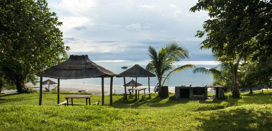
Senga Bay
Senga Bay is the most convenient Lake Malawi shoreline break from Lilongwe, set on the central lakeshore near Salima and geared toward straightforward, comfortable downtime. The draw is simplicity: wide sandy stretches, easy swimming conditions on calmer days, and a cluster of lodges that make it realistic to arrive, check in, and be at the water the same afternoon. It suits short stays of 1 to 3 nights, especially if you want a relaxed resort rhythm with lake views, basic water activities, and minimal logistics. The shoreline here is generally flatter and more developed than the northern bays, so the experience is less about dramatic scenery and more about a quick, accessible “lake weekend”.
From Lilongwe, Senga Bay is typically about 110 to 140 km depending on your exact lodge location, and the drive is commonly 2 to 3.5 hours. From Salima, it is often 20 to 40 km and about 30 to 60 minutes. From Blantyre, plan roughly 280 to 330 km and around 5 to 7.5 hours, so it works best as a stop on a longer route rather than a quick detour. The practical logic is clear: if you have limited time, Senga Bay delivers the lake experience with minimal travel. If you can spare extra days and want more scenery and a quieter feel, northern bases such as Nkhata Bay typically feel more rewarding.

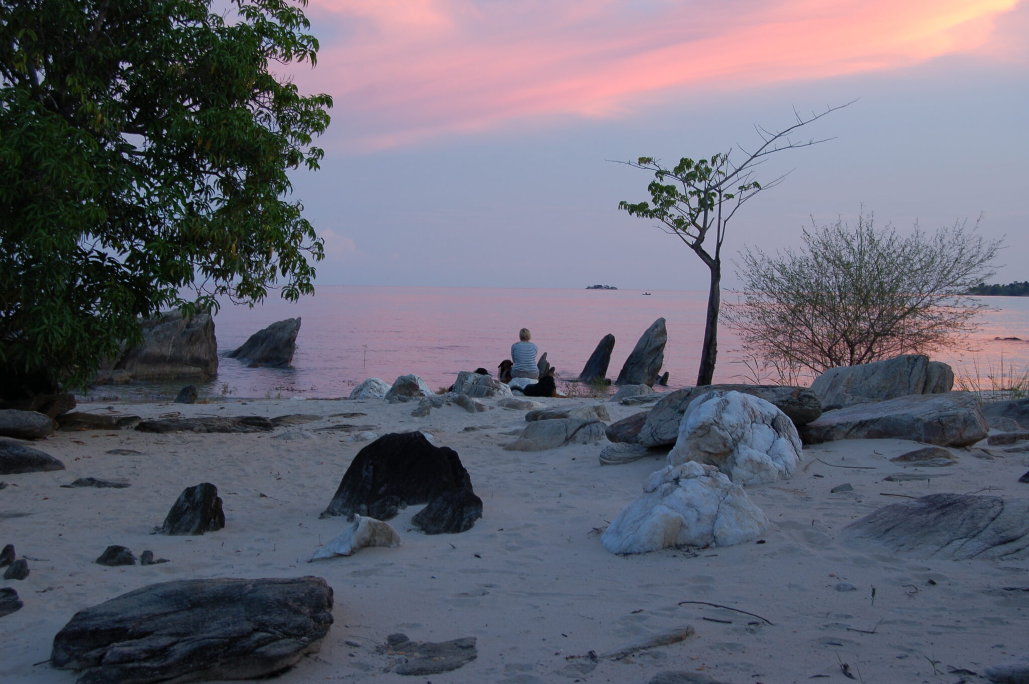
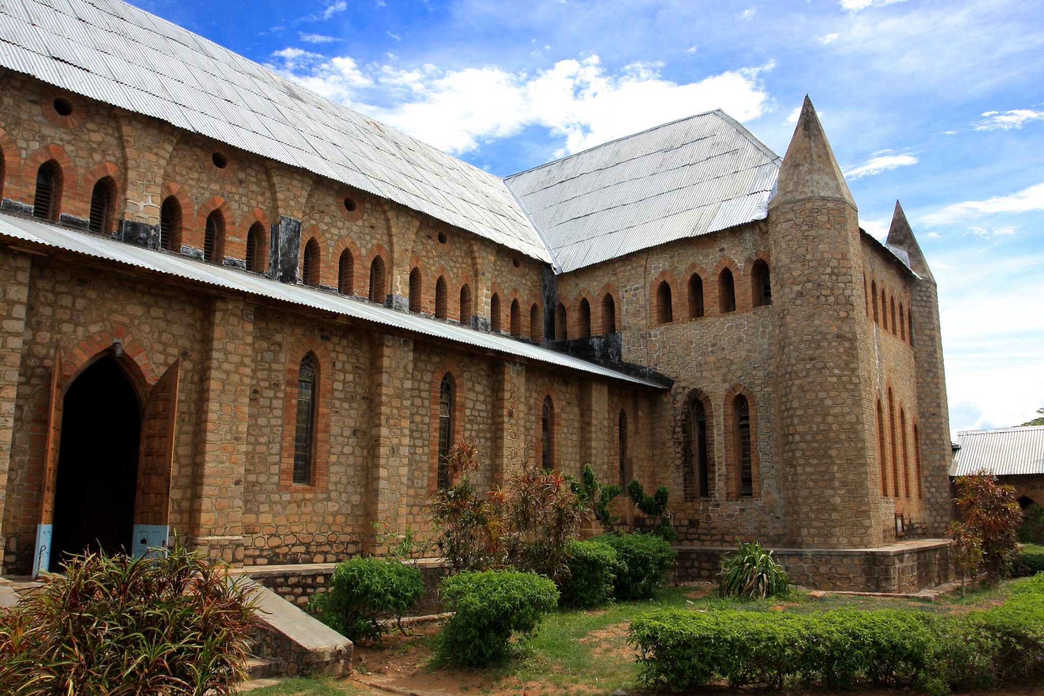
Likoma Island
Likoma Island has a genuinely remote, island-based rhythm that feels different from mainland lake stops, partly because it sits far out in Lake Malawi and even lies within Mozambique’s waters while being administered by Malawi. It is small, roughly 18 km², so you can settle into a simple routine quickly: swims off quiet beaches, short kayak paddles along the shoreline, and slow afternoons with lake views. A worthwhile cultural stop is St Peter’s Cathedral, an early-20th-century Anglican cathedral built by missionaries, notable for its scale relative to the island and for being one of the landmark historic buildings on the lake. If you like light activity, a bicycle loop around parts of the island is a classic low-effort day, with frequent stops for viewpoints and villages, and you can usually cover the main coastal sections comfortably in a few hours rather than treating it as an endurance ride.
To visit well, plan 2 to 4 nights and keep the schedule intentionally loose. The island’s best moments tend to be early morning and late afternoon when the light is softer and the water is calmer, while midday heat is ideal for shade, reading, and short dips close to your accommodation. Snorkeling can be enjoyable in clear conditions, especially around rocky edges rather than sandy shallows, but it is not a “do everything” destination. It is more about quiet lake time, slow pacing, and small, self-contained outings. Build buffer time into your plan because wind can roughen the lake and affect small-boat movements, and limited services mean you will want to arrive with the essentials you care about.
Best Cultural and Historical Sites
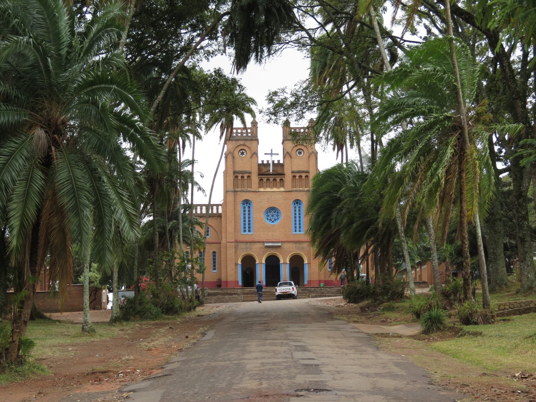
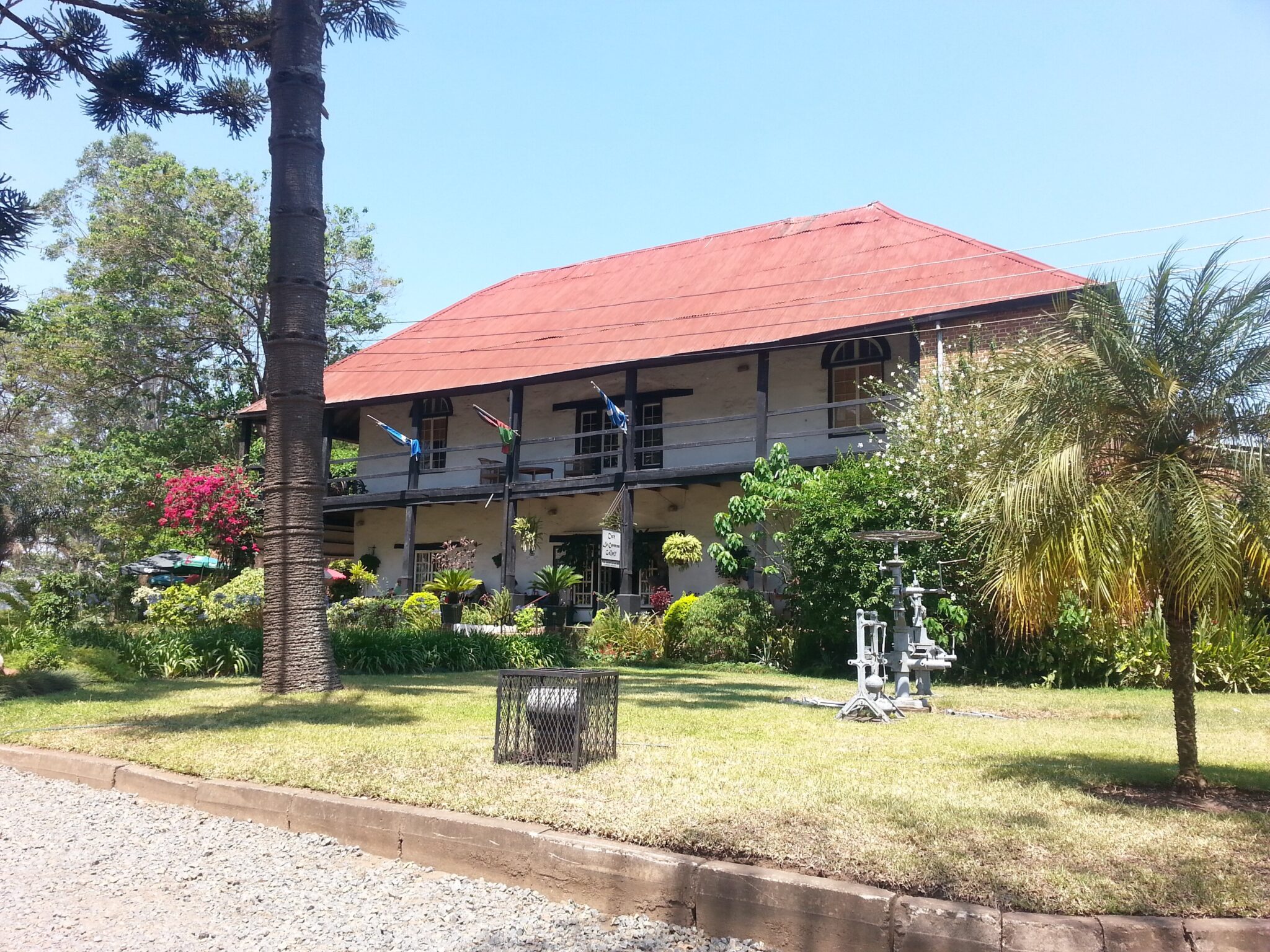
Mandala House (Blantyre)
Mandala House is one of Blantyre’s most recognizable heritage landmarks and one of the most historically important buildings in Malawi. Built in 1882, it is widely considered the oldest surviving European-style building in the country, originally linked to early commercial activity in the Blantyre-Limbe area. The architecture is part of the appeal: a compact historic house with a shaded veranda and period details that make it easy to visualize how the early settlement and trading era shaped the city. As a stop, it works particularly well because it is efficient. You can usually cover the site in 45 to 90 minutes, or extend to 1.5 to 2 hours if you also want time for the adjacent cultural spaces that often operate on the same compound.
To make the visit feel less “standalone,” pair it with everyday Blantyre nearby: a quick pass through Limbe Market for the city’s busiest local rhythm, then a café break or lunch in the central Blantyre-Limbe corridor. In practical terms, Mandala House is easy to reach: from central Blantyre it is typically a 10 to 20 minute drive depending on traffic; from Chileka International Airport often 20 to 40 minutes; and from Zomba roughly 1 to 1.5 hours by road. If you are connecting from Lilongwe, treat it as a long transfer day of roughly 4.5 to 6.5 hours by road, then use Mandala House as a low-effort cultural anchor before moving on to the highlands or reserves.
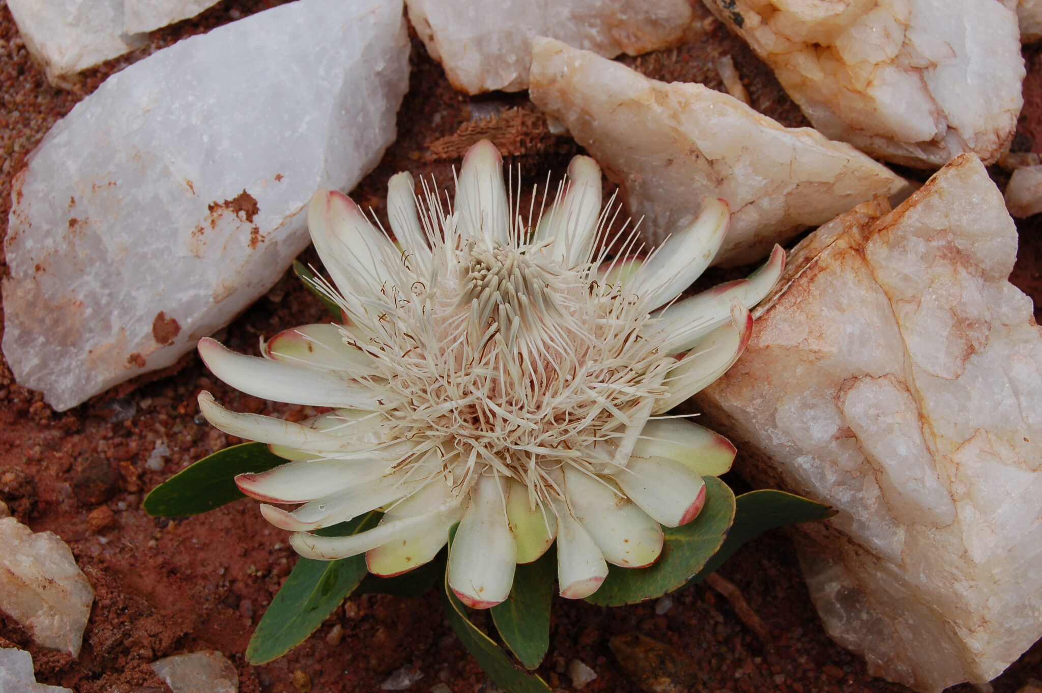
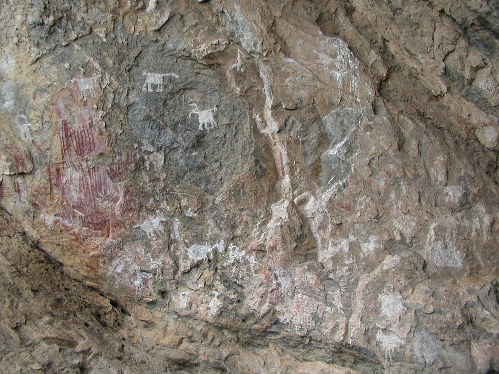
Chongoni Rock Art Area
Chongoni Rock Art Area is one of Malawi’s most important cultural landscapes, spread across the forested granite hills of the Dedza region and recognized for its concentration of rock shelters with painted panels. The site includes well over 100 shelters across the wider area, making it the densest known cluster of rock art in Central Africa, and it is valued not only for age but for continuity: some paintings are associated with earlier hunter-gatherer traditions, while others are linked to later farming communities and to Chewa cultural practices. The art is typically viewed in natural shelters rather than in a museum setting, so the experience feels like a walk through living terrain where geology, forest cover, and human history overlap. Because Chongoni is still relatively quiet compared with better-known African rock art circuits, a visit can feel personal and unhurried, especially if you start early.
Getting there is usually easiest via Dedza. From Lilongwe, Dedza town is roughly 85 to 100 km and typically 1.5 to 2.5 hours by road, depending on traffic and the exact start point. From Salima, allow roughly 120 to 150 km and about 2.5 to 4 hours. From Blantyre, plan approximately 320 to 360 km and around 5.5 to 8 hours, so it is best linked to a north-south transfer rather than done as a standalone detour.
Hidden Gems of Malawi
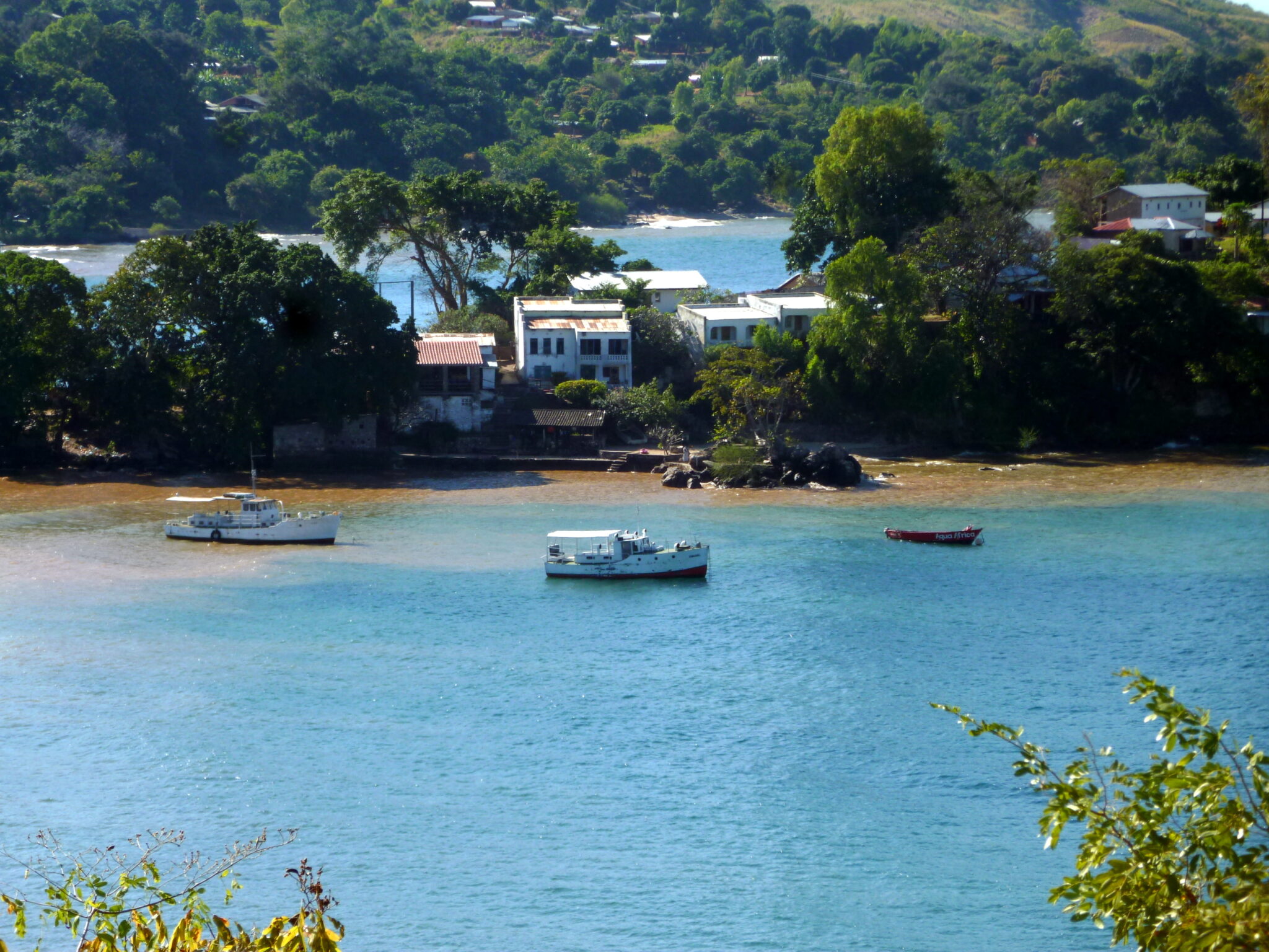
Livingstonia
Livingstonia is a historic mission settlement set high on the Livingstonia Plateau above Lake Malawi, known for sweeping viewpoints across the Rift Valley and a cool, quiet highland atmosphere. The altitude, often around 1,200 to 1,500 m in the immediate area, brings noticeably fresher air than the lakeshore and makes it ideal for scenic walks rather than heat-limited outings. The most memorable moments are the lookouts: on clear days you can see the lake far below, with layered escarpment lines that show why the Rift Valley landscape feels so dramatic here. The village itself has a distinct heritage character tied to the mission history, and the slower pace suits travelers who want a calm, scenic break between lake days and longer northern transfers.
Getting there typically routes through Chitimba on the lakeshore or via the M1 to Rumphi, then up the escarpment road. From Nkhata Bay, Livingstonia is roughly 90 to 110 km, but travel time is often 2.5 to 4 hours because the final ascent is steep and winding with switchbacks. From Mzuzu, plan about 2.5 to 4 hours in most cases, again shaped by the slow climb near the end. From Lilongwe, it is usually around 520 to 600 km and commonly 10 to 12+ hours by road, so it is best approached as part of a multi-stop northern route rather than a single push.

Kande Beach
Kande Beach is a laid-back lakeshore stop on Lake Malawi that feels calmer and less built-up than the headline hubs, making it a good choice for travelers who want simple water time without a busy scene. The shoreline here is typically broad and easy for long walks, with a relaxed, low-key rhythm that suits swimming, reading, and unhurried afternoons under shade. It is also a strong “in-between” base: close enough to northern routes to pair well with Nkhata Bay and Mzuzu, but quiet enough to feel like a retreat rather than a checkpoint. If you enjoy gentle activity, early-morning kayaking and short snorkel sessions around any nearby rocky patches can add structure to a day without turning it into an itinerary.
From Mzuzu, Kande Beach is commonly around 80 to 110 km depending on the exact turn-off and lodge location, often taking about 2 to 3.5 hours by road. From Nkhata Bay, allow roughly 40 to 70 km and about 1 to 2.5 hours. From Lilongwe, the journey is typically in the 380 to 460 km range and commonly 7 to 10 hours by road, so it is best approached as part of a northern route rather than a quick detour.

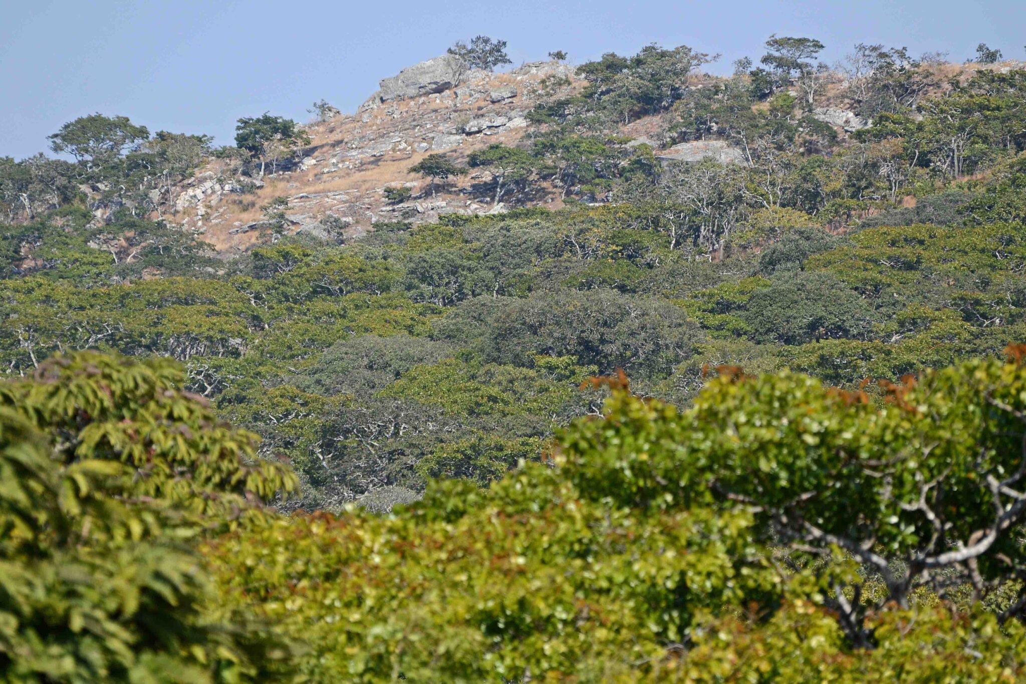
Viphya Forest
Viphya Forest is a broad highland forest zone between Mzuzu and the lakeshore, known for its cooler air, long pine plantations, and a quieter, “everyday nature” feel that contrasts strongly with Lake Malawi beaches and classic safari landscapes. At roughly 1,300 to 2,000 m elevation across different sections, temperatures can be noticeably lower than the lake, which makes it a pleasant stop for travelers who want to walk without heat stress. The scenery is simple but refreshing: tall pine stands, open clearings, and occasional views out toward surrounding hills, with a calm atmosphere that suits slow forest walks, short photo stops, and a break from road travel.
Access is straightforward because the forest sits close to the main northern corridor. From Mzuzu, many entry points are roughly 20 to 60 km away, commonly 30 to 90 minutes by road depending on where you start your walk. From Nkhata Bay, allow around 60 to 120 km and roughly 2 to 4 hours, since you need to climb away from the lakeshore and road speeds can be slower on the ascent. If you are coming from Lilongwe, the drive to Mzuzu is typically a full day at roughly 350 km and about 5 to 7 hours, and Viphya is an easy add-on either before you reach Mzuzu or as a detour on the way down to the lake.
Ntchisi Forest Reserve
Ntchisi Forest Reserve is one of Malawi’s most appealing “quiet nature” stops because it protects indigenous montane forest rather than plantation woodland, and it is largely outside the standard lake-and-safari circuit. The reserve sits on the Ntchisi massif, with higher sections around 1,500 m above sea level, so the air is cooler and the walking is often more comfortable than in the lowlands. The atmosphere is the main reward: dense evergreen forest, big old trees, shaded gullies, and a strong sense of seclusion that suits travelers who enjoy slow hiking, bird calls, and the feeling of being far from traffic and tour groups. Birding can be particularly satisfying in this type of habitat, and even a short walk can feel immersive because visibility is limited and the forest closes in around you.
From Lilongwe, the road distance is commonly around 160 to 200 km, often 3.5 to 5.5 hours depending on route and conditions. From Salima, allow roughly 110 to 160 km and about 2.5 to 4.5 hours. From Kasungu, it is often around 100 to 150 km and roughly 2.5 to 4 hours. Because the final approach can involve slower secondary roads, it is best to start early, arrive with daylight, and keep a buffer for the last 20 to 40 km.

Travel Tips for Malawi
Safety and General Advice
Malawi is often called the “Warm Heart of Africa” for its friendly people and welcoming atmosphere. It is generally safe and easy to travel in, with a relaxed pace that suits both independent travelers and guided tours. Normal precautions should be taken in cities and crowded markets, while visits to remote or rural regions benefit from advance planning and local support, particularly when arranging transport or accommodation near the lake or national parks.
A yellow fever vaccination may be required depending on your travel route, and malaria prophylaxis is recommended throughout the country. Tap water is not consistently safe to drink, so use bottled or filtered water for drinking and brushing teeth. Travelers should also pack insect repellent, sunscreen, and any prescription medications, as supplies can be limited outside major cities. Comprehensive travel insurance with evacuation coverage is strongly advised, particularly for those exploring rural areas or national parks.
Car Rental and Driving
An International Driving Permit is recommended alongside your national driver’s license, and both should be carried when driving or renting vehicles. Police checkpoints are common but typically routine; keeping documents accessible and being polite will ensure smooth passage. Driving in Malawi is on the left-hand side of the road. Main routes between cities and popular tourist areas are generally well maintained, though rural roads can be rough, especially during or after the rainy season. Night driving outside towns is not recommended due to livestock, pedestrians, and limited street lighting. Travelers planning to drive independently should ensure their vehicle is in good condition and carry spare fuel and water for longer trips.
Published February 03, 2026 • 23m to read