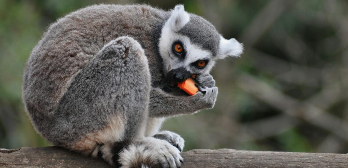
Madagascar is one of the world’s most distinctive travel destinations, defined by extraordinary biodiversity and ecosystems found nowhere else. The island is home to lemurs, baobab trees, spiny deserts, and rainforests where many plant and animal species evolved in isolation. Its landscapes vary sharply across regions, ranging from limestone formations and deep canyons to coral reefs and sparsely populated coastal areas.
Travel in Madagascar is shaped by logistics and distance rather than speed. Roads are often slow and uneven, and reaching key regions can take significant time. As a result, trips are most successful when they focus on a single route or region instead of attempting to see the entire island. For travelers who plan carefully and move patiently, Madagascar offers rare wildlife encounters and landscapes that feel genuinely unlike anywhere else.
Best Cities in Madagascar
Antananarivo
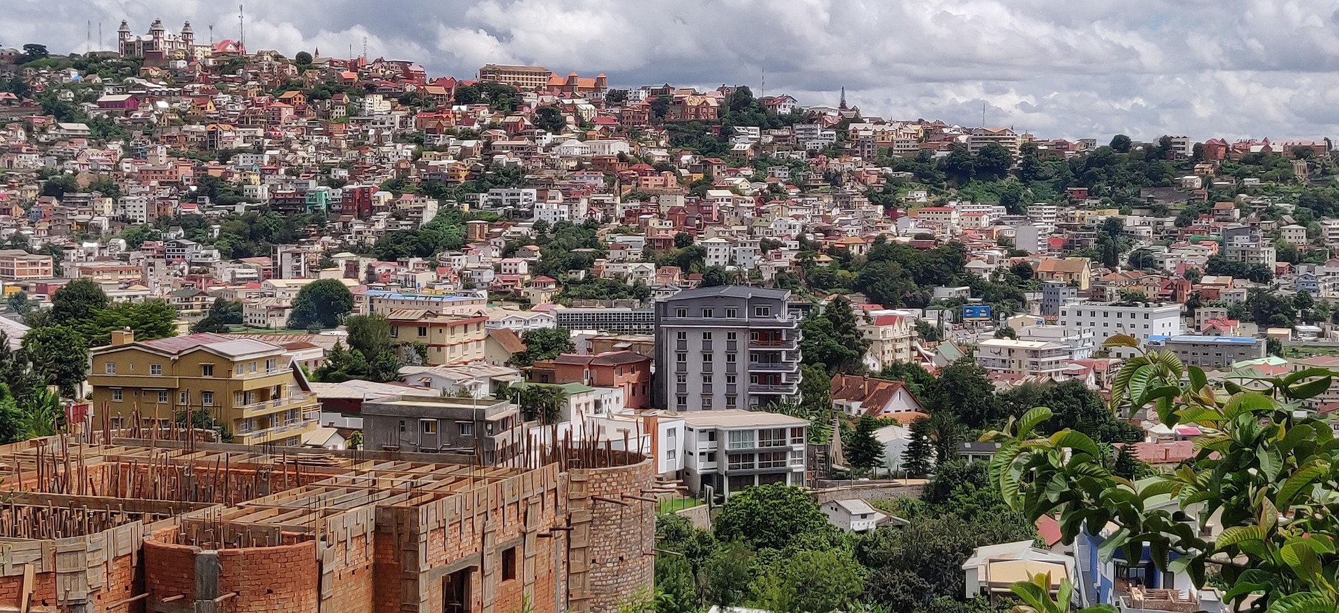
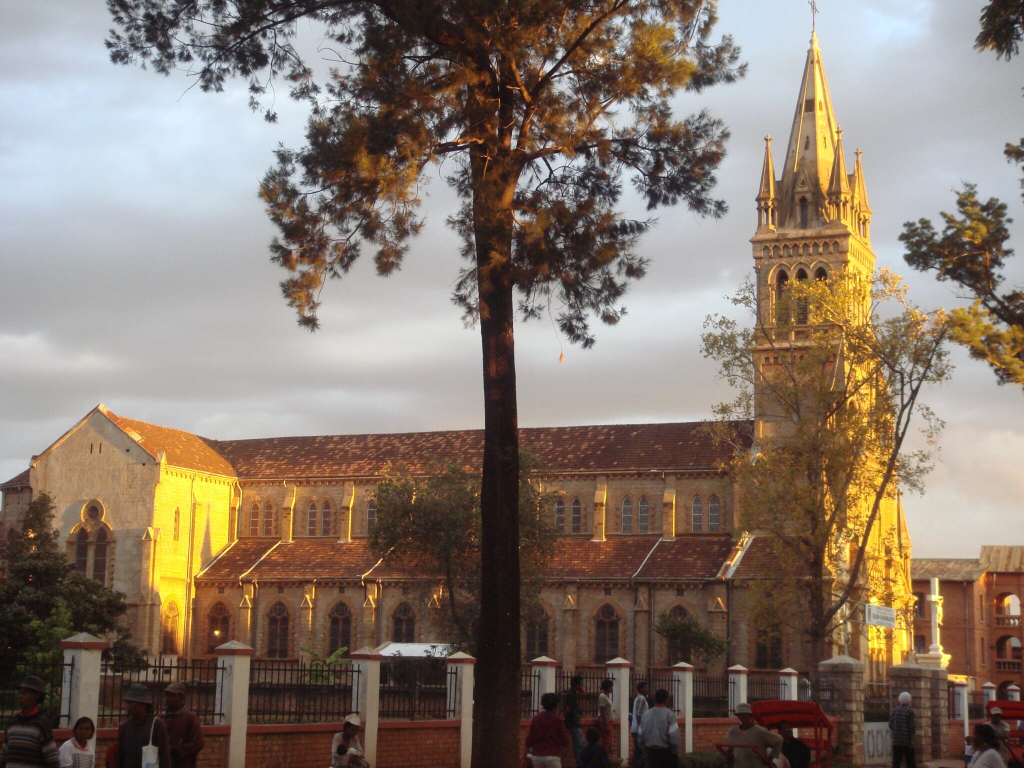
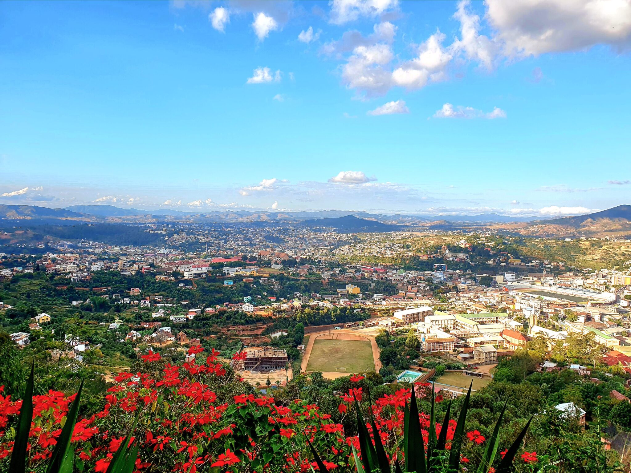
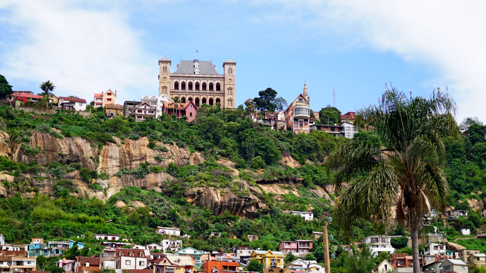
Antananarivo (Tana) is Madagascar’s capital and the country’s main international gateway, set at roughly 1,250–1,400 m above sea level in the Central Highlands. It is worth at least a half day for orientation, views, and a first look at Merina history. Start in the Upper Town around Haute-Ville and Andohalo, where steep lanes and stairways link lookout points over the city’s red-tiled roofs and surrounding rice terraces. The headline sight is the Rova of Antananarivo on the hill of Analamanga, long the symbolic heart of the Merina Kingdom. Even with periods of restoration, the site helps you understand why this ridge mattered strategically and culturally, and the viewpoints give a clear sense of the city’s scale. For everyday life, Analakely Market and the surrounding commercial streets are energetic and crowded; go in the morning, keep valuables minimal, and treat it as a short, purposeful visit rather than a long wander.
To visit efficiently, plan on 3–5 hours for the Upper Town and main viewpoints, plus another 1–2 hours if you want a market walk and a museum stop. Antananarivo is also a practical base for close-by day trips: Ambohimanga (a UNESCO-listed royal hill) is about 20–25 km northeast and usually takes 45–75 minutes by car depending on traffic; it is one of the best half-day excursions from the capital for history and landscape. Getting around inside Tana is fastest by pre-booked car with a driver; traffic can be heavy, and walking is best kept to daylight in the most visited areas. For onward travel, domestic flights leave from Ivato Airport (around 15–20 km from the center, often 30–90 minutes by road), while the main overland routes head south toward Antsirabe and beyond; if you are continuing by road, start early to avoid peak congestion and aim to be off the highway before dark.
Antsirabe
Antsirabe is a relaxed highland city at about 1,500 m elevation, and that altitude gives it noticeably cooler days and crisp nights compared with the coast. Many travelers use it as a natural break on the main southbound highway from Antananarivo, but it can be more than a transit stop if you like small-city atmospheres and photography. The center still shows colonial-era villas and civic buildings, and the town is known locally for thermal springs and a long tradition of crafts and small-scale industry. A simple way to experience Antsirabe is to spend a morning walking the central streets, then shift quickly to the countryside where the landscapes open into fields, eucalyptus-lined roads, and scattered villages.
The best use of Antsirabe is its easy access to nearby lakes and rural scenery. A popular outing is Lake Andraikiba, roughly 10 km from town (often 20–30 minutes by car depending on road conditions), for gentle shoreline walks and wide views across the water. For more dramatic terrain, the crater-lake area around Tritriva is about 15–20 km away and usually 45–75 minutes by car; it sits higher in the hills and feels more remote, with short paths leading to viewpoints. If you have limited time, do one of these as a half-day loop and keep the rest of the day for rest and logistics.
Fianarantsoa
Fianarantsoa (often called Fiana) is one of Madagascar’s most characterful highland cities, sitting at roughly 1,100–1,200 m above sea level and functioning as a key hub in the south-central region. Its standout area is the Old Town (Haute Ville), built on a steep hill with narrow lanes, stairways, and churches that create a very different mood from the more commercial roadside stops. The rewards are mainly atmospheric: viewpoints over terraced hillsides and valleys, small workshops, and everyday street scenes that feel distinctly highland. If you have time for only one structured activity, a guided walk through the Old Town is usually the best value, because it helps you navigate confidently, find the best lookouts, and understand how the city developed as an administrative, religious, and trading center.
Fianarantsoa is also practical, because it sits on the main RN7 route and links well to major nature areas. Many travelers use it as a staging point for Ranomafana National Park, one of the country’s flagship rainforest reserves. The park is roughly 60–70 km away, and the drive often takes 1.5–3 hours due to curving roads and variable surfaces, so it works well as a day trip or a one-night move. Beyond Ranomafana, Fiana connects you to southern highland scenery and the longer overland route toward the south, where travel times can stretch because conditions change quickly from one section to the next.
Toamasina (Tamatave)
Toamasina is Madagascar’s principal east-coast port city, set at sea level with a consistently hot, humid climate that feels very different from the central highlands. It is usually best treated as a transit hub, useful for stocking up, organizing transport, and breaking up long journeys rather than for major sightseeing. The most enjoyable time in town is often a short coastal stroll and a look at the working waterfront atmosphere that comes with a large port, plus an evening meal focused on fresh seafood. Because the east coast is rainier and more weather-exposed, Toamasina’s main value is how it connects you to nearby rainforest reserves and island or lagoon destinations.
From Toamasina, one of the most common onward routes is to Andasibe-Mantadia (for rainforest and lemurs) via the RN2 corridor. Although the distance is only around 140–160 km depending on the exact starting point and route, the drive can still take 4–6+ hours because of traffic, road condition, and weather. Another popular link is to the canal and lagoon scenery toward Akanin’ny Nofy (Palmarium) on Lake Ampitabe, which typically involves a road transfer to the Manambato area and then a boat crossing; the combined journey often takes most of a day and is highly sensitive to rain and boat schedules. Many travelers also use Toamasina as a stepping stone for east-coast islands, where timing matters, since rough seas and downpours can disrupt departures.
Best Wildlife and Natural Wonders Sites
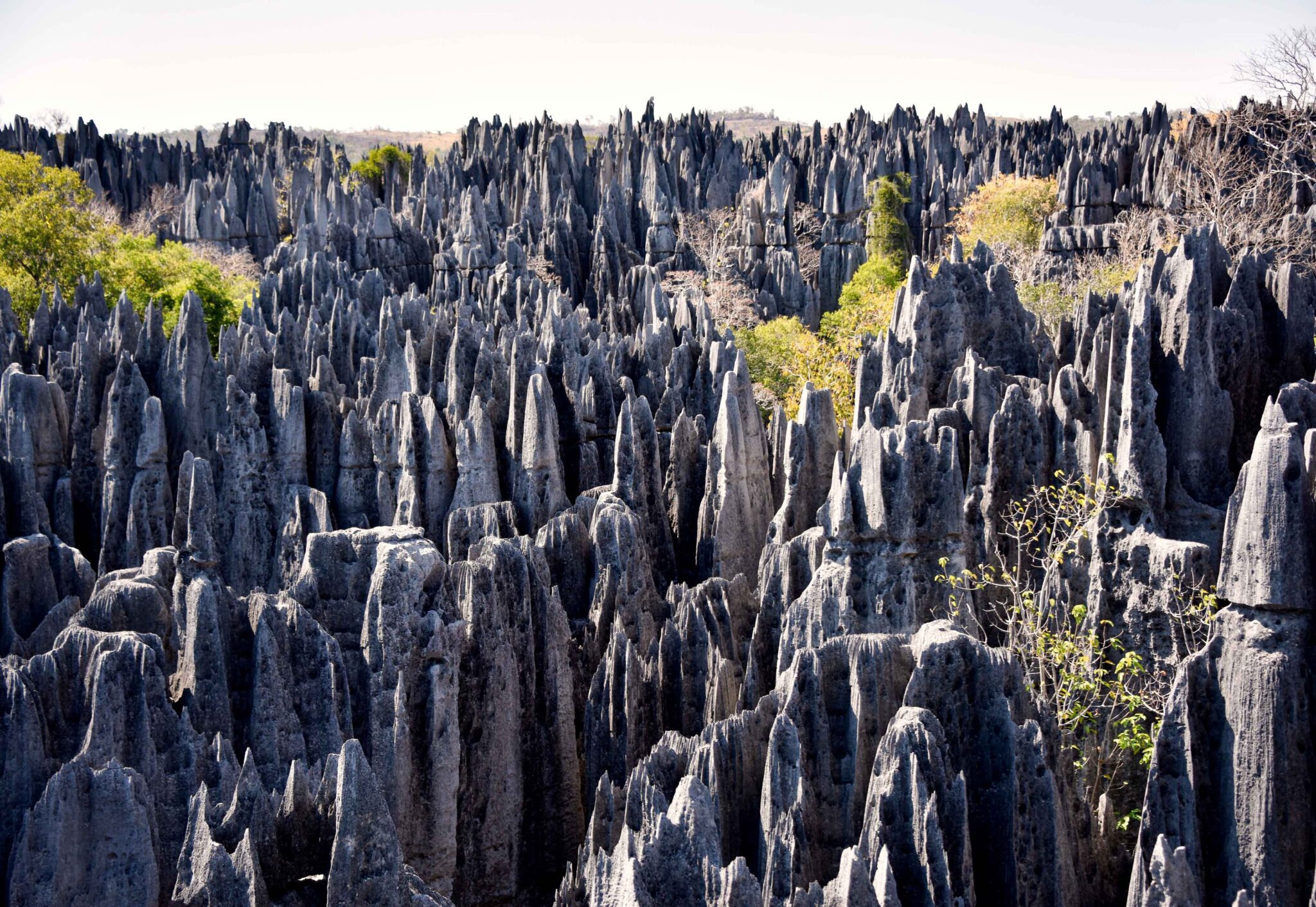
Tsingy de Bemaraha National Park
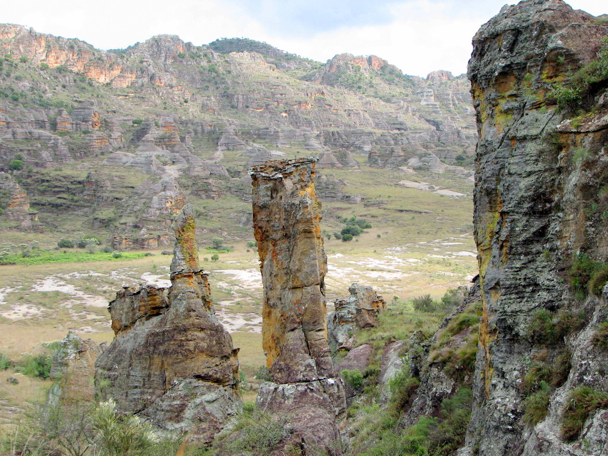
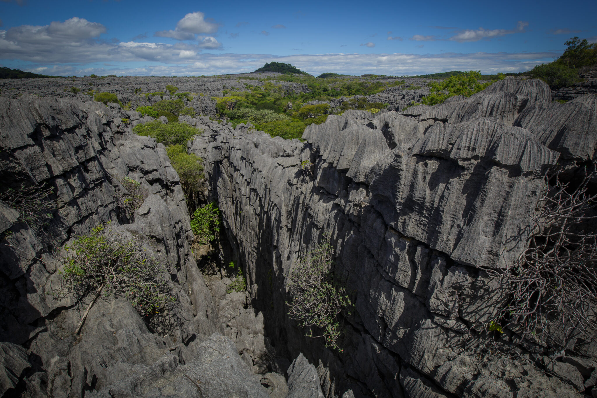
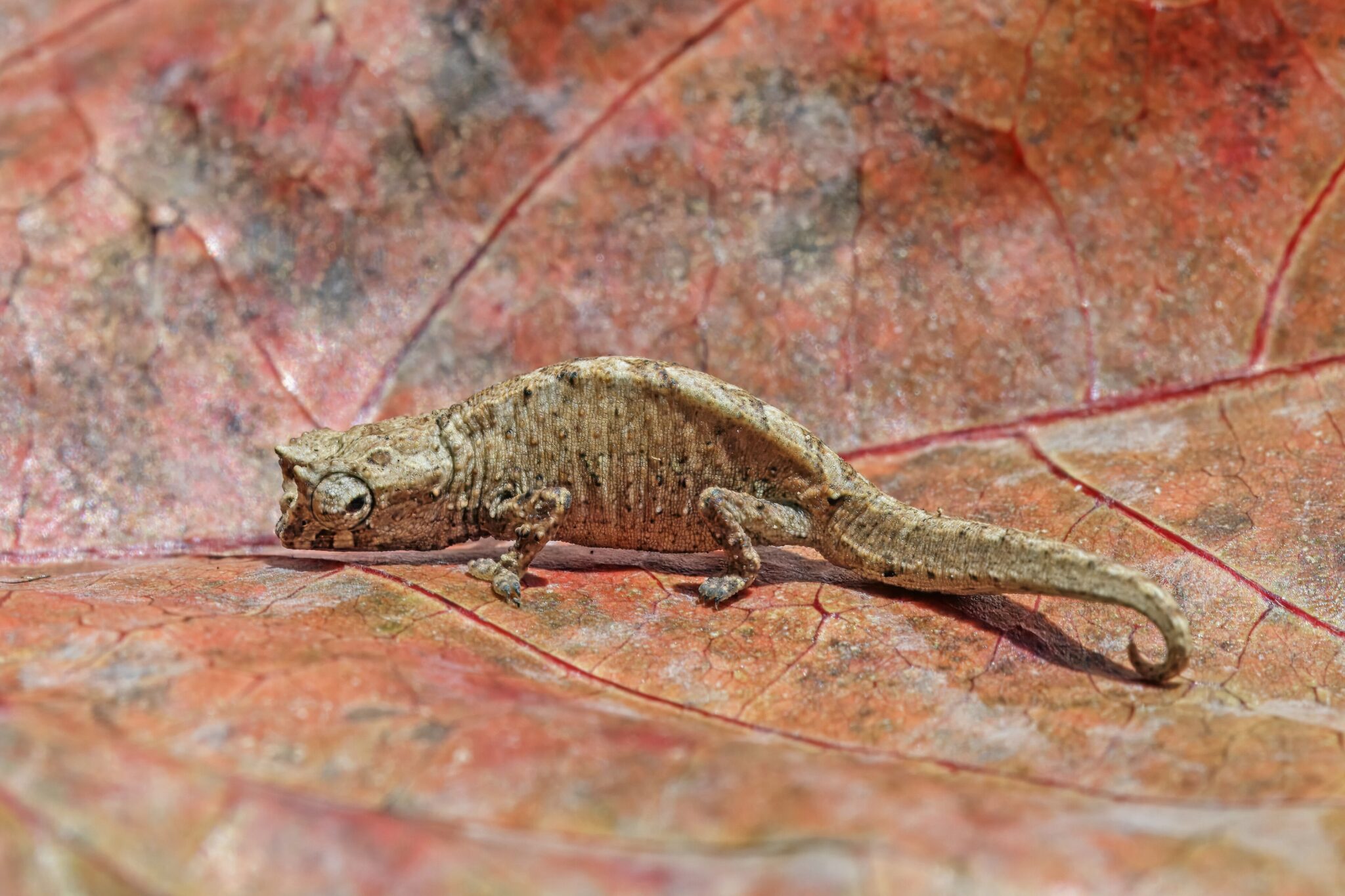
Tsingy de Bemaraha National Park is Madagascar’s flagship limestone wilderness and a UNESCO World Heritage area, famous for its razor-sharp karst pinnacles that rise like a stone forest above canyons and dry deciduous woodland. The classic visit combines narrow rock corridors, ladders, and suspended bridges with viewpoints over gorges and hidden pockets of vegetation that survive in cracks in the limestone. Wildlife sightings are often a bonus rather than the main event, but the park supports multiple lemur species, plus geckos, chameleons, and other reptiles that are well adapted to a dry, rocky environment. Most itineraries split time between the more accessible Petit Tsingy circuits and the longer, higher, more technical routes in the Grand Tsingy, where you spend hours moving across uneven rock and elevated walkways.
The practical reality is that Tsingy is a destination you earn through logistics. The usual base is Bekopaka, and the last stretch is slow because roads can be rough and river crossings can delay you. From Morondava the journey is often 8–12 hours one way in a 4×4, sometimes longer after rain, so it makes sense to stay at least 2 nights near the park to justify the travel. From Antananarivo, most travelers either fly or drive to Morondava first, then continue overland. Conditions are most reliable in the dry season, when trails are safer and access roads are less likely to become impassable, while the wetter months can disrupt plans or force route changes.
To visit well, plan for at least one full day on the rock circuits and consider two days if you want both Petit and Grand Tsingy without rushing. Wear sturdy hiking shoes with strong grip, bring work gloves to protect your hands on sharp limestone and metal rungs, and carry 2–3 liters of water per person for longer loops because heat and exposure can be intense.
Isalo National Park
Isalo National Park is Madagascar’s classic canyon landscape, defined by weathered sandstone massifs, sculpted gorges, and open, semi-arid plateaus that feel closer to a desert mountain park than a rainforest reserve. The most popular hikes link panoramic viewpoints with shaded canyon sections and natural swimming pools fed by small streams. Expect a mix of rock steps, sandy paths, and exposed ridgelines, with scenery that changes quickly from grassland and rocky domes to pockets of palms and fern-filled ravines. Wildlife is not the main draw, but you can still spot lemurs and birds along the greener canyon corridors, especially in the cooler hours.
The park’s best-known route is the circuit to Piscine Naturelle, usually a 2–4 hour round trip depending on pace and conditions, with time to swim and relax. Longer options add Canyon des Singes or Canyon des Rats, turning the day into a 4–7 hour hike with more dramatic rock walls and wider viewpoints. Because much of Isalo is exposed, heat builds fast, and the difference between an early start and a late start is significant. Starting around 06:00–08:00 typically gives cooler walking, better visibility, and softer light for photography. Bring at least 2 liters of water per person for shorter loops and more for long circuits, plus sun protection and shoes with good grip for slick rock near pools.
How to visit and get there: The usual base is Ranohira, a small town right by the park entrance. From Fianarantsoa to Ranohira is roughly 280–300 km and commonly 6–9 hours by road, while from Toliara (Tuléar) it is about 240–260 km and often 5–8 hours depending on road condition and stops. Most travelers arrive in Ranohira the evening before, hike early the next morning, and leave the following day to keep the pace realistic.
Andasibe-Mantadia National Park
Andasibe-Mantadia is the classic rainforest experience within realistic reach of Antananarivo, and it consistently delivers on what most travelers come for: lush eastern rainforest, loud dawn choruses, and one of the best chances in Madagascar to encounter indri, the country’s largest living lemur. The easier, most visited section near Andasibe village is often referred to as Analamazaotra, where trails are relatively well-established and wildlife density is high for a short trip. Expect humid forest, slippery roots, and frequent light rain, with walks focused on listening first, then tracking movement in the canopy. Even if you are not a serious wildlife watcher, the soundscape alone is memorable, because indri calls can carry for several kilometers through the valley.
Overland from Antananarivo to Andasibe is roughly 140 to 160 km on the RN2 corridor and typically takes 3 to 5 hours by car depending on traffic leaving the capital and roadworks. Many travelers arrive by early afternoon, do a first daytime walk, sleep locally, then hike again at dawn and add the night walk before or after dinner. If you are coming from the east coast, the drive from Toamasina to Andasibe is usually 4 to 6 hours despite a shorter distance on paper, largely due to road pace and weather. Build time buffers in the wetter months, because rain can slow driving and also makes trails slick, which affects how far you can comfortably go inside the forest.
Ranomafana National Park
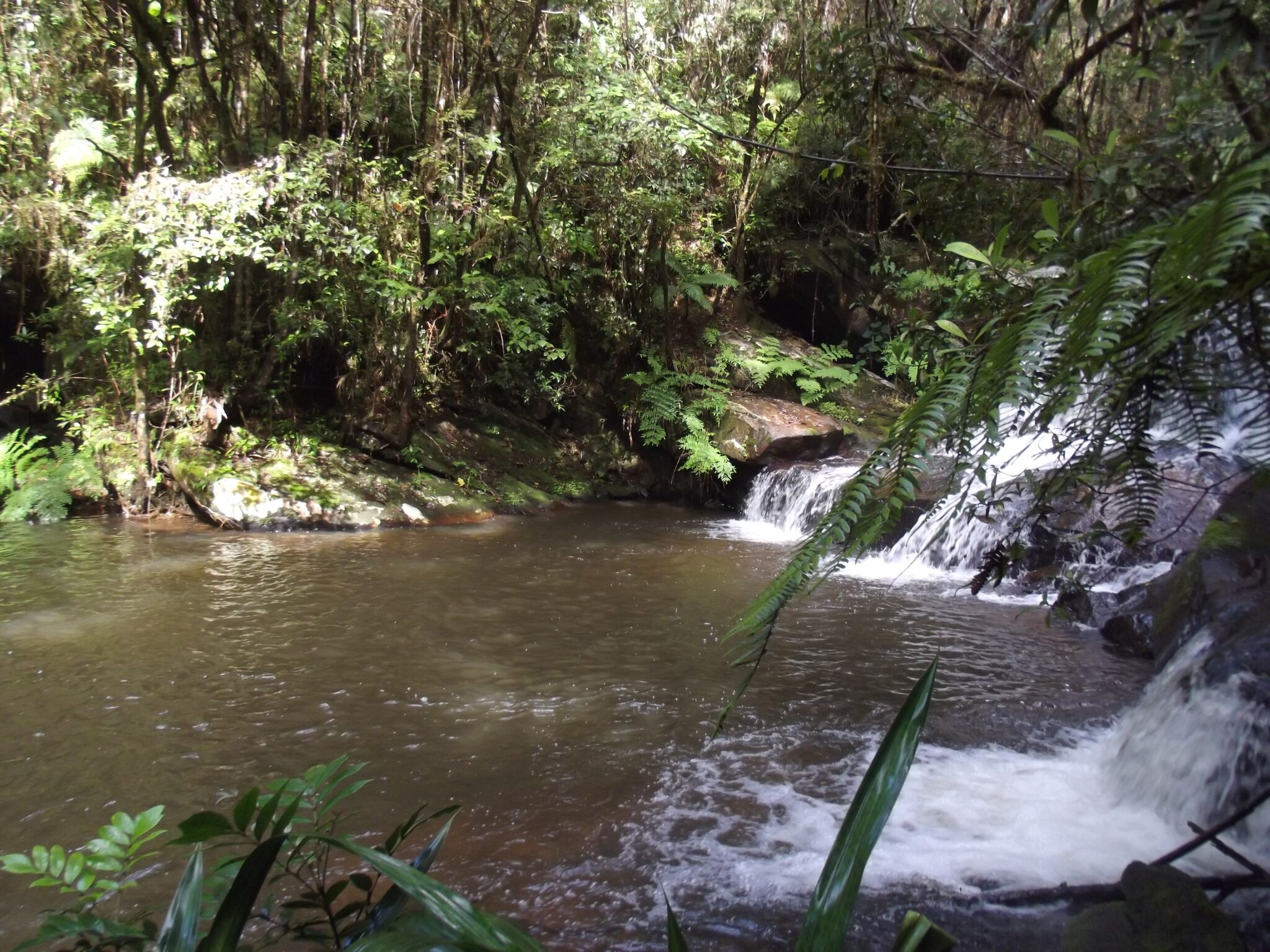
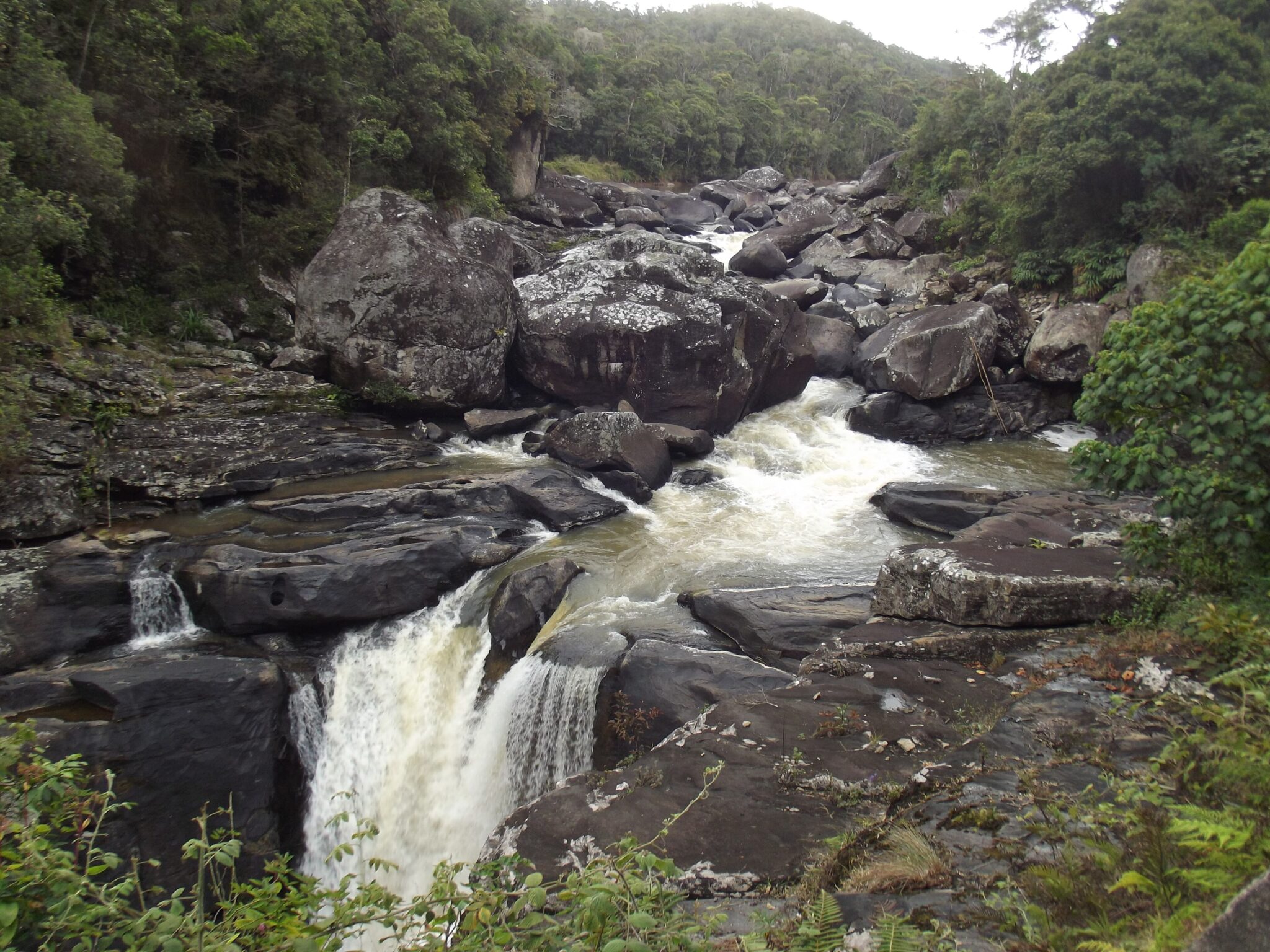
Ranomafana National Park is one of Madagascar’s strongest rainforest destinations for biodiversity and longer, more immersive trekking. The protected area covers roughly 416 km² and spans about 800 to 1,200 m in elevation, which creates cooler, mistier forest conditions than the lowlands and supports a dense mix of habitats. Expect steep, muddy trails, stream crossings, and frequent humidity, plus a good chance of primate activity if you give your guide time to track calls and movement. In addition to lemurs, the park is known for rich amphibian and reptile life, and birding can be excellent along forest edges and river valleys. Waterfalls and cascades are common on longer routes, and the nearby hot-water tradition that gave Ranomafana its name can be a pleasant low-effort add-on after a demanding hike.
To visit well, plan at least one full day in the forest and ideally two, mixing a moderate loop with a longer trek of 4 to 7+ hours depending on trail conditions. Start early for cooler temperatures and better wildlife activity, carry 2 to 3 liters of water per person on longer days, and protect electronics in dry bags because rain and spray are routine. Base yourself in Ranomafana village for the easiest early starts. For access, Ranomafana is about 60 to 70 km from Fianarantsoa, typically 1.5 to 3 hours by road because speeds vary, and it is often reached via the RN7 corridor before turning east. From Antananarivo, the overland journey is roughly 390 to 410 km and commonly takes 8 to 12 hours in real conditions, so many itineraries break the trip with an overnight on the way. If your schedule is tight, treat Ranomafana as a two-night stop to avoid rushing the hikes and to keep a buffer for rain-related delays.
Ankarana National Park
Ankarana National Park in northern Madagascar protects a rugged limestone plateau of about 180 km², cut by canyons, sinkholes, and sharp tsingy pinnacles. The headline experiences are the tsingy viewpoints and ridge walks, plus cave sections where you can see karst chambers, stalactites, and underground waterways. It is also a strong wildlife stop for the north: guided forest walks commonly focus on lemurs (including crowned and Sanford’s brown lemurs), roosting bats near cave entrances, and a high variety of reptiles, with the best viewing usually early morning and late afternoon when temperatures are lower.
To visit, you typically enter with a local guide from one of the main access points (often near Mahamasina on the RN6 corridor). Choose a circuit that matches your fitness: shorter routes can take around 2 to 4 hours, while full-day circuits can run 6 to 8 hours and include ladders, narrow limestone corridors, and exposed sections on the tsingy. Wear sturdy, closed shoes with good grip, carry at least 1.5 to 2 liters of water per person, and bring a headlamp if your route includes caves; gloves can also help on sharp rock. The dry season months are generally easier for footing and river crossings, while the wet season can make trails slick and some sections slower.
Getting there is simplest by road on RN6. From Antsiranana (Diego Suarez) it is roughly 100 to 120 km and usually about 2 to 3 hours by car depending on road conditions; from Ambilobe it is around 25 to 35 km, often under an hour. From Nosy Be, most travelers go via Ambanja and then continue by road to the RN6, which commonly makes it a long day (often 5 to 7+ hours total with transfers). If you are coming from Antananarivo, many visitors fly to Antsiranana first and then drive, or travel overland as part of a multi-day RN4 and RN6 route through the north.
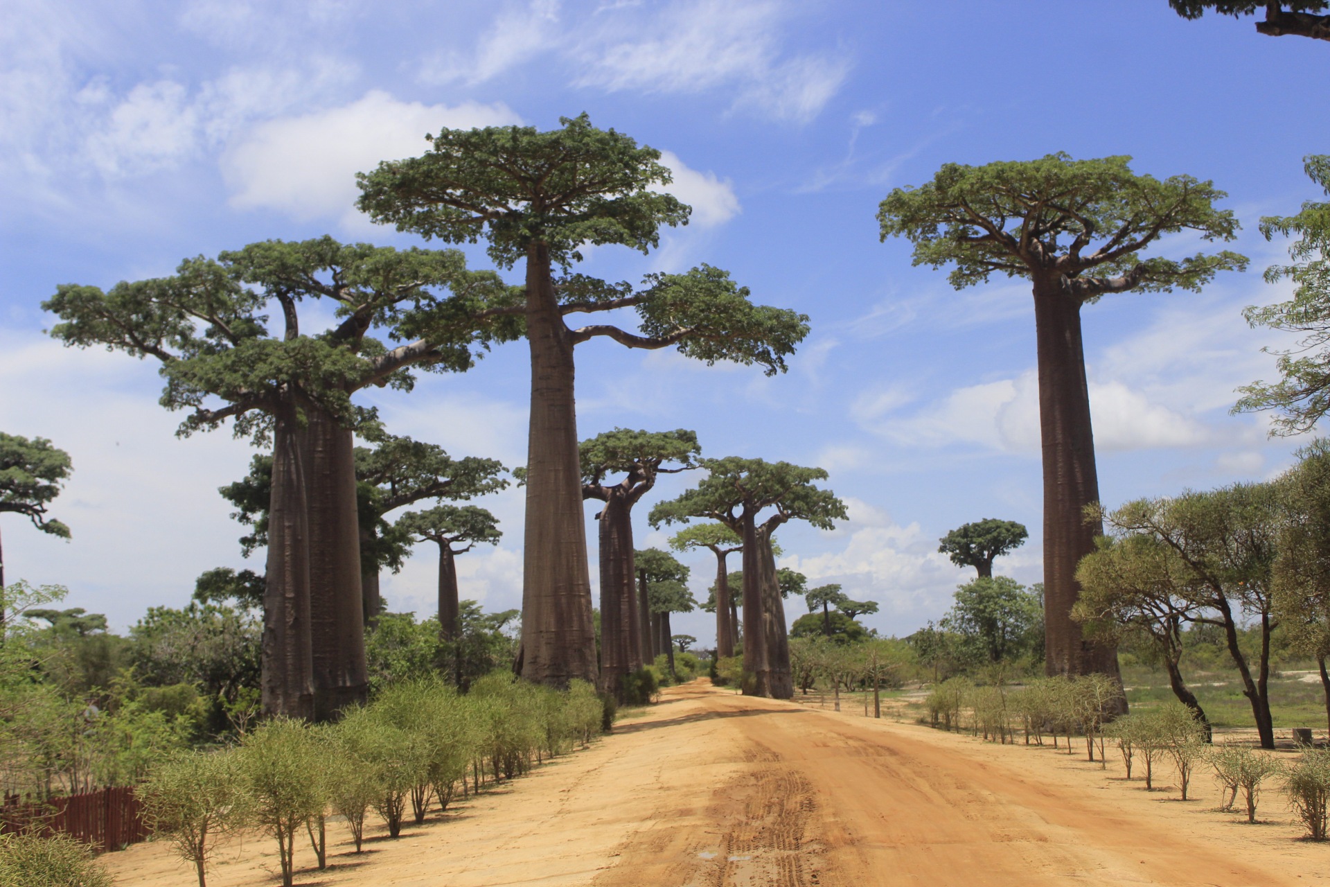
Avenue of the Baobabs
The Avenue of the Baobabs is a sandy dirt road about 20 km northeast of Morondava in western Madagascar, lined with towering Grandidier’s baobabs that often reach roughly 25 to 30 m tall and can be many centuries old. The classic experience is light: at sunrise the silhouettes look crisp and the air is cooler, while at sunset the trunks glow gold and long shadows stretch across the road as zebu carts and bicycles pass through. In the dry season, fine dust in the air can make the scene more dramatic, and you can also look for the nearby cluster sometimes called the Baobab Amoureux, where two trees lean toward each other, plus smaller side tracks with fewer visitors if you want quieter compositions.
Plan it as an easy half-day from Morondava, but consider visiting twice, because the atmosphere changes completely. Aim to arrive 30 to 45 minutes before sunrise or sunset to claim a good spot and watch the colors build, and bring water and sun protection since there is very little shade. Getting there is straightforward: by car or taxi it is typically 30 to 45 minutes from Morondava depending on the condition of the dirt road, while by motorbike it can be similar but dustier.
Kirindy Forest
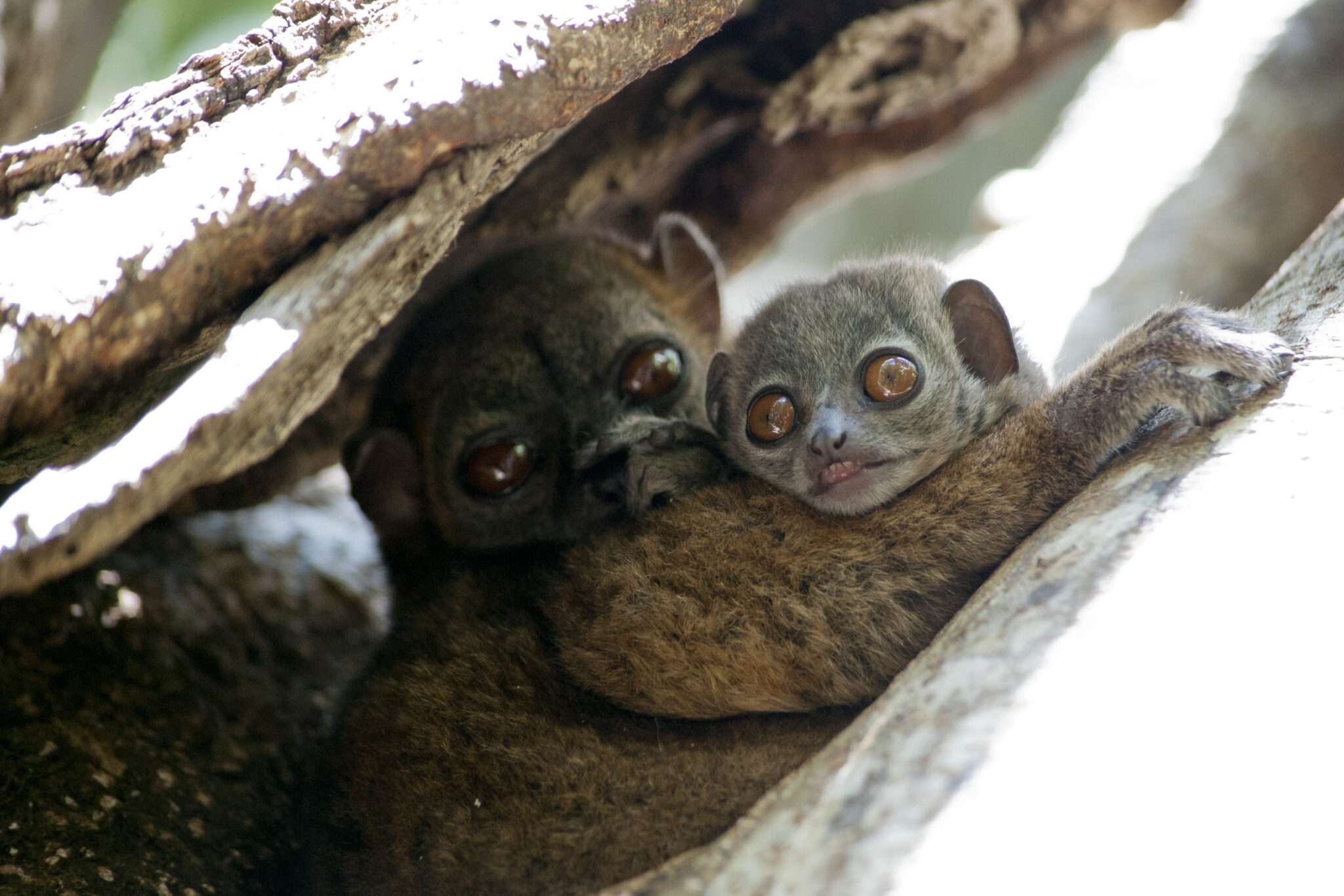
Kirindy Forest is a dry deciduous forest reserve about 60 km northeast of Morondava in western Madagascar, best known for night walks and the chance to spot species that are hard to see elsewhere. The star is the fossa, Madagascar’s top predator, and Kirindy is also a reliable place for nocturnal lemurs such as the fat-tailed dwarf lemur, plus sportive lemurs and mouse lemurs. By day, the forest feels open and sunlit compared with the island’s rainforests, with big seasonal contrasts: in the dry months many trees lose their leaves, visibility improves, and wildlife often concentrates around remaining water sources. Day walks can also turn up sifakas, giant jumping rats, and a high variety of reptiles, while birding is best early morning when temperatures are still mild.
Plan for both a daytime walk and a night walk to cover the full range of animals and behavior. A typical day walk is often around 2 to 3 hours, while night walks commonly run 60 to 120 minutes, moving slowly with a guide scanning tree trunks and canopy for eye-shine. Bring a headlamp with a red-light option if you have it, plus long sleeves, insect repellent, and closed shoes, since thorny undergrowth and sand can be an issue. Nights can feel cooler than you expect in the dry season, so a light layer is useful, and keeping noise low improves your odds of seeing shy species.
Masoala National Park
Masoala National Park protects one of Madagascar’s largest remaining blocks of lowland rainforest along the Masoala Peninsula, combined with coastal habitats and coral-fringed bays that make it a rare forest and marine package in one destination. The park area is roughly 2,300 km², and the experience feels genuinely remote: dense primary forest, mangroves, river mouths, and beaches where you can switch between guided rainforest hikes and coastal exploration in the same trip. Wildlife highlights can include red-ruffed lemurs, helmet vangas and other rainforest birds, chameleons and frogs, plus seasonal marine encounters offshore. During the austral winter months, humpback whales migrate along the northeast coast and are sometimes seen from boats, adding a big extra draw if your timing is right.
On the ground, plan for slow travel and immersive days rather than quick sightseeing. Guided walks range from short 2 to 3 hour forest loops to longer day treks that push deeper into the peninsula, with humidity, leeches in wetter periods, and slippery roots on steep sections. Bring fast-drying layers, a dry bag for electronics, and footwear that grips well in mud. Coastal time can include snorkeling in calmer bays, beach walks, and boat transfers between villages and trailheads, but sea conditions and rain can change plans quickly. Because logistics dominate the experience, Masoala works best with a base for several nights, allowing you to do one focused forest day, one longer interior hike, and at least one coastal day without feeling rushed.
Makay Massif
Makay Massif is one of Madagascar’s most remote wilderness areas, a vast sandstone plateau carved into a maze of narrow gorges, hidden valleys, seasonal rivers, and hundreds of isolated rock towers. It lies inland in the south-central west and is often described as a true exploration destination because there is no conventional park infrastructure, roads are limited, and many canyons can only be reached on foot with porters and camp support. The landscape is the main attraction: steep-walled canyons, natural pools and waterfalls after rains, panoramic ridge viewpoints, and pockets of forest sheltered deep in the gorges that can hold surprising biodiversity. Trips here feel like continuous discovery, but also continuous effort, with heat, navigation complexity, and long days walking on sand, rock, and riverbeds.
A typical Makay itinerary is expedition-style and usually runs around 7 to 14 days, sometimes longer, with multi-day treks between camps and daily hikes that can easily reach 10 to 20 km depending on the canyon route. Expect to carry only day gear while the team handles food, water planning, and camp equipment; water sources can be seasonal, so the route and timing matter. The best season is generally the drier months when trails and river crossings are safer, but even then temperatures can be high in exposed sections. This is not a destination for improvised logistics: you need a structured plan, satellite communications, strong local knowledge, and contingency days for delays.
Best Beaches and Coastal Destinations
Nosy Be
Nosy Be is a volcanic island off Madagascar’s northwest coast, often treated as the country’s easiest base for beach time thanks to frequent connections, a broad range of hotels, and reliable day-trip logistics. The main draws are lagoon-like bays, offshore reefs, and short boat hops to smaller islands such as Nosy Komba and Nosy Tanikely, where snorkeling is often the headline activity. Conditions vary a lot by beach: some areas have calmer water and better near-shore reef access, while others are better as a departure point for excursions, diving, and sunset cruises. On land, you can break up the beach rhythm with a climb in the Lokobe area for rainforest and wildlife, or a visit to viewpoints and plantation zones in the island’s interior.
Nosy Iranja
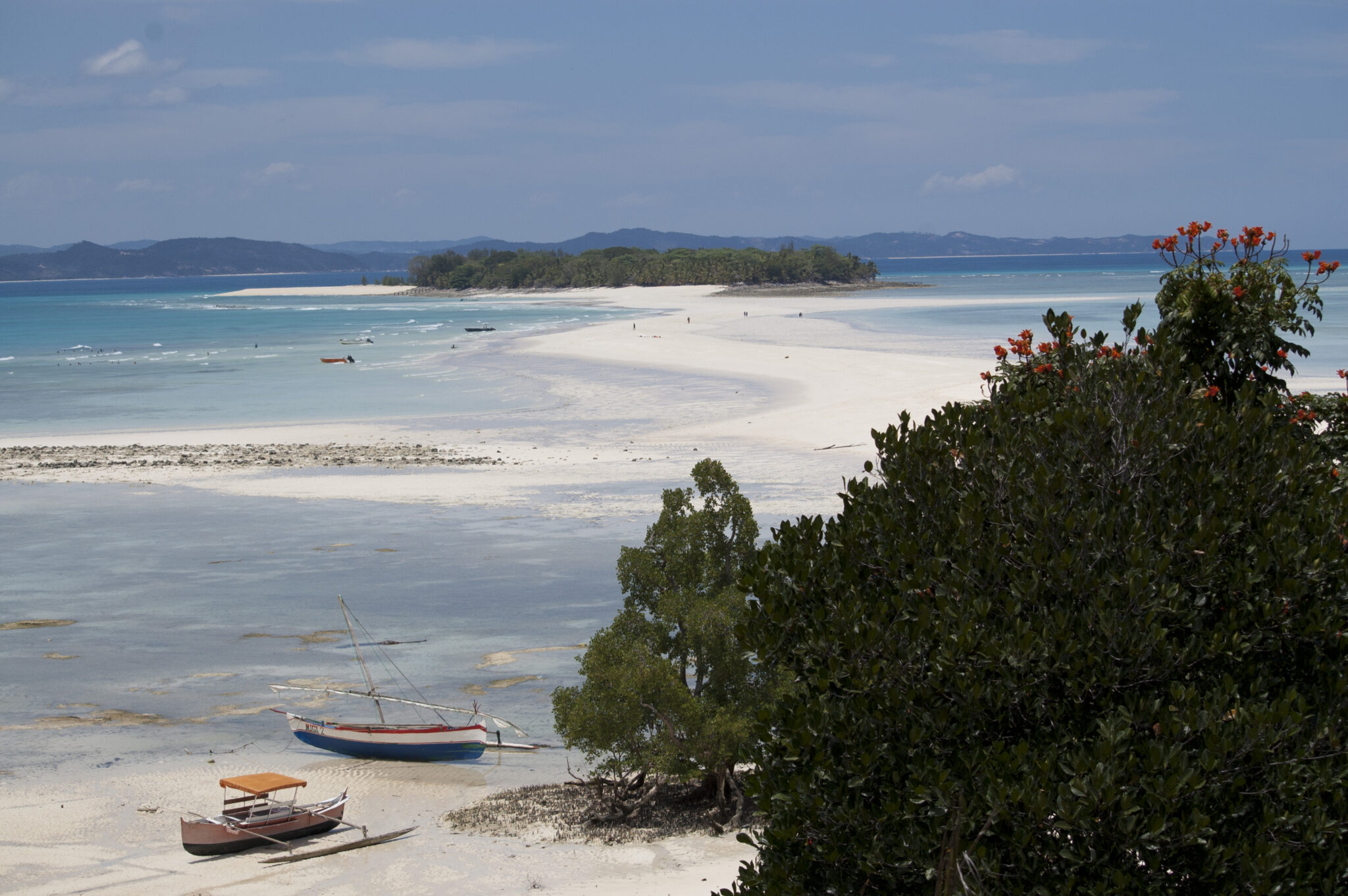
Nosy Iranja is a pair of small islands connected by a pale sandbar that appears and narrows with the tide, creating that postcard look of white sand over shallow, turquoise water. The usual experience is simple and high impact: a boat ride across open water, time on the sandbar for swimming and photos, and snorkeling in clear shallows where visibility is often best when the sea is calm. Because it is remote and low-built compared with Nosy Be, the scenery can feel more pristine, but it is also a destination where conditions control everything: wind, swell, and sun angle can change the color of the water and the comfort of the crossing.
Most visitors go as a day trip from Nosy Be by speedboat, commonly taking around 1.5 to 2.5 hours each way depending on sea conditions and departure point. In rougher weather the crossing can be uncomfortable or cancelled, so it is wise to keep your schedule flexible and place this trip earlier in your Nosy Be stay rather than on your last day. If you are based on the mainland around Ambanja or Hell-Ville, you typically connect by road and then join a boat departure, but for most travelers, staying on Nosy Be is the simplest way to make the timing work around tides and morning departures.
Île Sainte-Marie (Nosy Boraha)
Île Sainte-Marie, also known as Nosy Boraha, is a long, narrow island off Madagascar’s east coast with a noticeably quieter feel than the northwest resort circuit. It is roughly 50 km long, so the best way to experience it is to base yourself for several nights and explore in short hops rather than rushing. Highlights include relaxed beaches and shallow lagoons, a compact main town around Ambodifotatra, and a small but atmospheric pirate-era heritage that you can see in local sites such as old cemeteries and coastal anchorages tied to the island’s seafaring past. For a classic low-effort tropical day, many visitors add Île aux Nattes at the southern tip, reached by a short canoe crossing, for calmer water, softer sand, and an even slower pace.
If whale watching is a priority, plan around the typical humpback migration window, usually from July to September, with peak sightings often in August, and build in multiple days so you can rebook around wind and swell. Trips are commonly a few hours on the water, and success often improves with early departures and a flexible schedule that lets you go out more than once. Outside whale season, Sainte-Marie still works well for a gentle island routine: cycling or scooter rides along the coastal road, beach time, lagoon swims, simple snorkeling when visibility is good, and short guided walks where you can add a bit of nature and village life to the stay.
Anakao
Anakao is a small fishing village on Madagascar’s southwest coast, known for wide beaches, clear shallows, and a strong sense of local life centered on traditional pirogue sailing canoes. It feels intentionally simple: sandy lanes, low-key lodges, and days paced by tides and fishing routines rather than nightlife or big resorts. The main reasons to come are the coastal scenery and the marine environment. Boat trips can take you to offshore islets and protected areas where snorkeling is often at its best on calm mornings, with coral gardens, reef fish, and sea turtles more likely when visibility is high and wind is low. On land, a short excursion can also introduce the spiny forest landscape that makes the southwest so different from Madagascar’s rainforests.
Plan for a slower stay and fewer built-in services. Electricity may be limited by generator hours in some places, mobile signal can be inconsistent, and supplies are basic, so it is wise to bring essentials such as sunscreen, insect repellent, a dry bag, and any specific medication you need. Cash is important because ATMs and card payments are not something you should rely on, and you will want small bills for boat trips and local purchases. Most visitors stay at least 2 to 4 nights to make the travel effort worthwhile and to have a spare day in case wind or swell disrupts snorkeling plans.
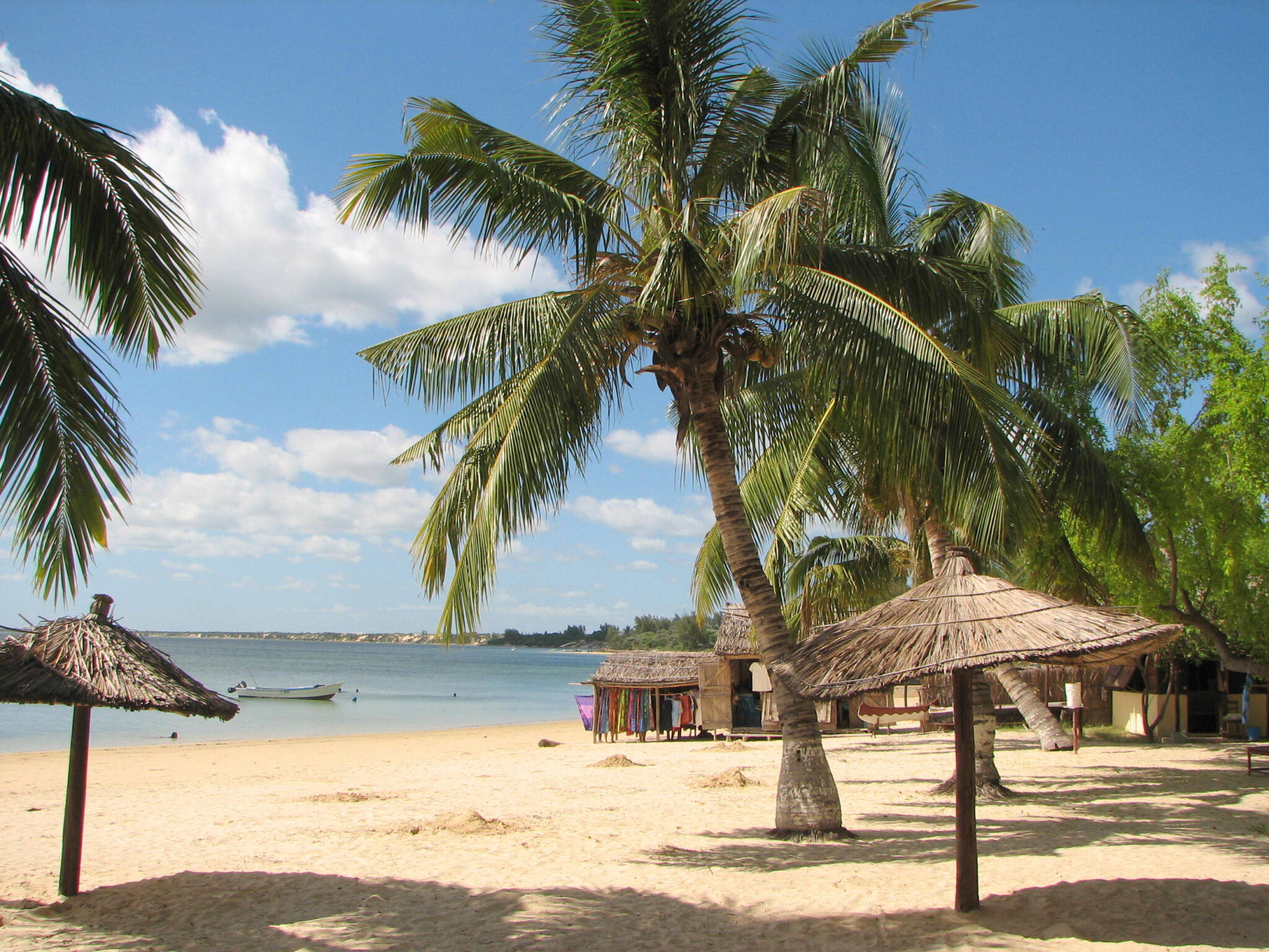
Ifaty
Ifaty is a coastal area north of Toliara on Madagascar’s southwest shore, best known for its lagoon and reef system and for being an easy base to sample two very different environments in one stay. On the water, the draw is snorkeling and relaxed beach time in a setting that often feels calmer and more accessible than more remote Vezo villages. In good conditions you can expect clear, shallow water over coral patches with plenty of reef fish, and some trips add sandbank stops or short boat rides to reach better coral. On land, Ifaty is also one of the most convenient places to experience the spiny forest, a semi-arid ecosystem dominated by drought-adapted plants, including octopus trees and other endemic species that exist only in Madagascar’s southwest.
Best Cultural and Historical Sites
Rova of Antananarivo
The Rova of Antananarivo is the historic royal enclosure of the Merina Kingdom, set on Analamanga hill in the Upper Town and visible from much of the city. It is the capital’s most important heritage landmark because it anchors Madagascar’s highland political history: this was the symbolic center of royal authority, with a fortified compound that included palaces, ceremonial spaces, and royal tombs. The hilltop setting also makes it one of the best panoramic viewpoints in Antananarivo, especially in clear weather when you can read the city’s layout of ridges, rice paddies, and dense hillside neighborhoods from above.
Plan the visit as part of a compact Upper Town circuit rather than a standalone stop, because the best experience comes from combining history with viewpoints nearby. Allow more time than the map suggests: traffic can turn short transfers into long ones, and walking streets can be steep. From central Antananarivo it is typically a 20 to 45 minute taxi ride depending on congestion, while from the airport area it can often be 45 to 90 minutes at busy times. If you are connecting from nearby highland cities, treat it as a full-day plan: Antsirabe is roughly 170 km away and commonly 4 to 6 hours by road, while Toamasina is roughly 350 km and often 8 to 10 hours, so you will want buffers in both directions to avoid squeezing the Rova into an already tight schedule.
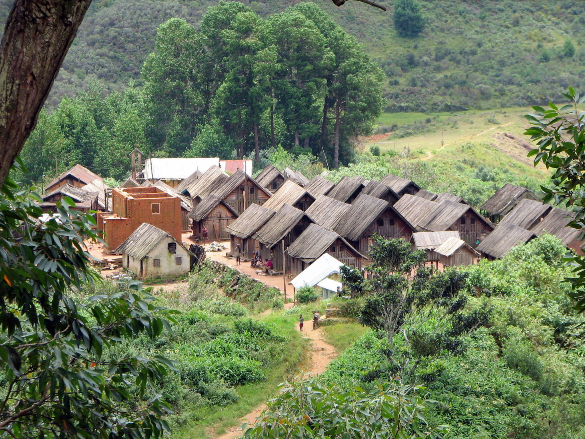
Zafimaniry Villages
Zafimaniry villages are a network of small highland communities in the forested hills southeast of Ambositra, renowned for intricate wood carving used in everyday life as much as in art. Carved geometric motifs appear on doors, shutters, wall panels, and furniture, with patterns repeated across households and passed through generations. The cultural tradition is widely described as spanning roughly 100 villages and hamlets, with a total community population often estimated at around 25,000 people, which helps explain why the experience feels like living rural culture rather than a single attraction. The most rewarding visits focus on seeing how objects are made, how homes are constructed and decorated, and how the craft is tied to forest-based livelihoods and environmental pressures in the surrounding landscape.
From Antananarivo, the usual approach is south by road to Ambositra and then onward toward Antoetra, so many travelers plan this as a multi-day segment rather than a quick detour. If you are already in Antsirabe, it is closer and easier to build in, but the same rule applies: schedule buffers for road delays and weather, because the last stretch and the hike determine the pace more than the headline distance.
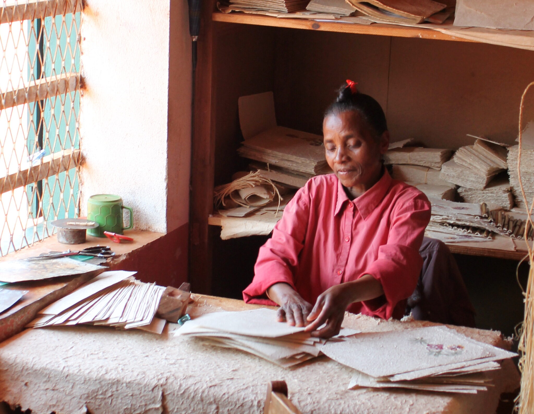
Antemoro Paper Workshops
Antemoro paper workshops are one of the most distinctive craft stops in southeastern Madagascar, especially around Ambalavao and Manakara corridors. The craft is based on pulping natural fibers, traditionally including the inner bark of the avoha plant, then forming sheets by hand on framed screens and pressing decorative inclusions such as dried flowers, leaves, or geometric cut-outs into the wet pulp before drying. Watching the process is the main appeal because it is highly visual and step-by-step: soaking and beating the fibers, spreading the slurry evenly, lifting a fresh sheet, pressing out water, and laying it to dry. The finished paper is light, easy to pack, and commonly sold as cards, notebooks, wrapping sheets, and small art pieces, making it a practical stop to break up long driving days.
If you are buying items, ask which pieces were made recently and how they were dried, because humidity can affect stiffness and warping in transit. Flat sheets and notebooks usually travel best if you keep them pressed in a folder or between cardboard, while thicker, layered products can absorb moisture and bend if they are not fully cured. If you are heading to wetter coastal areas next, keep paper in a sealed bag inside your luggage and avoid storing it near damp swim gear. Workshops are typically easy to fit into a short visit, but it is worth taking 20 to 40 minutes to ask about materials, how long a sheet takes to dry in different seasons, and which products are made to handle handling and travel.
Hidden Gems of Madagascar
Makira Natural Park
Makira Natural Park is a vast protected rainforest landscape in northeastern Madagascar, best known for its conservation role and for offering a quieter alternative to the country’s more visited rainforest parks. The appeal is depth: long stretches of humid lowland and mid-elevation forest, strong birdlife, and a solid chance of seeing multiple lemur species on guided walks, often with fewer groups on the trails. Expect classic northeast rainforest conditions: dense canopy, muddy footing after rain, frequent leeches in wetter periods, and wildlife that rewards patience rather than fast sightseeing. If you enjoy slow, attentive walking, Makira can feel like genuine wilderness, with a stronger focus on forest immersion than on polished visitor infrastructure.
Many itineraries route via Maroantsetra or nearby regional hubs, then continue by a mix of road and boat, with timing heavily influenced by rain and river levels. From Antananarivo, the most practical approach is usually to fly to a northeastern gateway when schedules align, then continue overland, while purely road-based travel is long and often best treated as multi-day. To make Makira feel worth the effort, plan at least 3 to 5 nights in the area, more if you want both shorter walks and one or two longer forest days without rushing your logistics.
Lokobe National Park
Lokobe National Park is a protected lowland rainforest area on the southeast side of Nosy Be, and it is one of the easiest ways to add a rainforest day without leaving the island. Visits typically combine a short boat transfer across mangrove-fringed inlets with a guided forest walk on narrow, humid trails. The payoff is classic northwestern rainforest atmosphere plus wildlife that can be surprisingly rewarding in a few hours: black lemurs are a key highlight, and guides often search for chameleons, leaf-tailed geckos, colorful frogs, and forest birds that are easy to miss without trained eyes. Because the reserve is compact and logistics are simple, it works well as a half-day or full-day break from beach routines, and it often feels quieter than the most famous mainland parks.
Start early for two reasons: heat builds quickly in lowland rainforest, and animal activity is generally better in the first part of the morning. A typical outing is 2 to 4 hours of walking plus boat time, with muddy sections after rain and occasional boardwalk-style stretches near wetter ground. Wear closed shoes with grip, bring insect repellent and at least 1 liter of water per person, and keep electronics in a dry bag because boat spray and sudden showers are common. A local guide is effectively mandatory, not only for navigation but because many animals are camouflaged and are identified by subtle movement, calls, or eye-shine in shaded undergrowth.
Baie de Sakalava
Baie de Sakalava is a broad, open bay on the coast west of Antsiranana, known for its sweeping sand, big-sky views, and near-constant trade winds that shape both the mood and what you can do there. It is not a classic calm-lagoon beach; it is an exposed coastline where the scenery is the main event: curving shoreline, dunes and scrubby vegetation, and light that changes fast as clouds and sea spray move through. The wind also makes it a well-known spot for wind sports, and even if you are not kitesurfing, it is an excellent place for coastal photography, short walks, and watching the sea conditions shift through the day.
Getting there is simple as a half-day trip from Antsiranana. By car or taxi, it is typically around 20 to 40 minutes depending on where you start in town and the condition of the coastal road, and it pairs well with other nearby stops on the northern peninsula if you want a full day of viewpoints and beaches. If you are arriving from farther south, most travelers base in Antsiranana first, then use short day trips like Baie de Sakalava to explore the coastline without changing hotels.
Montagne d’Ambre National Park
Montagne d’Ambre National Park is a lush volcanic massif just south of Antsiranana, where altitude creates a noticeably cooler, wetter microclimate than the surrounding northern lowlands. The park is known for easy-to-moderate rainforest walks that deliver high rewards in a short time: mossy forest, tree ferns, crater-lake scenery, and several waterfalls that are most impressive after recent rain. Because temperatures are milder, it is one of the most comfortable places in Madagascar for daytime hiking, and it is also strong for wildlife spotting, especially chameleons, geckos, frogs, and forest birds, with lemurs occasionally seen along quieter trails.
Getting there is straightforward from Antsiranana: most visitors go by car or taxi to the park entrance area, commonly around 45 to 90 minutes depending on traffic, road conditions, and the exact starting point. It also works well as a day trip, but an overnight near the park can be even better if you want the earliest start and the calmest forest conditions. If you are traveling overland on RN6 from Ambilobe or beyond, many itineraries place Montagne d’Ambre either before or after a stay in Antsiranana to break up long, hot road segments with a cooler, greener hiking day.
Travel Tips for Madagascar
Safety and General Advice
Madagascar is a rewarding but logistically challenging destination, where flexible planning and patience are essential. The country’s tourism infrastructure varies widely between regions, and travel times can be longer than expected. Visitors are advised to use local guides, particularly when exploring national parks, rural areas, or remote coastlines, as they can assist with navigation, language, and logistics. With preparation, travelers will find Madagascar’s biodiversity and landscapes among the most remarkable in the world.
A yellow fever vaccination may be required depending on your travel route, and malaria prophylaxis is recommended for all visitors. Medical facilities are limited outside major cities such as Antananarivo, so travelers should carry a personal first-aid kit and prescription medications. Tap water is not safe to drink, so always use bottled or filtered water. Comprehensive travel insurance with evacuation coverage is essential, especially for those visiting remote regions or national parks.
Car Rental and Driving
An International Driving Permit is recommended alongside your national driver’s license, and both should be carried when renting or driving vehicles. Police checkpoints are routine throughout the country, so drivers should keep documents accessible and remain polite during inspections Driving in Madagascar is on the right-hand side of the road. Roads outside major cities are frequently unpaved or uneven, so a 4×4 vehicle is essential for most routes, especially those leading to rural or coastal regions. Hiring a driver is common and highly recommended, as it eases navigation and ensures safer travel in challenging conditions.
Published February 03, 2026 • 30m to read