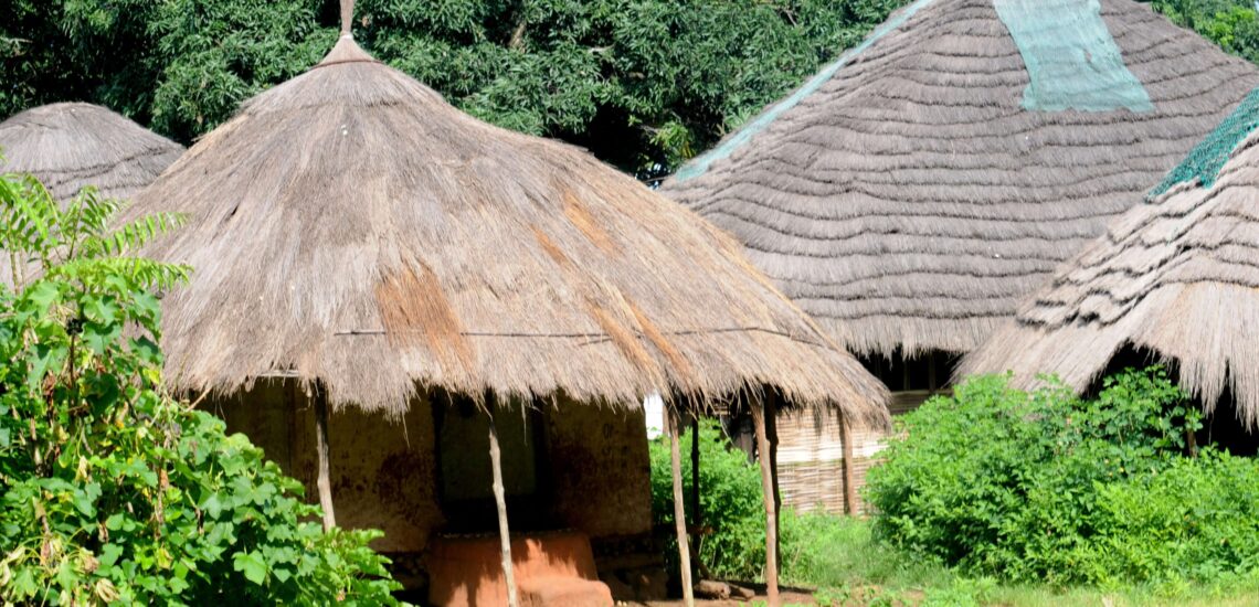
Guinea-Bissau is a small country on the West African coast, known for its quiet landscapes and strong local traditions. It remains one of the region’s least-visited destinations, which gives it a sense of authenticity and calm. Rivers, mangroves, and tropical islands define much of its geography, while the influence of Portuguese language and African culture creates a distinctive character.
The Bijagós Archipelago, a UNESCO Biosphere Reserve, is the country’s most remarkable area – a group of islands where wildlife such as hippos and sea turtles live alongside communities that maintain ancient customs. On the mainland, visitors can explore historic ports, local markets, and rural villages surrounded by forests. Guinea-Bissau offers a chance to experience West Africa in its natural, unhurried form, with a focus on culture, nature, and simplicity.
Best Cities in Guinea-Bissau
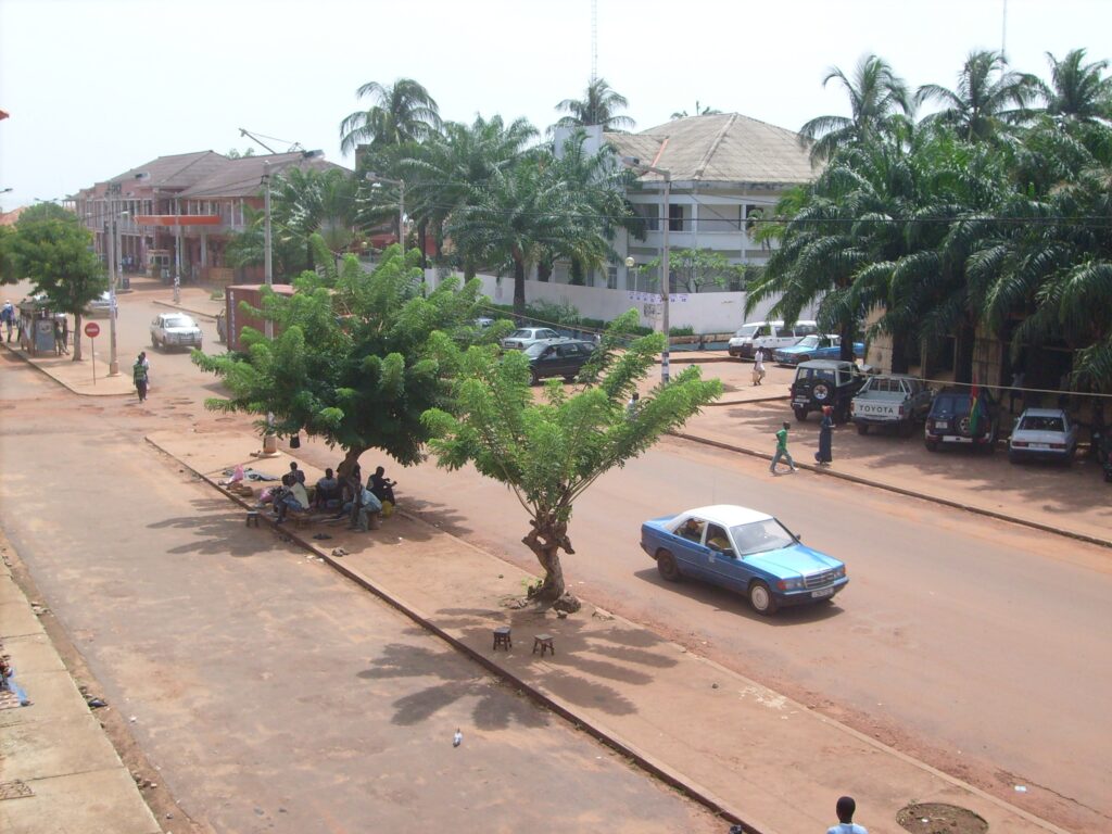
Bissau
Bissau is the administrative and cultural center of Guinea-Bissau, located along the Geba River estuary. The historic district of Bissau Velho contains narrow streets and colonial-era buildings that reflect the city’s Portuguese influence. Walking through this area provides insight into how the port, trading houses, and administrative offices once structured urban life. Key landmarks include the Presidential Palace and the São José da Amura fortress, which help explain the country’s political history and periods of conflict and reconstruction. The area is compact, allowing visitors to explore on foot while moving between riverfront viewpoints, cafés, and small public squares.
Bandim Market is one of the city’s busiest commercial zones and serves as a major distribution point for textiles, produce, household goods, and street food. A visit offers a clear view of how trade networks function between the capital and rural regions. Bissau also acts as a hub for travel to the rest of the country, including boat departures to the Bijagós Archipelago and road routes to inland towns.
Cacheu
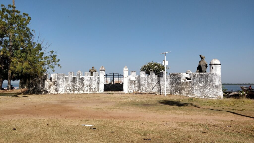
Cacheu is one of Guinea-Bissau’s oldest urban centers and an early focal point of Atlantic trade along the West African coast. During the colonial period, the town served as a key administrative base and a departure point for river and ocean routes. Cacheu Fort, located beside the river, now functions as a museum that presents archival material and exhibits explaining the region’s involvement in the slave trade. Walking through the fort and adjacent waterfront areas provides a clear understanding of how the town operated during different phases of colonial expansion and resistance.
Beyond its historical core, Cacheu is a gateway to mangrove-lined rivers and small settlements that still depend on fishing and rice cultivation. Boat trips explore narrow channels where visitors can observe local transport, oyster harvesting, and birdlife. These excursions often include stops in nearby villages to learn about community traditions tied to the river environment.
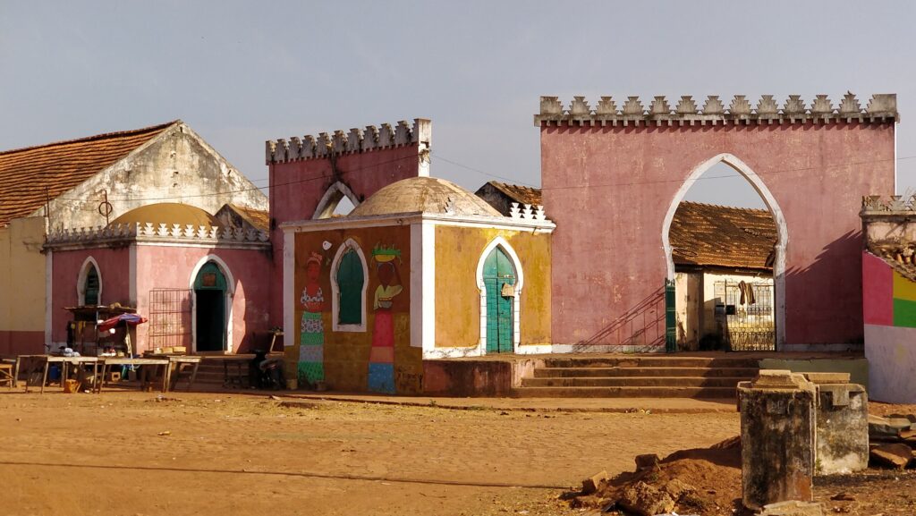
Bolama
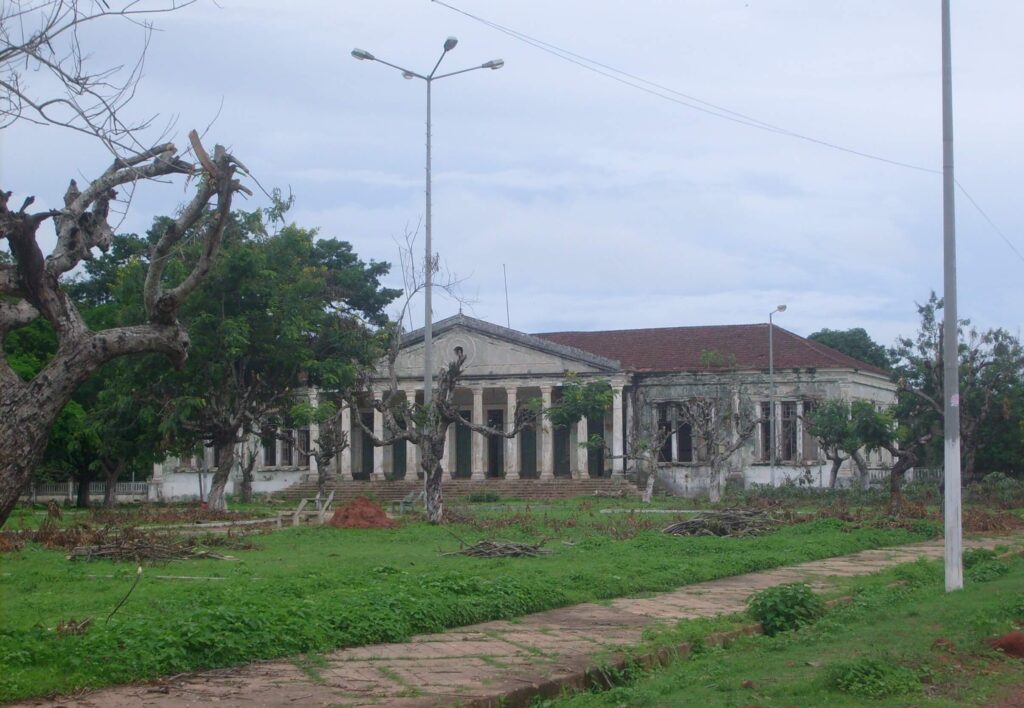
Bolama Island served as the colonial capital of Portuguese Guinea until the early 20th century, and its town layout still reflects that administrative role. Wide streets, open plazas, and neoclassical buildings remain standing, even though many are no longer in active use. Walking through the former government quarter gives visitors a direct sense of how the island functioned as a political center, with structures such as the old governor’s palace, administrative offices, and public squares forming the core of the settlement. Informal local guides often explain the transition from colonial rule to independence and how the town’s population adapted after the capital moved to Bissau.
Outside the town center, the island offers quiet coastal paths, small villages, and areas where residents engage in fishing, cashew harvesting, and subsistence farming. Travel to Bolama is typically by boat from Bissau, with departures depending on tides and local schedules. Visitors often stay overnight to explore at a relaxed pace and to observe daily routines without heavy traffic or modern infrastructure.
Best Islands and Coastal Destinations
Bijagós Archipelago (UNESCO Biosphere Reserve)
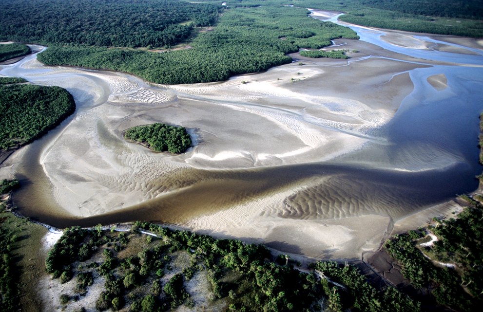
The Bijagós Archipelago consists of more than eighty islands and islets spread across the coastal waters of Guinea-Bissau. Recognized as a UNESCO Biosphere Reserve, the area includes mangroves, tidal flats, savannas, and coastal forests that support a wide range of marine and bird species. Several islands, such as Orango and João Vieira–Poilão, are known for conservation work involving manatees, sea turtles, and migratory birds. Because many islands have low populations and limited infrastructure, most travel is organized through guided boat journeys that link key ecological zones and community settlements.
The archipelago is also notable for the traditions of the Bijagó people, whose cultural practices include forms of matrilineal organization and ceremonies tied to specific islands and natural features. Visitors can observe daily life in villages, where fishing, shellfish gathering, and small-scale agriculture remain central activities. Travel logistics usually begin in Bissau, with scheduled or chartered boats providing access to the main islands. Accommodations range from basic community lodges to small eco-oriented camps.
Bubaque Island
Bubaque is the main entry point to the Bijagós Archipelago and hosts the archipelago’s administrative center, port, and most consistent transport links. The town has small hotels, guesthouses, and restaurants that make it a practical base for travelers planning multi-day trips. Local beaches and fishing areas offer opportunities for walking, swimming, and observing how coastal communities rely on the surrounding waters for their livelihoods. The island’s modest infrastructure – shops, markets, and boat operators – supports both residents and visitors moving between the islands.
From Bubaque, scheduled and charter boats depart for more remote parts of the archipelago, including Orango, Rubane, and João Vieira. These routes allow travelers to access protected marine zones, wildlife observation areas, and villages with longstanding cultural traditions. Because many outer islands have limited accommodation and no regular public transport, Bubaque often serves as the logistical hub where itineraries are arranged and supplies are gathered. Visitors choose the island for its accessibility, its role as a starting point for exploring the biosphere reserve.
Orango National Park
Orango National Park occupies several islands in the southern Bijagós Archipelago and is one of Guinea-Bissau’s most distinctive protected areas. The park is known for its population of saltwater-adapted hippos, which inhabit lagoons surrounded by mangroves and savanna vegetation. Guided boat and walking excursions take visitors to observation points near these lagoons, with local guides explaining how water levels, tides, and seasonal changes influence hippo movement. The park’s coastline contains nesting sites for sea turtles, and birdlife is common along the tidal flats and mangrove channels.
Communities living within and around Orango maintain cultural practices linked to the land, water, and ancestral sites. Visits often include meetings with village leaders or community groups who explain the role of animist traditions, taboos, and locally managed conservation efforts. Access to the park is by boat from Bubaque or other nearby islands, and logistics usually require coordination with tour operators familiar with tidal conditions and remote travel.
João Vieira-Poilão Marine National Park
João Vieira–Poilão Marine National Park covers a group of uninhabited islands in the southern Bijagós Archipelago and is one of West Africa’s most important nesting sites for green sea turtles. Poilão Island, in particular, hosts a large proportion of the region’s turtle nesting activity. Because the islands have no permanent settlements, all visits are operated under strict environmental guidelines, and traveler numbers remain limited to protect the breeding habitat. Research teams and park rangers monitor nesting seasons, and guided visits focus on observing the natural processes without disturbing wildlife.
The park is reached by boat from Bubaque or other islands in the archipelago, with itineraries planned around tides, weather conditions, and nesting schedules. In addition to turtles, the surrounding waters support diverse marine life, and the islands’ beaches and shallow reefs are part of broader conservation initiatives. Most trips are organized as part of multi-day expeditions that combine wildlife observation with stops in community areas elsewhere in the Bijagós.
Best Natural and Wildlife Destinations
Cacheu Mangroves Natural Park
Cacheu Mangroves Natural Park protects an extensive mangrove system in northern Guinea-Bissau, one of the largest and most ecologically important in West Africa. The area is made up of tidal channels, mudflats, and coastal forests that support manatees, crocodiles, monkeys, and numerous fish and shellfish species. Boat safaris are the main way to explore the park, allowing visitors to move through narrow waterways while observing birdlife and learning how water flows influence the distribution of wildlife. Guides also explain how local fishing methods, oyster harvesting, and small-scale agriculture are adapted to the mangrove environment.
Several communities live along the park’s edges, relying on the mangroves for transport, food, and building materials. Visits often include stops in these villages, where residents describe conservation practices and the challenges of managing a productive but sensitive ecosystem. Access to the park is typically arranged from Cacheu or nearby settlements, with trips organized around tides and weather.
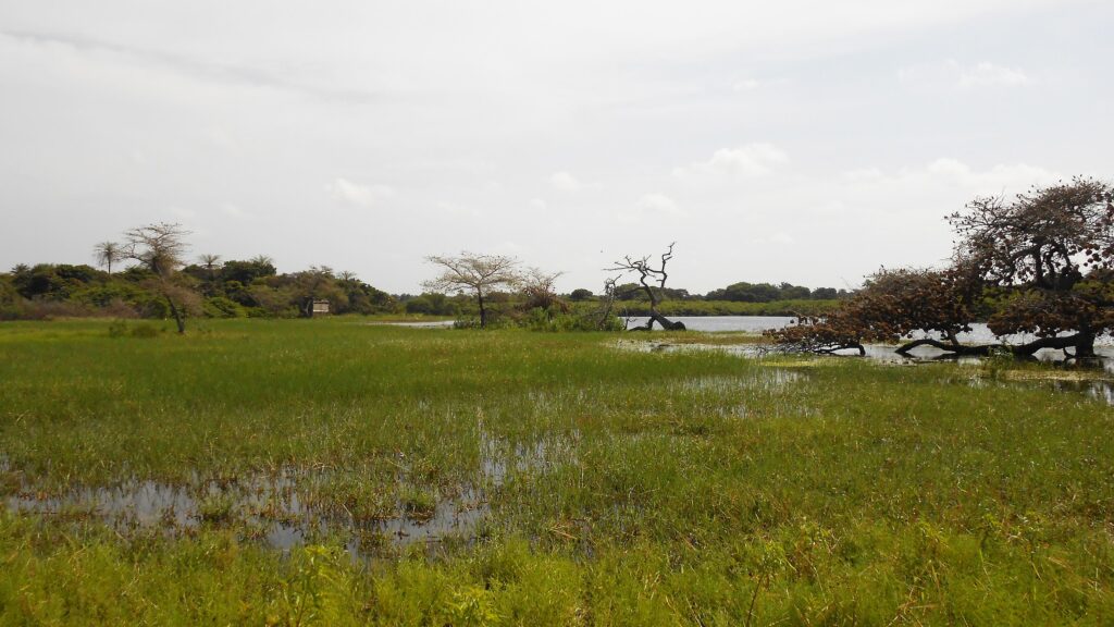
Cufada Lagoons Natural Park
Cufada Lagoons Natural Park lies inland between the coastal regions and the eastern forests of Guinea-Bissau. The park covers wetlands, lowland forest, and stretches of open savanna surrounding a series of freshwater and seasonal lakes. These habitats support hippos, antelope, monkeys, and a wide range of migratory and resident bird species. Because water levels shift throughout the year, wildlife tends to gather around the lagoons during the dry season, making this period especially suitable for observation. The park’s limited infrastructure and low visitor numbers give it a quieter atmosphere compared with coastal reserves.
Access to Cufada usually requires arranged transport from Bissau or nearby towns, and visits are most often organized through local guides familiar with routes, wildlife behavior, and current conditions around the lakes. Activities include guided walks, birdwatching sessions, and informal wildlife tracking along established paths.
Corubal River
The Corubal River flows through eastern Guinea-Bissau and forms one of the country’s important inland waterways. Its banks are lined with forest, farmland, and small villages that rely on the river for fishing, irrigation, and local transport. Canoe and small-boat trips move along calm stretches where visitors can observe daily routines such as net fishing, river crossing, and crop cultivation on nearby terraces. Birdlife is common along the forested edges, and stops in riverside settlements provide insight into how families organize work and trade around the waterway.
Access to the Corubal region is generally arranged from towns such as Bafatá or Bambadinca, with local guides helping coordinate transport and visits to communities. Activities include short walks through village paths, demonstrations of traditional fishing techniques, and observation of river-based commerce. Because the area receives relatively few travelers, it offers an opportunity to experience rural life and river landscapes at a slower pace.
Best Beaches in Guinea-Bissau
Bruce Beach (near Bissau)
Bruce Beach lies a short drive from central Bissau and serves as one of the capital’s most accessible coastal areas. The shoreline provides space for swimming, walking, and informal gatherings, and its proximity to the city makes it a common choice for residents looking for a quick break from urban routines. Simple beach bars and small restaurants offer refreshments and meals, especially in the late afternoon when visitors come to watch the sunset. The beach is reached by taxi or private transport and is often combined with visits to nearby neighborhoods or coastal viewpoints. Because it is close to major roads and accommodation areas, Bruce Beach is frequently used as a short stop before or after trips into the islands or inland regions.
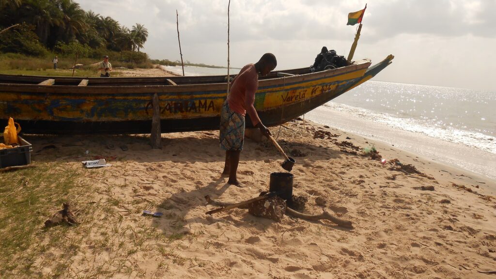
Varela Beach
Varela Beach is located in the far northwest of Guinea-Bissau, close to the Senegalese border, and is known for its wide shoreline, dunes, and low levels of development. The beach extends for several kilometers, allowing visitors to walk long distances, swim, or observe fishing activity from nearby villages. Because infrastructure is limited, most accommodations consist of small lodges or community-run guesthouses that operate with basic services and direct access to the sand.
The surrounding area includes dune fields, cashew groves, and mangrove channels that can be explored on foot or by arranged boat trips. Wildlife – especially birds – is often seen along the coast and in the nearby wetlands. Varela is reached by road from São Domingos or from the border region, though travel times depend on road conditions.
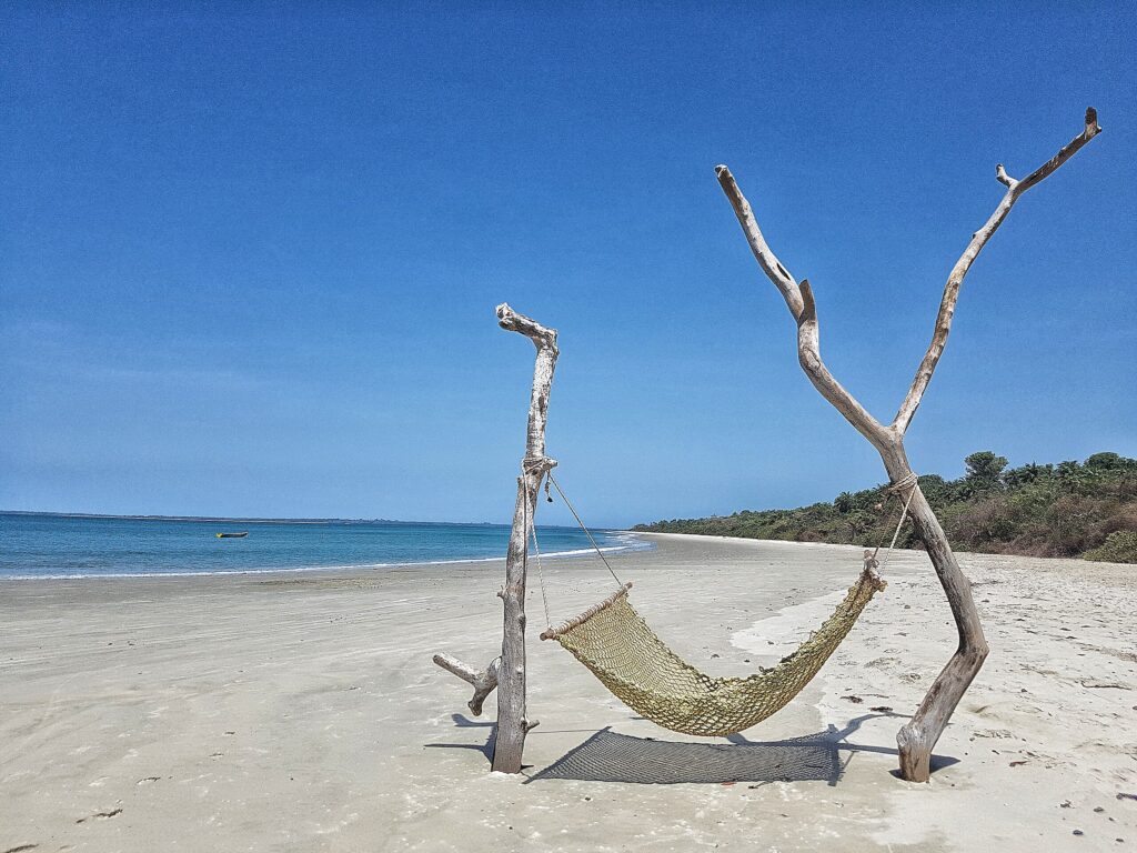
Bijagós Beaches
Beaches across the Bijagós Archipelago vary from long open coastlines to small coves bordered by mangroves. Many islands, especially the uninhabited or lightly populated ones, have stretches of sand where visitors can spend extended periods without meeting other travelers. These areas are used for walking, swimming, and observing coastal wildlife, including migratory birds and, in certain seasons, sea turtles that nest on remote shores.
Because the islands have limited infrastructure, access to most beaches is arranged by boat from Bubaque or other inhabited islands. Snorkeling is possible in shallow coastal waters, where reefs and seagrass beds support fish and shellfish. Mangrove estuaries located behind some beaches can be explored by canoe or small motorboat, offering opportunities to see how tidal cycles shape local ecosystems.
Hidden Gems in Guina-Bissau
Quinhamel
Quinhamel is a small riverside town northwest of Bissau, positioned near extensive mangrove systems that line this part of the coast. The town functions as a local trading point, with small markets, boat landings, and workshops that support surrounding villages. Its location makes it a useful base for arranging short excursions into nearby creeks and wetlands, where visitors can observe fishing practices, oyster harvesting, and birdlife.
Boat trips from Quinhamel typically follow narrow tidal channels and provide access to community-managed conservation areas and remote settlements that rely on the mangroves for transport and livelihoods. The town is reached by road from Bissau and is often included as a half-day or full-day stop for travelers interested in low-impact nature exploration and everyday life along the estuary.
Bafatá
Bafatá sits along the Geba River in central Guinea-Bissau and serves as an important commercial and administrative center for the inland region. The town contains colonial-era buildings, grid-pattern streets, and a riverside market where traders sell produce, textiles, and goods from nearby villages. Walking through the older quarters offers insight into how administrative functions were established during the colonial period and how they continue to support regional governance today.
Bafatá is also known for its strong Mandinka cultural identity, visible in music, language, and community traditions. Visitors often combine a tour of the town with stops at surrounding villages or with short excursions along the river, where fishing and small-scale farming remain central to local livelihoods. The town is reachable by road from Bissau or from towns farther east, making it a practical stop on overland routes.
Tite
Tite is a small town south of Bissau that acts as a starting point for visits to rural communities and the river systems of southern Guinea-Bissau. The town itself functions as a local service center, with small markets, transport connections, and workshops that support surrounding villages. Travelers often stop here to organize guides, transport, or supplies before continuing into areas where infrastructure becomes limited.
From Tite, roads and waterways lead toward settlements along the Rio Grande de Buba and other southern rivers. Visits typically focus on community life, agriculture, and fishing practices that shape the economy of the region. Some itineraries include stops in nearby villages where residents explain local traditions, craft techniques, or land-use practices.
Rubane Island
Rubane Island lies a short boat ride from Bubaque and is one of the most accessible islands for travelers looking to base themselves within the Bijagós Archipelago. The island hosts a small number of eco-lodges that operate with limited infrastructure and direct access to quiet beaches. Walking paths connect lodge areas with sections of coastline used for swimming, canoeing, and birdwatching. Because the island is surrounded by shallow channels, visitors can observe herons, waders, and other coastal species throughout the day.
Rubane also serves as a practical jumping-off point for excursions to nearby islands such as Bubaque, Soga, or the southern wildlife zones. Boat operators at the lodges arrange day trips for snorkeling, village visits, or travel to protected areas farther south. The island is reached by scheduled or charter boat from Bubaque, which itself receives regular services from Bissau.
Travel Tips for Guinea-Bissau
Travel Insurance & Safety
Travel insurance is essential when visiting Guinea-Bissau, as medical facilities are limited, especially outside the capital. Coverage for medical emergencies and evacuation is crucial, particularly for travelers heading to the Bijagós Islands or the remote inland national parks. A comprehensive plan ensures access to care and reliable assistance in case of unexpected illness or injury.
Guinea-Bissau is generally peaceful and welcoming, though it has experienced periods of political instability in the past. It is advisable to check current travel advisories before your trip and remain aware of local news during your stay. A yellow fever vaccination is required for entry, and malaria prophylaxis is strongly recommended. Bottled or filtered water should be used for drinking, as tap water is not considered safe. Basic health precautions, insect repellent, and sun protection are also important, especially when exploring rural or coastal regions.
Transportation & Driving
Travel within Guinea-Bissau can be an adventure in itself. Domestic transport options are limited, and patience is often required when moving between regions. On the coast, boats provide the main means of access to the Bijagós archipelago, while on the mainland, shared taxis and minibuses connect major towns and regional centers. Though journeys may be long, they offer a rewarding window into local daily life.
Travelers who plan to drive should carry their national license, passport, rental documents, and an International Driving Permit, which is useful and may be requested at checkpoints. Driving in Guinea-Bissau is on the right-hand side of the road. While roads in and around Bissau are generally passable, many rural routes are unpaved and can become difficult during the rainy season, making a 4×4 vehicle highly recommended.
Published December 21, 2025 • 15m to read