Equatorial Guinea is one of Central Africa’s least-visited countries, and that gives it a very different feel from more established destinations. Travel here is a mix of island life and mainland rainforest, with Spanish colonial history, volcanic landscapes, and pockets of wildlife-rich nature. Most visitors spend time on Bioko Island, where the capital Malabo sits, then add the mainland around Bata if they want forests, rivers, and a more rural atmosphere.
It is not a plug-and-play destination. Logistics can be slow, costs can be higher than you expect, and planning matters more than usual. If you prepare well, Equatorial Guinea can deliver quiet beaches, dramatic scenery, and a sense of traveling somewhere genuinely under the radar.
Best Cities in Equatorial Guinea
Malabo
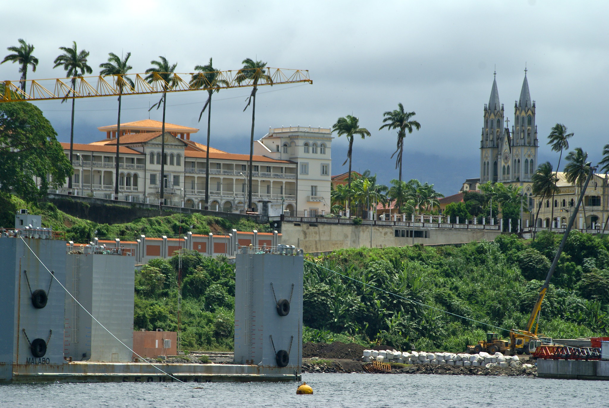
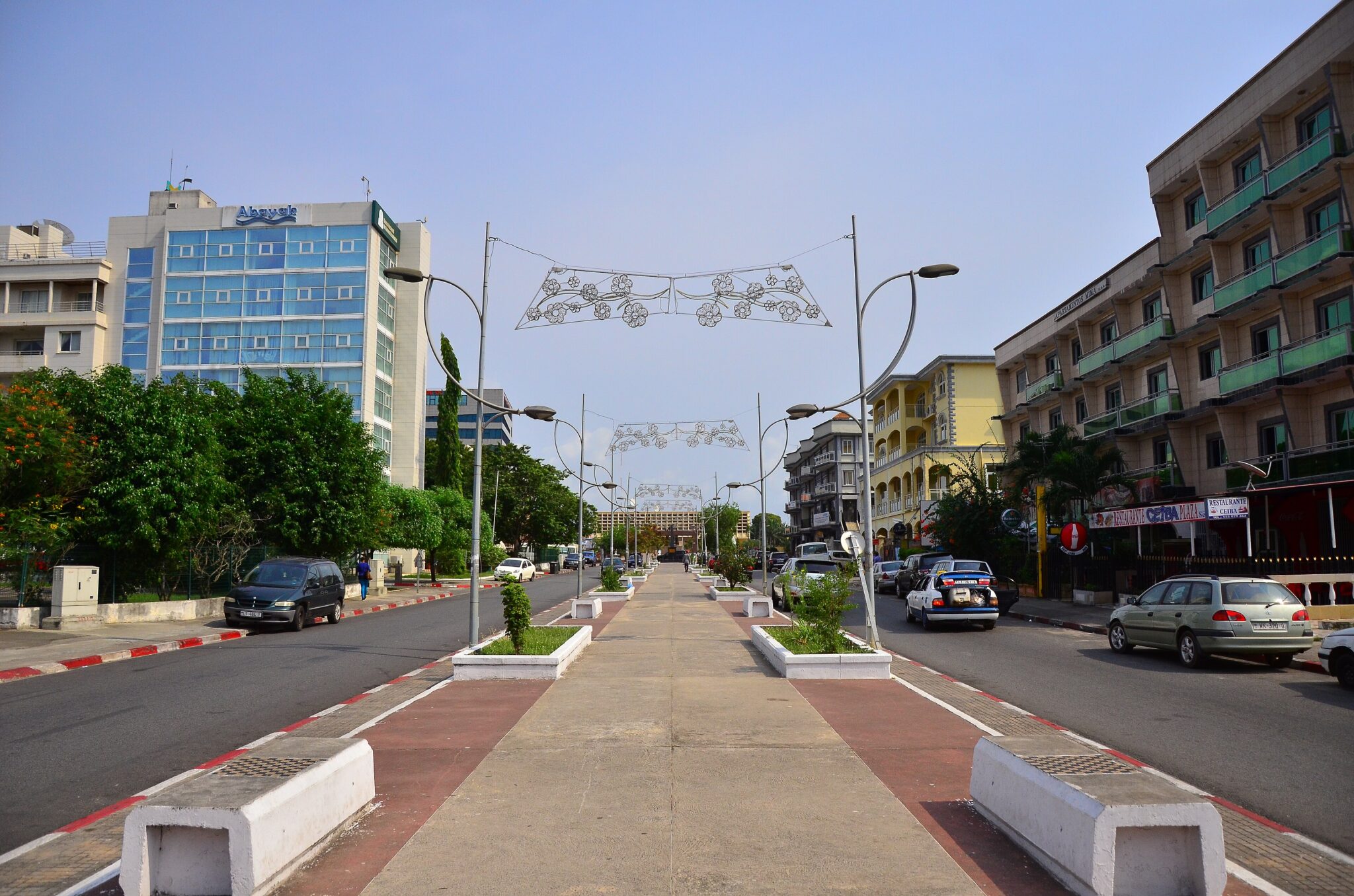
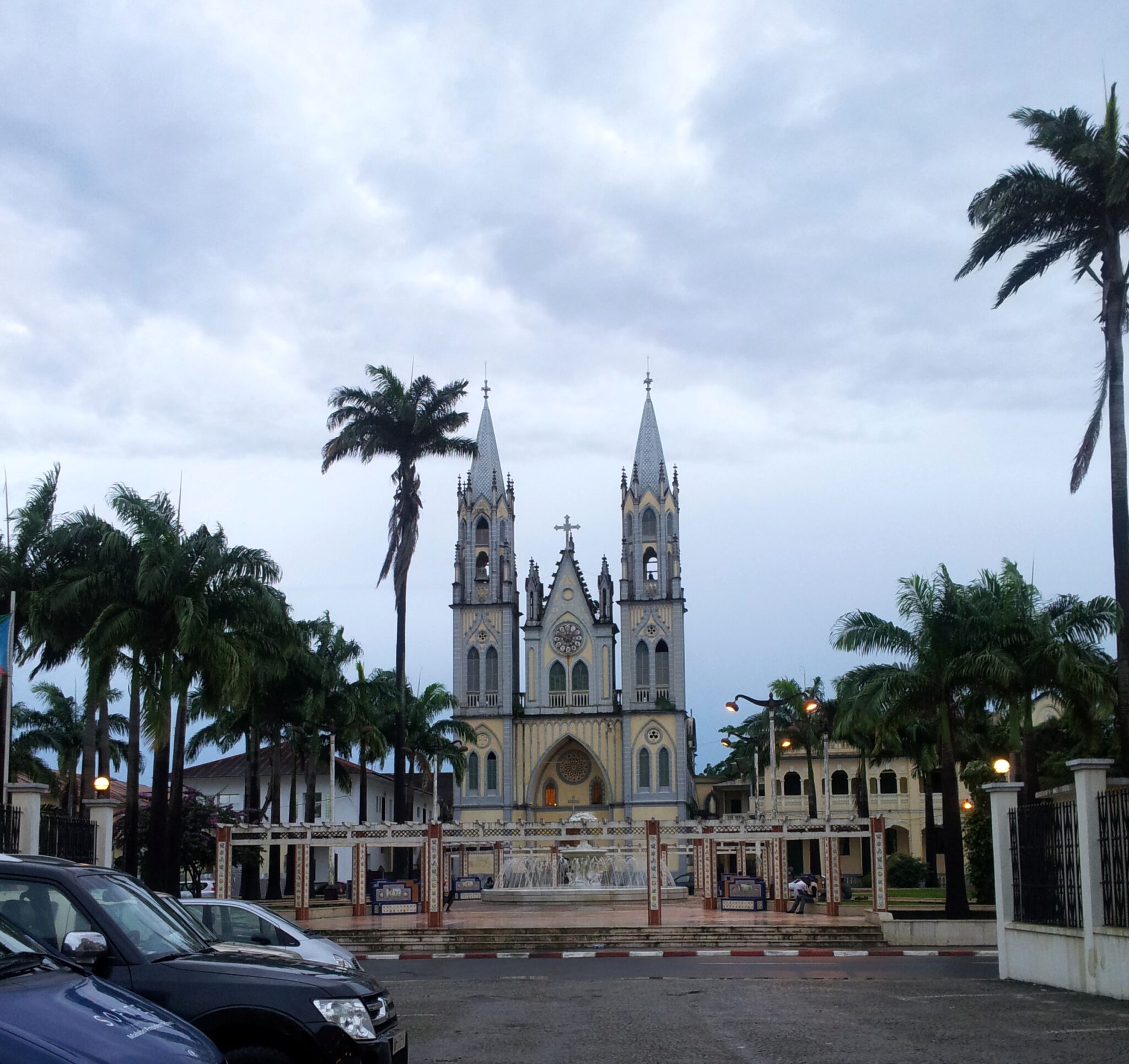
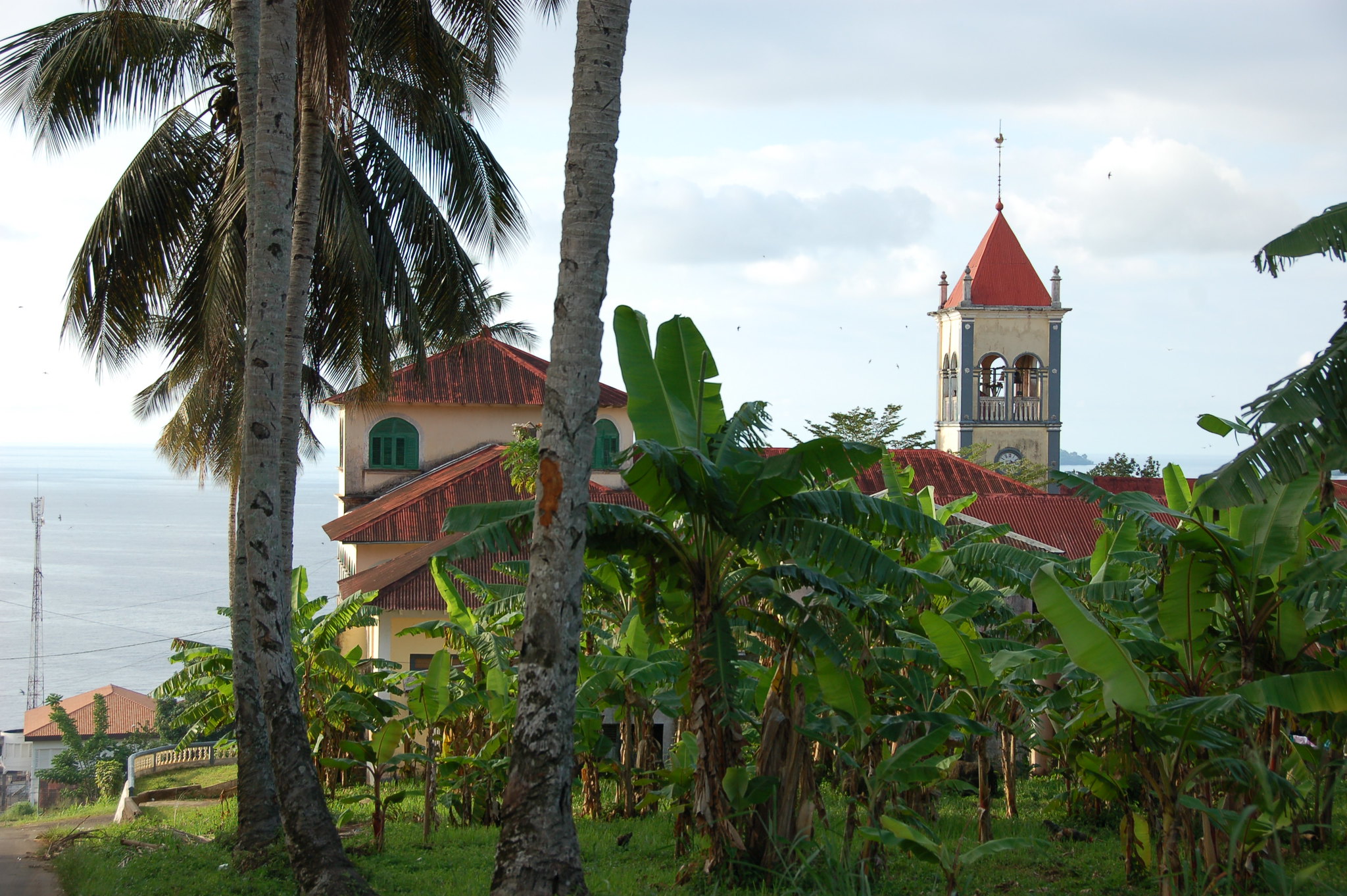
Malabo is the capital of Equatorial Guinea on Bioko Island and the main entry point for most visitors via Malabo International Airport. The city is compact enough that you can cover the central areas by short taxi rides and some walking, especially around Plaza de la Independencia, the waterfront, and the older streets where Spanish colonial-era buildings are still visible. Malabo Cathedral is one of the clearest landmarks in the center and is easy to combine with a walk through nearby streets to understand the city’s layout, public buildings, and everyday pace without needing a packed itinerary.
Use Malabo as a practical setup base before heading elsewhere on Bioko. Arrange cash, a local SIM, and transport in advance, since options can be limited outside the capital and plans may change with road conditions or local schedules. For trips to the south of Bioko or to interior areas, it’s often more efficient to hire a driver for the day rather than trying to string together informal transport, and it helps to confirm any access rules locally if you plan to visit protected areas or remote beaches.
Bata
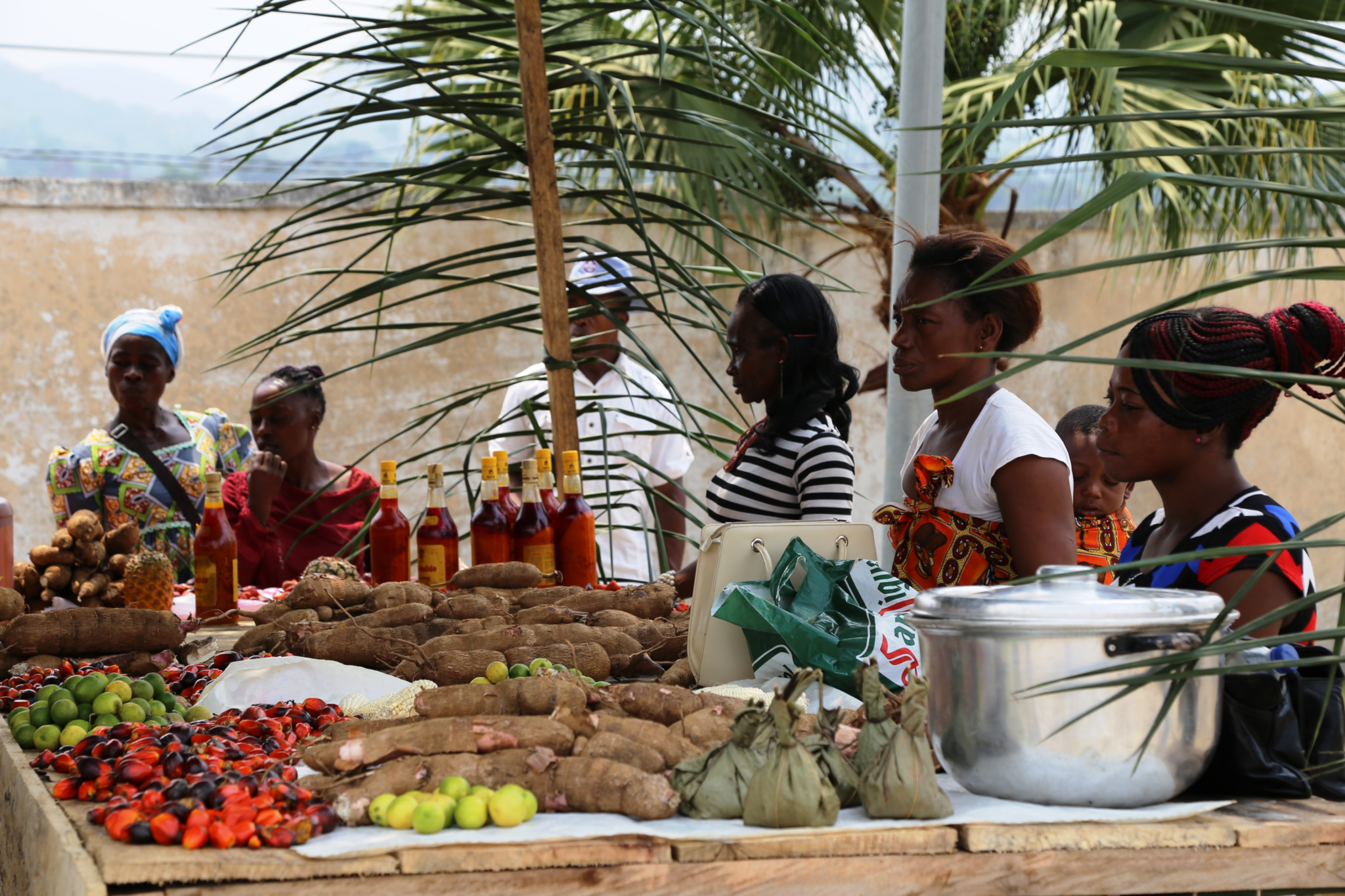
Bata is Equatorial Guinea’s largest mainland city and a major commercial hub on the Atlantic coast, with a layout that feels more spread out than Malabo and a stronger focus on daily trade and transport. The most useful way to experience Bata is through its markets and food streets, where you can see how goods move between the port, inland towns, and neighboring countries, and by spending time along the seafront for simple coastal viewpoints. It also functions as the main gateway for travel to inland forest regions, so even a short stay can give you a clear sense of mainland rhythms before you move on.
If you plan to visit rainforest areas, use Bata to organize logistics rather than trying to solve everything on the road. Arrange a reliable driver, confirm fuel and supplies, and plan realistic travel times, since road conditions can change quickly after rain and schedules outside major towns are less predictable.
Luba
Luba is a small coastal town on Bioko Island, southwest of Malabo, and it is usually visited for a quieter base with access to beaches, forested hills, and short nature outings rather than for major landmarks. The town’s waterfront and nearby viewpoints are easy to reach, and it works well for relaxed walks, simple meals, and organizing short drives into greener inland areas where you can see village landscapes and dense vegetation close to the road. Luba is also a practical stepping stone for continuing farther south toward Ureka and Bioko’s less developed coastline. Most travelers reach Luba by road from Malabo, typically with a hired car or driver, since schedules can be limited and road times vary.
Ebebiyín
Ebebiyín is an inland city in Equatorial Guinea near the Cameroon and Gabon borders, and its character is shaped by cross-border commerce rather than tourism. The most informative time is usually spent around markets, transport yards, and main streets where traders move food, textiles, and household goods between countries, giving a clear sense of how regional supply lines work away from the coast. Because it sits in a border zone, the city also reflects a mix of languages and influences, and it can be a useful stop if you are traveling overland between mainland towns.
Travel to Ebebiyín is typically by road from Bata or other mainland centers, and road conditions can vary, especially after rain, so a driver with local experience saves time. Border areas often have more checkpoints and formalities, so keep your passport and any permits easy to access, stay patient during stops, and avoid photographing official buildings or security points. If you are continuing into Cameroon or Gabon, confirm entry requirements and route details locally before you leave, since procedures and timing can change.
Best Beaches Destinations
Arena Blanca
Arena Blanca is a beach on Bioko Island known for pale sand, clear water, and a relatively undeveloped setting compared with the more built-up areas near Malabo. The visit is usually simple: time on the sand, short swims when conditions are calm, and walking the shoreline, with few services on site and a quieter feel than city-adjacent beaches. Because infrastructure is minimal, it suits travelers who are comfortable treating the beach as a self-contained day out rather than expecting restaurants, rentals, or organized activities.
Access is typically by road with a hired driver from Malabo or from towns on the island, and travel time can be longer than expected depending on road conditions and stops. Bring water, snacks, and sun protection, and plan for limited shade, since open stretches of sand may have little natural cover. If you plan to swim, ask locally about currents and the safest area to enter the water, especially after rain or when surf is higher.
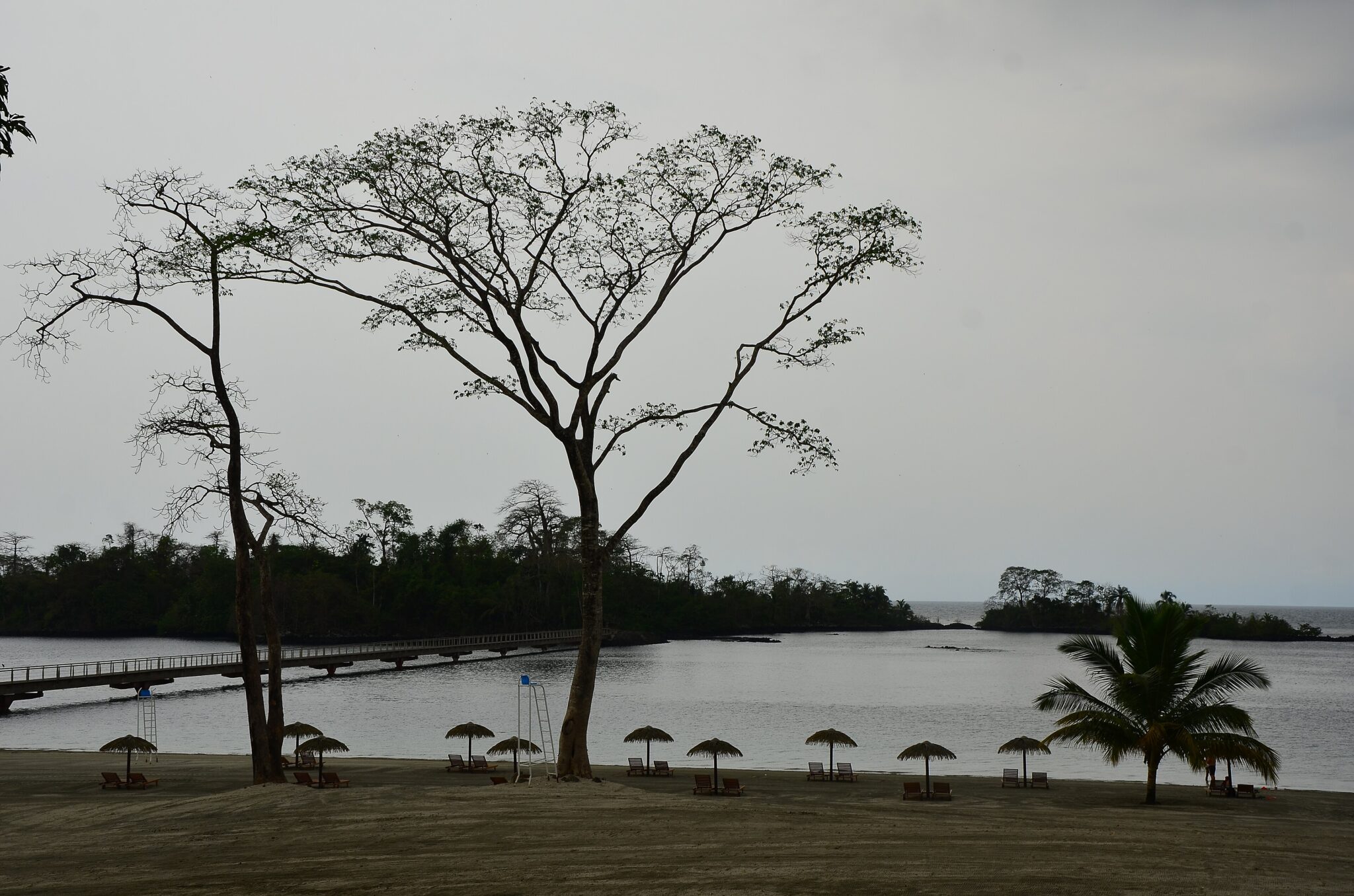
Sipopo Beach
Sipopo Beach is a modern coastal area just outside Malabo, developed around resorts and conference facilities, so it tends to feel more organized than many other beaches on Bioko. It works well for a low-effort beach day with reliable basics such as paved access, managed beachfront areas, and nearby places to eat or sit, which is useful if you have limited time or prefer not to deal with long drives and minimal infrastructure. Getting there is straightforward by taxi or hired car from Malabo, and most visits are short, often just a few hours by the water followed by a meal.
Ureka Coast
Ureka Coast is on the far south of Bioko Island, where the road ends and rainforest landscapes meet an exposed Atlantic shoreline. People come here for the setting rather than facilities, with long stretches of beach, river mouths, and forest edges that make it one of the strongest nature areas on the island. In some seasons, parts of the coast are used by nesting sea turtles, and visits are usually arranged with local guidance so you know which sections are appropriate to access and how to avoid disturbing wildlife.
Reaching Ureka typically requires an early start from Malabo and overland travel via Luba and the southern road, usually with a hired driver and, in wet periods, a vehicle that can handle rough or muddy sections. Plan it as a full-day trip at minimum, and consider an overnight if you want time on the beach without rushing the return, since travel times can be longer than maps suggest.
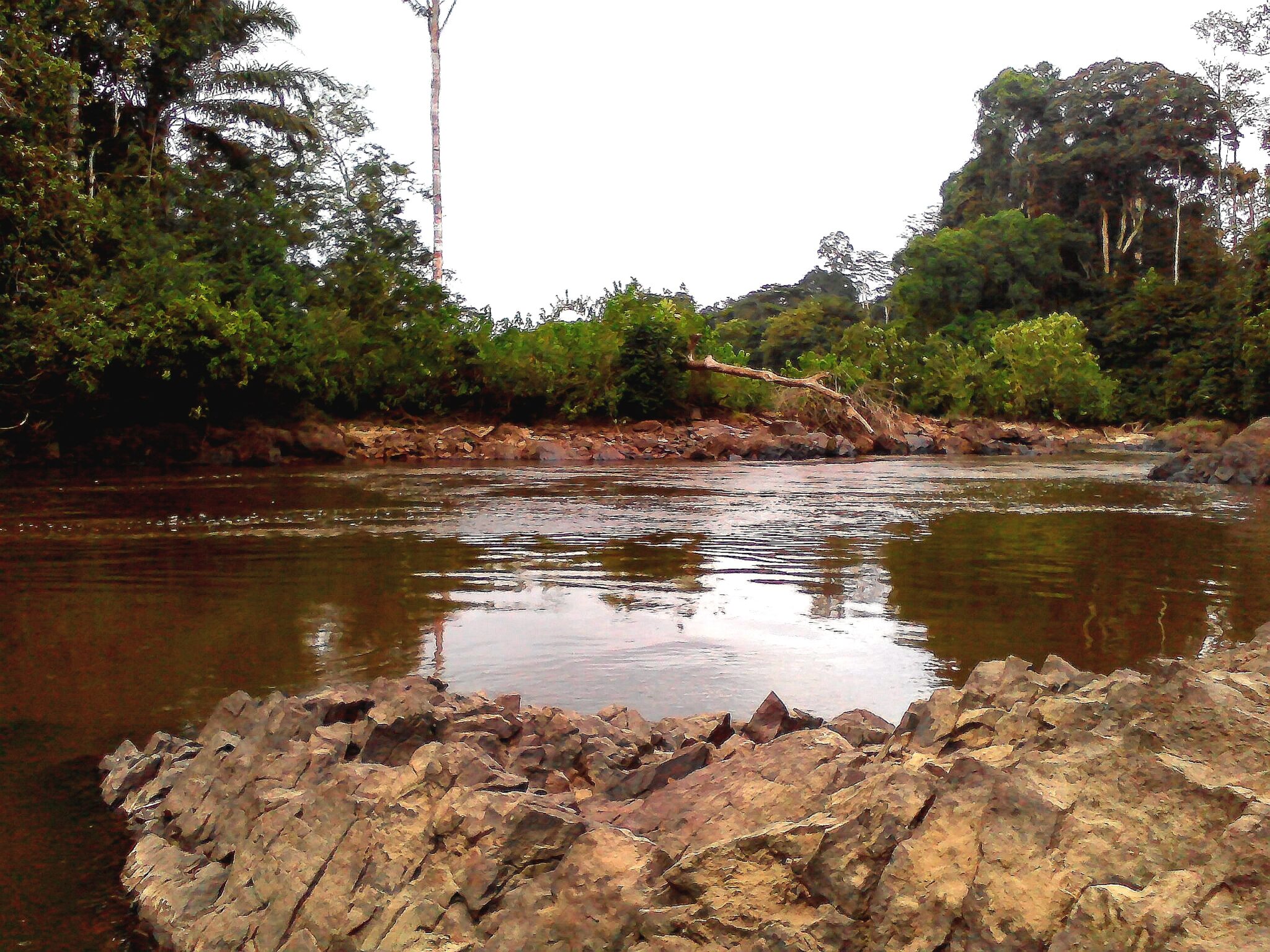
Mbini Coast
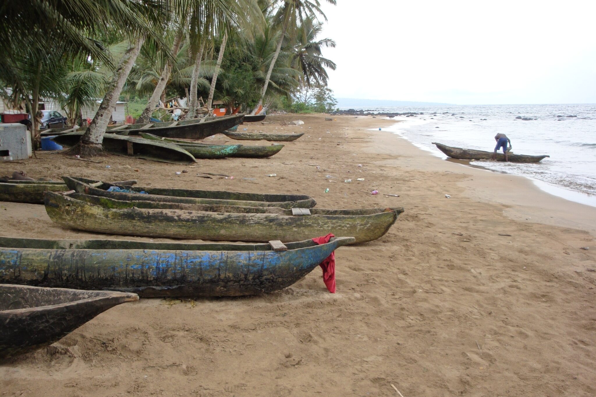
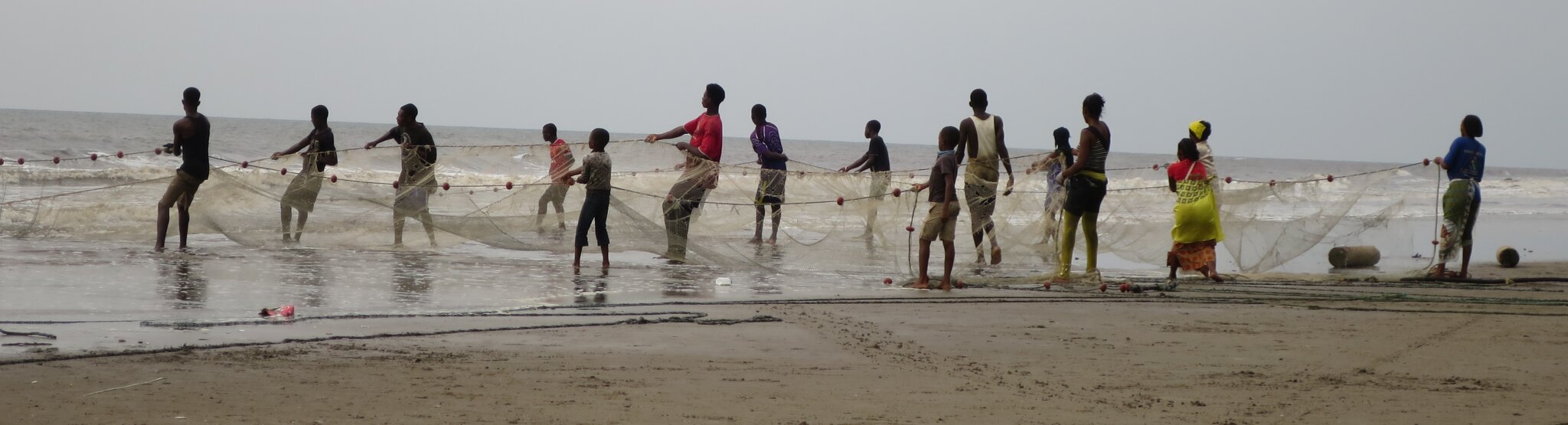
The Mbini coast on Equatorial Guinea’s mainland is shaped by estuaries, mangroves, and river mouths rather than long resort beaches, so the experience is more about calm water landscapes and working coastal life. Visits typically focus on fishing settlements, small landing points, and mangrove channels where you can see how boats, tides, and seasonal river flow structure daily routines. It suits travelers who prefer atmospheric shoreline scenery and slow observation over swimming and beach infrastructure.
Access is usually organized by road from Bata, then continued on smaller routes toward Mbini and nearby coastal communities, often with a hired driver because schedules can be irregular outside main towns. The best time to explore is earlier in the day when heat is lower and transport is easier to find, and it helps to plan around tides if you want to see active boat traffic at river mouths. Mosquito protection is important in mangrove areas, especially near sunset, so wear long sleeves in the evening and use repellent consistently.
Best Natural Wonders and National Parks
Pico Basilé National Park
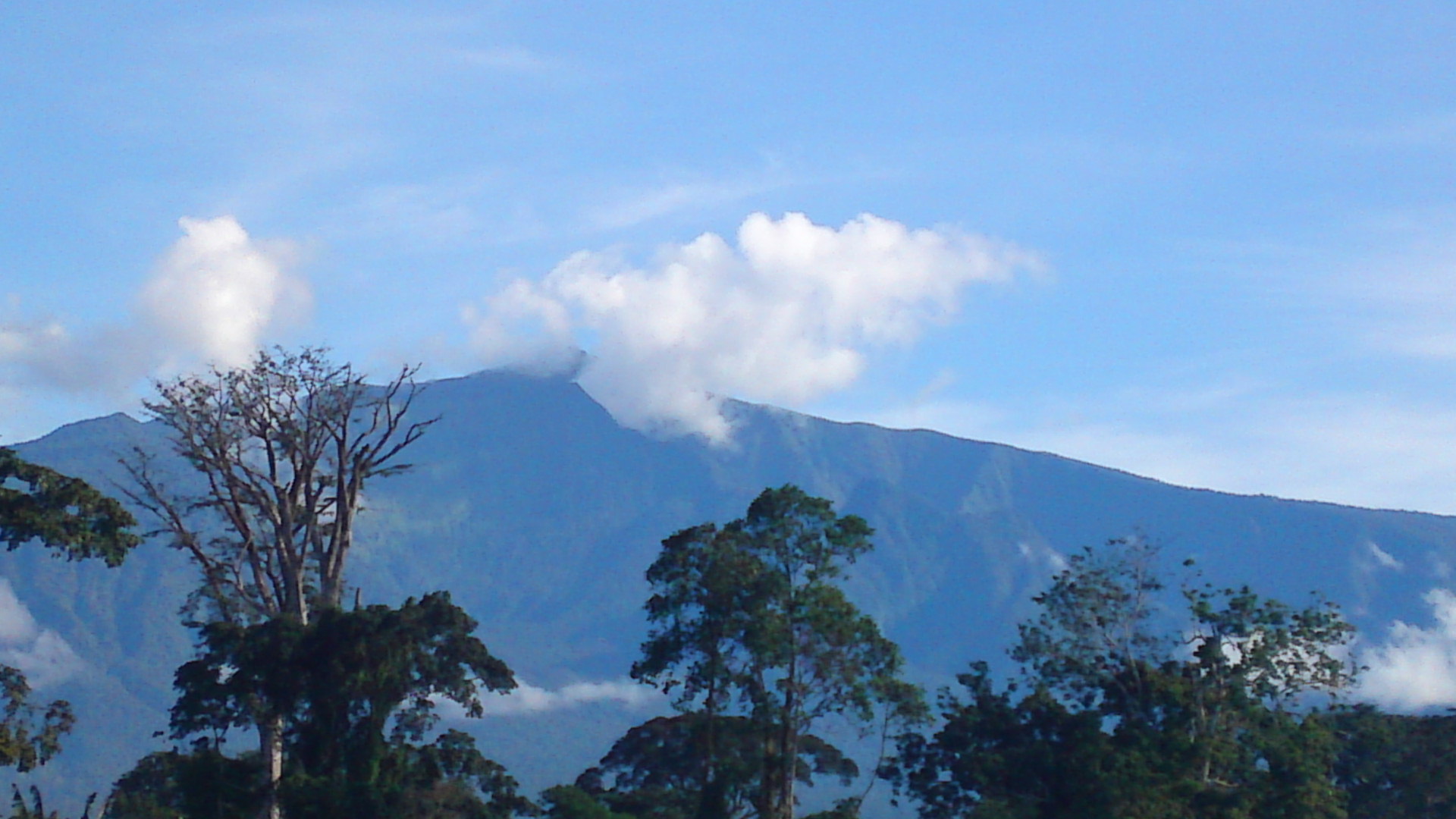
Pico Basilé National Park covers the high slopes of Pico Basilé, the highest point on Bioko Island, and the main reason to go is the change in environment as you gain altitude. Lower sections transition into cooler, wetter forest, and higher up you often reach cloud forest with frequent mist, lower visibility, and different bird and plant life than the coast around Malabo. Even a short walk on the mountain can feel distinct because temperature drops quickly and the air is noticeably less humid than at sea level, especially in the morning.
Most visits start from Malabo by road toward the mountain, then continue either to a suitable drop-off point or as far as access allows, followed by hiking on footpaths or rough tracks. Because conditions and access rules can vary, it is usually best to go with a local guide or driver who knows the current route and where stops are appropriate, and to start early for clearer views before cloud builds.
Pico Basilé
Pico Basilé is the highest point in Equatorial Guinea and an extinct volcanic peak on Bioko Island above Malabo. The main reason to go is the high-altitude setting and viewpoints, with cooler air and fast changes in vegetation as you climb, often moving into misty cloud forest near the upper slopes. On clear mornings, lookouts can give wide views over Bioko and the ocean, but visibility depends heavily on weather and cloud cover.
Most visits start in Malabo and go by road up the mountain as far as current access allows, then continue on foot if you want to reach higher viewpoints or the summit area. Because conditions and local access rules can vary, it is usually simplest to hire a driver and arrange a local guide who knows the route and where hiking is appropriate.
Monte Alén National Park
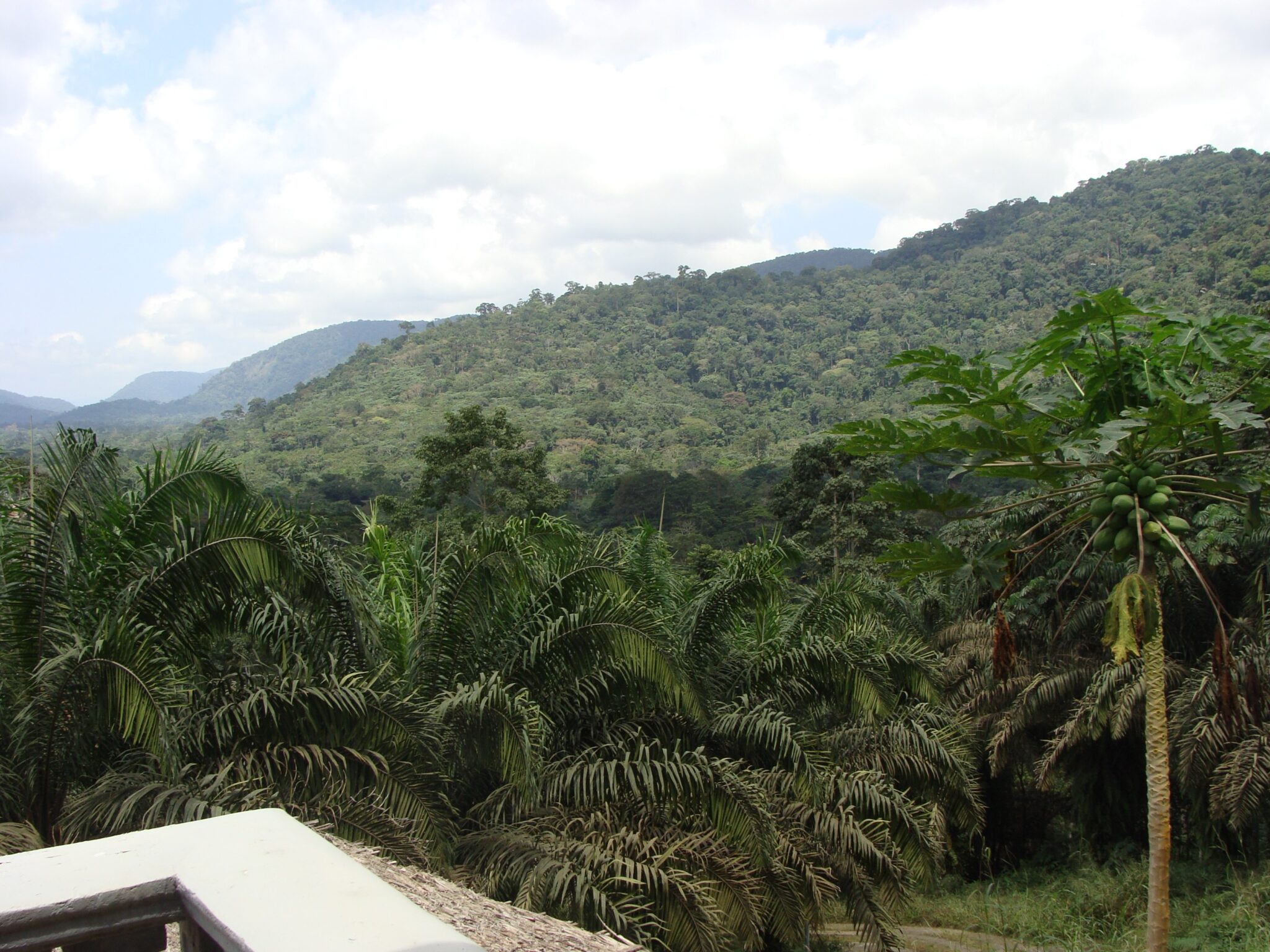
Monte Alén National Park is a large rainforest reserve on Equatorial Guinea’s mainland, known for dense forest, rivers, and strong biodiversity. Visits are usually organized around guided walks on forest trails, where the main rewards are the environment itself: canopy cover, bird and insect life, and the chance of hearing or glimpsing primates moving through the trees. Wildlife sightings can be unpredictable because visibility is limited in thick forest, so the experience is most satisfying when you treat it as a forest immersion rather than a safari-style drive.
Access is typically arranged from Bata with a driver and local guides, then continued by road toward the park area, with travel times and road conditions varying, especially after rain. Plan for basic infrastructure, start early for cooler temperatures and more activity in the forest, and keep your schedule flexible in case weather slows movement.
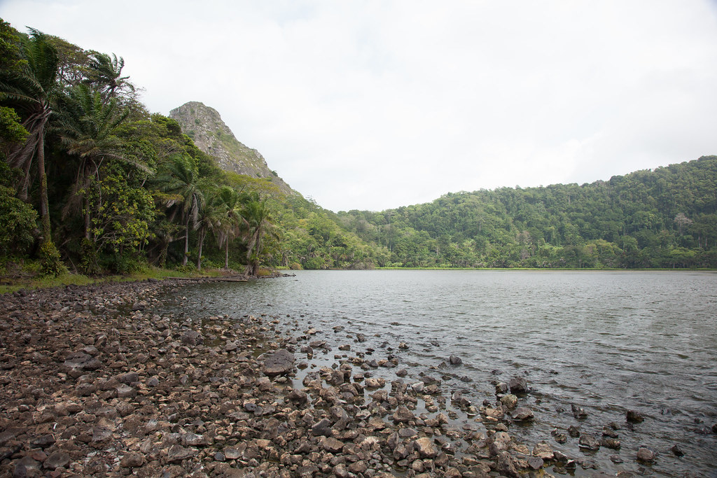
Southern Bioko Forests
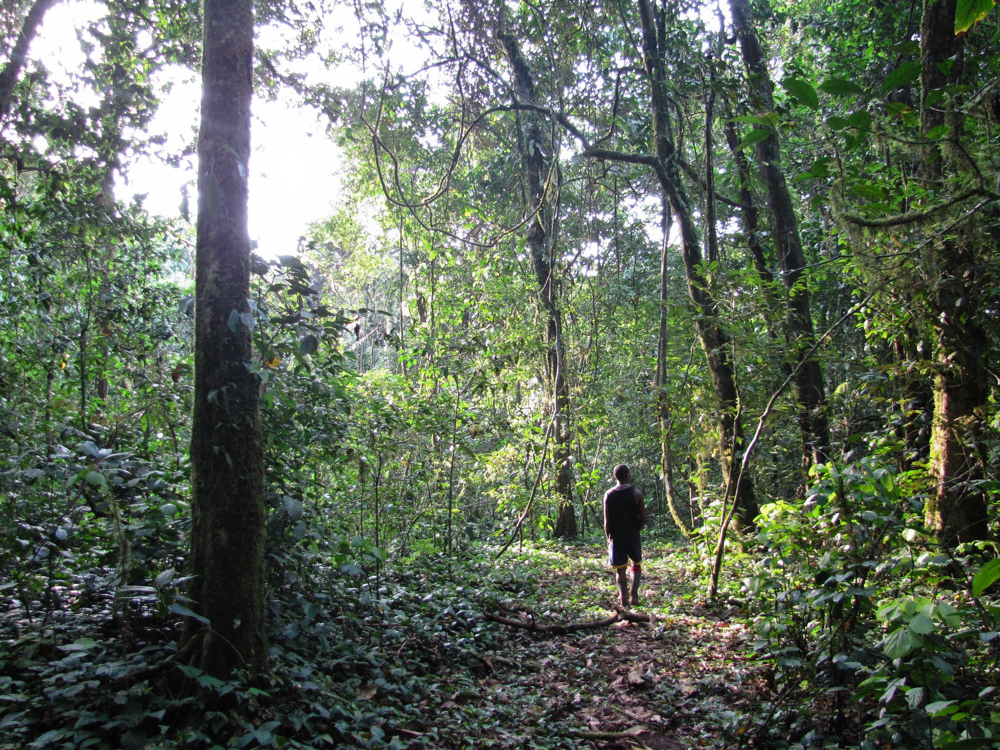
Southern Bioko’s forests cover the less developed part of Bioko Island and feel noticeably more remote than the Malabo area, with dense rainforest, river valleys, and fewer settlements. The main experience is forest immersion, with chances to hear and sometimes see wildlife in the canopy, and to visit waterfalls or river crossings when access is possible and water levels are right. Because infrastructure is limited, visits usually depend on local knowledge for which trails are usable and which areas can be reached safely in the current season.
Most trips are arranged with a driver from Malabo via Luba as a base, then continued on smaller roads and on foot for short hikes, with timing and route choice shaped by recent rain. Trails can become muddy and slippery quickly, so closed shoes with good grip are better than sandals, and a small dry bag is useful for protecting your phone, documents, and water. Start early for cooler hiking conditions and to avoid rushing the return drive, since travel times in the south often run longer than expected.
Best Cultural and Historical Sites
Malabo Cathedral
Malabo Cathedral is one of the most recognizable buildings in central Malabo and a clear reference point in the older part of the city. Built during the Spanish colonial period, it stands out for its historic church architecture and its role as a focal point near key public squares, making it an easy stop to combine with a walk through nearby streets where colonial-era facades and civic buildings are still visible. The cathedral is usually easiest to visit in the morning or late afternoon, when the area is less hot and the light is better for seeing exterior details. If you go inside, dress modestly and keep your behavior low key, especially during services or when local residents are praying.
Traditional Fang Villages
Traditional Fang village life on Equatorial Guinea’s mainland is most visible in rural areas outside the main coastal cities, where daily routines follow farming, forest use, and community gatherings rather than tourism schedules. A respectful visit can include observing housing compounds, small craft work, and social structures that organize village life, but the value comes from context and conversation rather than “attractions.” If you go with the right introductions, you may also learn how traditions are maintained alongside modern influences such as schooling, migration, and trade with nearby towns. Arrange visits through a trusted local guide or community contact and do not arrive unannounced, especially with cameras. Ask permission before entering compounds or photographing people, and accept that some spaces or activities may be private or inappropriate for visitors.
Best Islands in Equatorial Guinea
Bioko Island
Bioko Island is Equatorial Guinea’s main island and the easiest part of the country to explore because it combines the capital, paved roads on key routes, and a good mix of landscapes within a relatively small area. You can do Malabo for city orientation and Spanish-era architecture, then shift quickly into cooler high elevations around Pico Basilé for cloud forest and viewpoints, and continue south for quieter coastline, rainforest scenery, and occasional waterfalls depending on season and access. Beaches range from organized areas near Malabo to more isolated stretches farther from the main road network, so the island works well for travelers who want variety without internal flights.
For a one-week trip, Bioko can comfortably fill your time if you plan it as a loop rather than day trips from one base. A two-base approach is usually the most efficient: spend a few days in Malabo to handle cash, SIM, and transport, then move to a smaller town such as Luba to reduce backtracking and make southern excursions more realistic.
Annobón Island
Annobón is a small, remote volcanic island of Equatorial Guinea in the Gulf of Guinea, far from both the mainland and Bioko, and it is known for strong local identity and a sense of isolation that shapes daily life. The landscape is defined by steep volcanic slopes, rugged coastline, and a compact settlement pattern, so visits are usually about walking, viewpoints, and observing how a small island community functions with limited supplies and infrequent connections rather than about formal attractions.
Reaching Annobón is the main challenge, with transport that can be irregular and subject to last-minute changes, so it should not be treated as a quick add-on. Build buffer days into your plan, confirm transport repeatedly as your dates approach, and rely on dependable local coordination for lodging, movement on the island, and any permissions.
Corisco Island
Corisco Island is a small island off Equatorial Guinea’s mainland coast near the Gabon border, visited mainly for quiet beaches, fishing life, and a slower pace than Bata. The island experience is simple and low-key, focused on walking along the sand, watching daily boat activity, and spending time in small settlements rather than on organized tours. It works well if you want an island break without the long-distance logistics of more remote islands, and it can be combined with mainland travel if you are already in the coastal region.
Access is usually by boat from the mainland, and timing depends on sea conditions and local schedules, so it helps to arrange transport through a reliable contact and avoid leaving planning to the last minute. Infrastructure is basic, so bring cash, water, and anything you need for a few days, and expect limited shopping and occasional service interruptions.
Hidden Gems of Equatorial Guinea
Ureka Village
Ureka Village is a small settlement in the far south of Bioko Island and one of the main gateways to the island’s wilder rainforest and coastline. It is less about village attractions and more about location: from here you can reach remote beaches, forest edges, and river mouths that feel far removed from Malabo, with a stronger sense of isolation and limited services. If you are interested in nature rather than comfort, Ureka is one of the best places on Bioko to base yourself for short walks and coastline exploration.
Getting to Ureka is typically done by road from Malabo via Luba with a hired driver, and travel times can be longer than expected, especially after rain. Conditions can be more challenging in the rainy season because roads and paths become muddy and slippery, but the landscape is also greener and rivers and waterfalls are more active. If you want easier access, choose a drier period, and in any season bring cash, water, and basic supplies, since you should not rely on finding what you need once you arrive.
Río Campo
Río Campo is a small town on Equatorial Guinea’s mainland near the Cameroon border, where the Río Campo river and surrounding estuary landscapes shape travel more than any single landmark. The main interest is geographic and everyday: riverbanks, fishing and transport activity, and the way border proximity influences language, trade, and movement between communities. It can be a useful stop if you want to see a quieter, less coastal-city side of the mainland and understand how rivers function as local corridors.
Access is usually by road from Bata or other mainland centers, often with a hired driver because schedules can be unpredictable outside main routes and road conditions can change after rain. Border regions often have more checkpoints and official attention, so keep your approach low key, carry documents where you can reach them quickly, and avoid unnecessary filming, photography of security points, or drone use.
Mbini River
The Mbini River area on Equatorial Guinea’s mainland is defined by mangrove channels, river mouths, and calm-water scenery where daily life follows fishing schedules and boat travel rather than road traffic. The most rewarding way to experience it is usually a short boat outing that follows the riverbanks and mangrove edges, where you can watch fishing activity, see river settlements, and look for birds that concentrate around wetlands and tidal zones. Arrange boat trips through reliable local operators and treat safety as part of the plan, not an afterthought.
Travel Tips for Equatorial Guinea
Safety and General Advice
Travel conditions in Equatorial Guinea vary by region. The main urban centers – Malabo on Bioko Island and Bata on the mainland – are generally calm and well-policed, while remote areas require more preparation and reliable local contacts. Visitors should be aware that official permits may be needed for certain areas, photography, or specific activities. It’s best to confirm requirements in advance and carry identification at all times.
Health and Vaccinations
A yellow fever vaccination is required for entry, and malaria prophylaxis is strongly recommended for all visitors. Tap water is not safe to drink, so rely on bottled or filtered water. Travelers should also pack insect repellent, sunscreen, and a small first-aid kit, particularly when visiting rural areas or islands where medical facilities may be limited. Comprehensive travel insurance with evacuation coverage is essential, as healthcare outside major cities can be basic.
Car Rental and Driving
Driving in Equatorial Guinea is on the right-hand side of the road. While paved roads are common in cities like Malabo and Bata, many rural and coastal routes remain rough or unpaved. A 4×4 vehicle is highly recommended for travel outside major cities, particularly if exploring the mainland’s forested or mountainous areas. Because checkpoints are frequent, drivers should always carry identification and relevant travel permits. Hiring a driver is often more practical and reduces the challenges of navigating unfamiliar routes. An International Driving Permit is required alongside your national driver’s license, and all documents should be carried at checkpoints, which are routine across the country.
Published January 11, 2026 • 16m to read